City and Village Plat MapsPorter County plats of cities, villages, and additions . . . .
Below are numerous links to plats of cities,
villages, and additions within Porter County. Note that several plats were
surveyed and recorded
for villages that never came into existence; most of these plats were recorded
very early in Porter County's history and were platted as speculative land
investments that did not materialize. Other plats were published for small
villages that existed but then later became depopulated, largely due to the fact
that railroads became less
important as a factor in creating and maintaining communities.
City, village, and addition plats have been categorized alphabetically below by
township. Clicking the links will provide access to
full size images. Note that several of these images are large files and may take
considerable time to load on slower Internet connections, such as dialup.
Boone Township
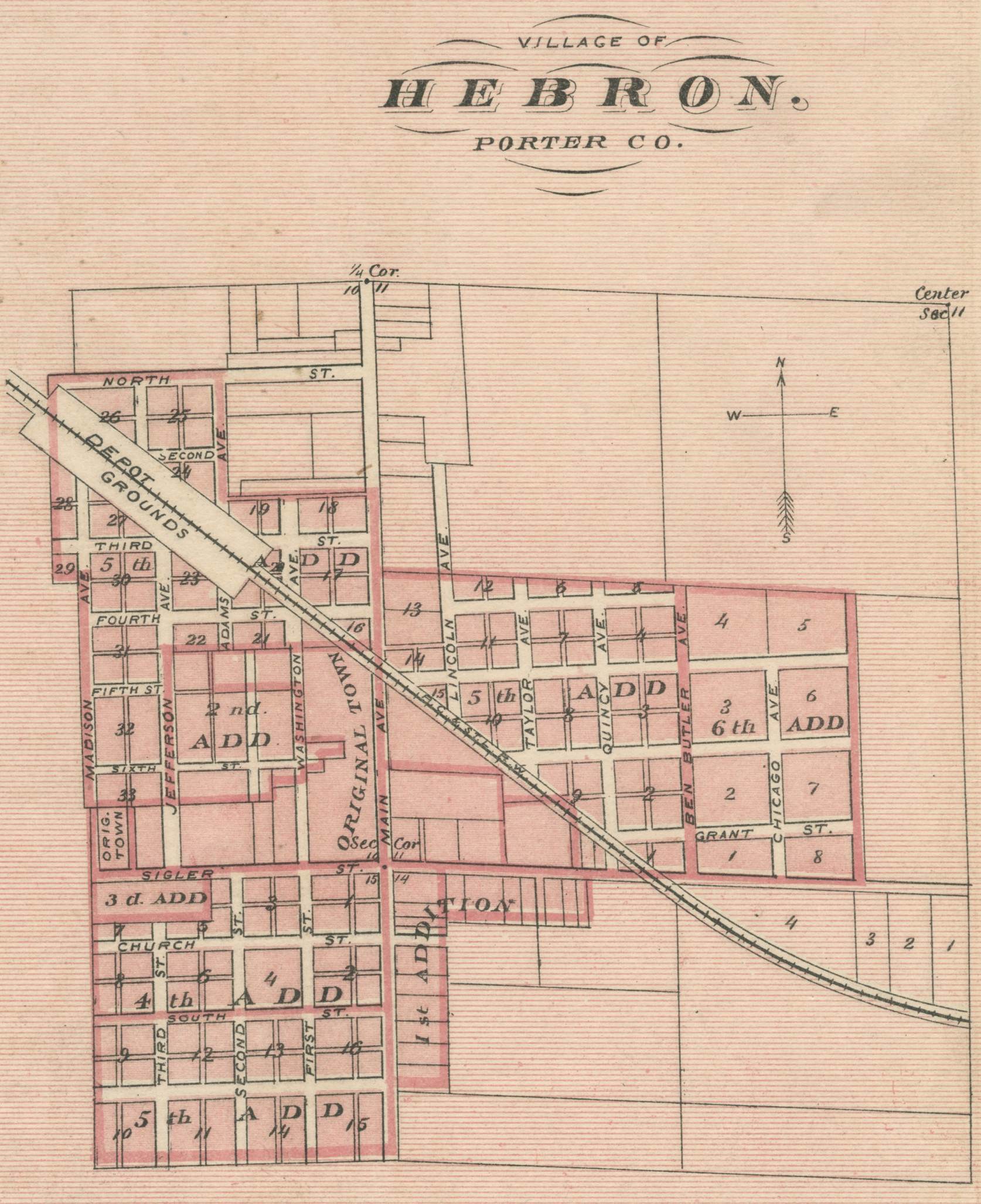
Hebron, 1876 [Indiana Historical Atlas]
Hebron, 1876
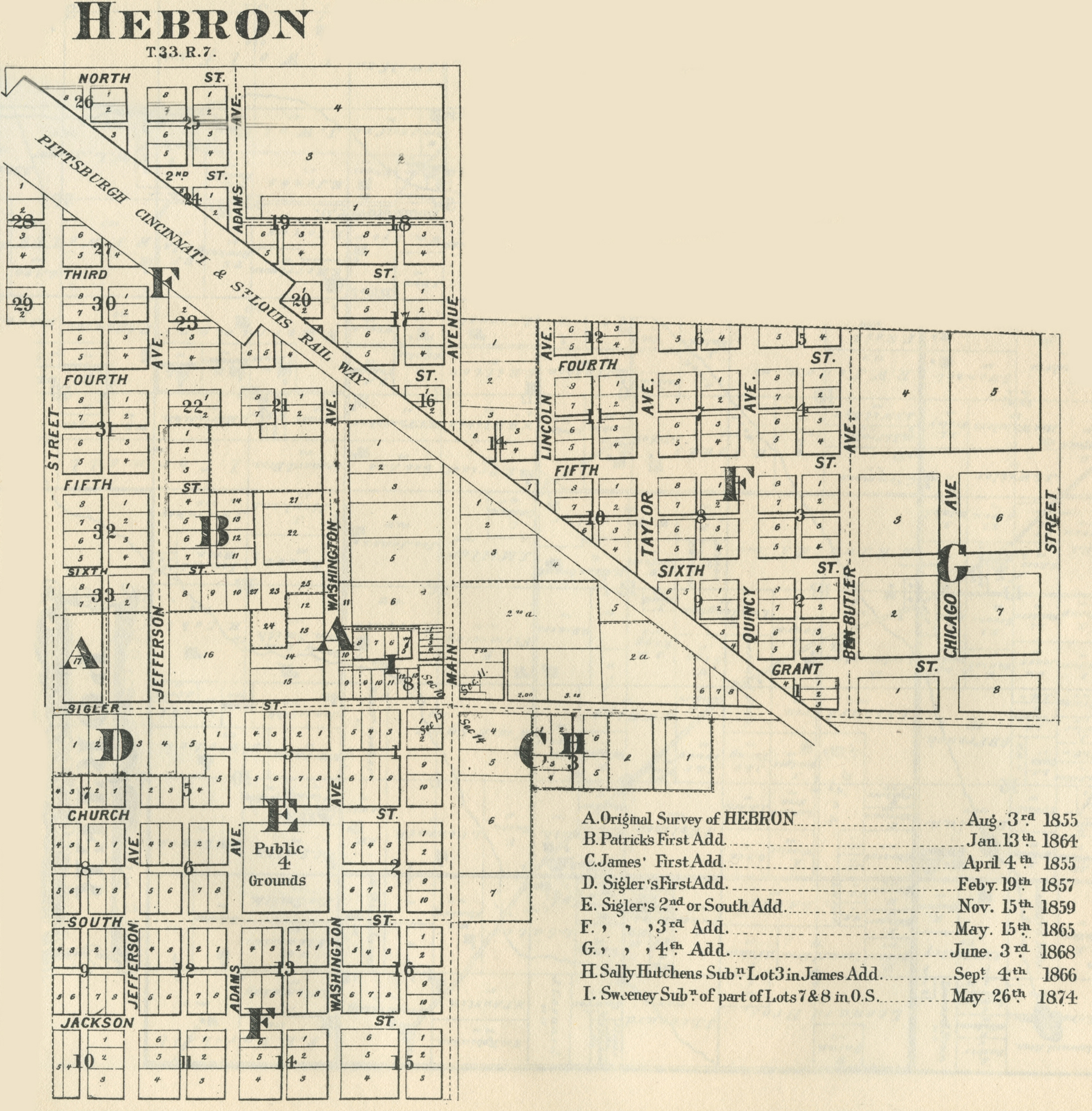
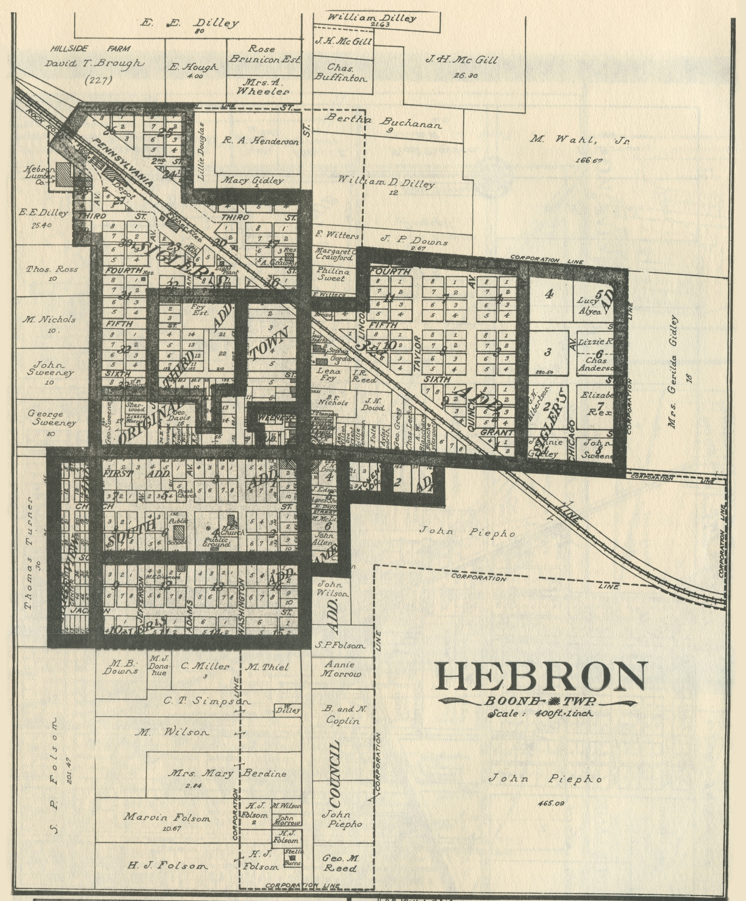
Hebron, 1895
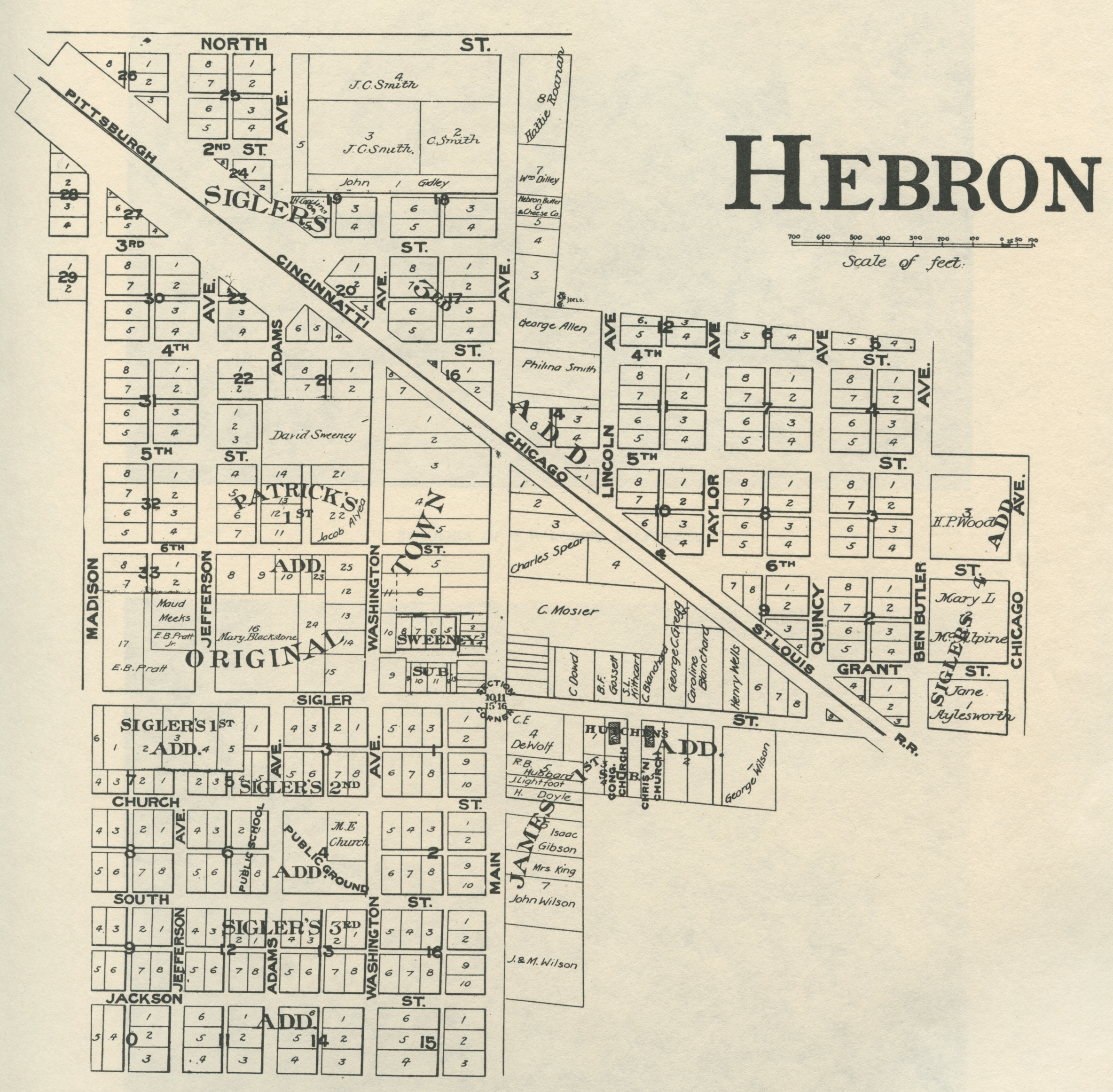
Hebron, 1906
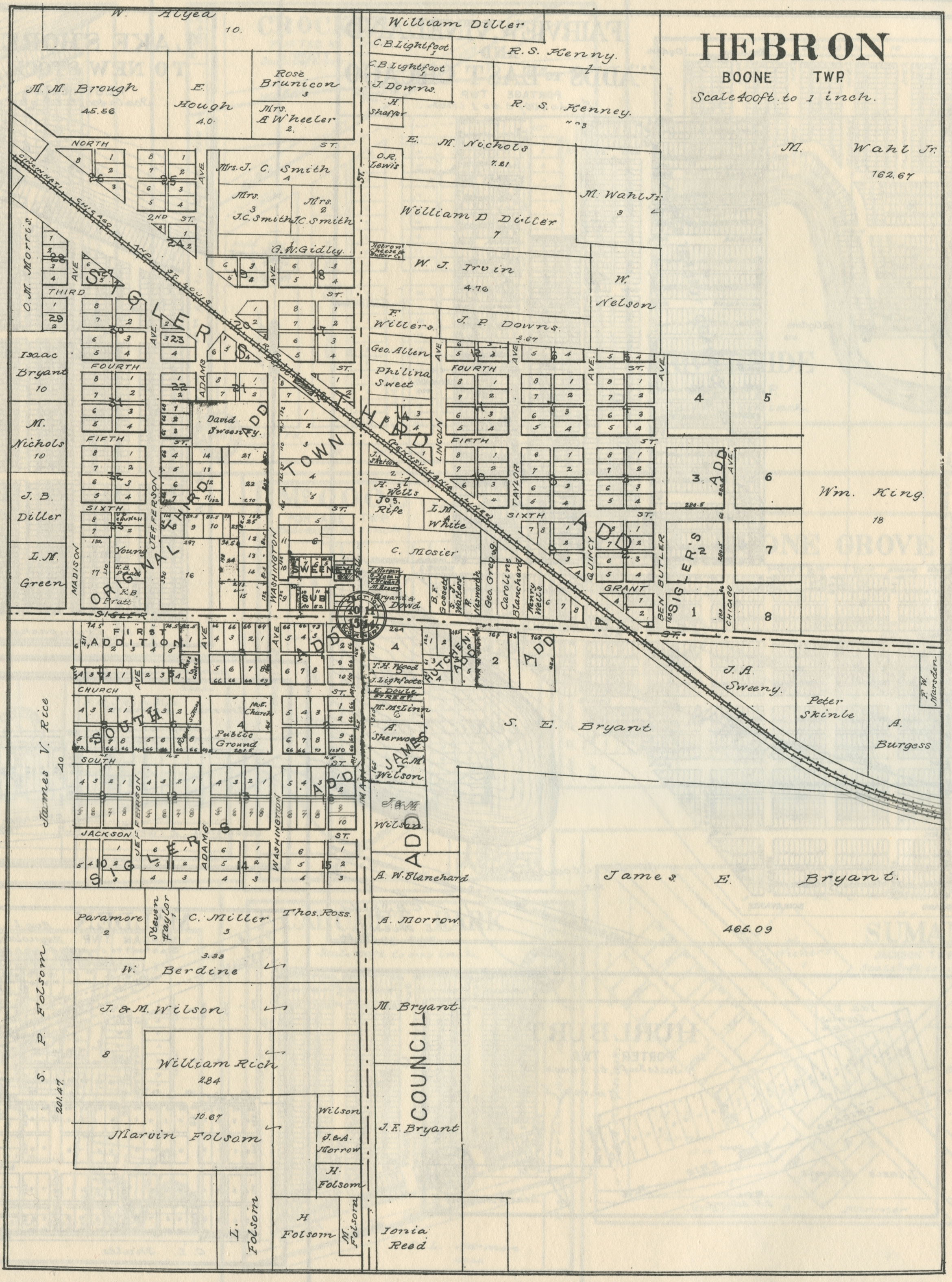
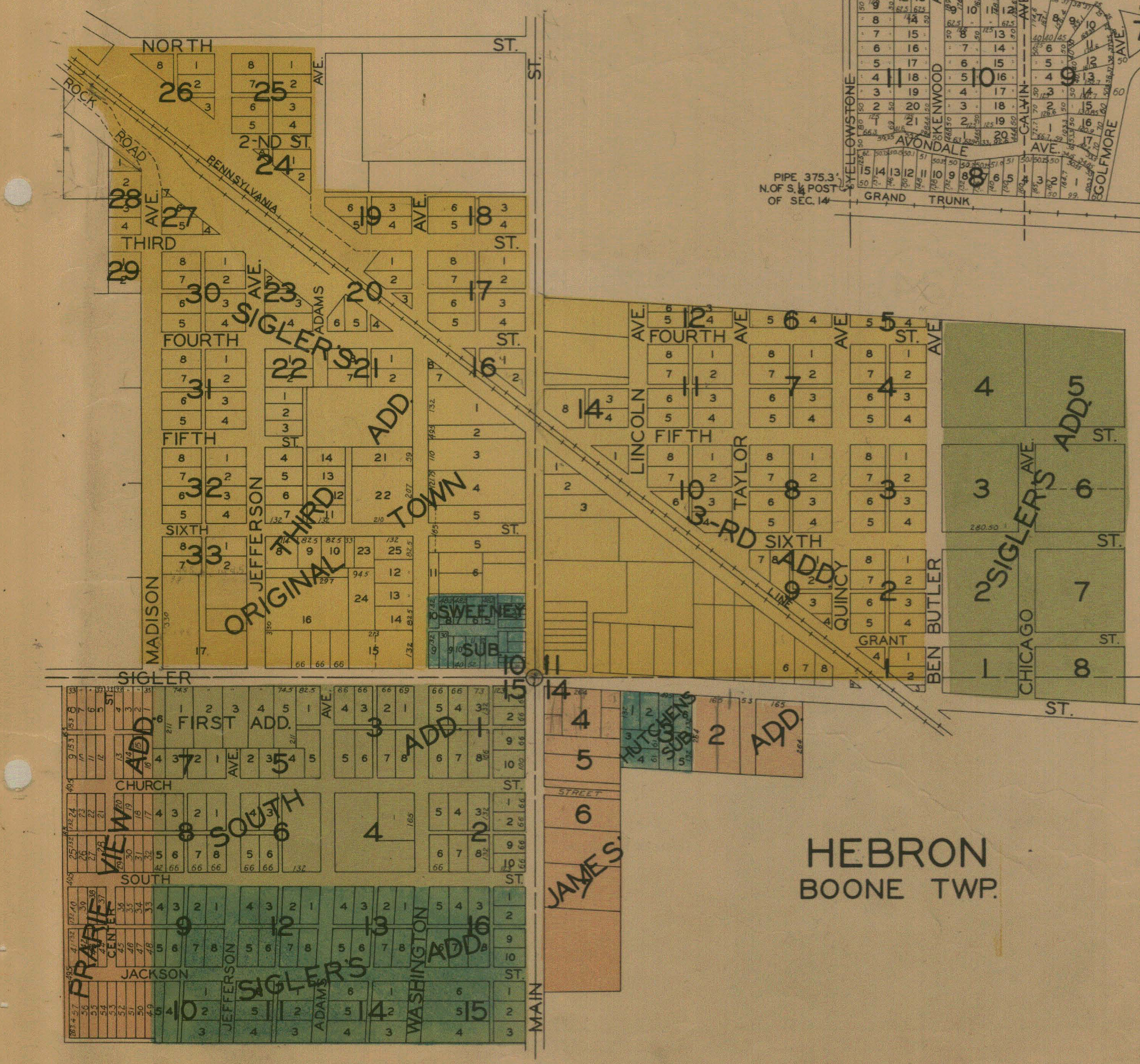
Hebron, 1921
Hebron, 1928
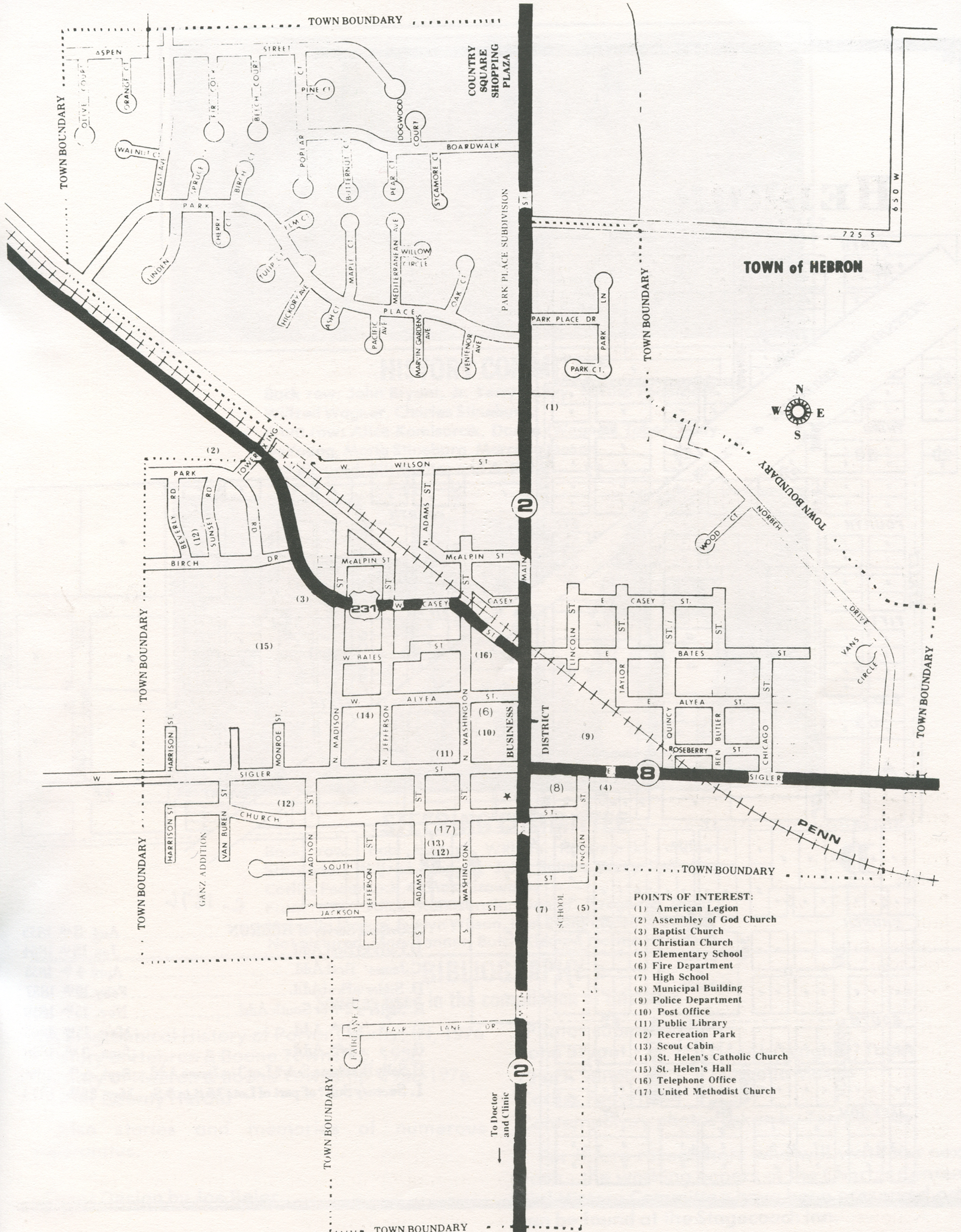
Hebron, 1990
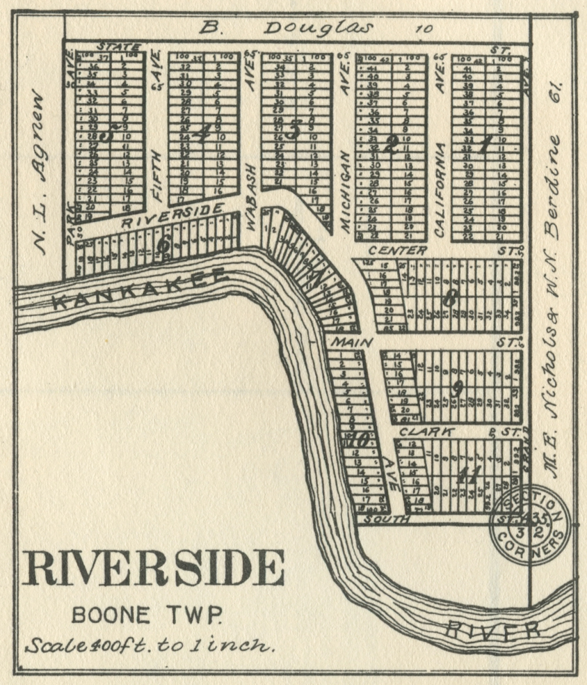
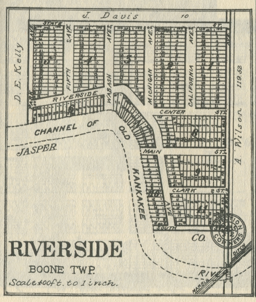
Riverside,
1894
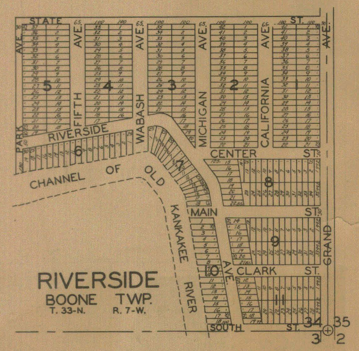
Riverside,
1906
Riverside,
1921
Riverside,
1928
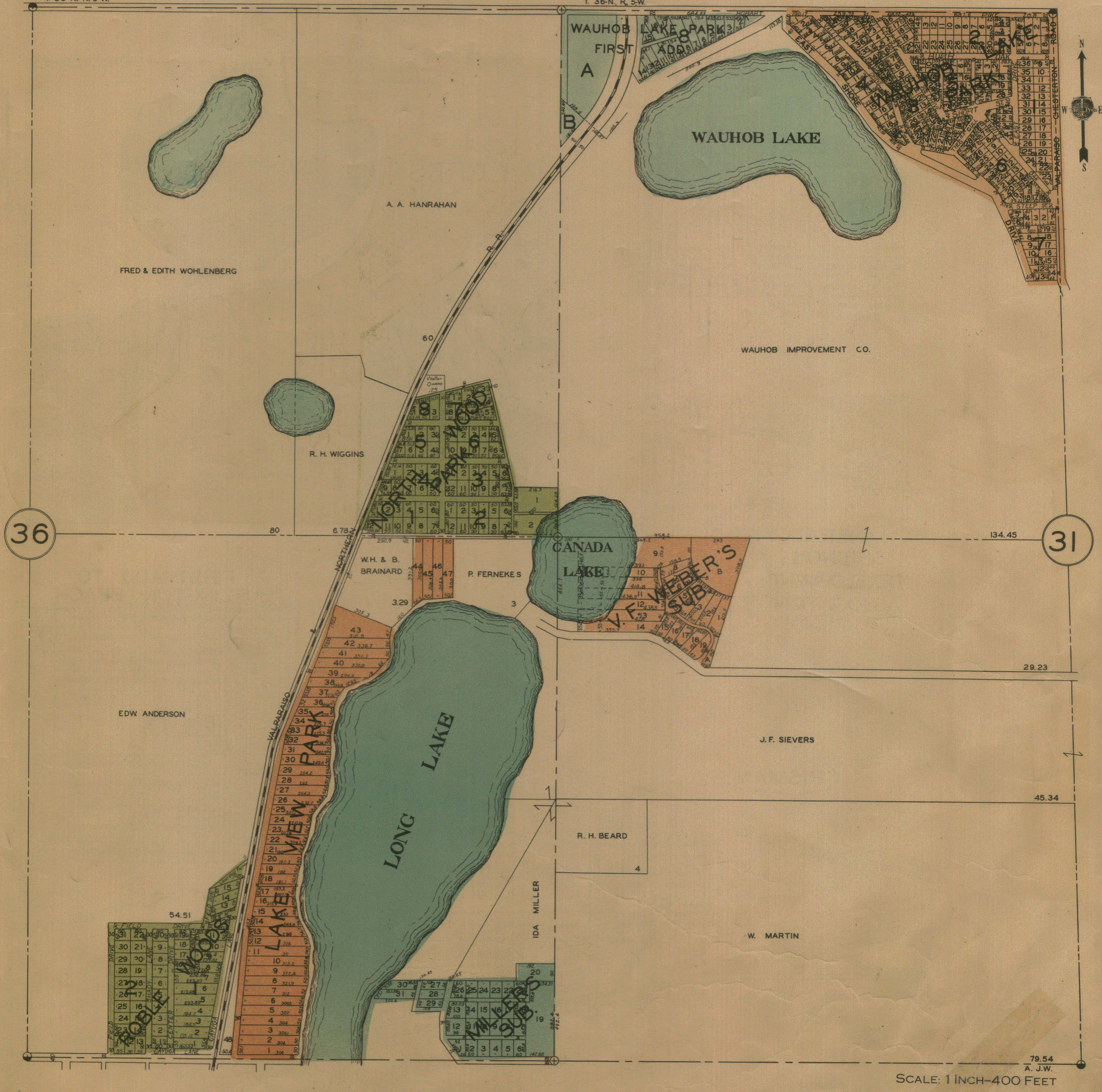
Center Township
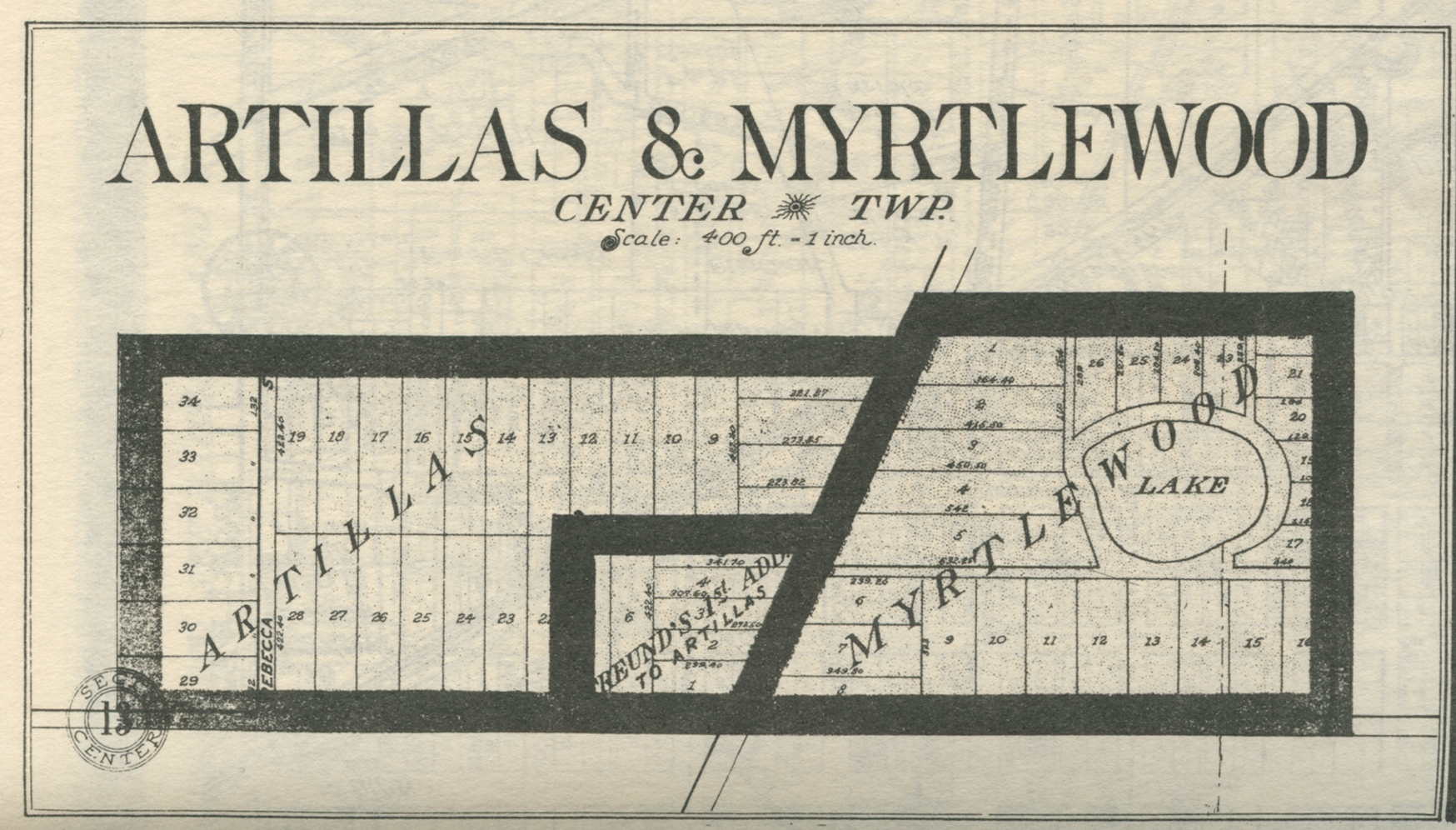
Artillas and Myrtlewood Additions - Part I, 1921
Artillas and Myrtlewood Additions - Part II, 1921
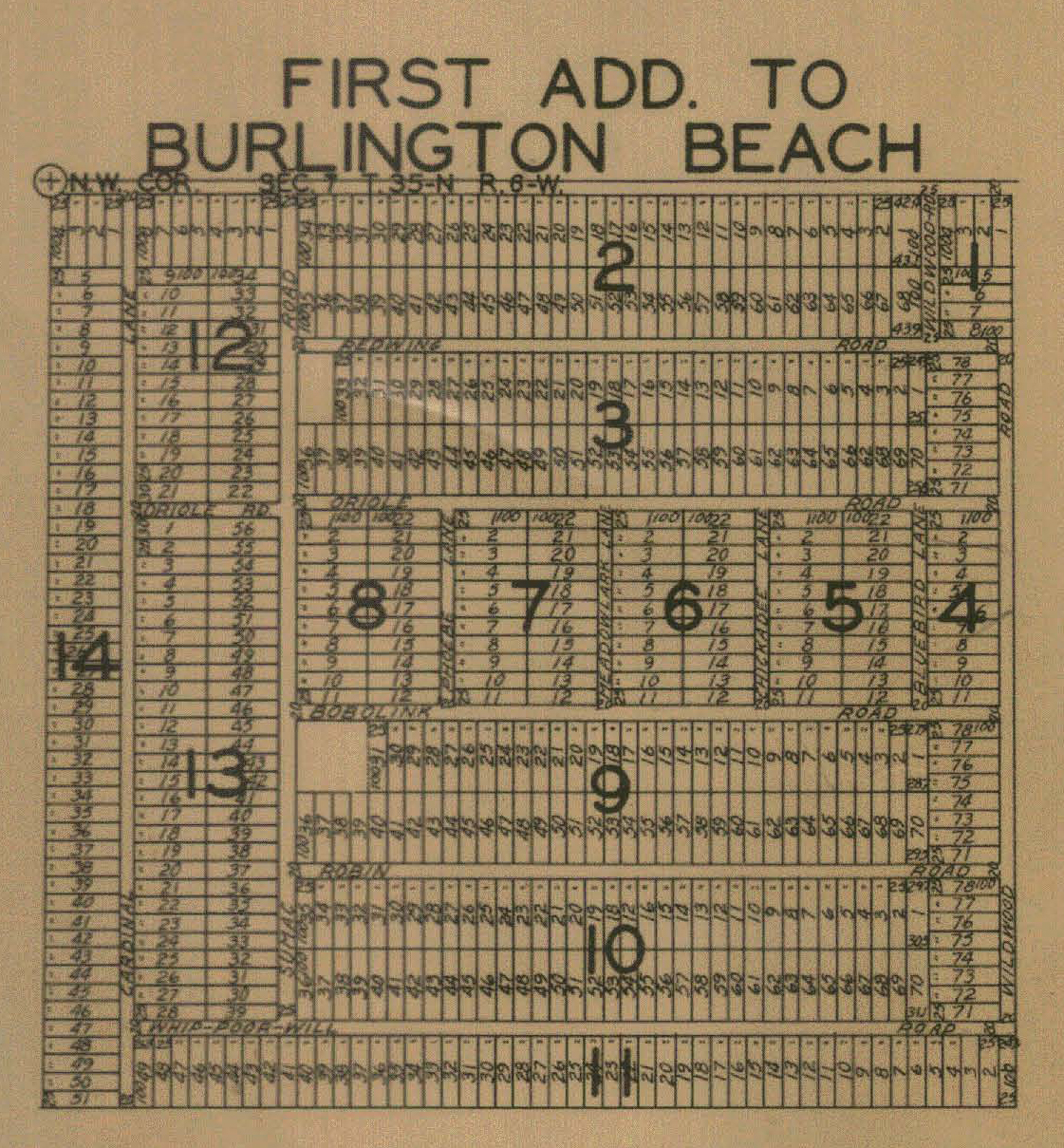
Burlington Beach - Part I, 1928
Burlington Beach - Part II, 1928
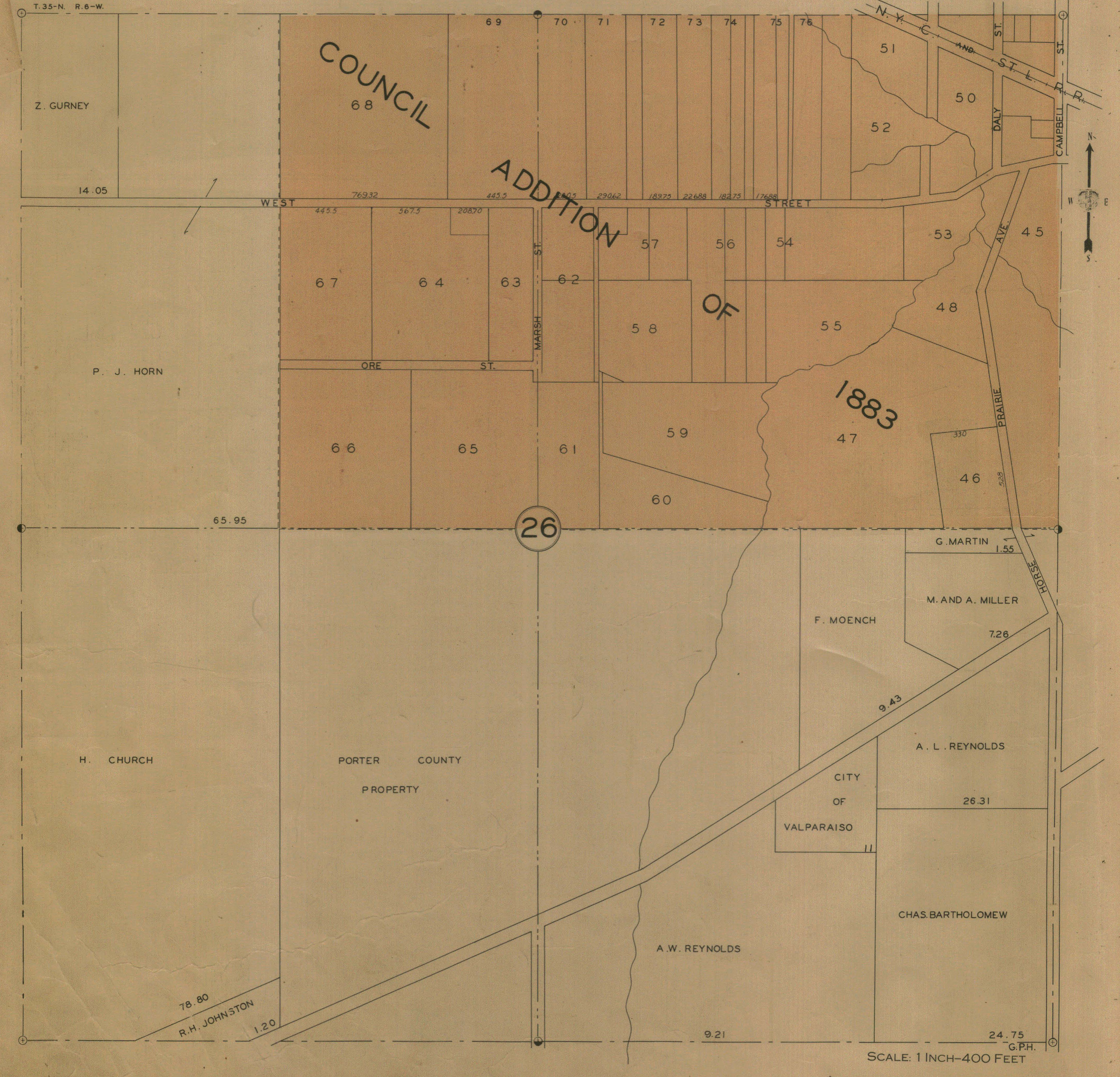
Council Addition of 1883 - West Part, 1928
Council Addition of 1883, East Part, 1928
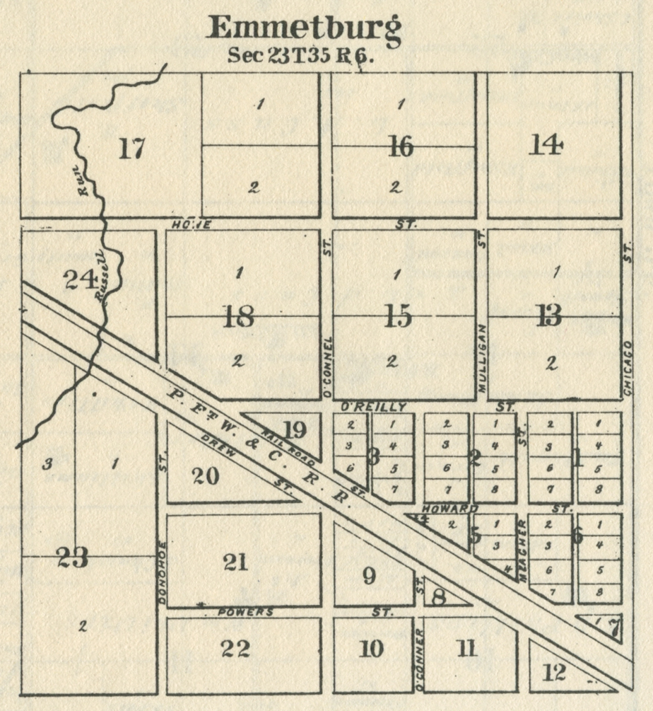
Emmetsburg, 1876
Flintville, 1876
Flintville, 1928
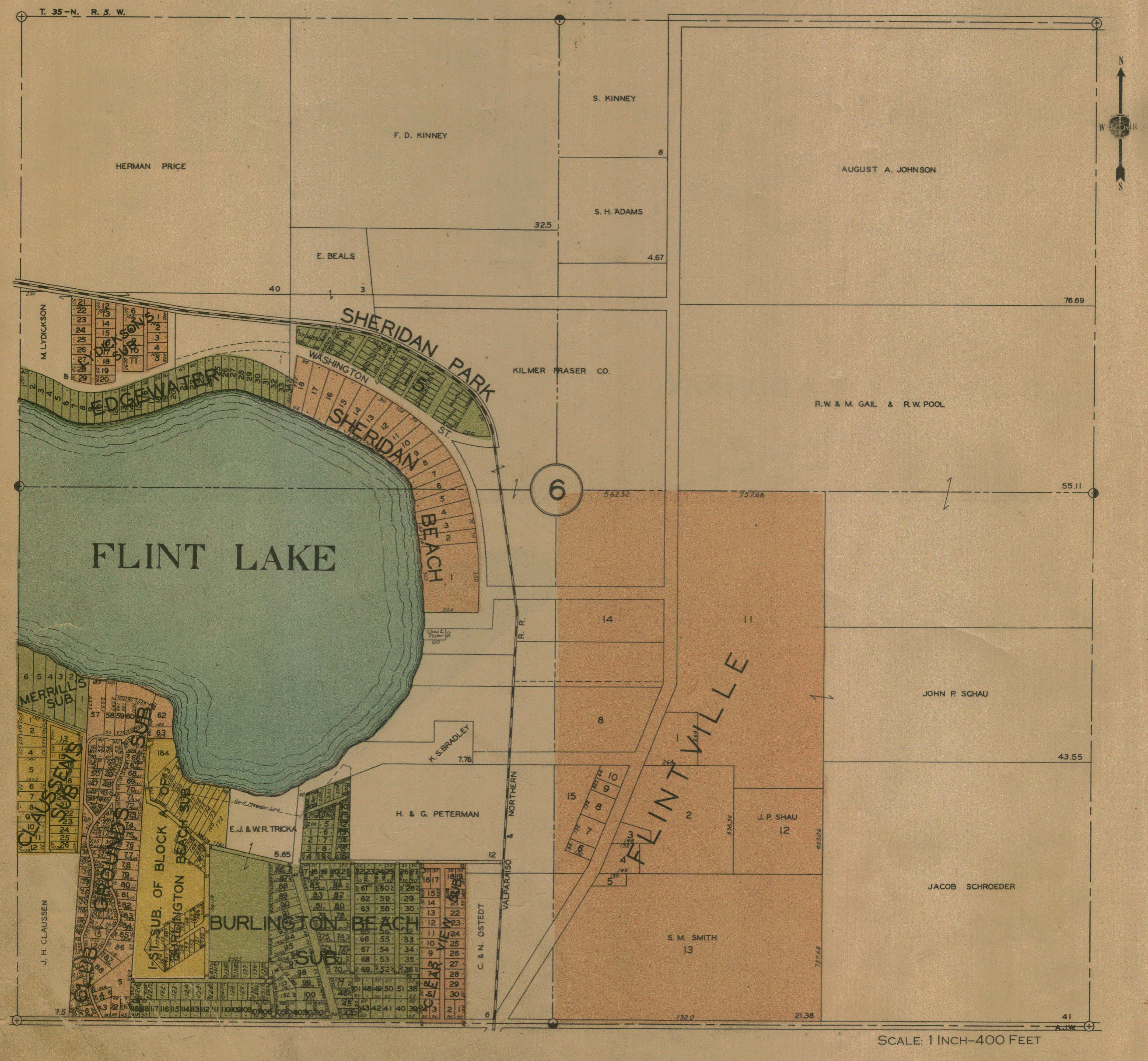
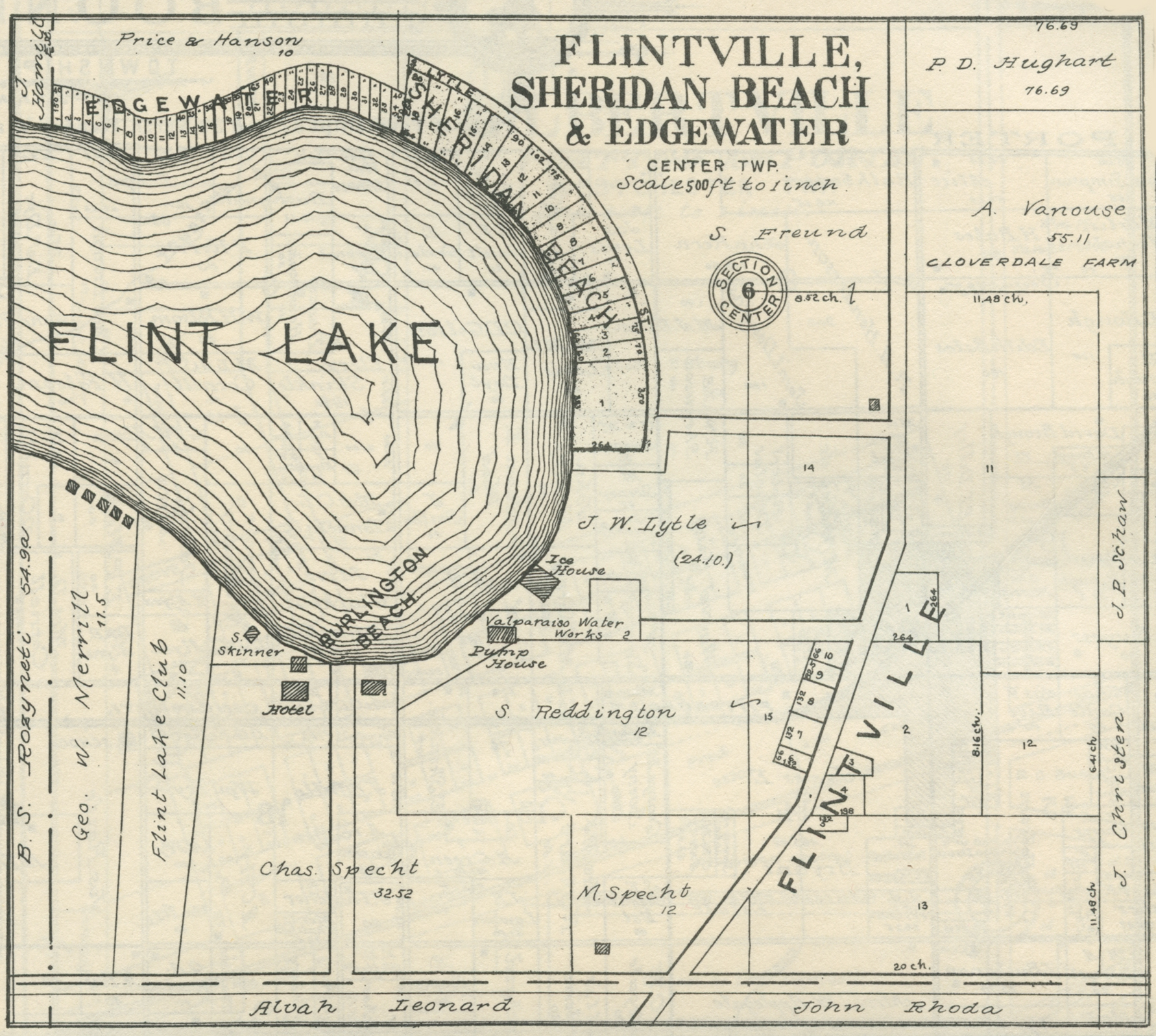
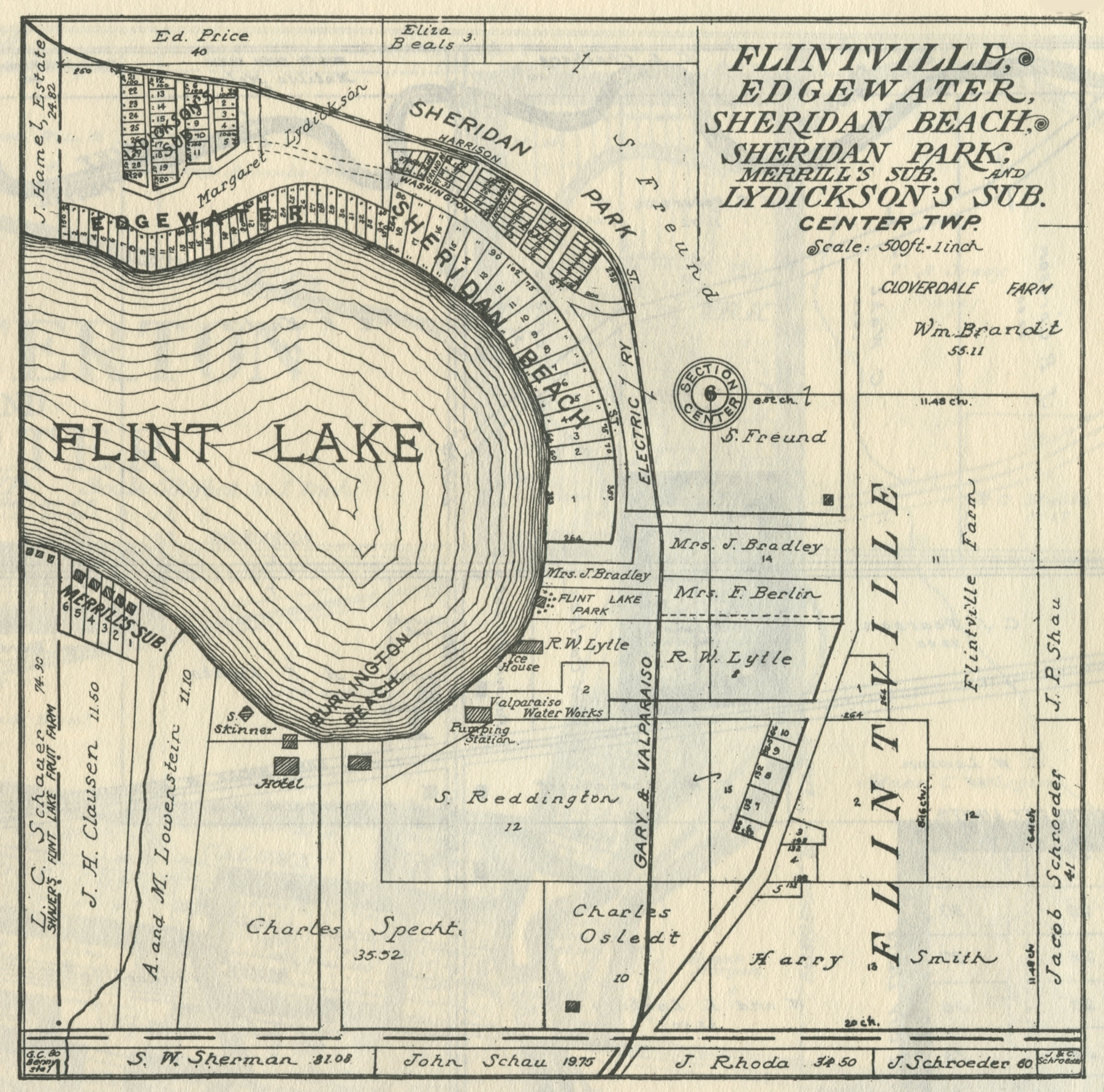
Flintville, Edgewater, and Sheridan Beach, 1906
Flintville, Edgewater, and Sheridan Beach, 1921
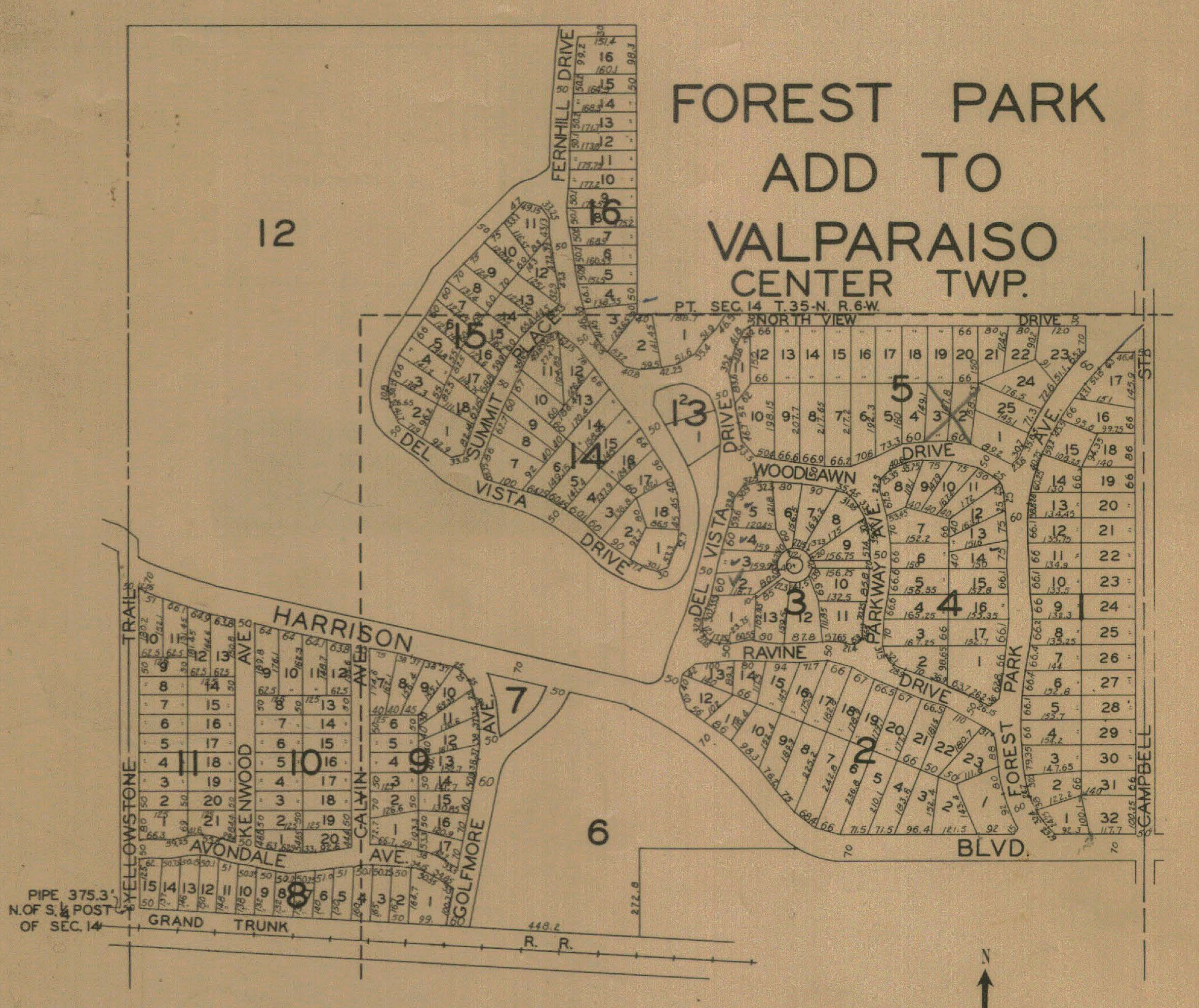
Forest Park Addition, 1928
Hightower's Channel, 1928
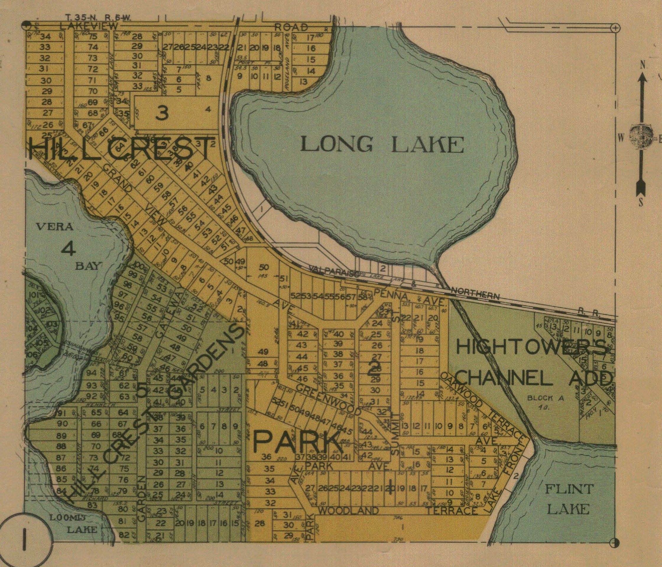
Hillcrest Gardens, 1928
Hillcrest Park, 1928
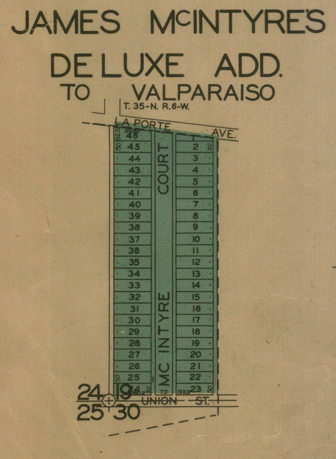
James McIntyre's Deluxe Addition, 1928
Mitzner's Addition, 1928
Portersville, 1836
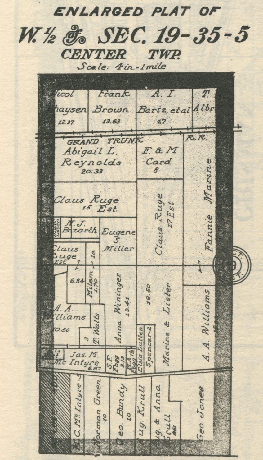
Section 19, West Half
Sheridan Beach, 1928
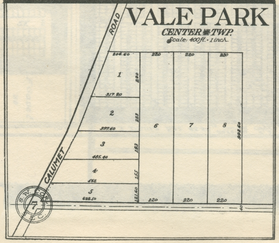
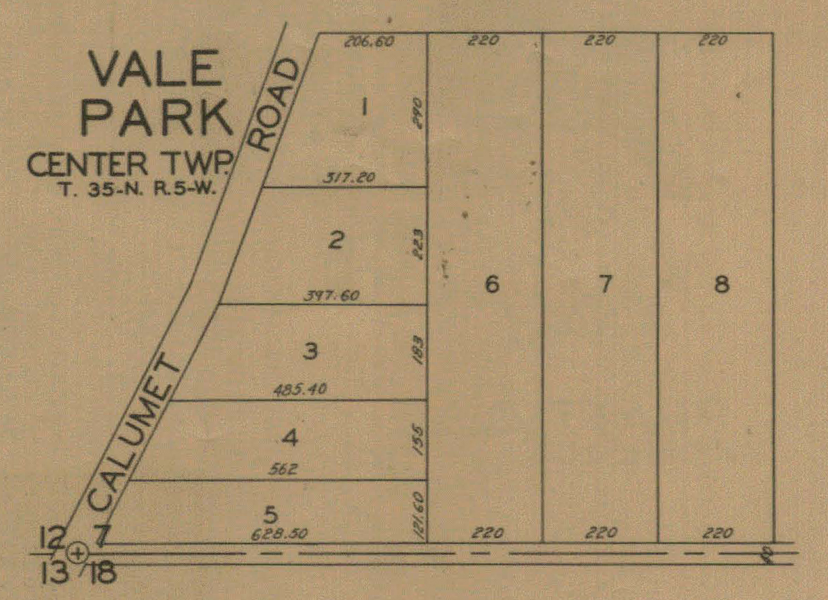
Vale Park,
1921
Vale Park,
1928
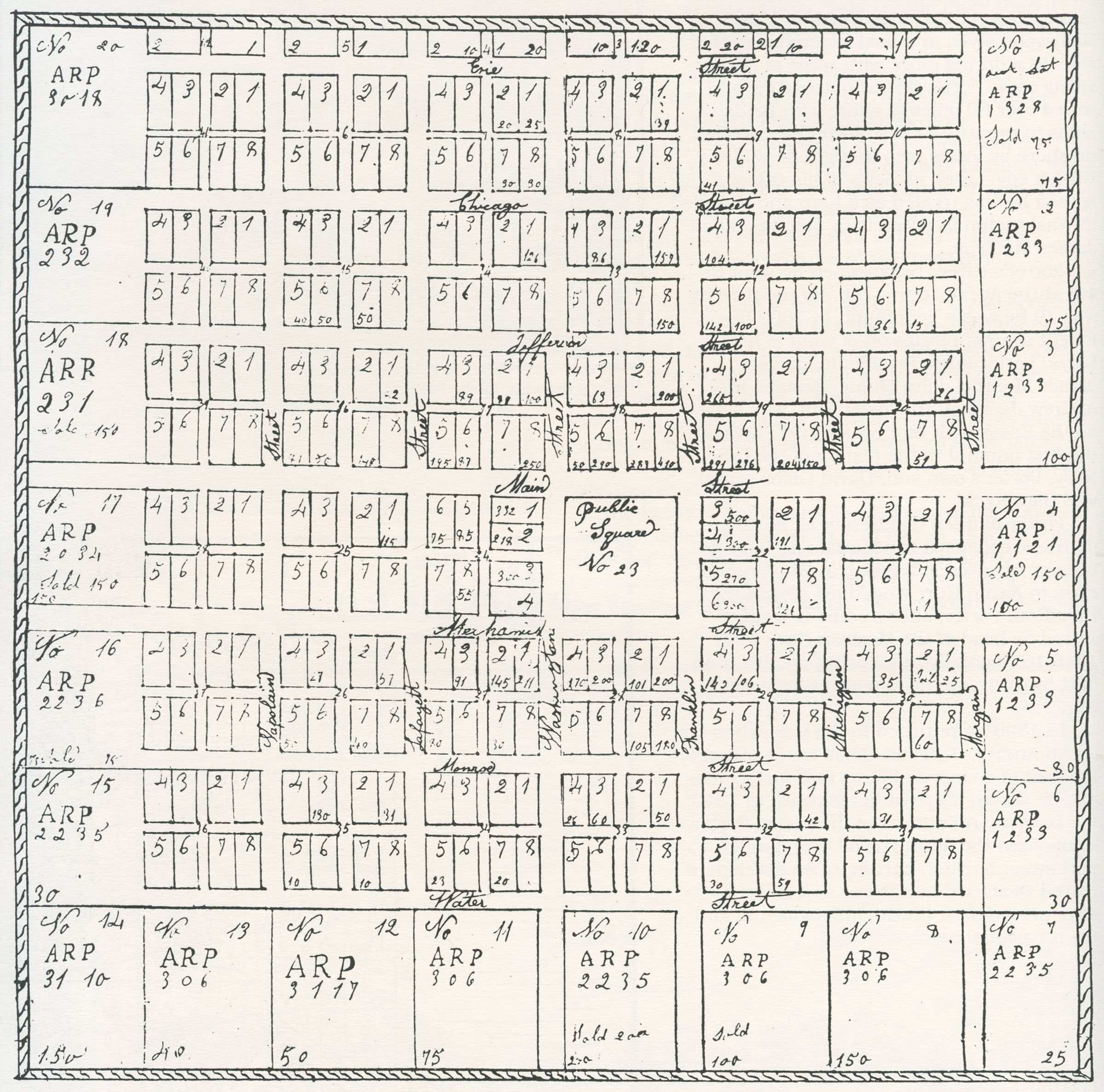
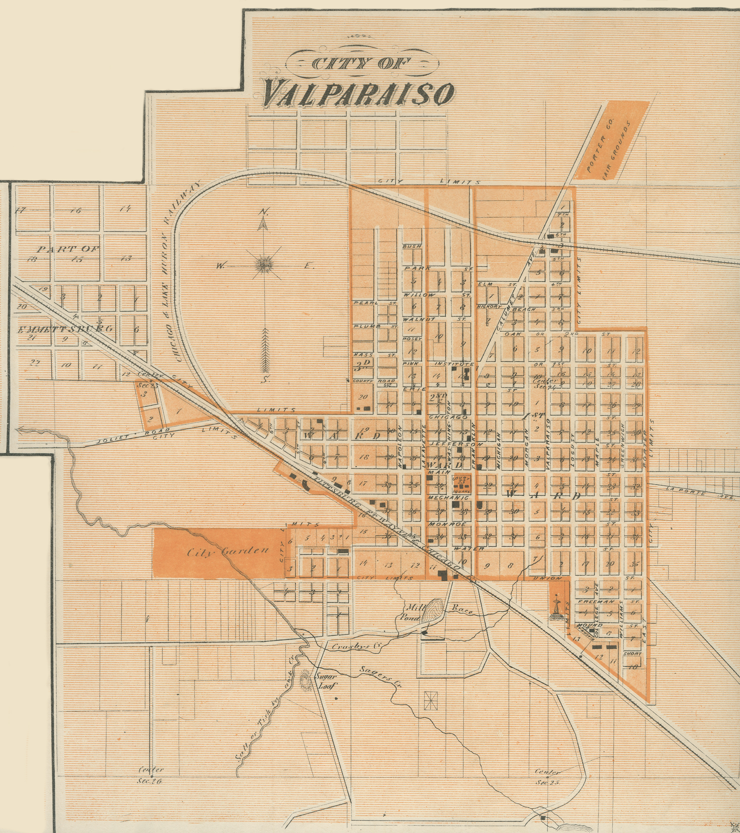
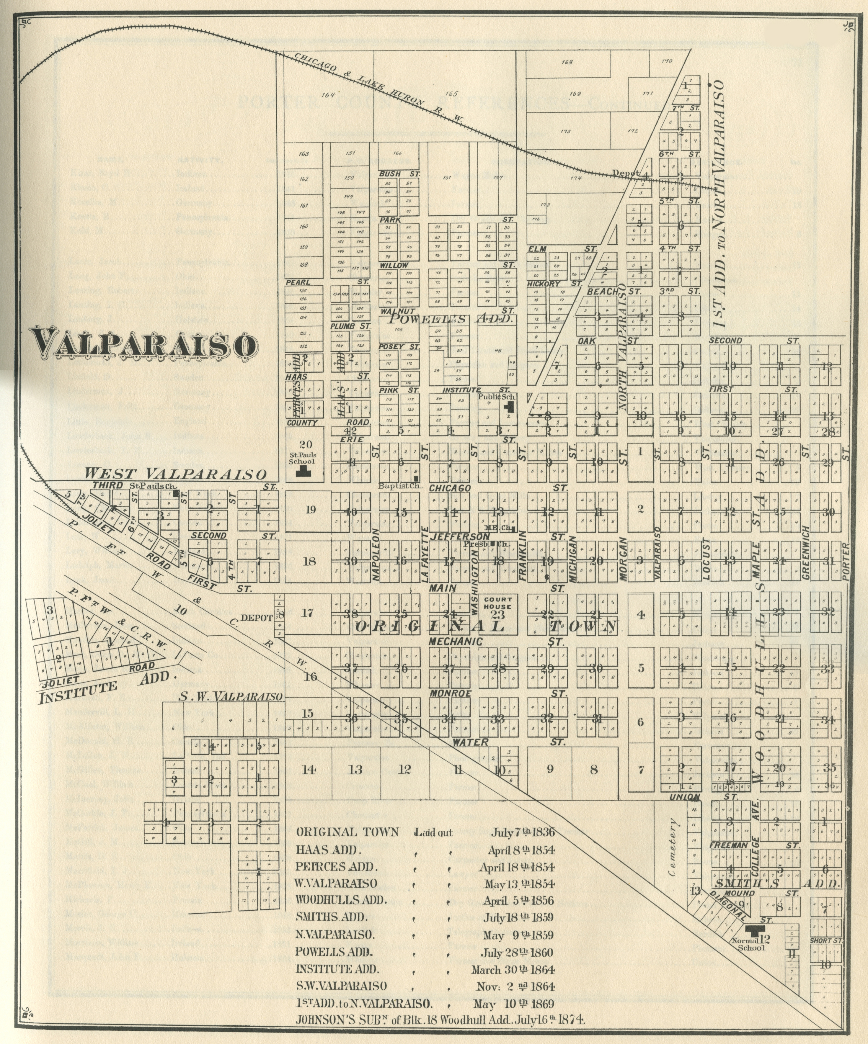
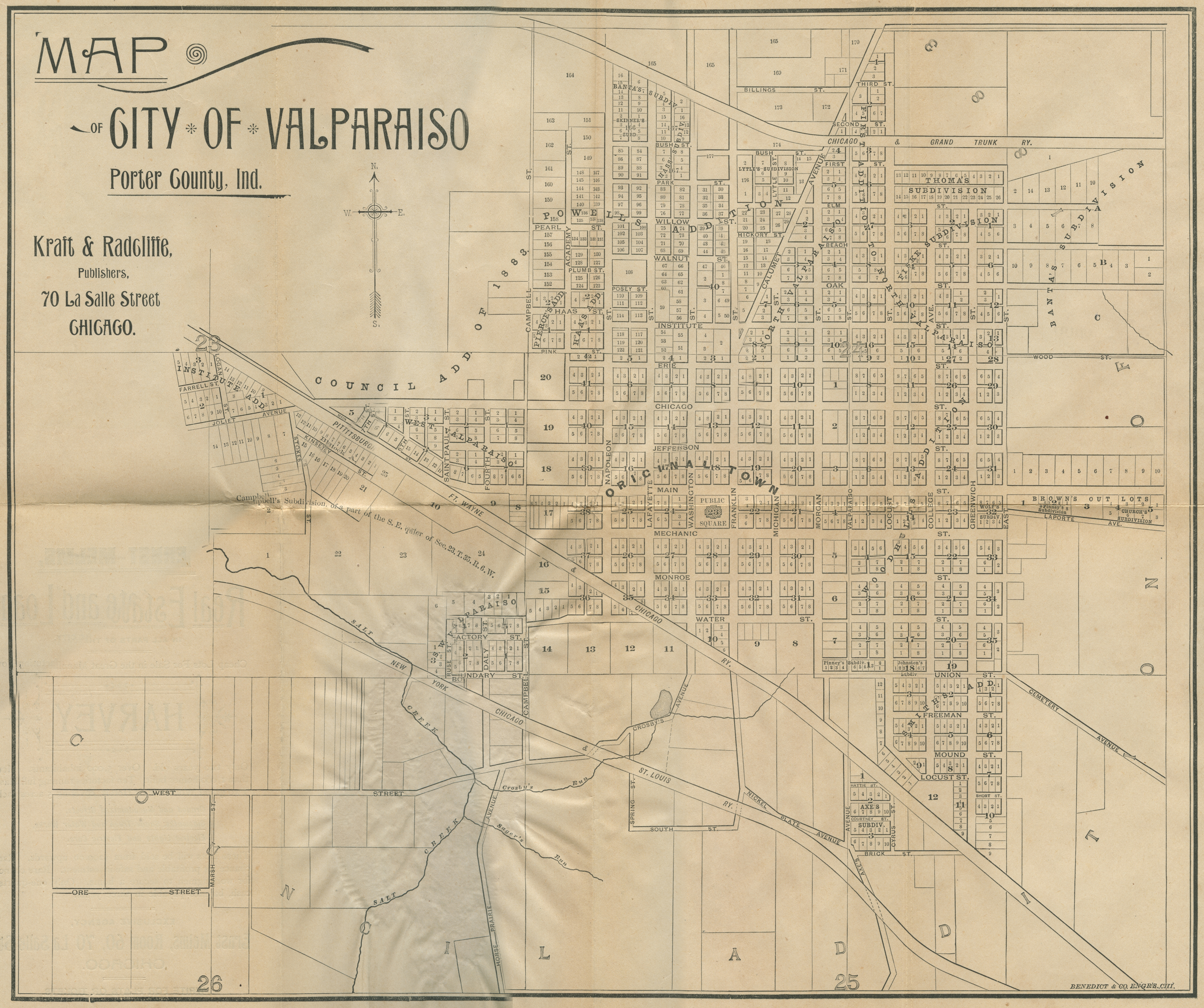
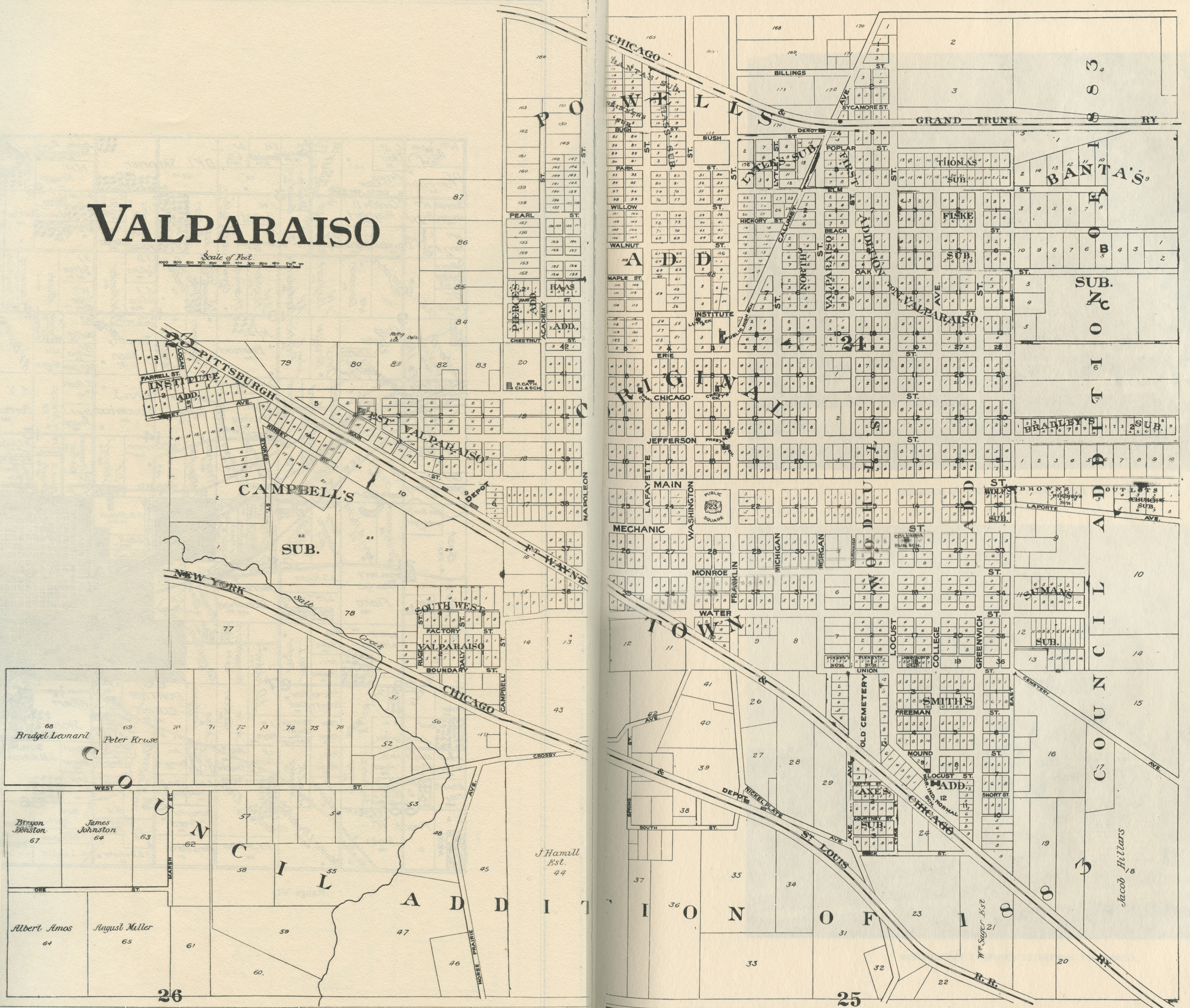
Valparaiso, 1836
Valparaiso, 1837
Valparaiso, 1876 [Indiana Historical Atlas]
Valparaiso, 1876
Valparaiso, 1893
Valparaiso, 1895
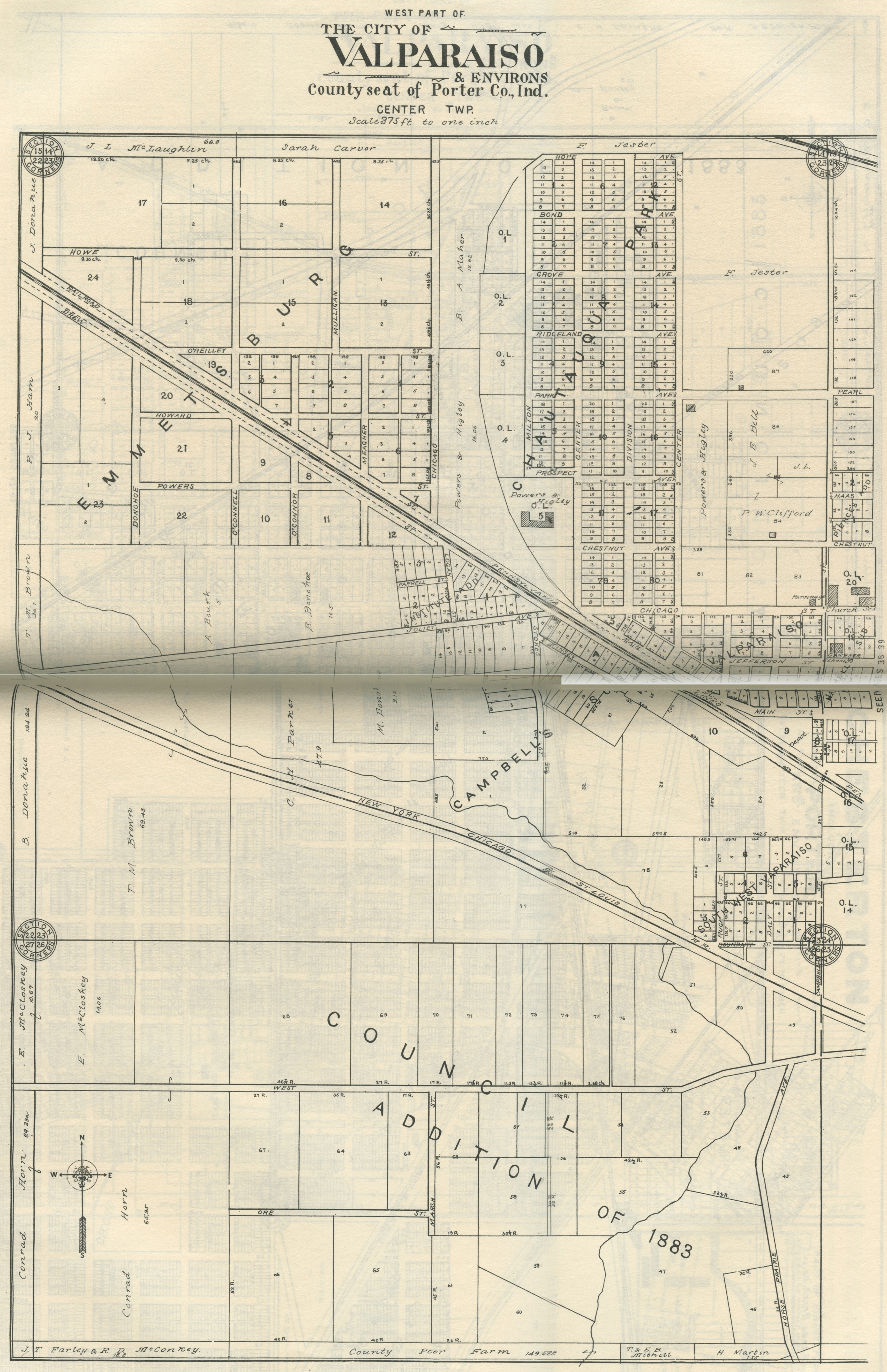
Valparaiso - West Part, 1906
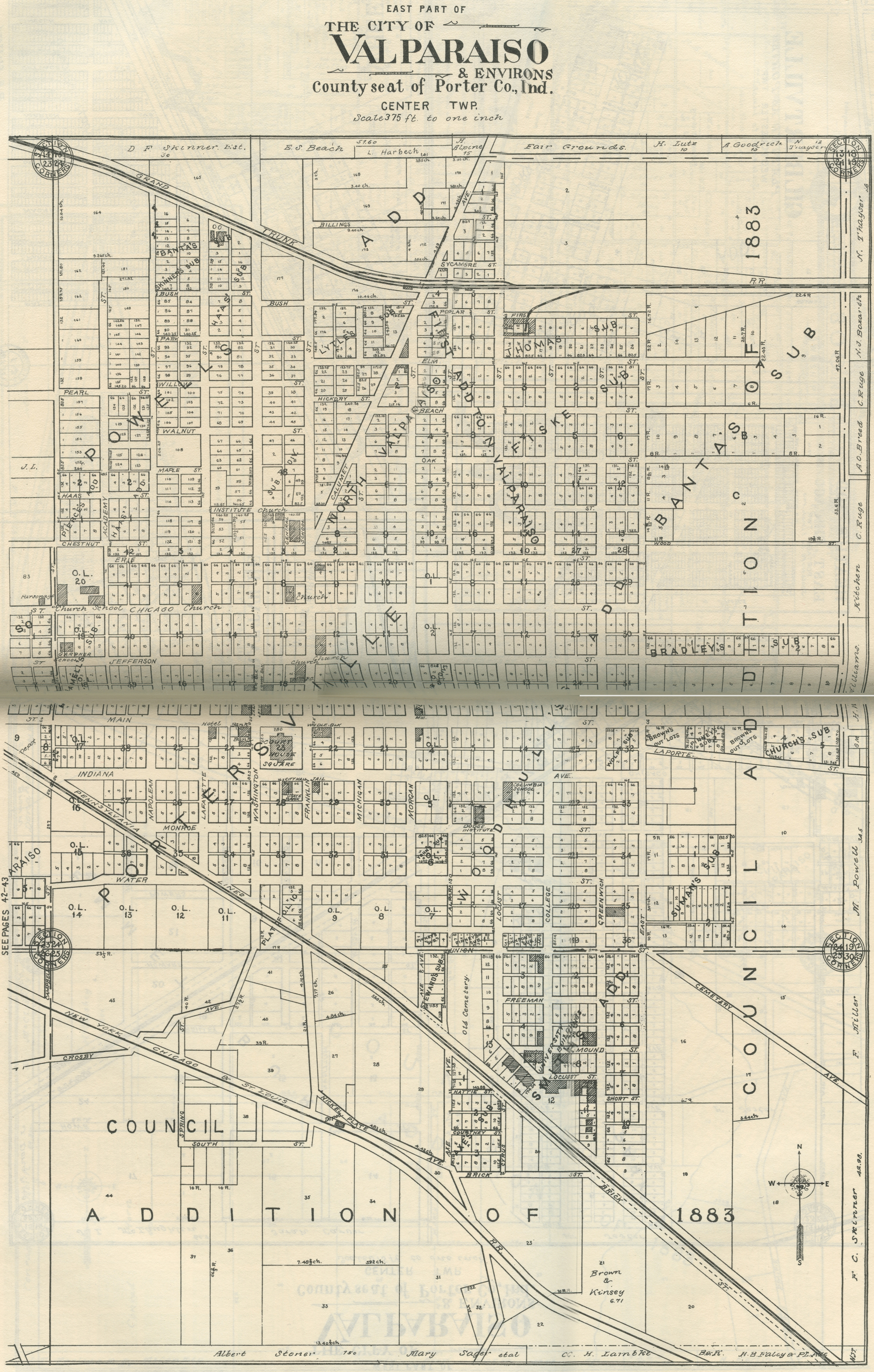
Valparaiso - East Part, 1906
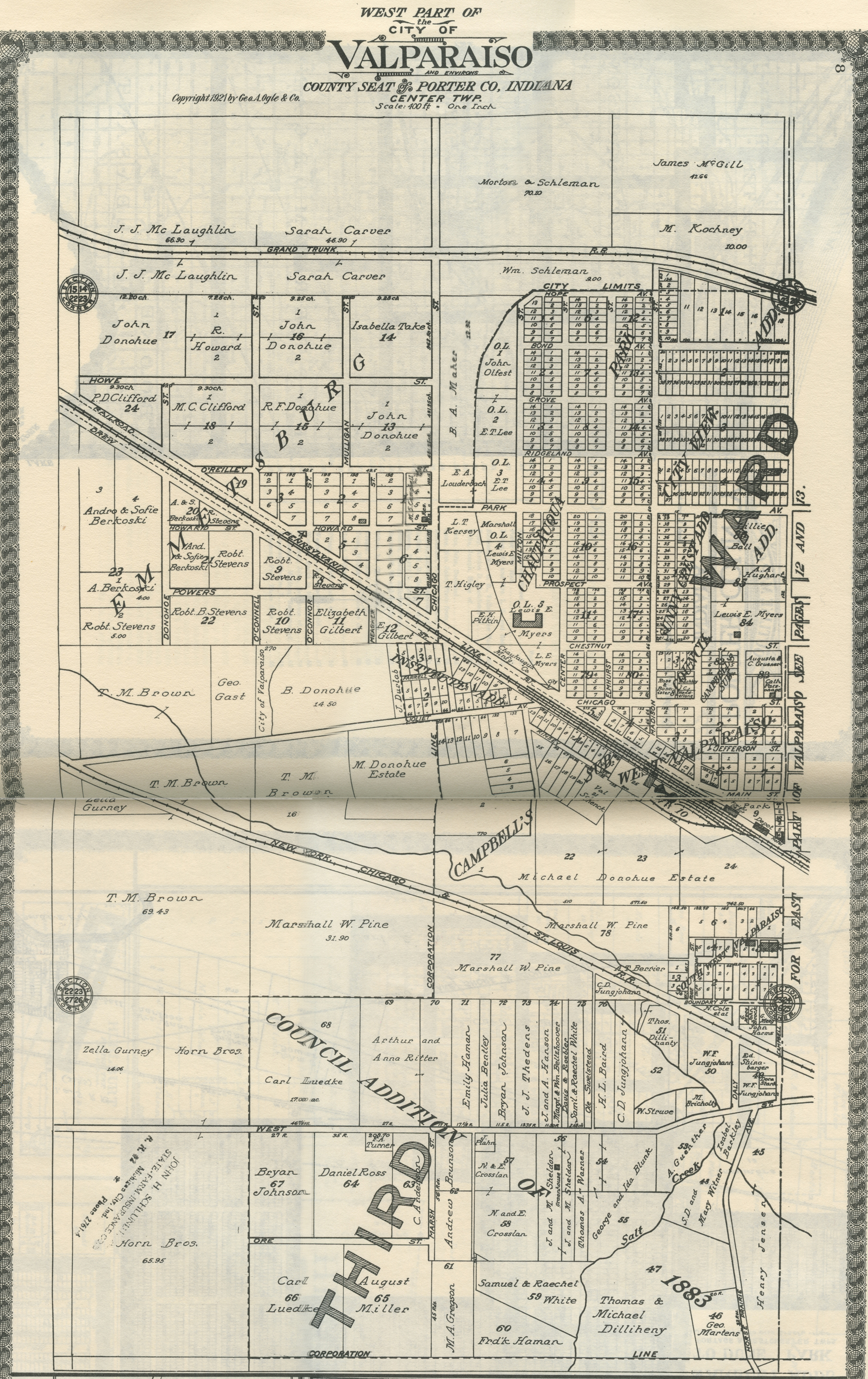
Valparaiso - West Part, 1921
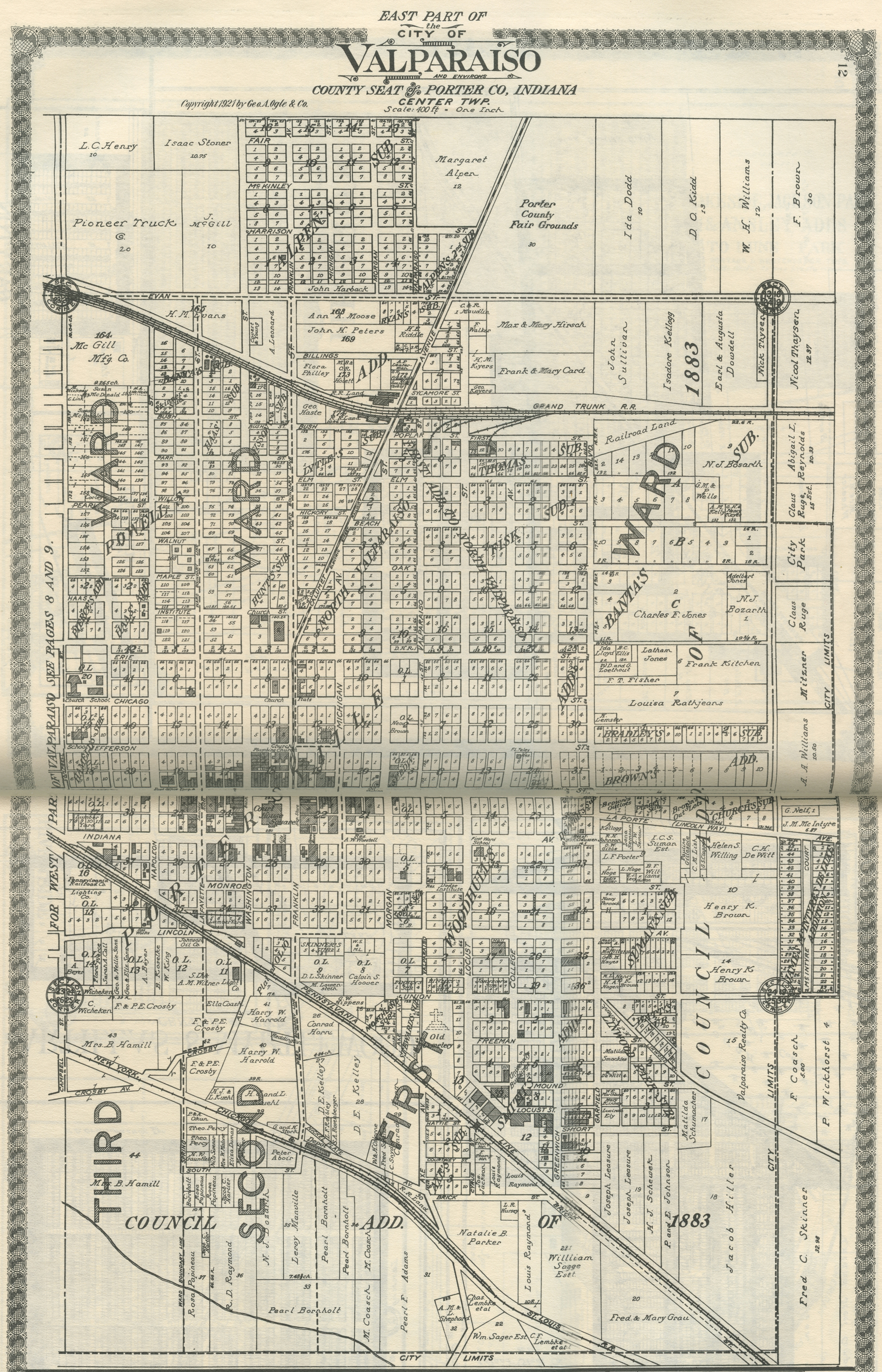
Valparaiso - East Part, 1921
Valparaiso - Part I, 1928
Valparaiso - Part II, 1928
Jackson Township
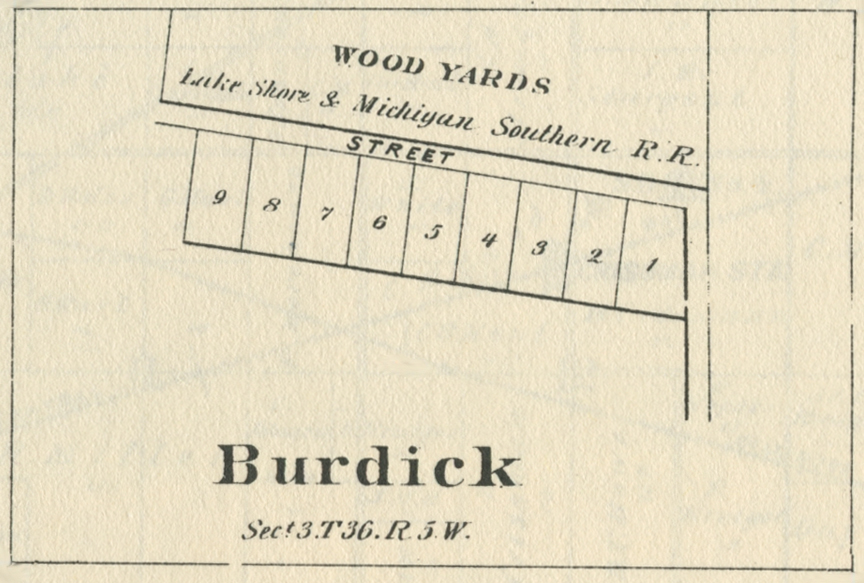
Burdick,
1875
Burdick,
1876
Burdick,
1906
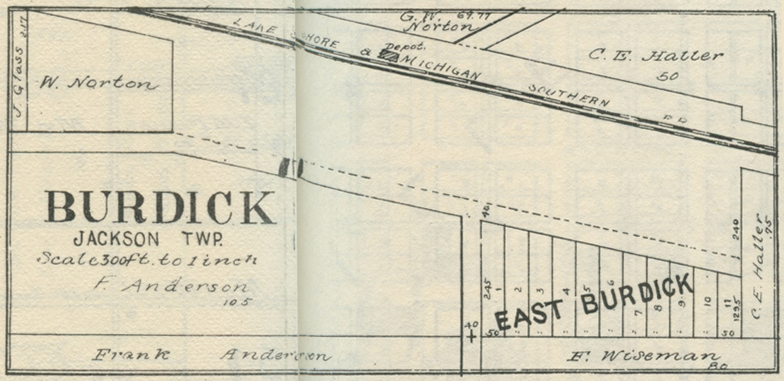
Burdick,
1921
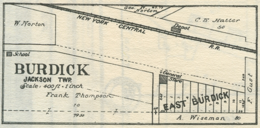
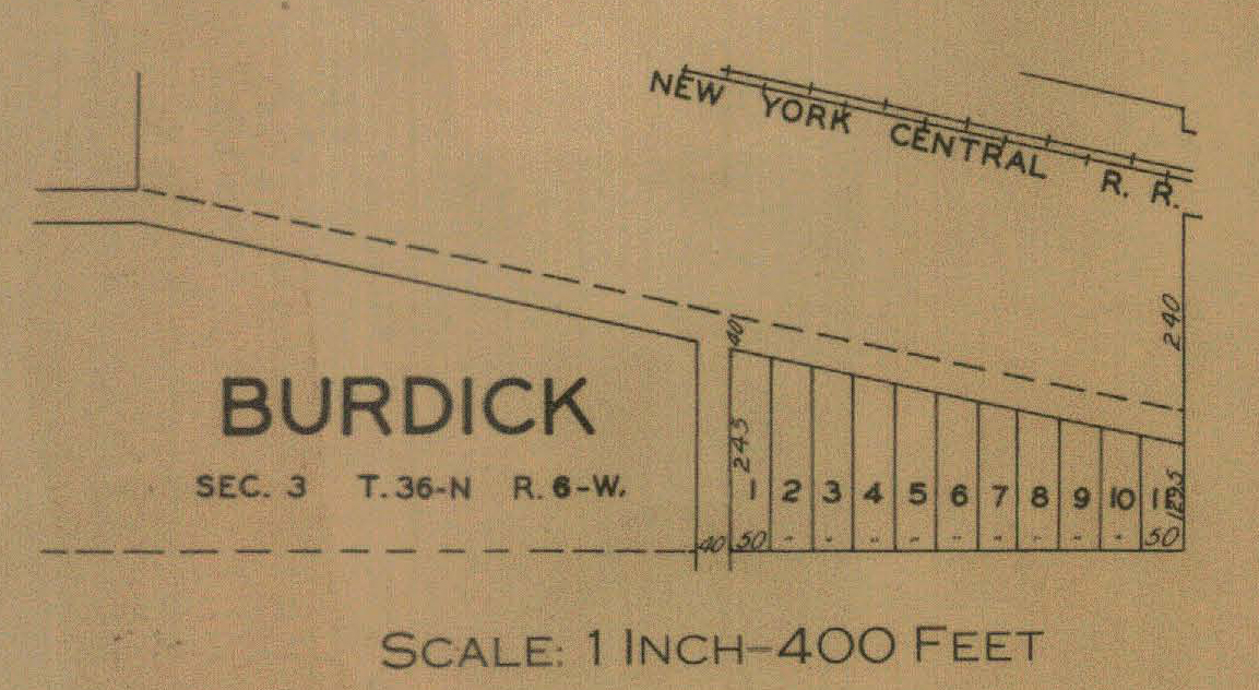
Burdick,
1928
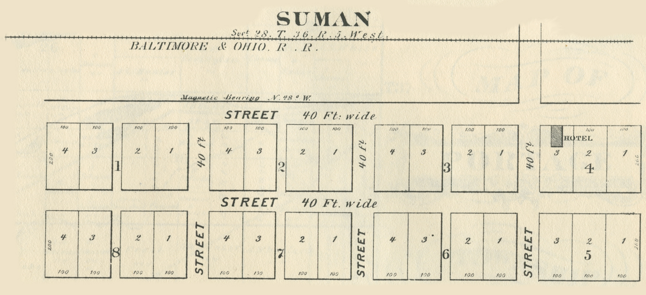
Suman, 1876
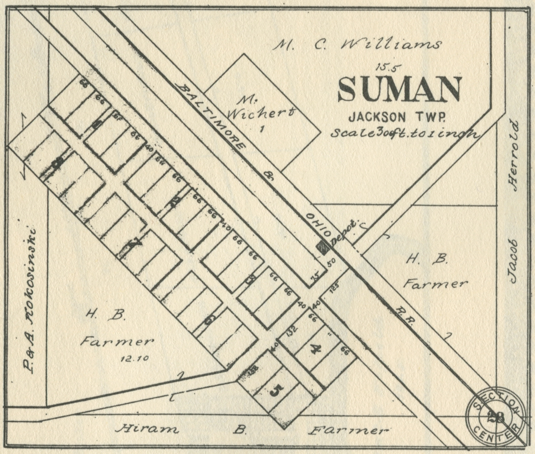
Suman, 1906
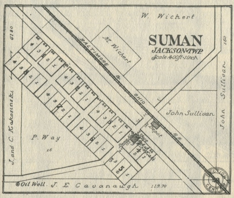
Suman, 1916
Suman, 1921
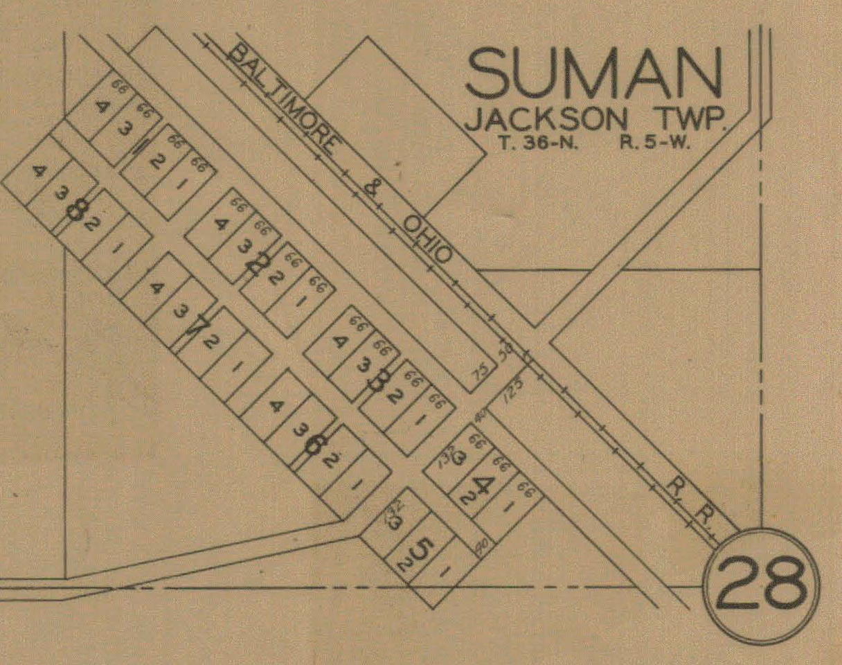
Suman, 1928
Liberty Township
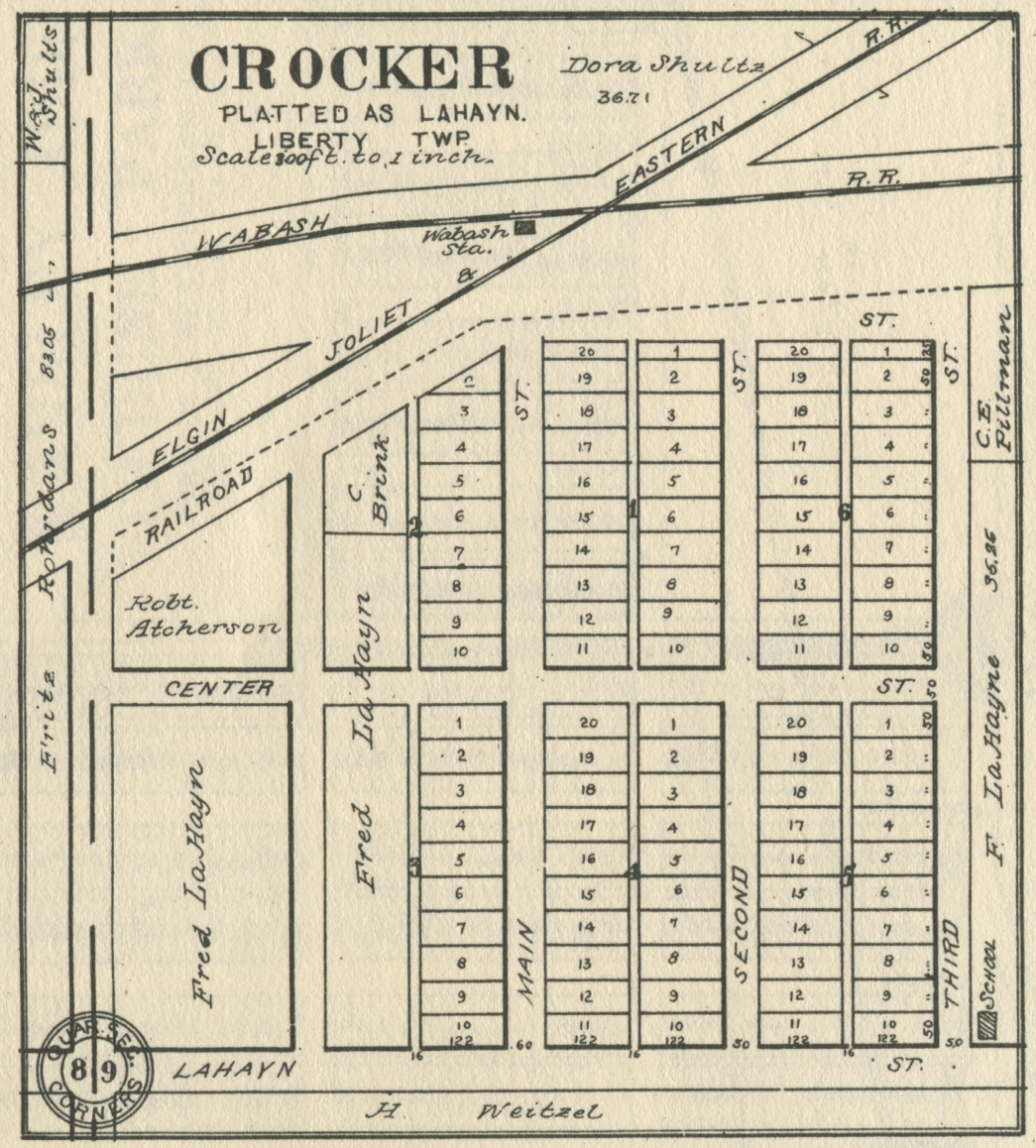
Crocker,
1906
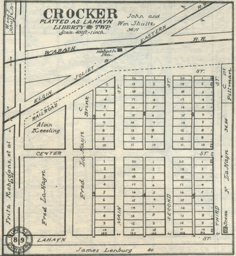
Crocker,
1921
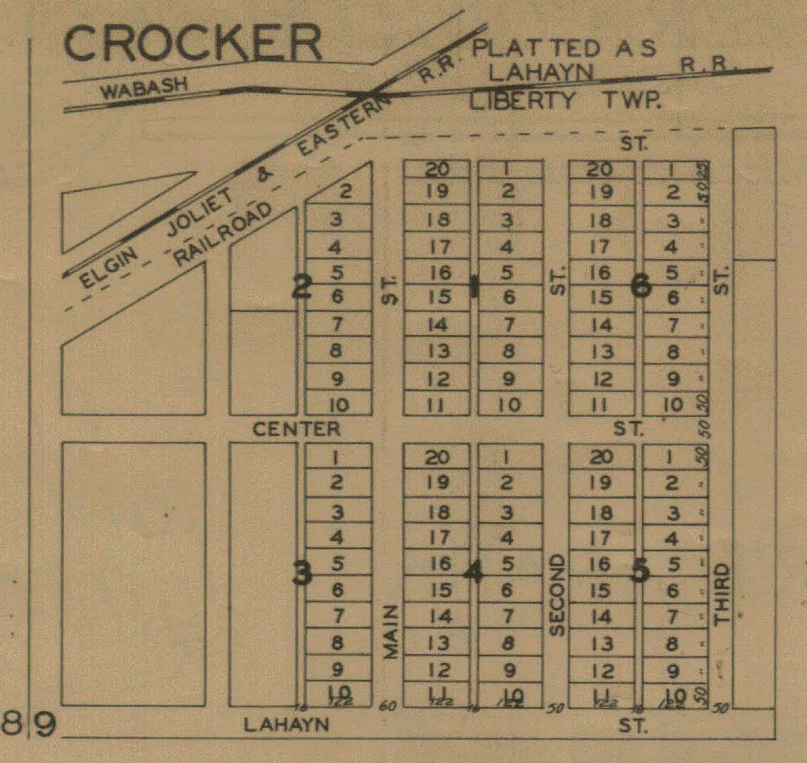
Crocker,
1928
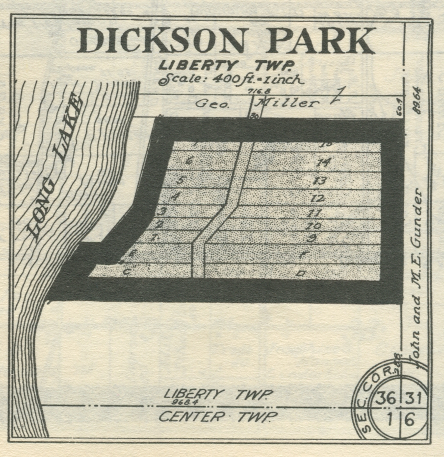
Dickson
Park, 1921
Sections 31 and 36, 1928
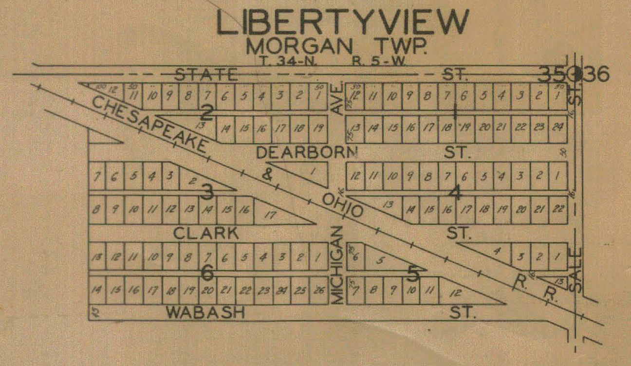
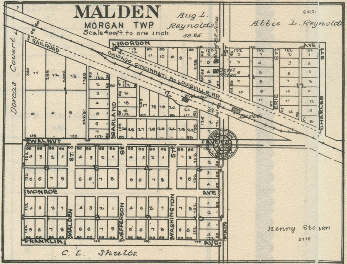
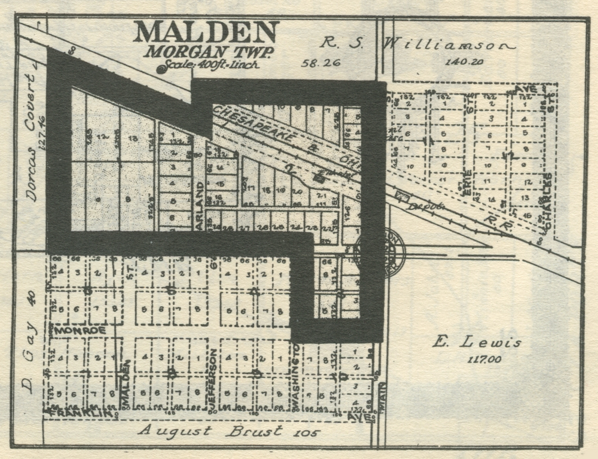
Morgan Township
Libertyview, 1921
Libertyview, 1928
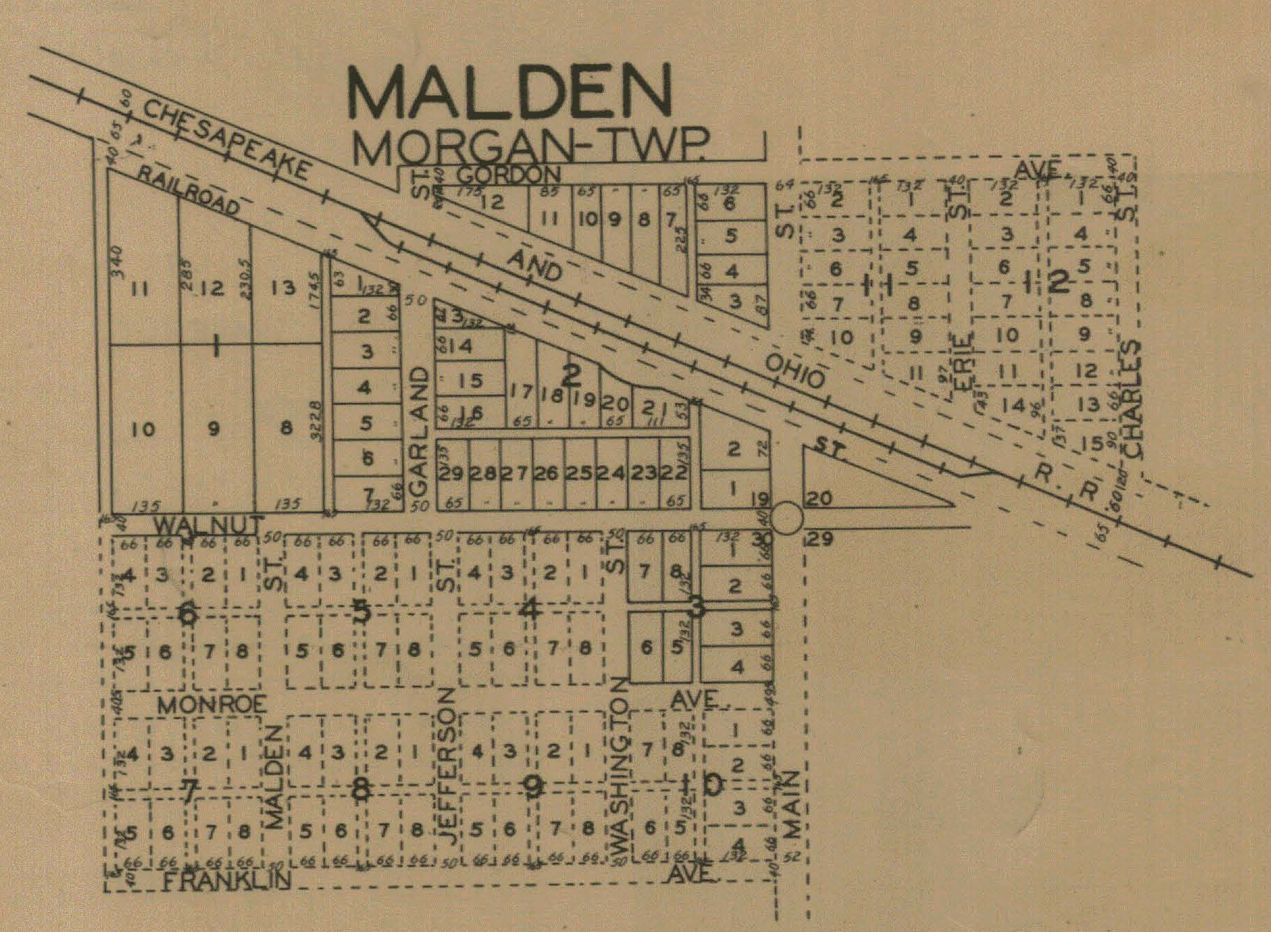
Malden, 1906
Malden, 1921
Malden, 1928
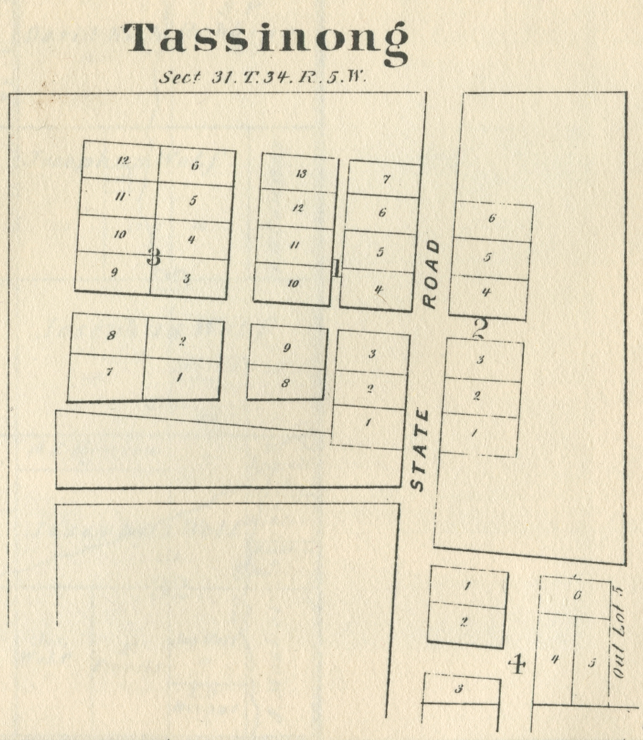
Tassinong,
1869
Tassinong,
1876
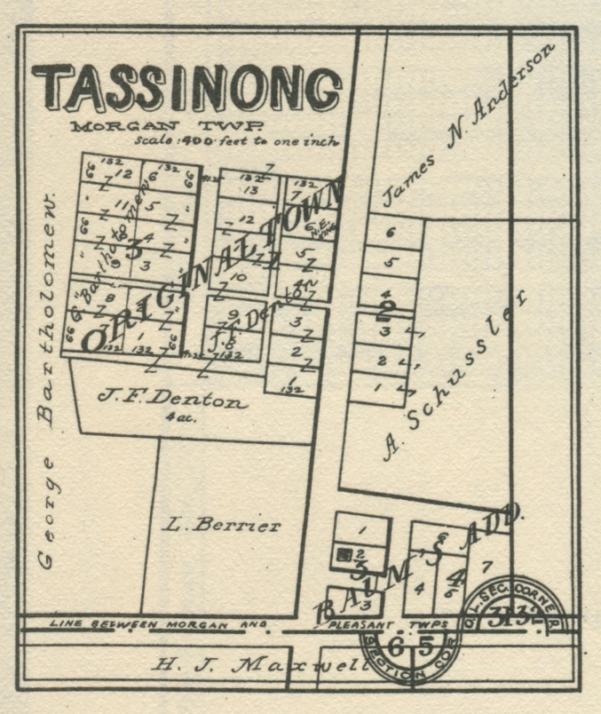
Tassinong,
1906
Tassinong,
1921
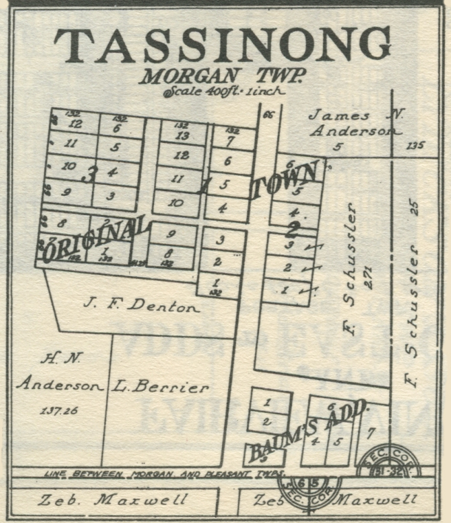
Tassinong,
1928
Pine Township
Beverly
Shores, 1928
Beverly
Shores, 1937
Joers, 1928
The Pines,
1928
Pleasant Township
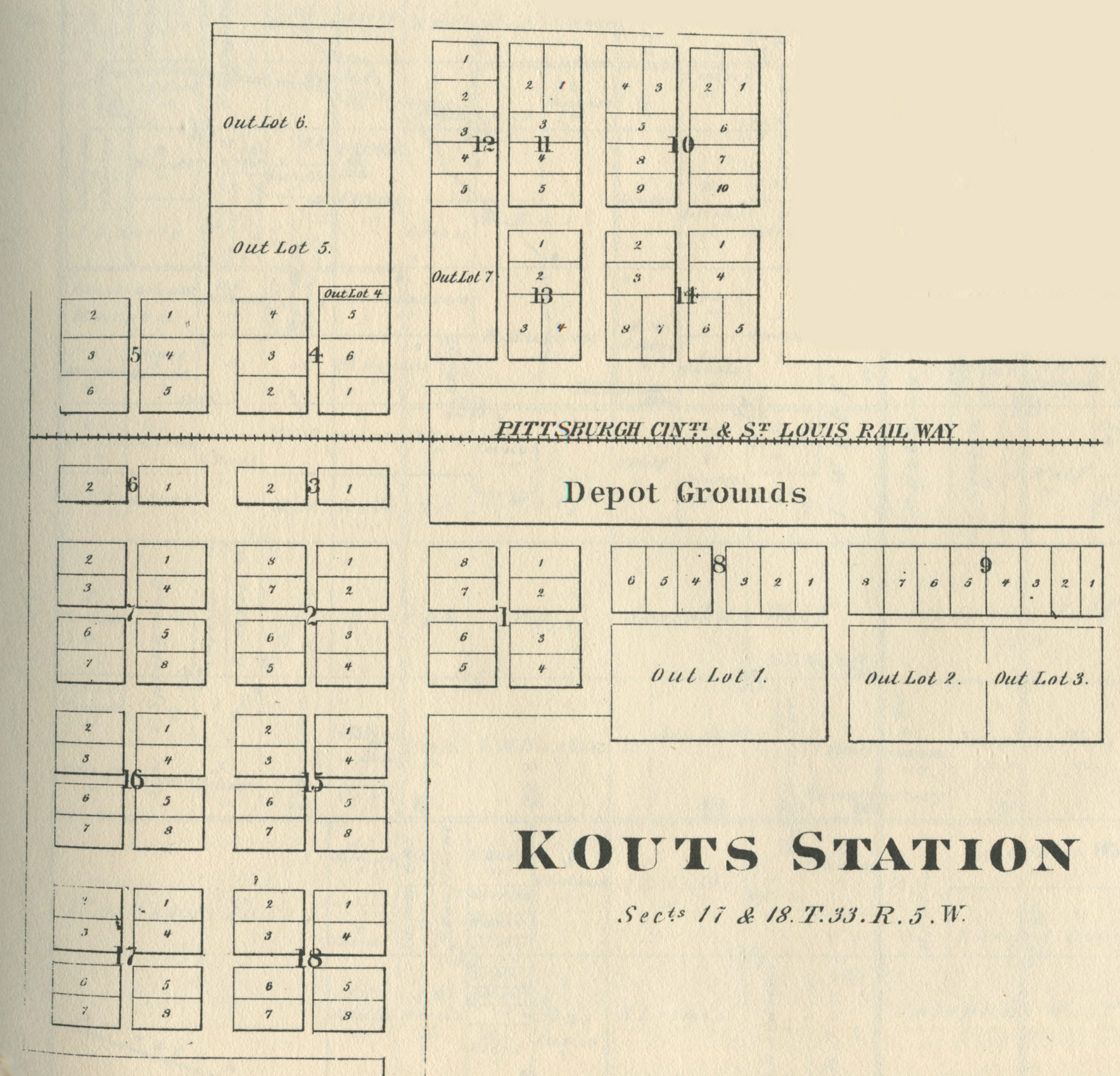
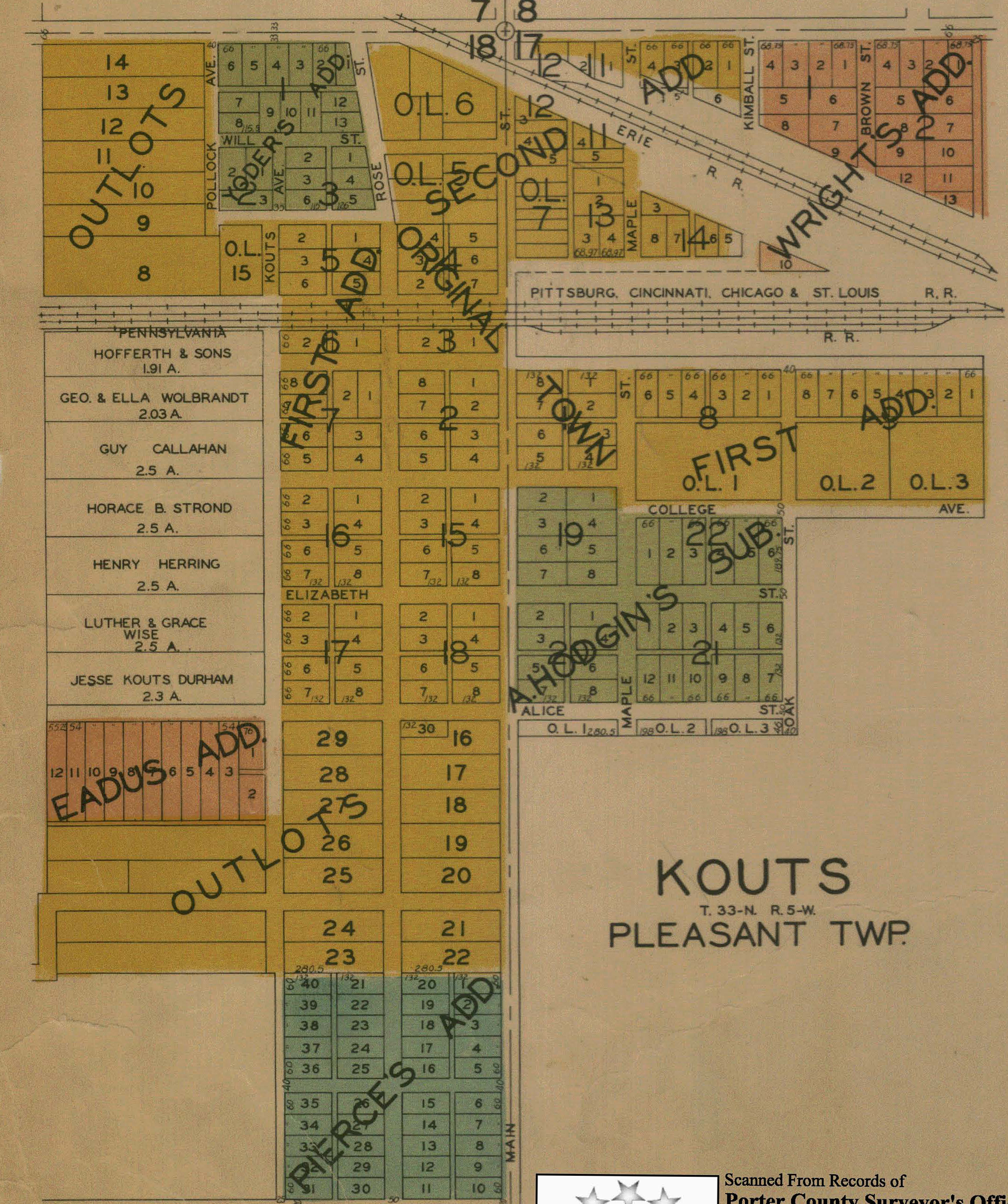
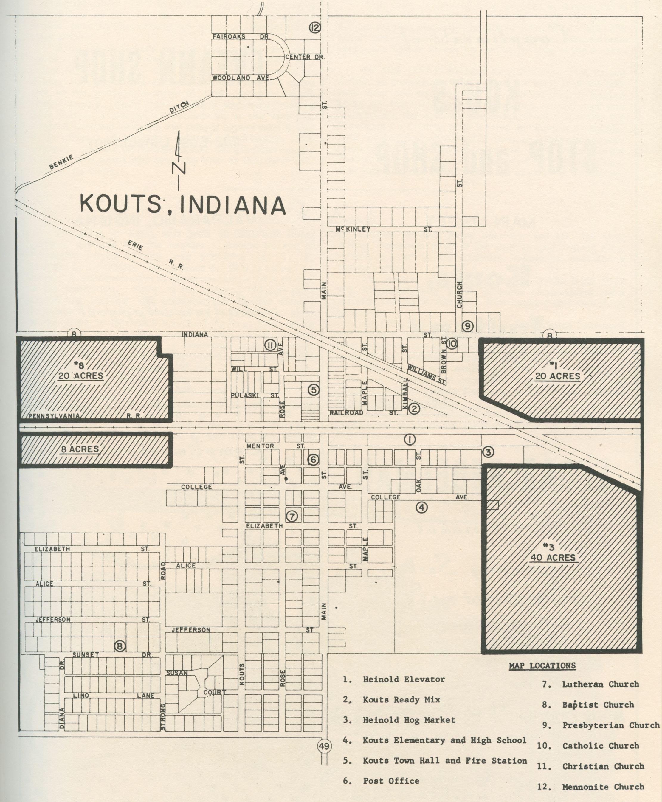
Kouts, 1876
Kouts, 1895
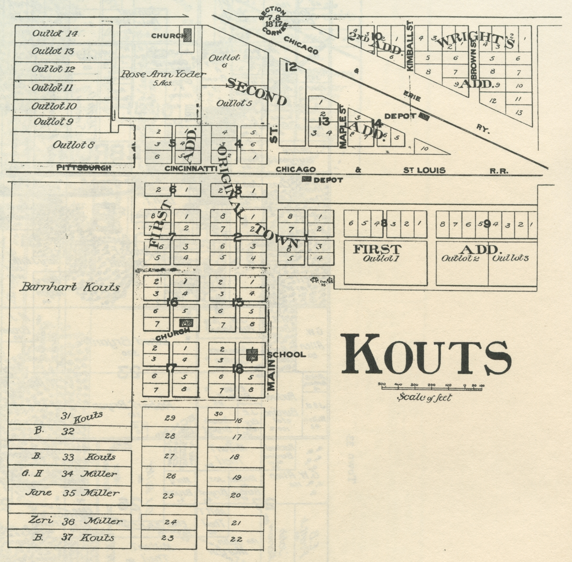
Kouts, 1906
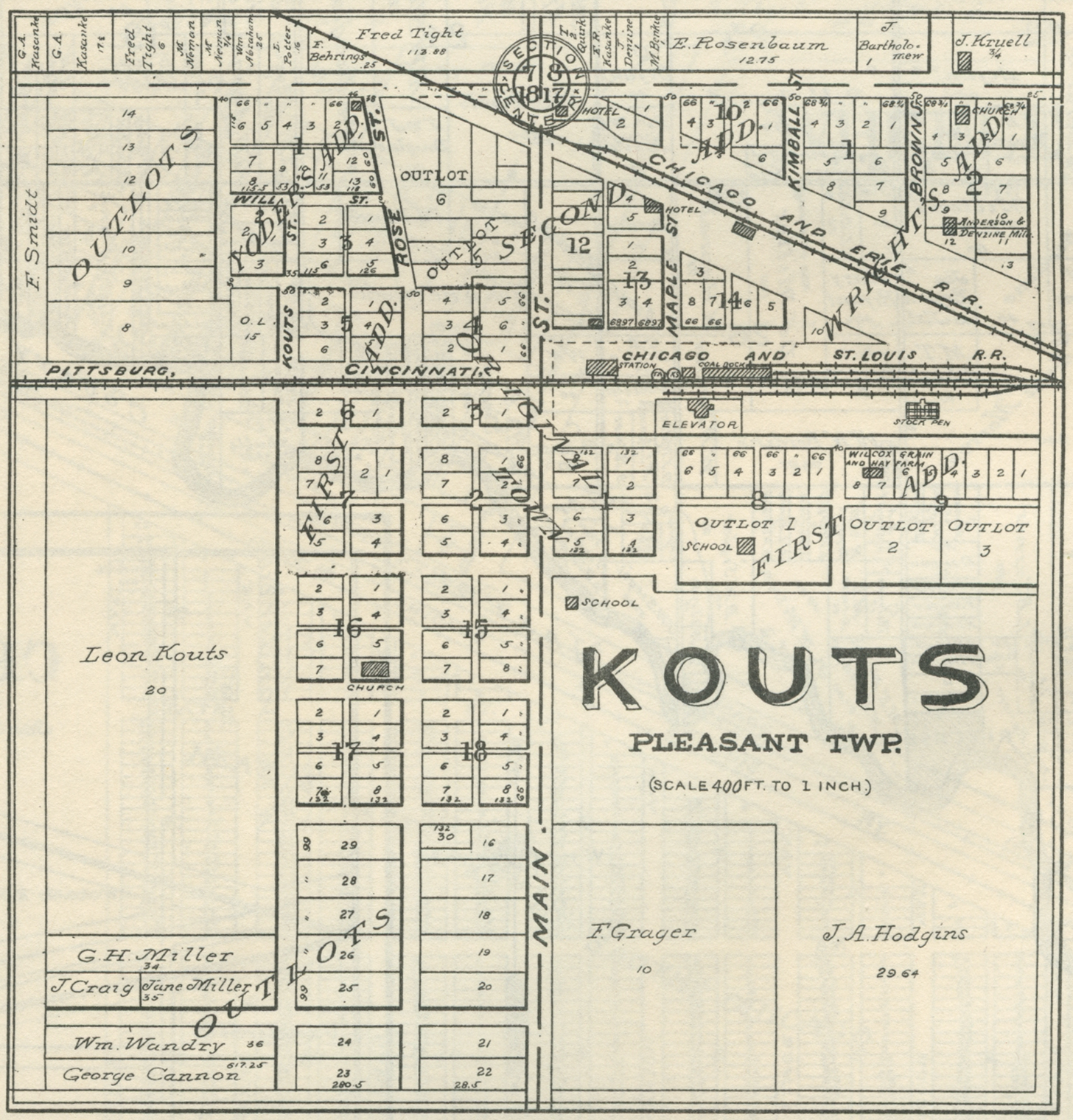
Kouts, 1921
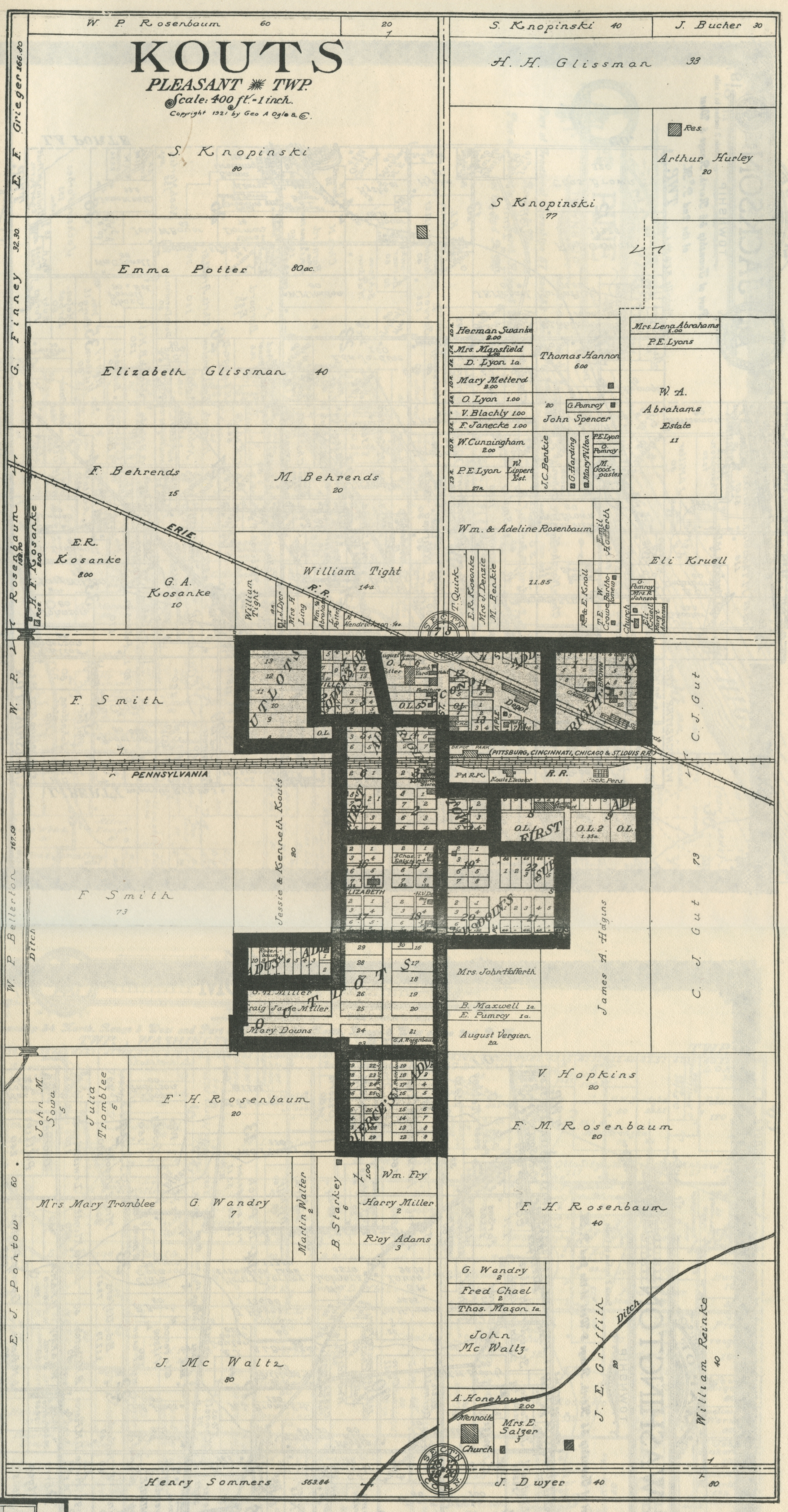
Kouts, 1928
Kouts, 1965
Riverview, 1928
Roosevelt, no date
Portage Township
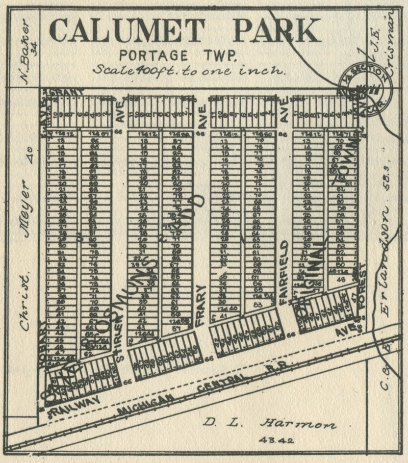
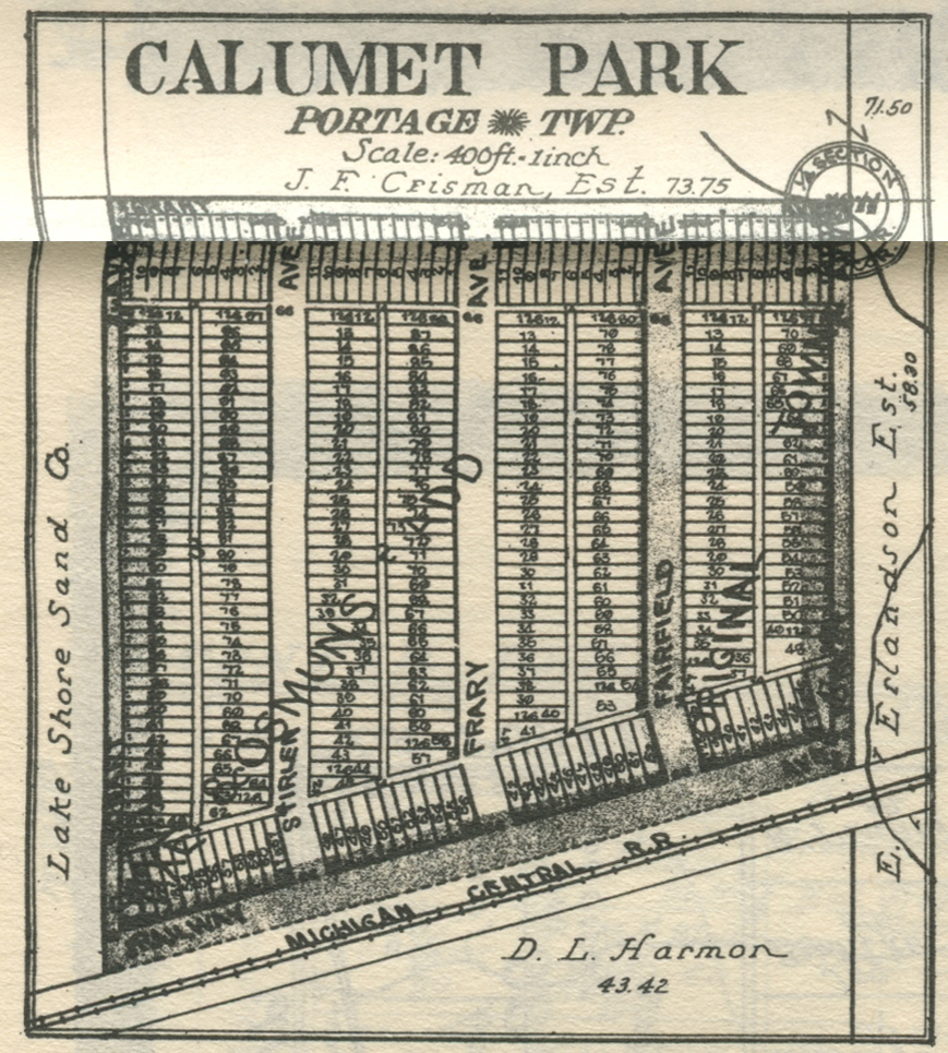
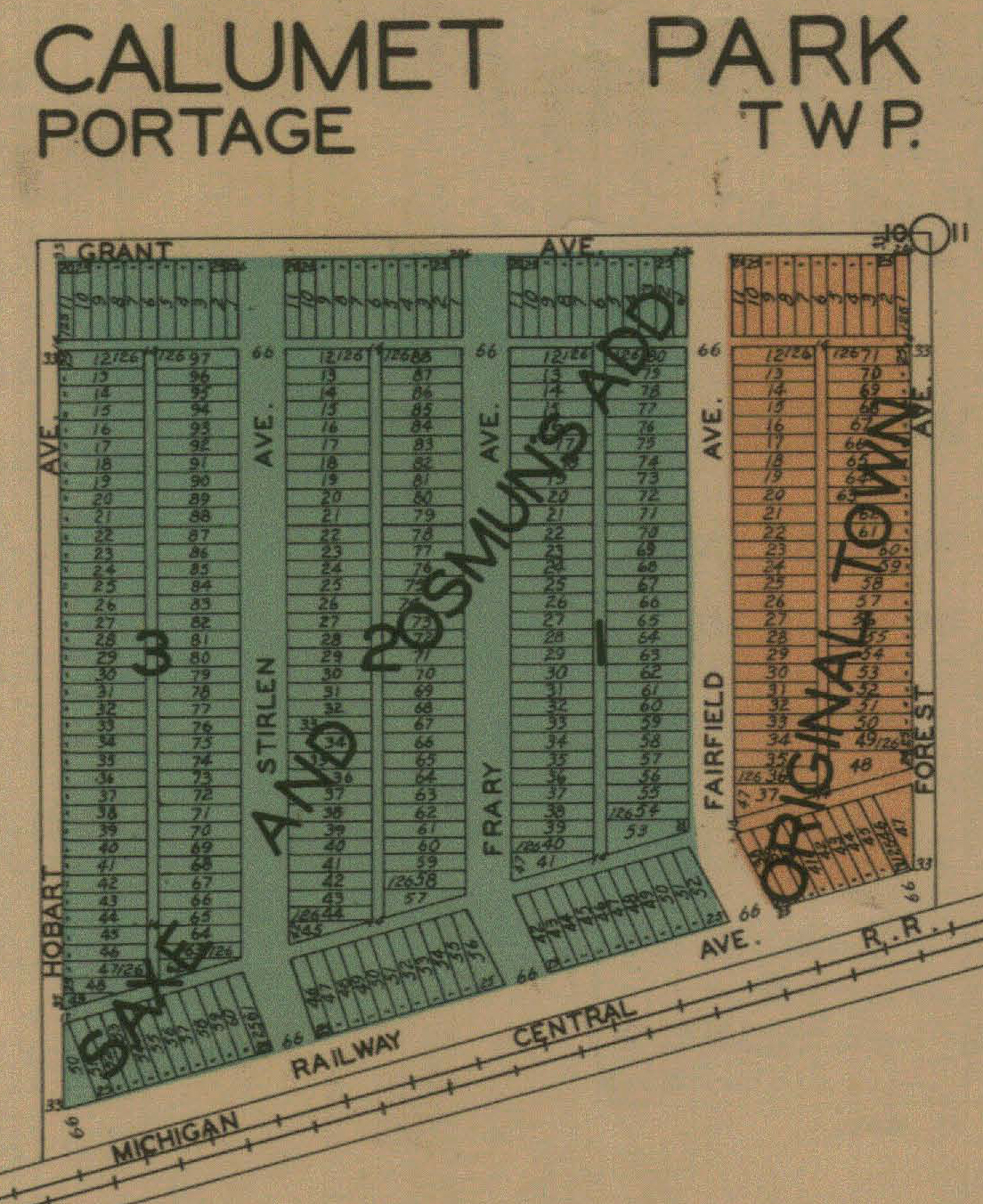
Calumet
Park, 1906
Calumet
Park, 1921
Calumet
Park, 1928
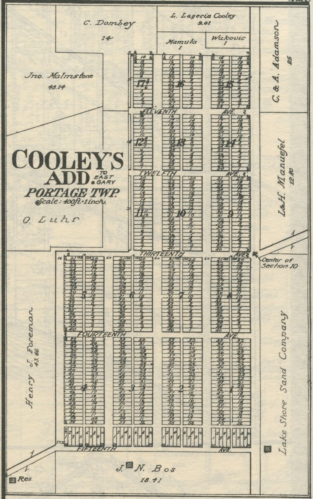
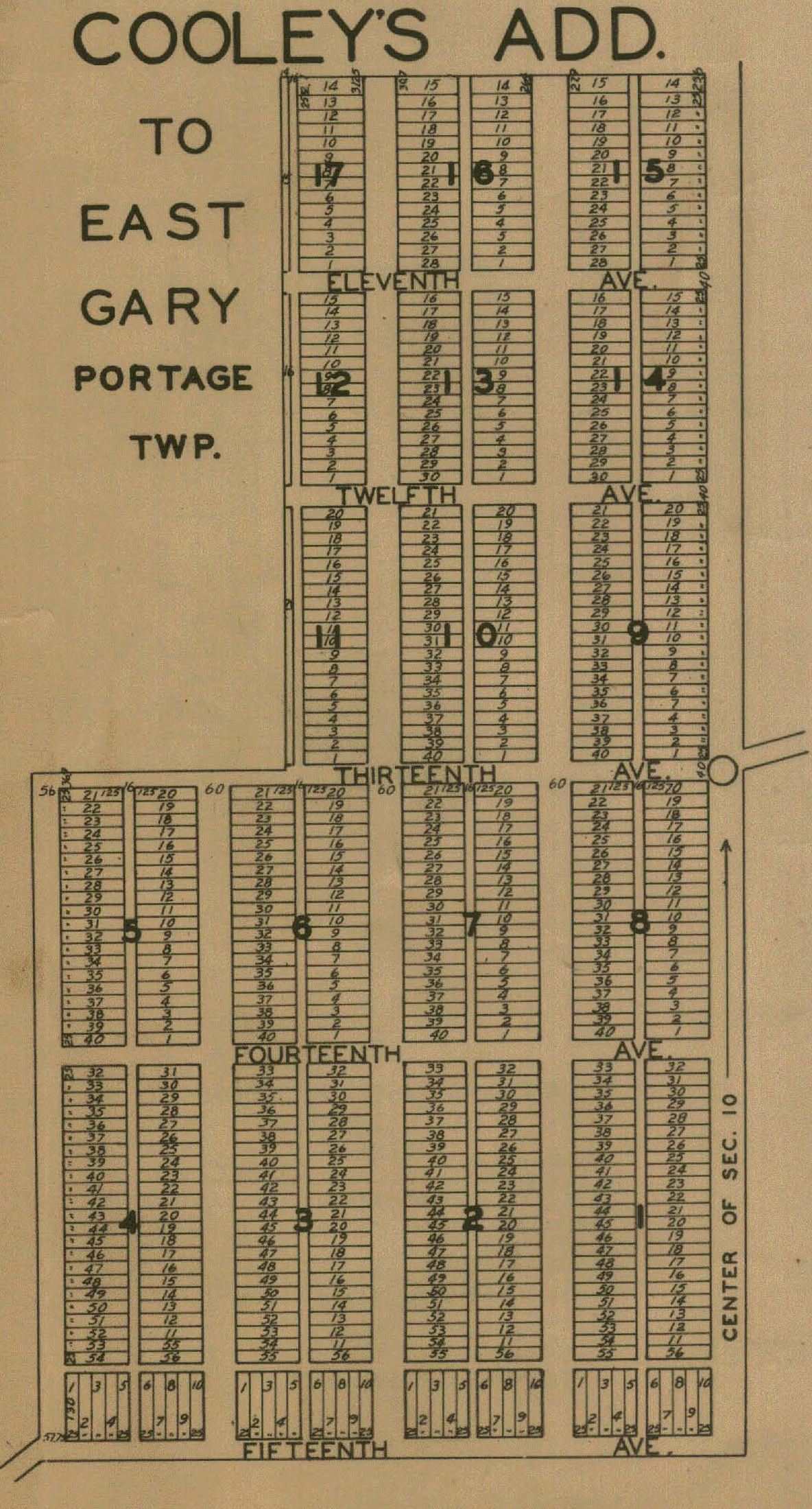
Cooley's Addition to East Gary, 1921
Cooley's Addition, 1928
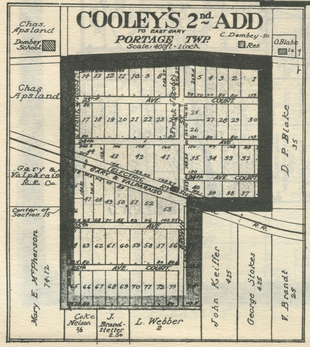
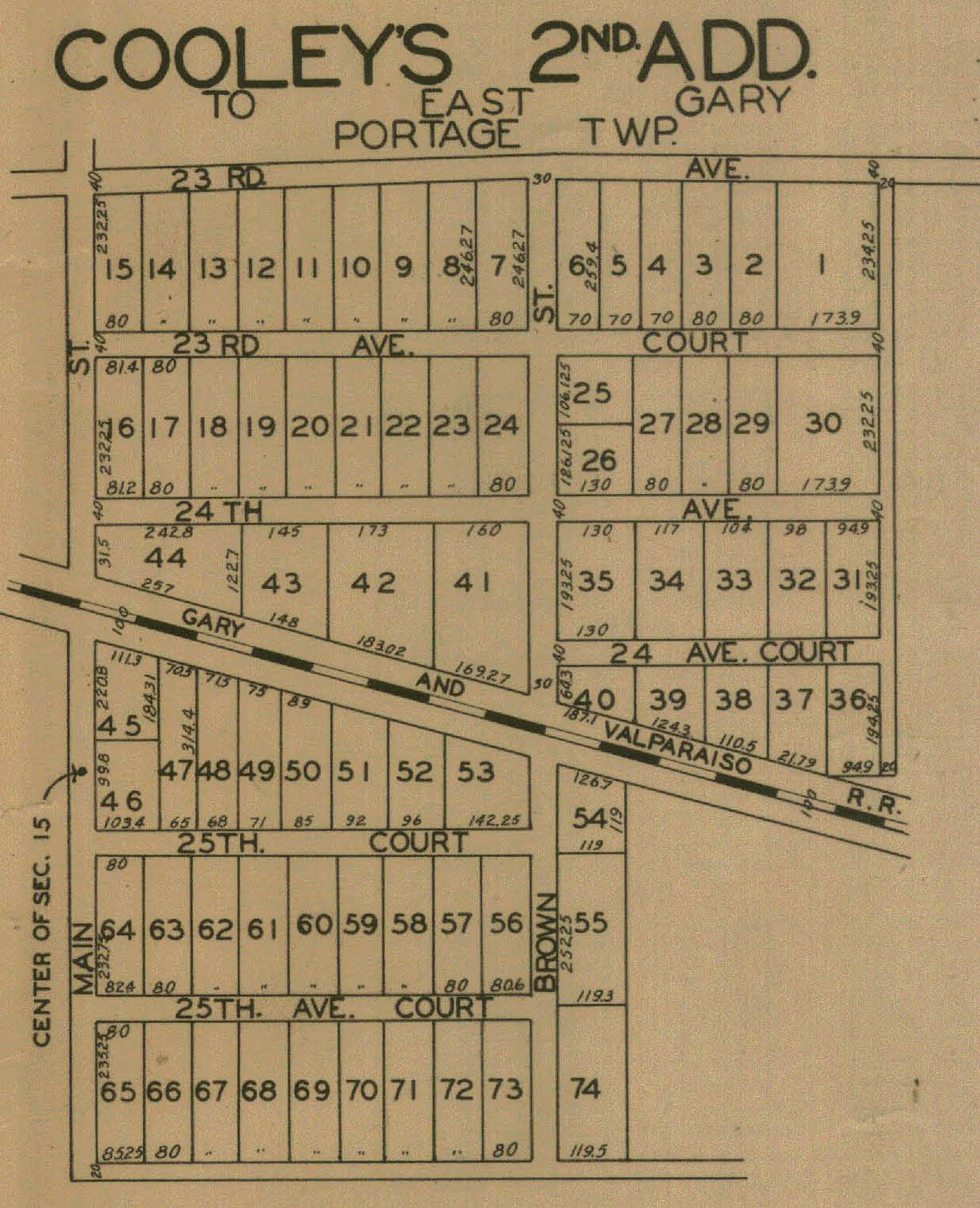
Cooley's Second Addition to East Gary, 1921
Cooley's Second Addition, 1928
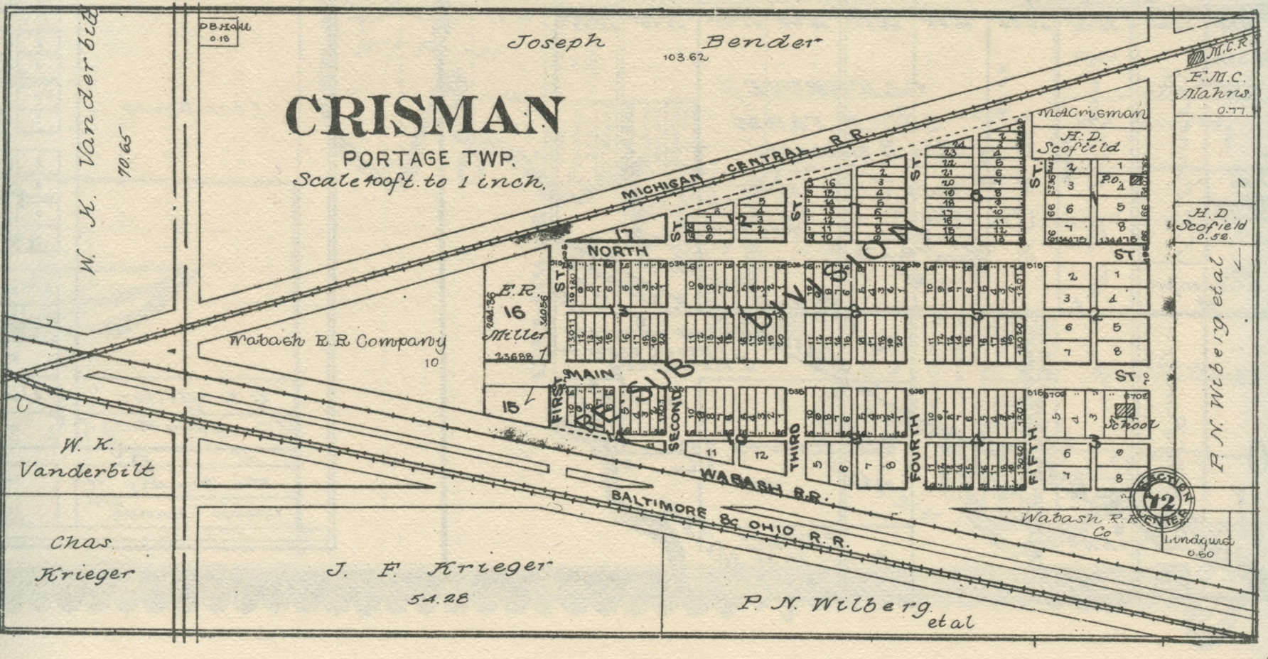
Crisman,
1906
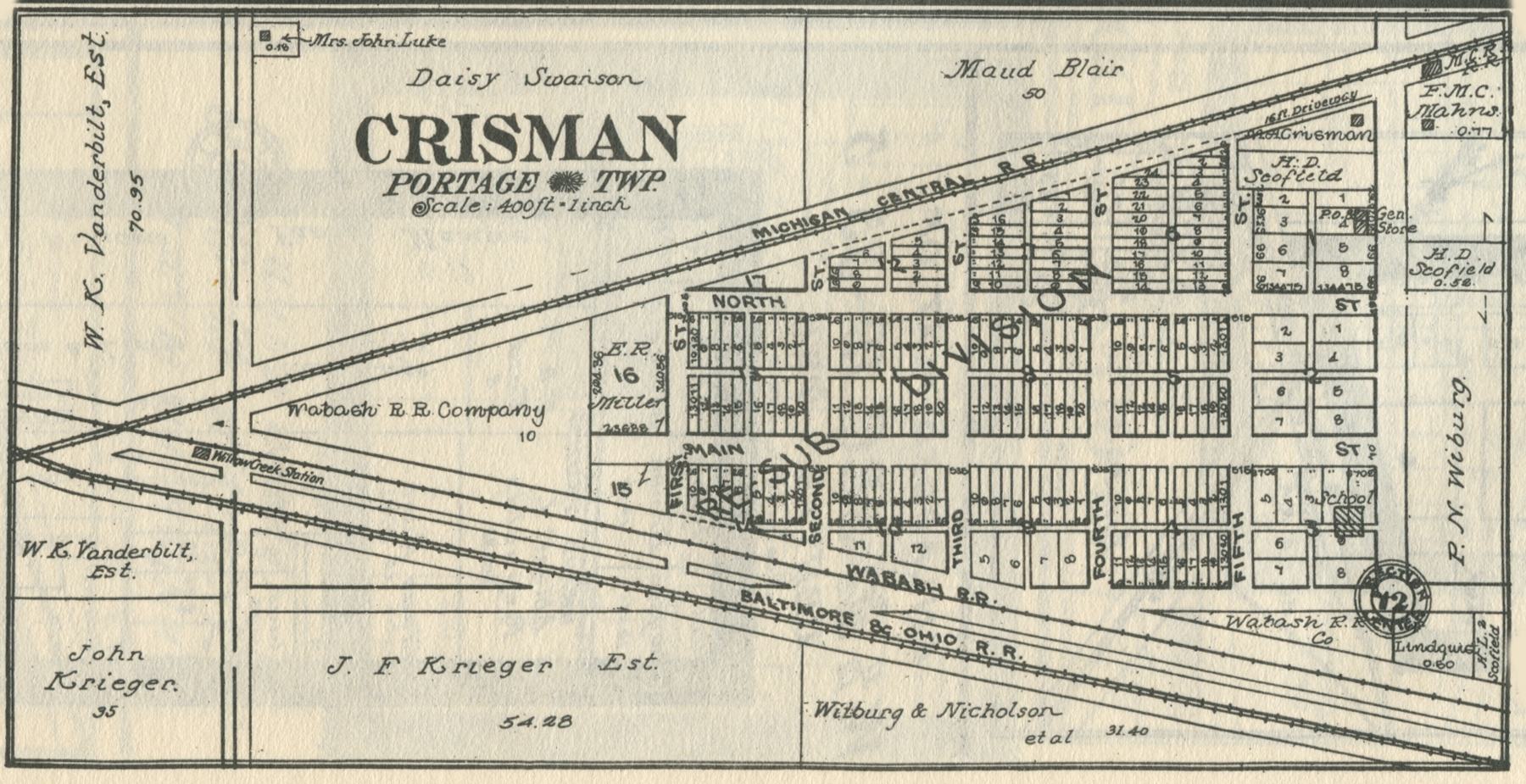
Crisman,
1921
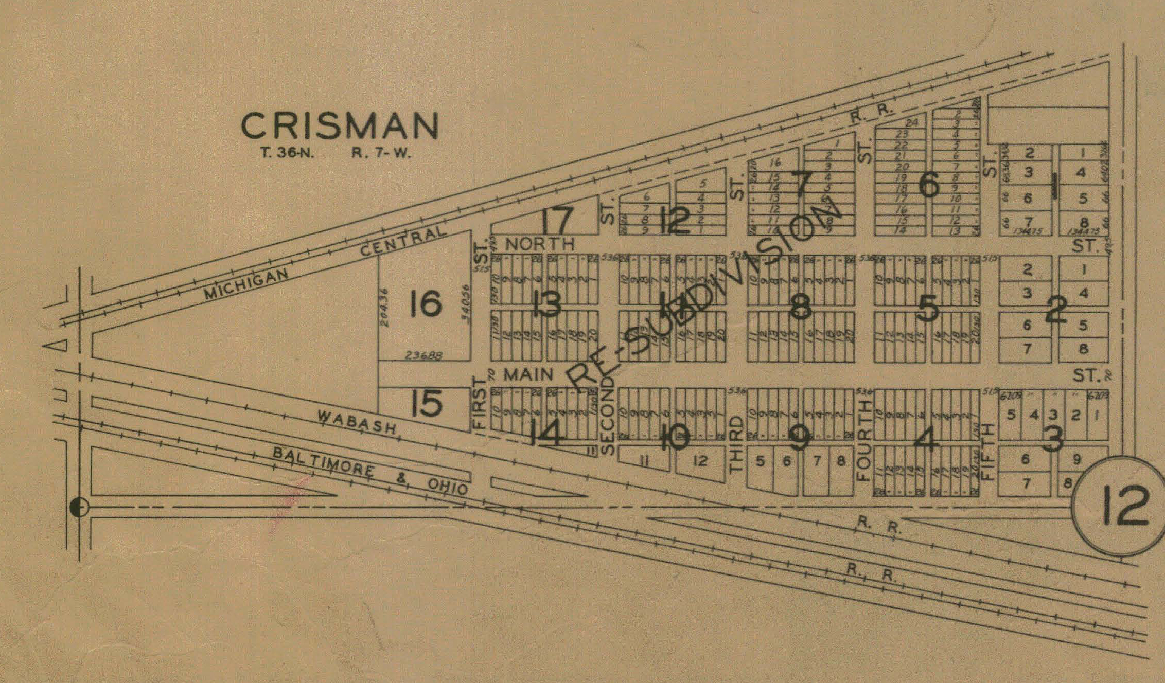
Crisman,
1928
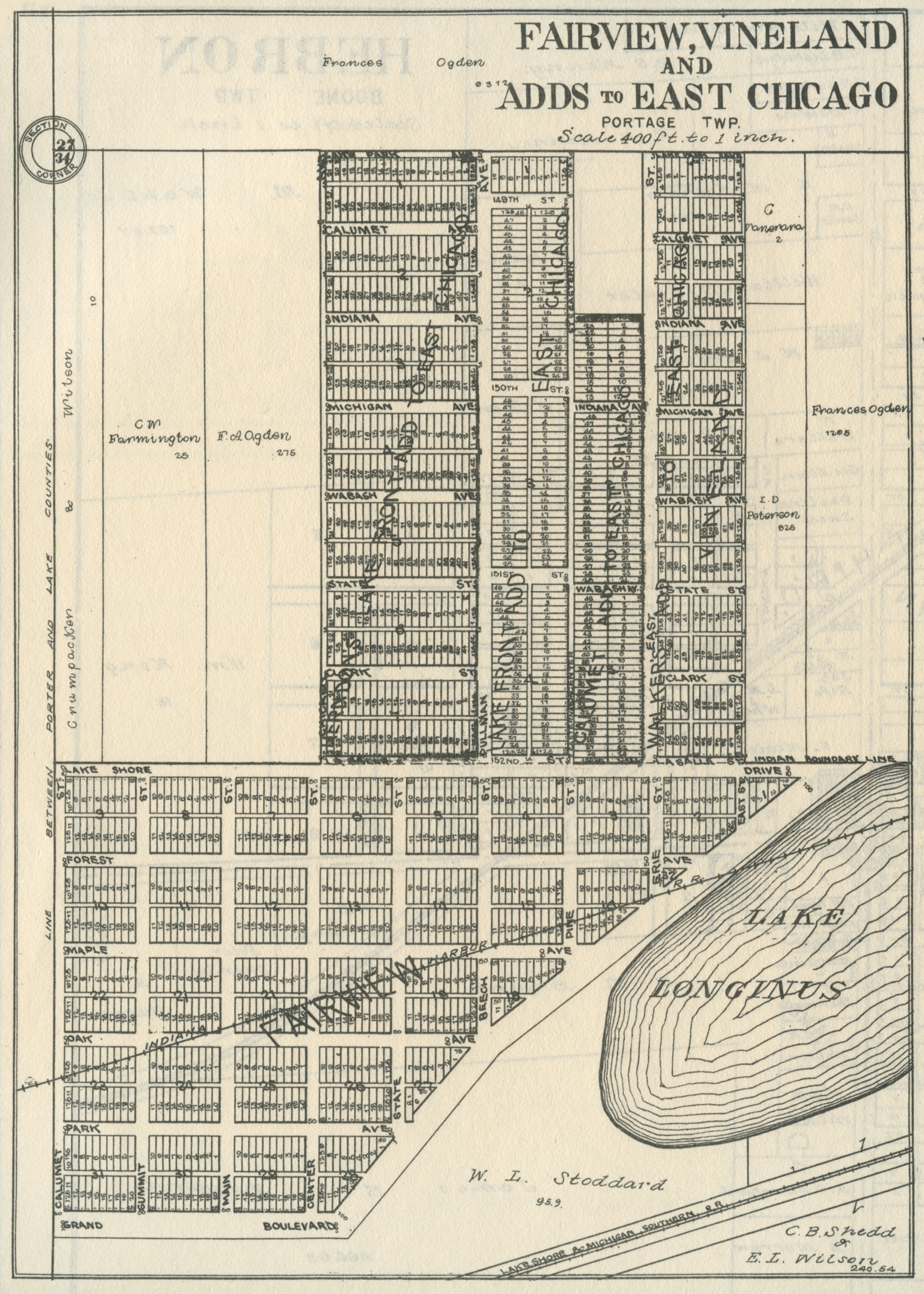
Fairview and Vineland Additions to East Chicago, 1906
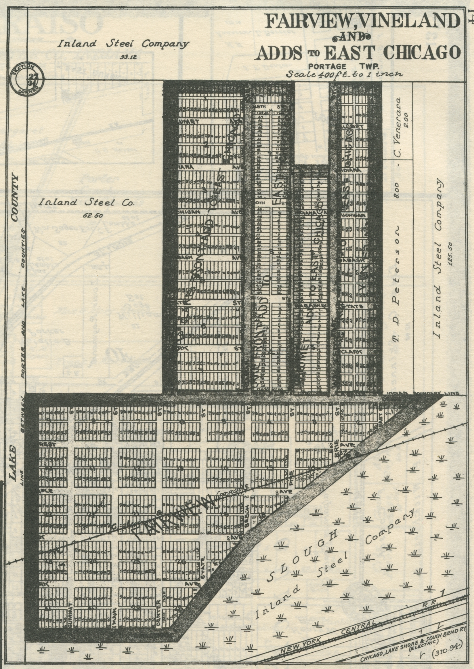
Fairview and Vineland Additions to East Chicago, 1921
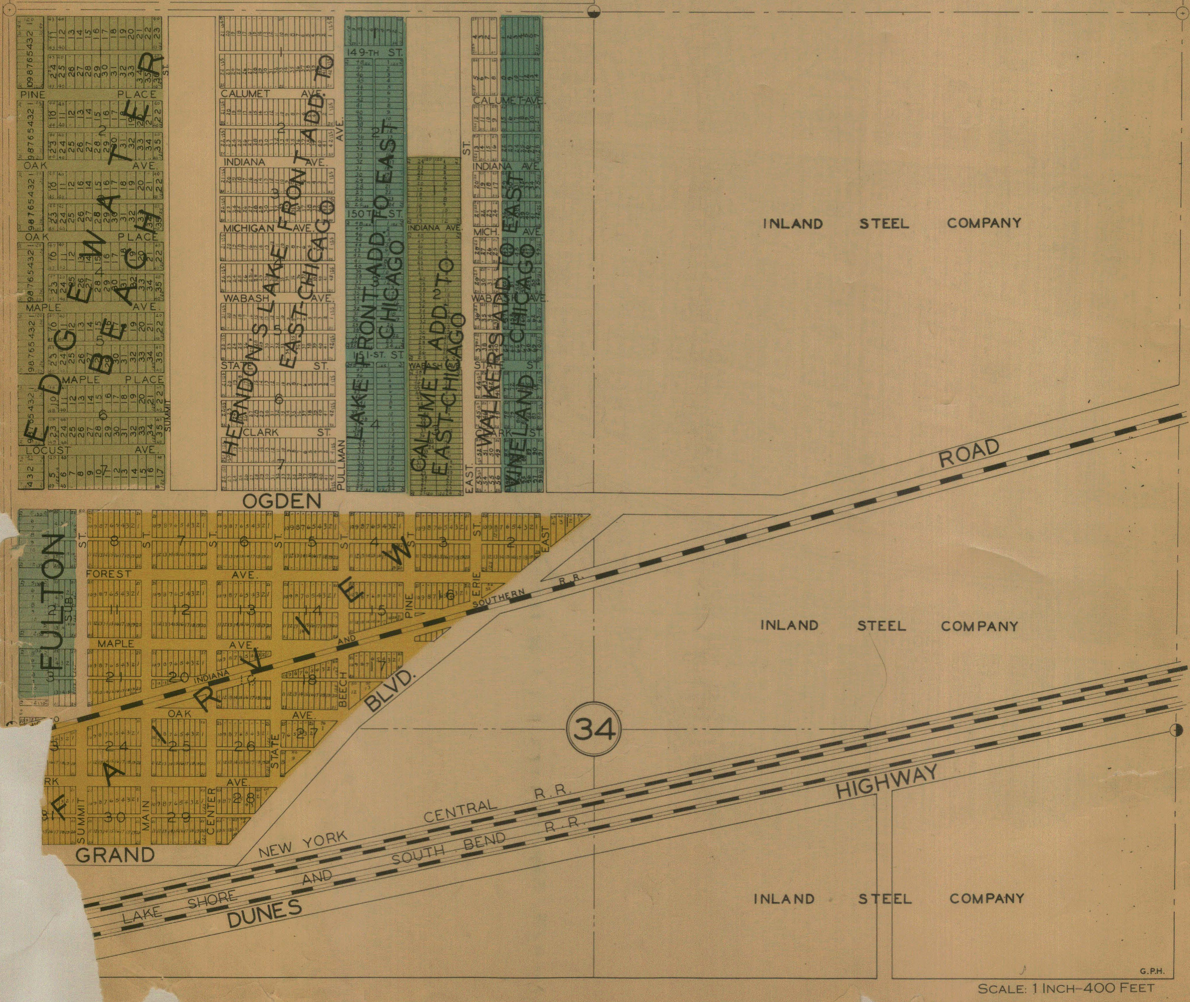
Fairview, 1928
Fairview,
no date
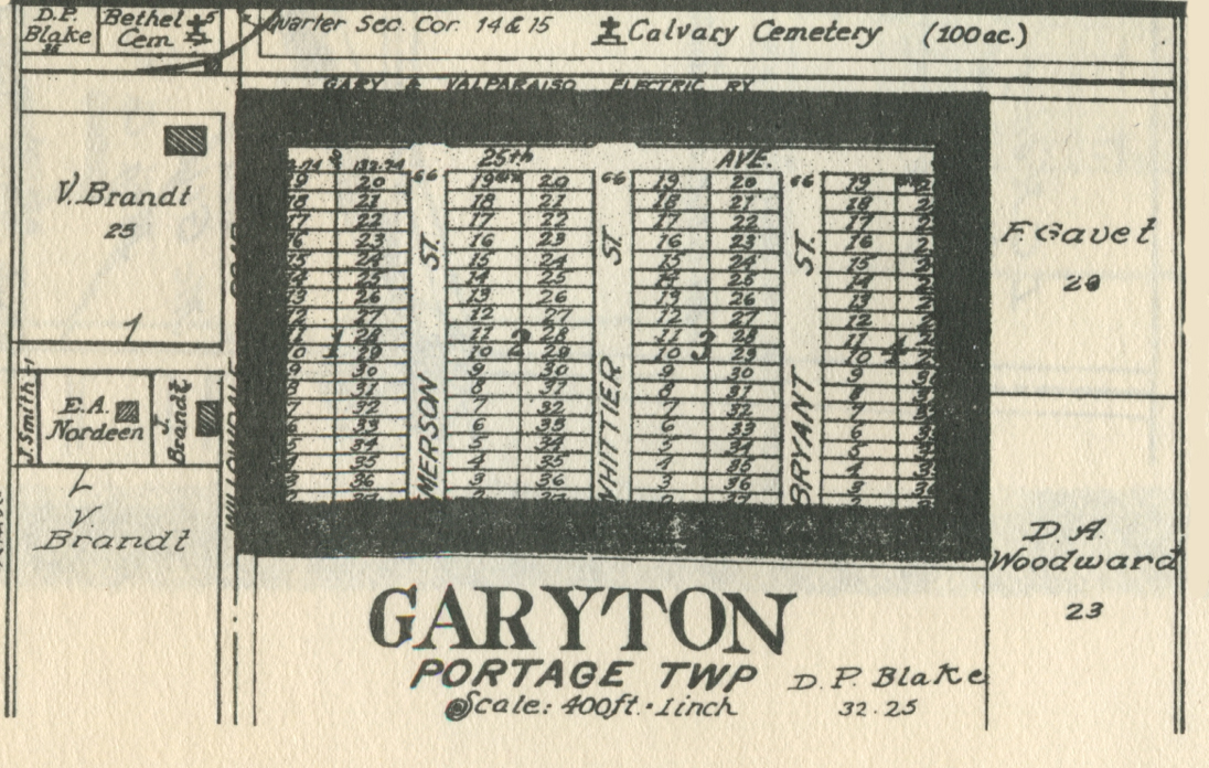
Garyton,
1921
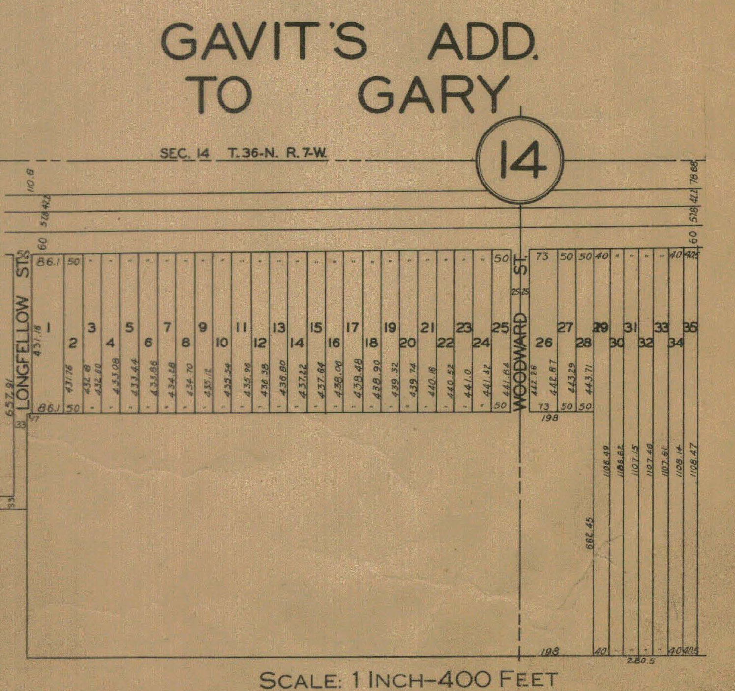
Gavit's Addition, 1928
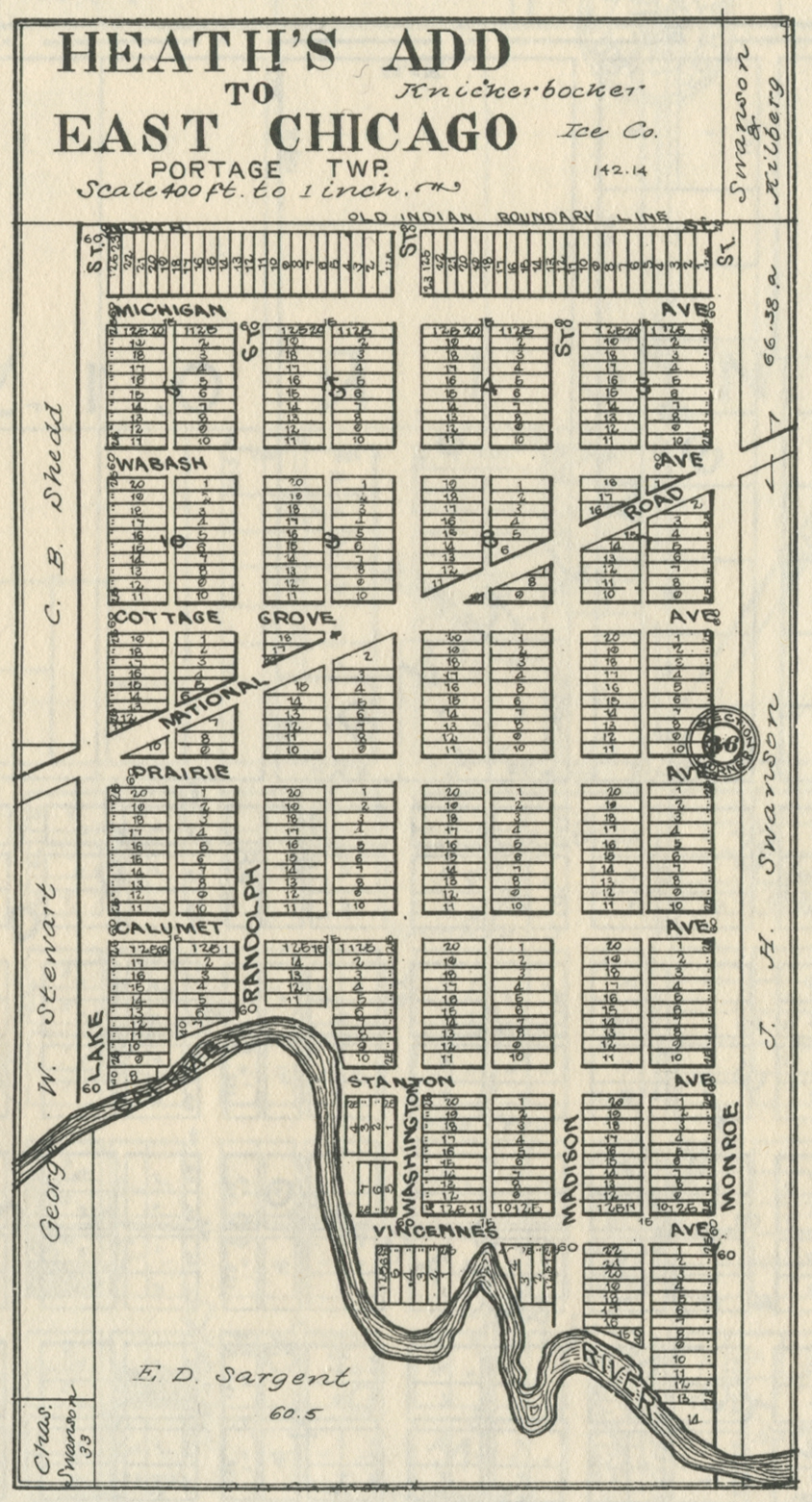
Heath's Addition to East Chicago, 1906
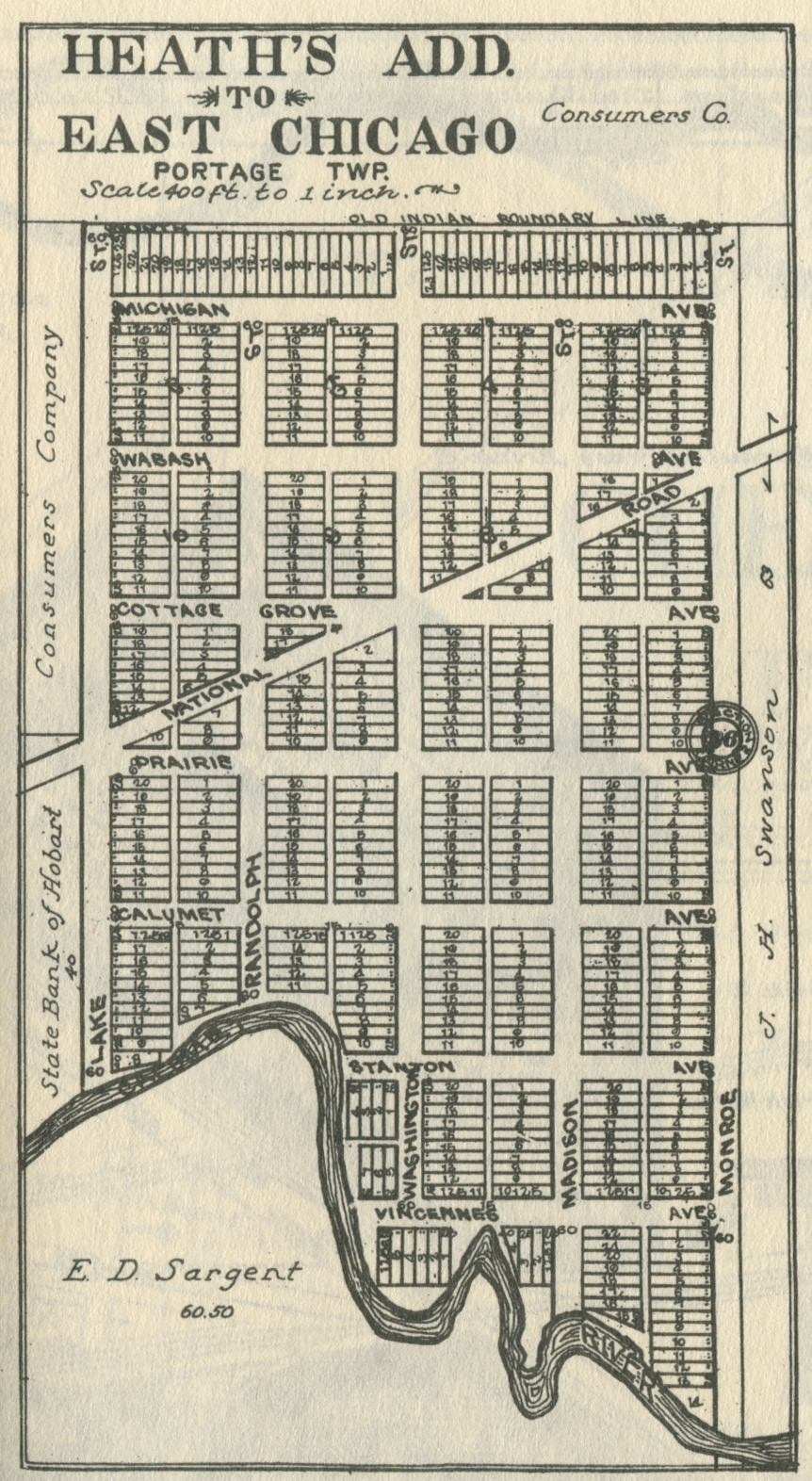
Heath's Addition to East Chicago, 1921
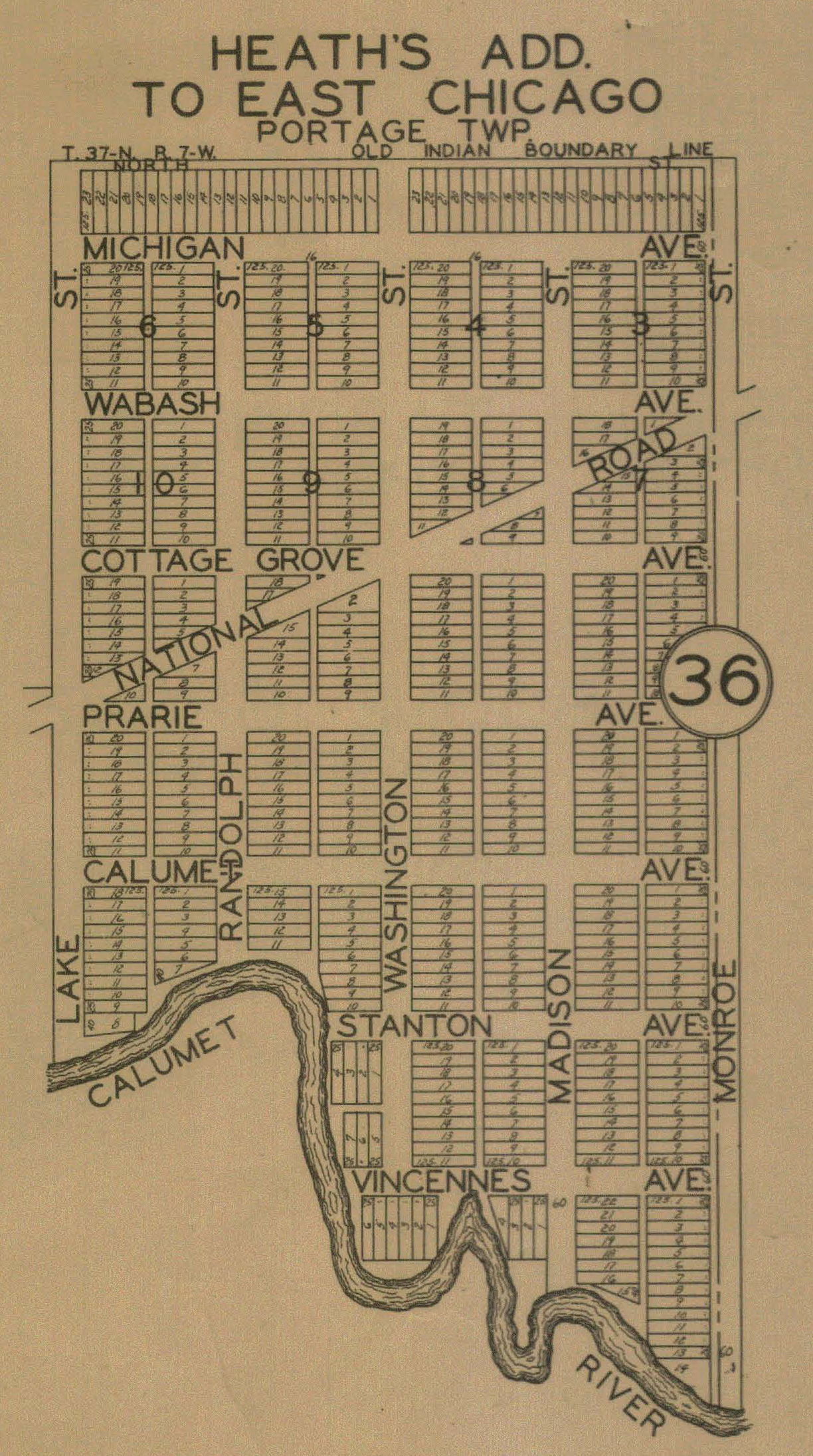
Heath's Addition, 1928
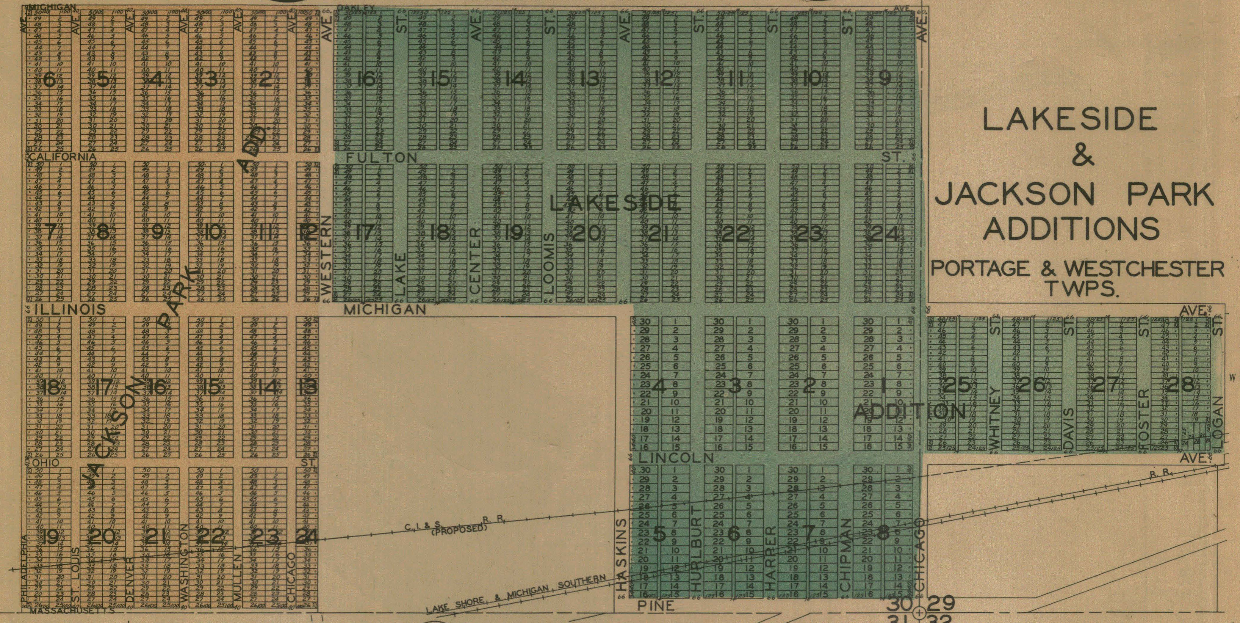
Jackson Park Addition, 1928
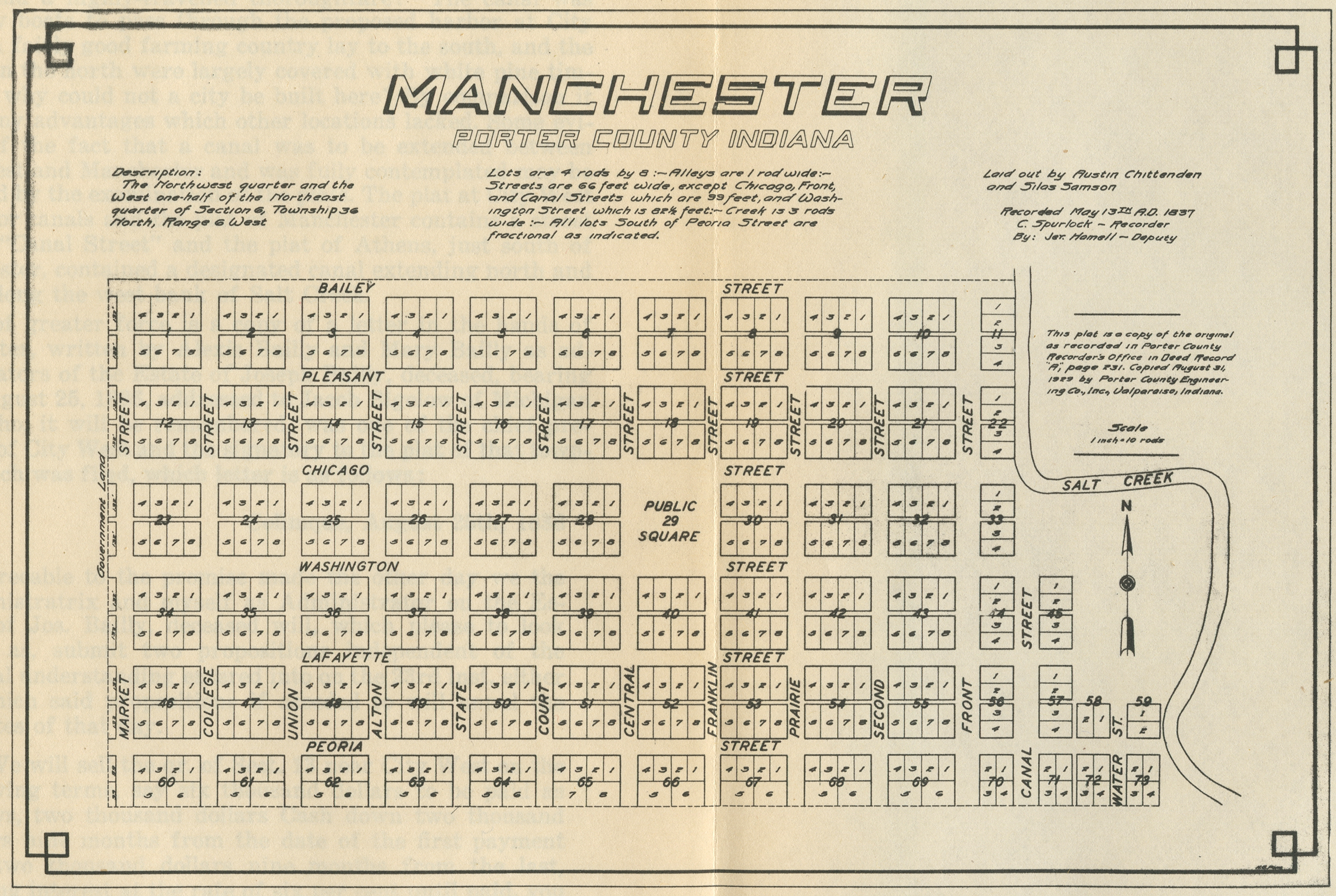
Manchester, 1837 [a "Dream
City"]
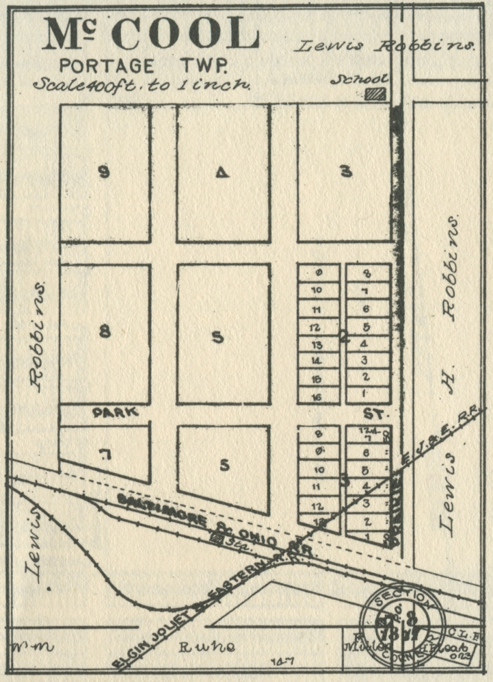
McCool, 1892
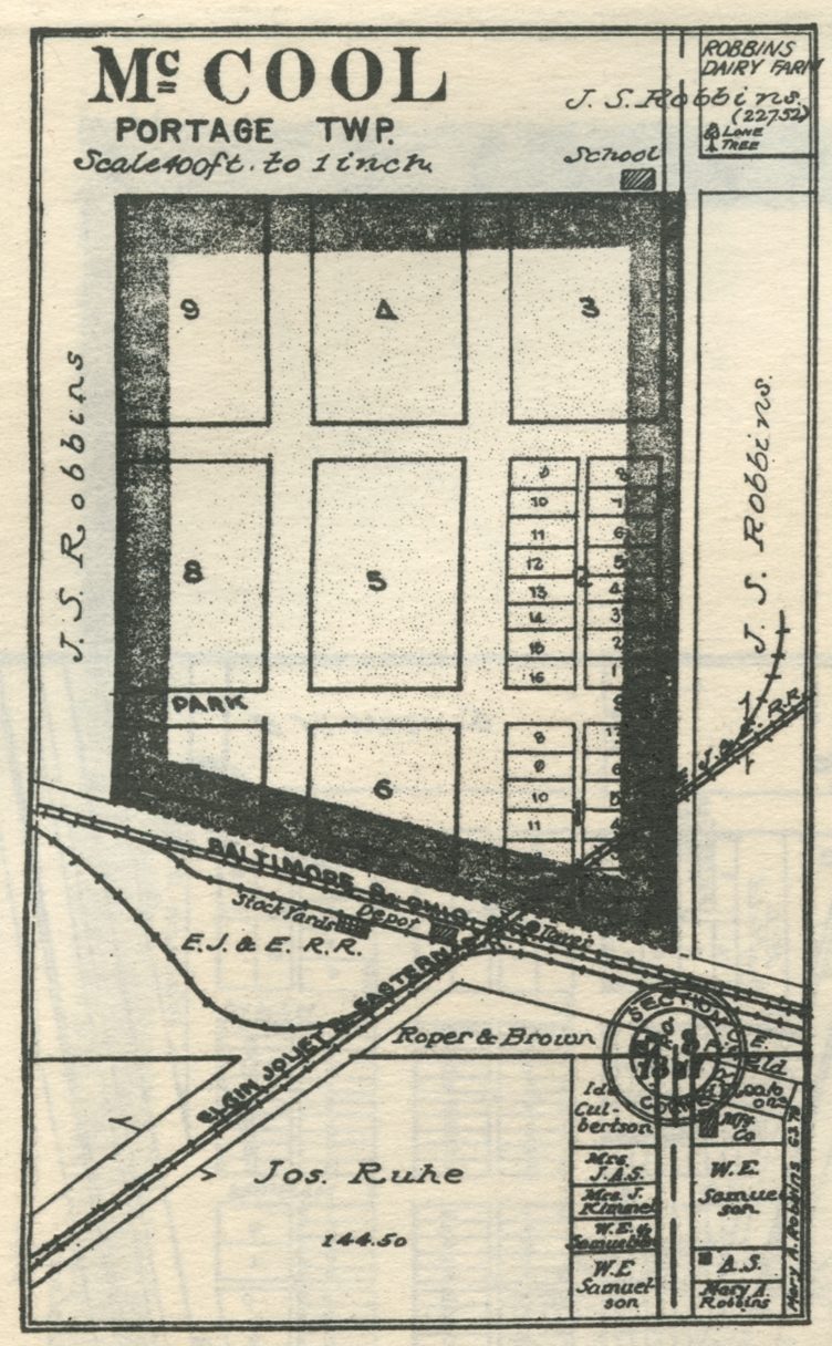
McCool, 1906
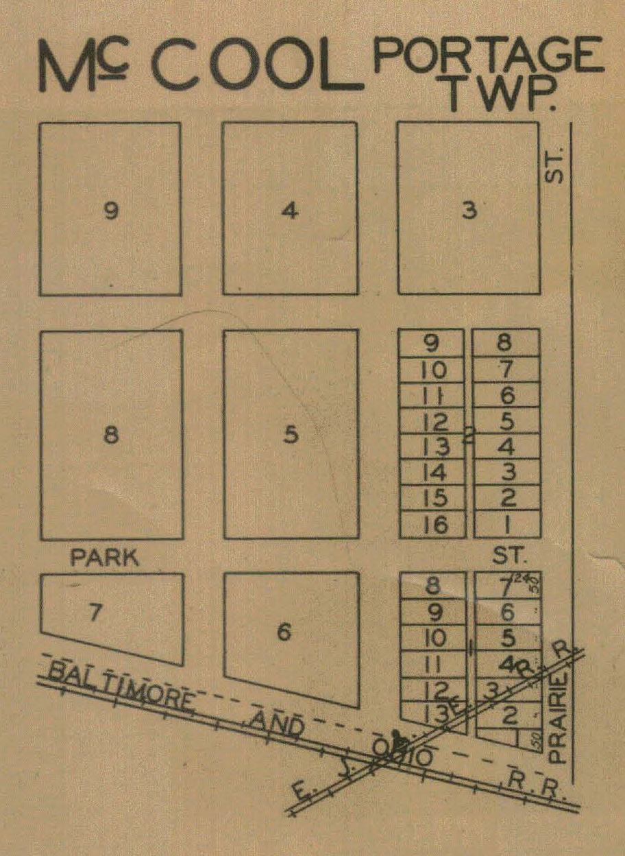
McCool, 1921
McCool, 1928
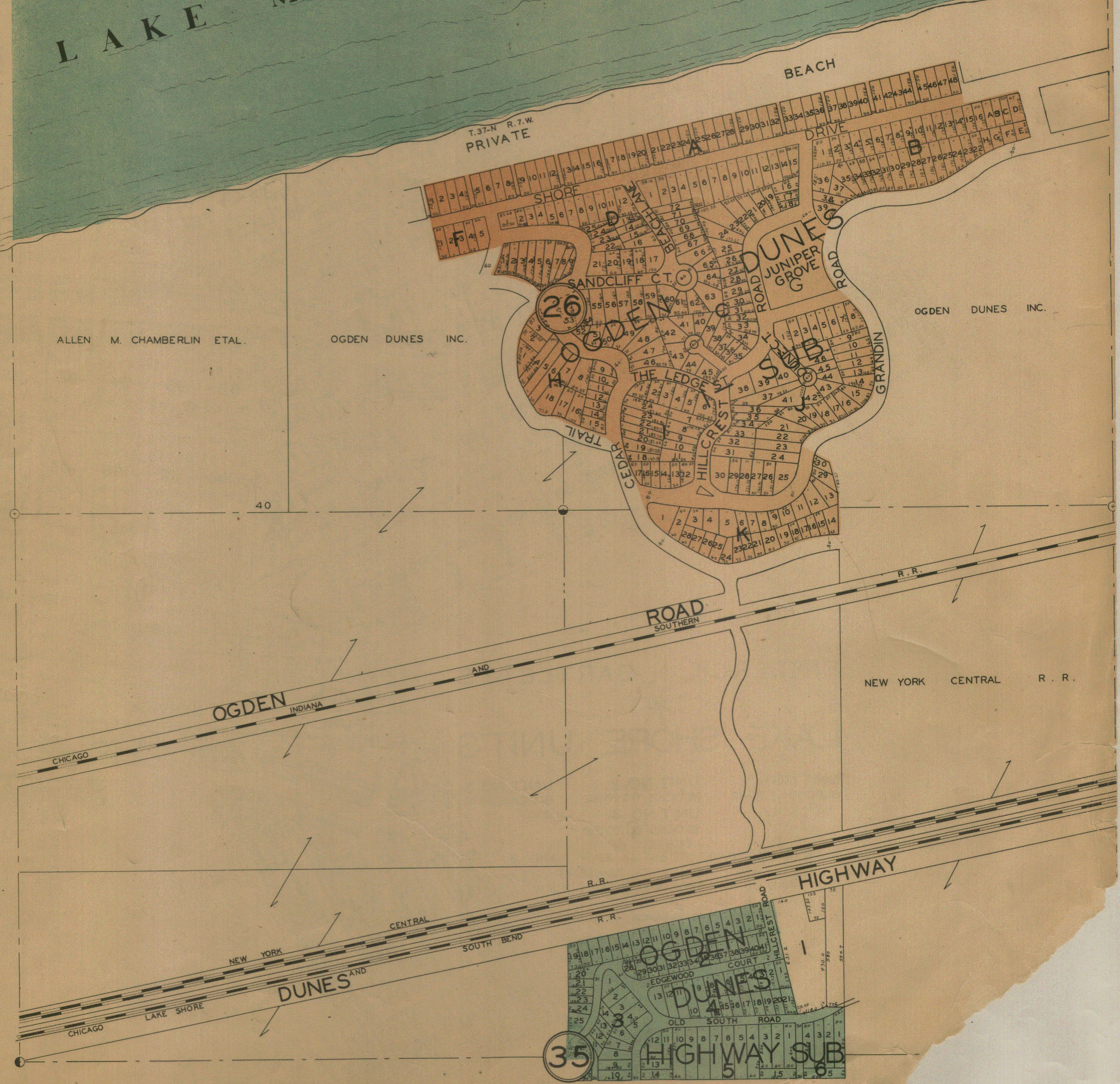
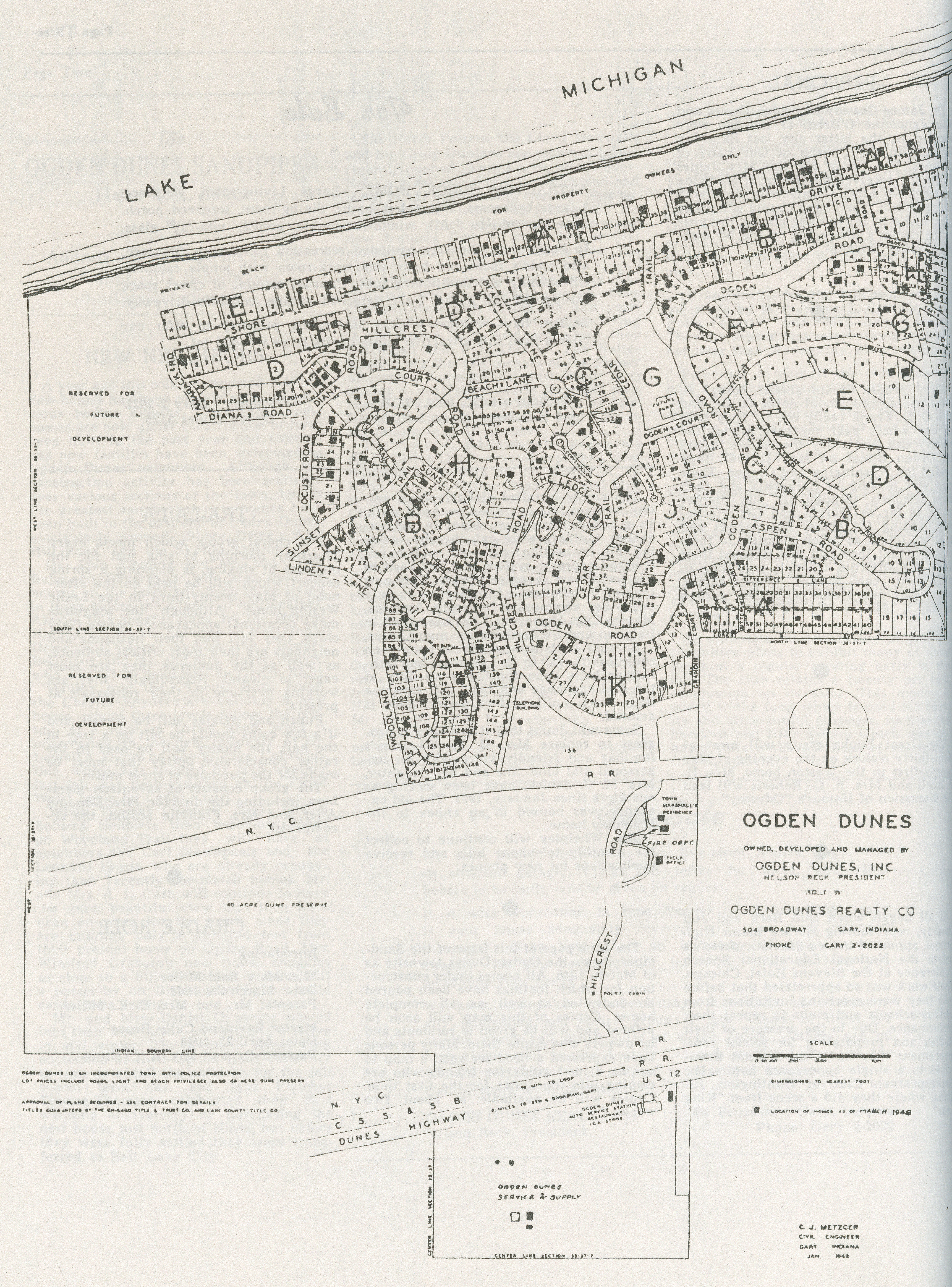
Ogden
Dunes, 1928
Ogden Dunes, 1948
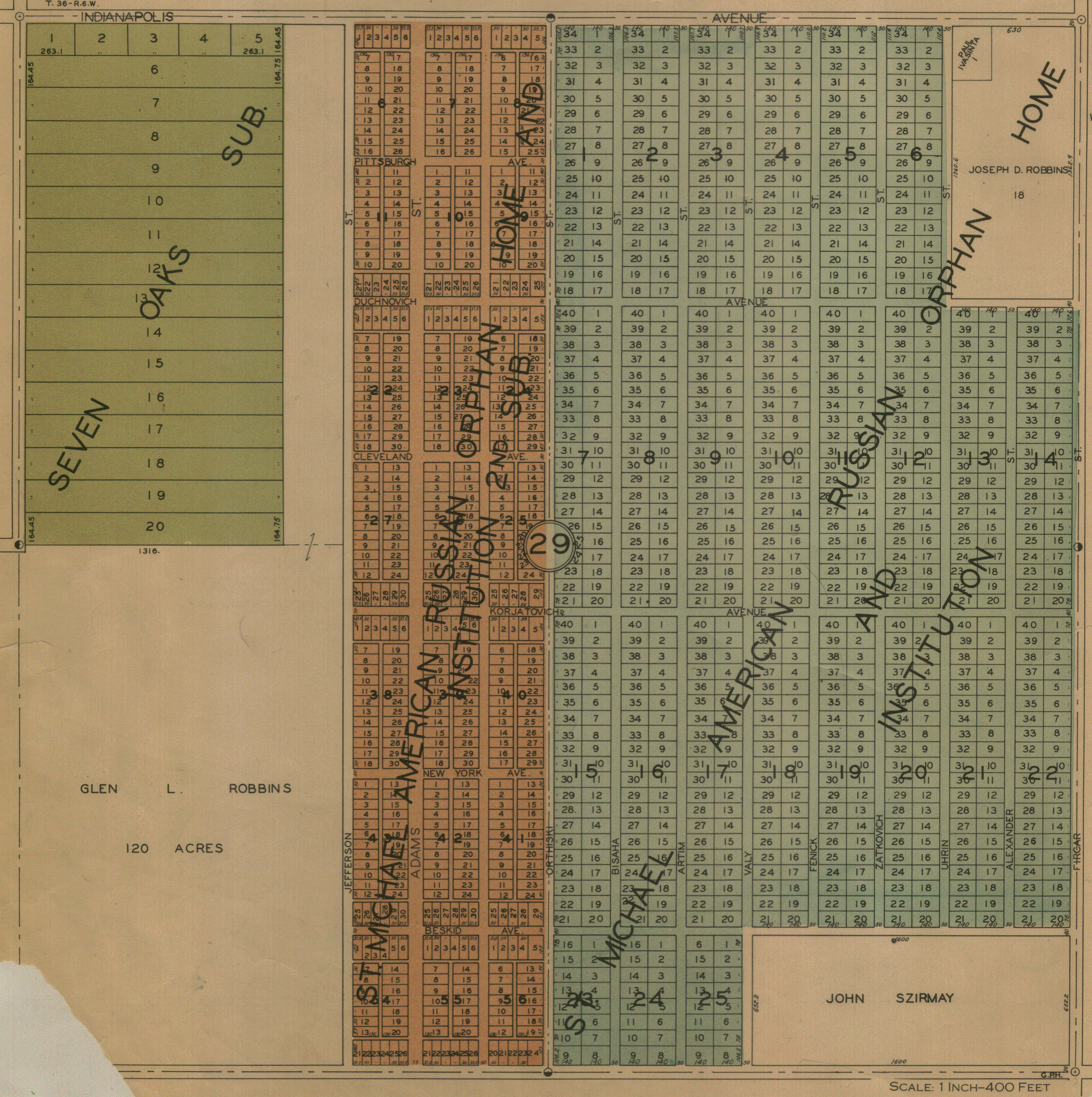
Seven Oaks and St. Michael's, 1928
Vineland, 1928
Porter Township
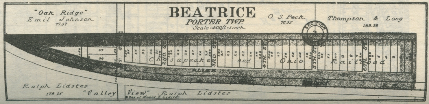
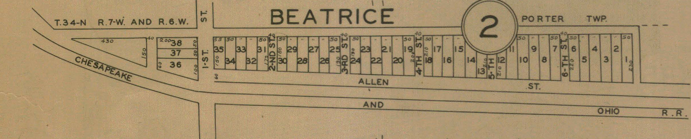
Beatrice,
1906
Beatrice,
1921
Beatrice,
1928
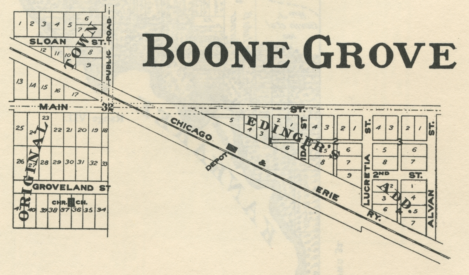
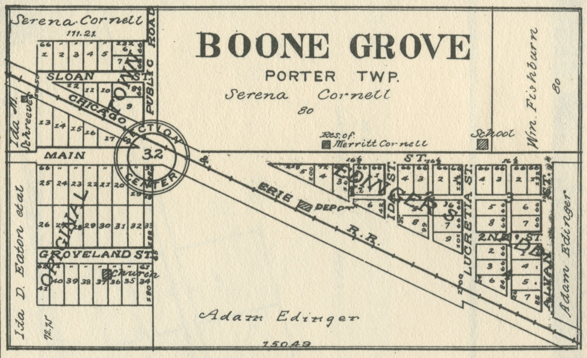
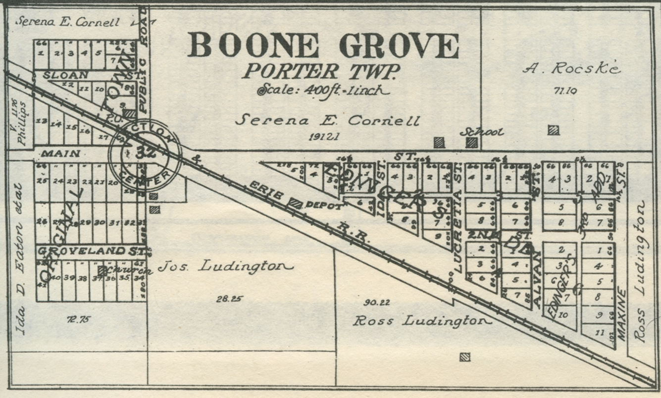
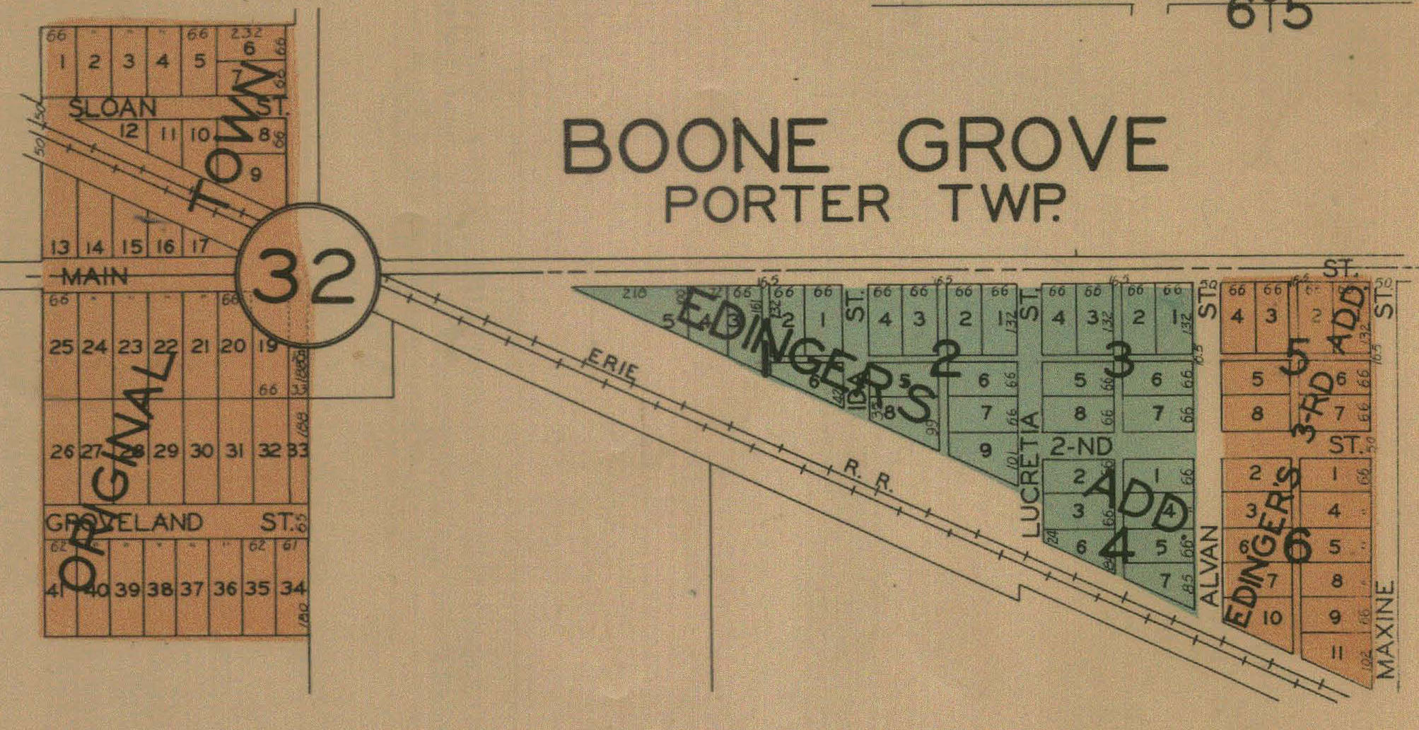
Boone
Grove, 1883
Boone
Grove, 1895
Boone
Grove, 1906
Boone
Grove, 1921
Boone
Grove, 1928
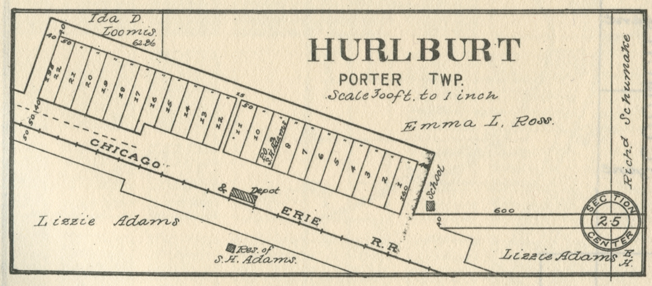
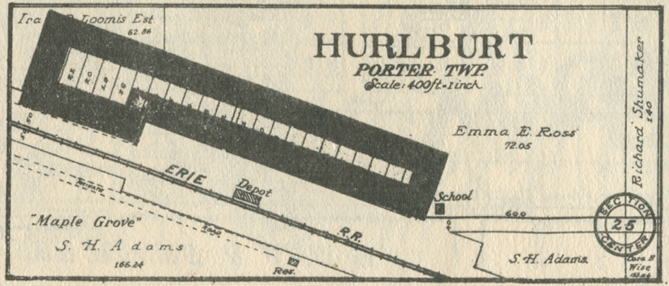
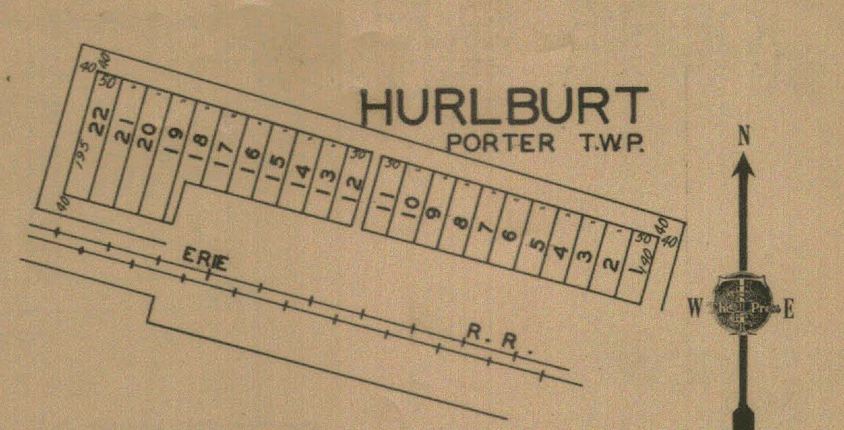
Hurlburt,
1883
Hurlburt,
1906
Hurlburt,
1921
Hurlburt,
1928
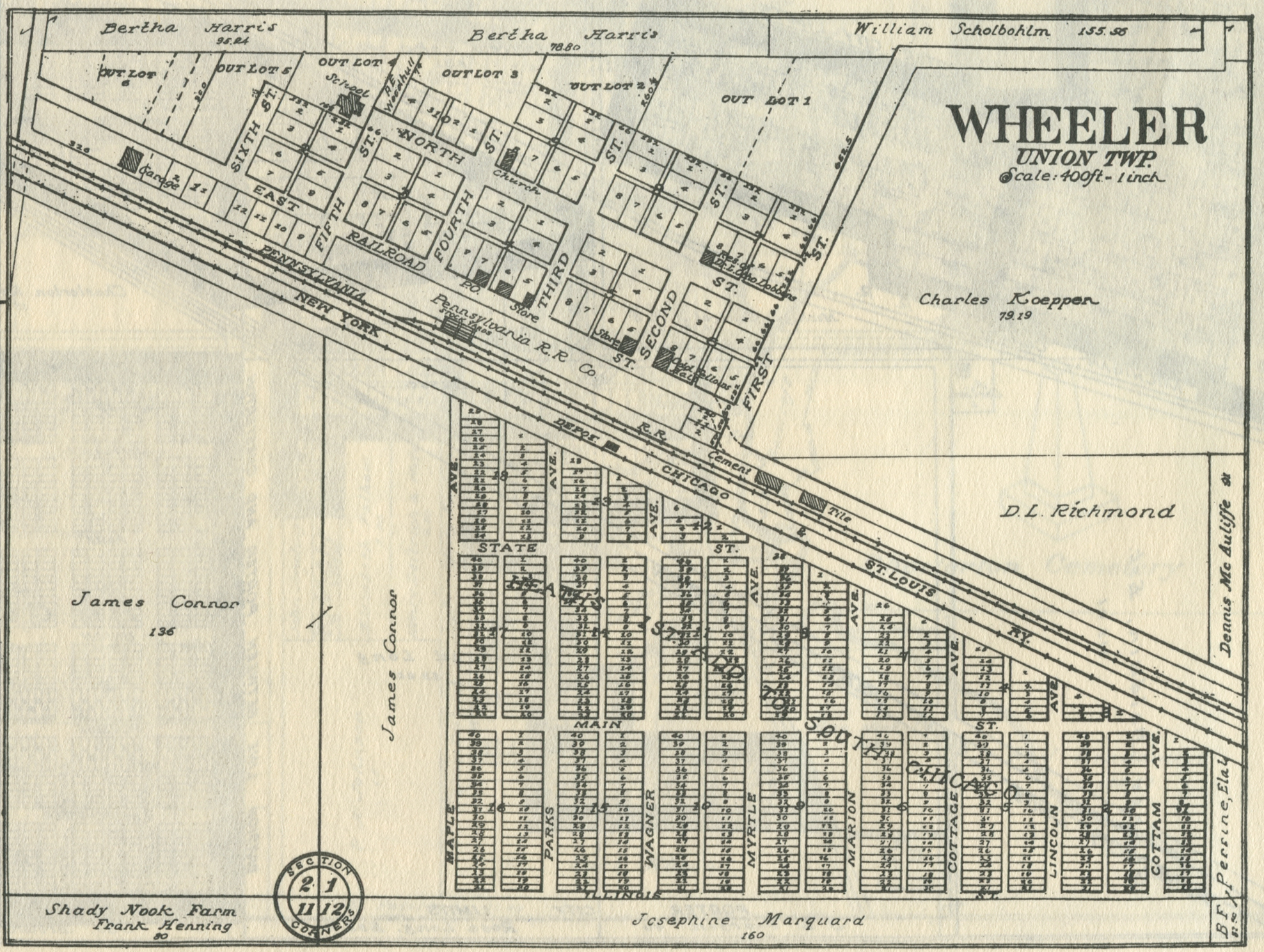
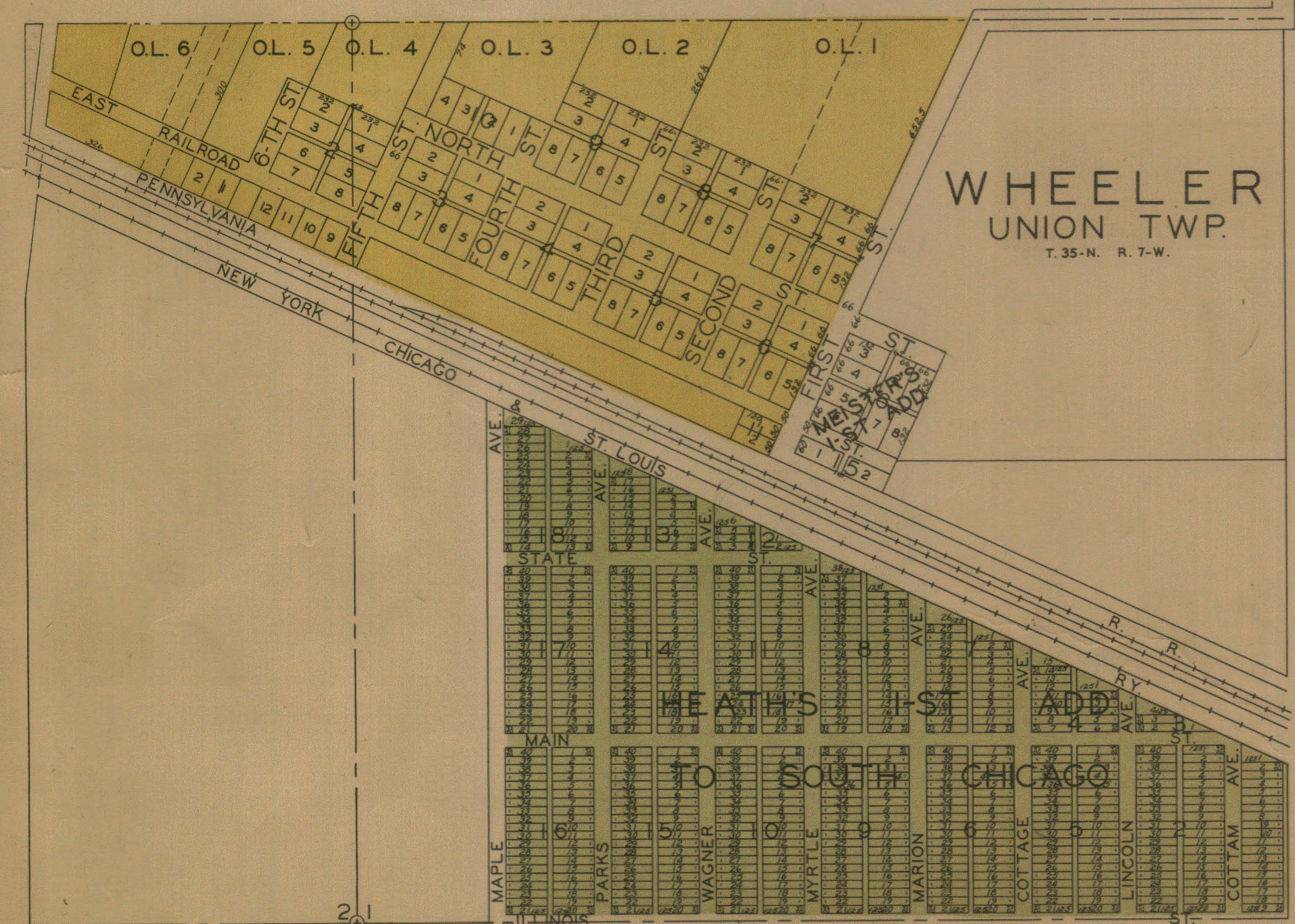
Union Township
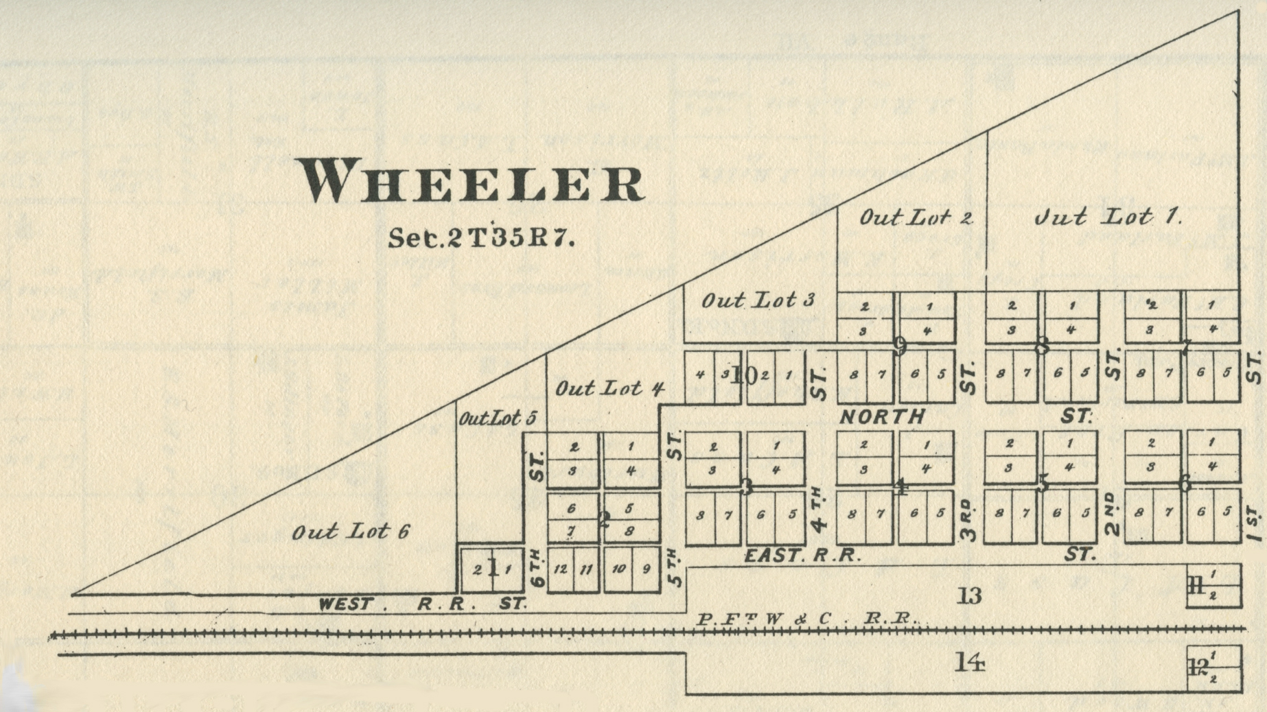
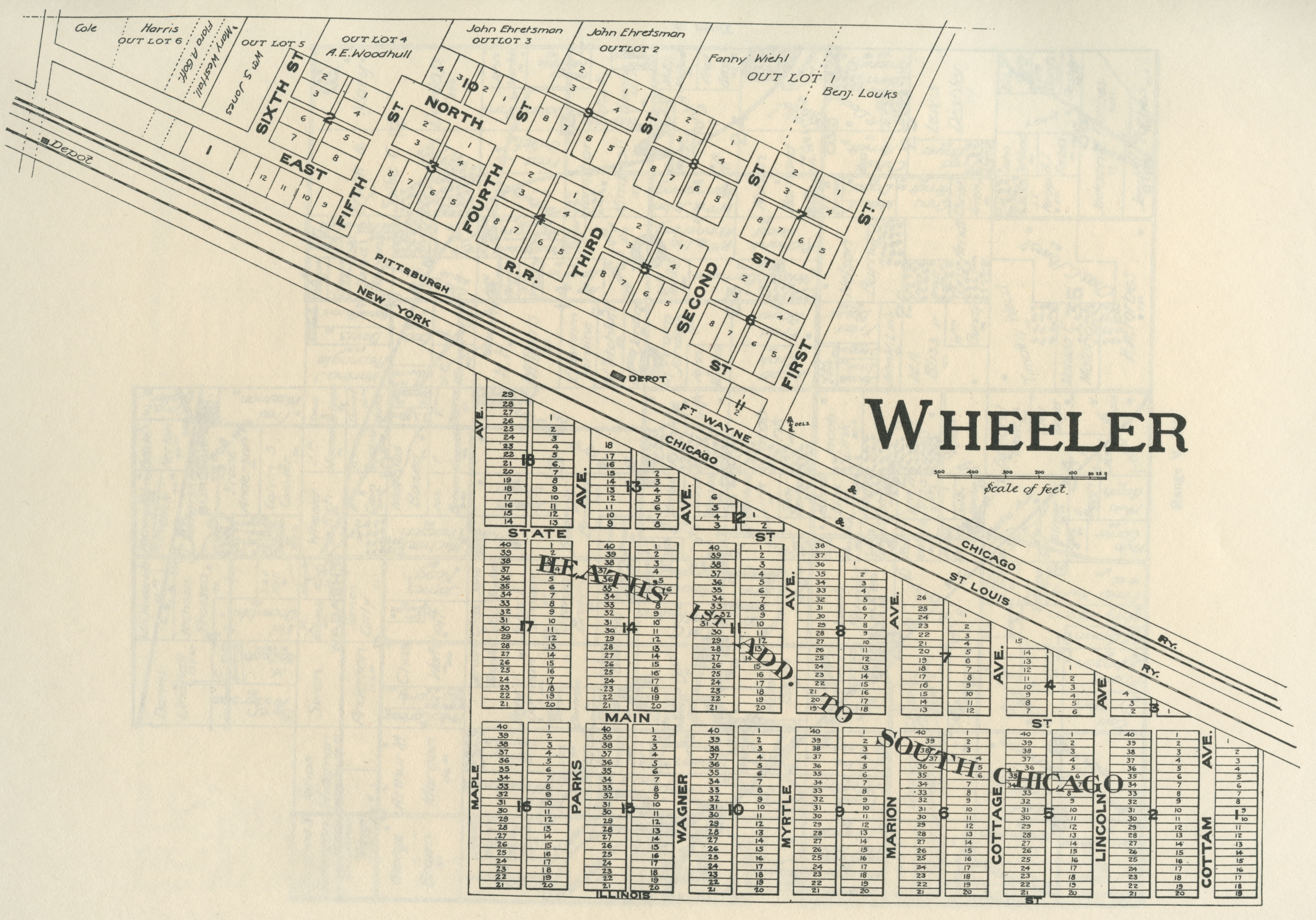
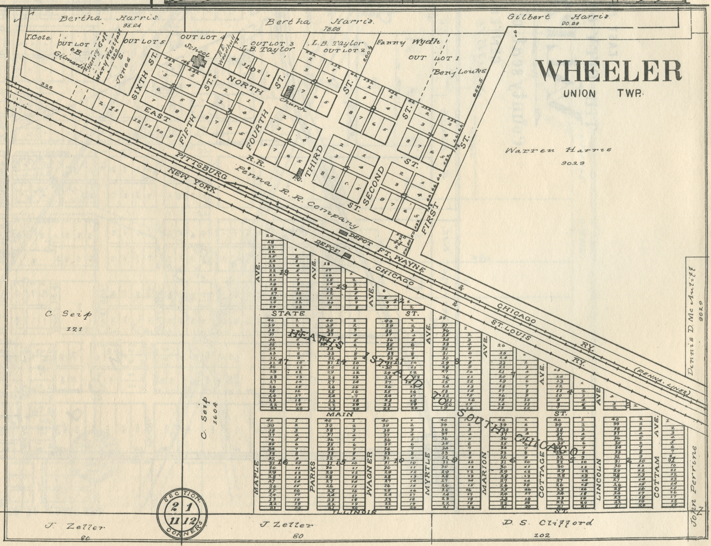
Wheeler, no
date
Wheeler, 1876
Wheeler, 1895
Wheeler, 1906
Wheeler, 1921
Wheeler, 1928
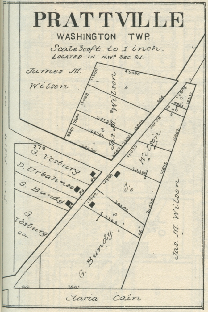
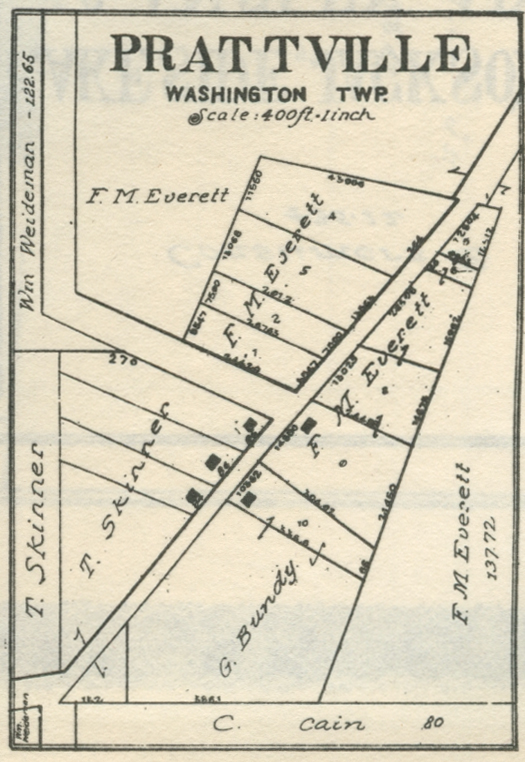
Washington Township
Coburg,
no date
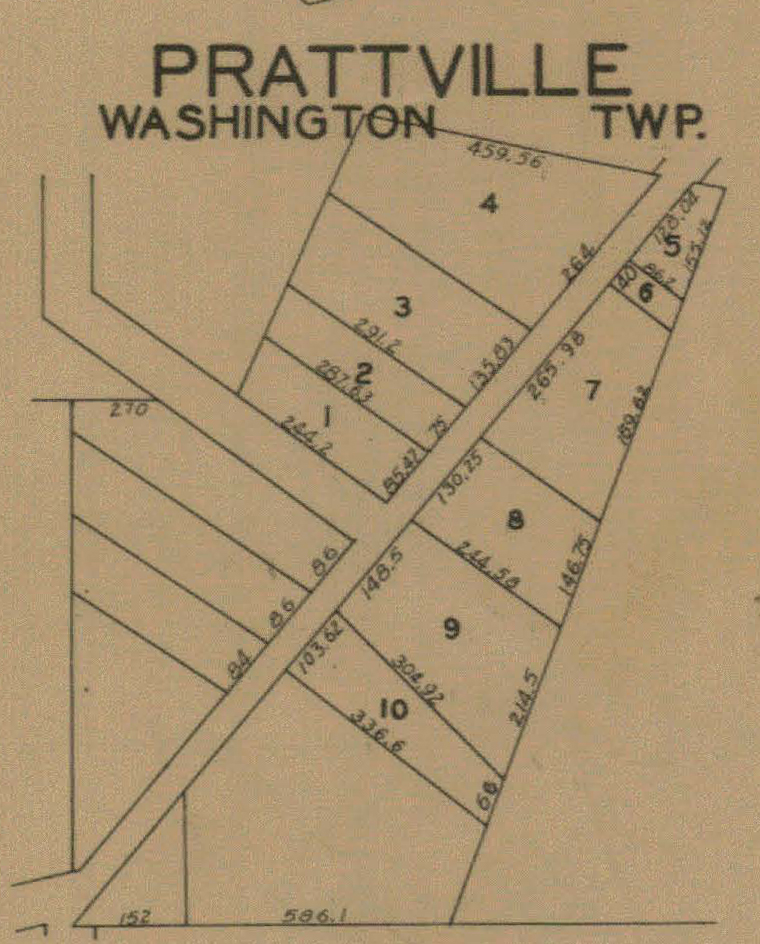
Prattville, 1876
Prattville, 1906
Prattville, 1921
Prattville, 1928
Prattville, 1956
Westchester Township
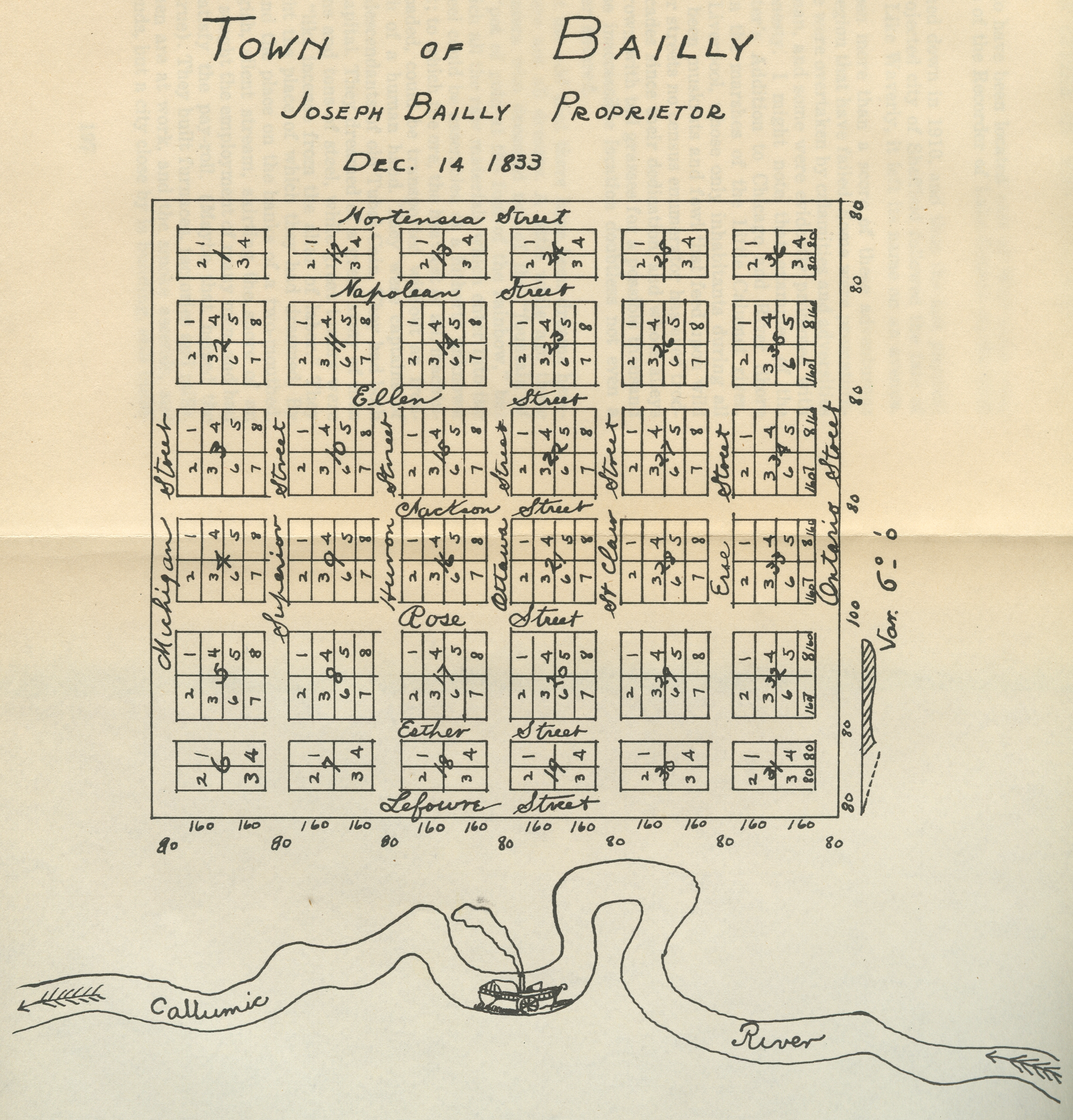
Bailly, 1833 [a "Dream
City"]
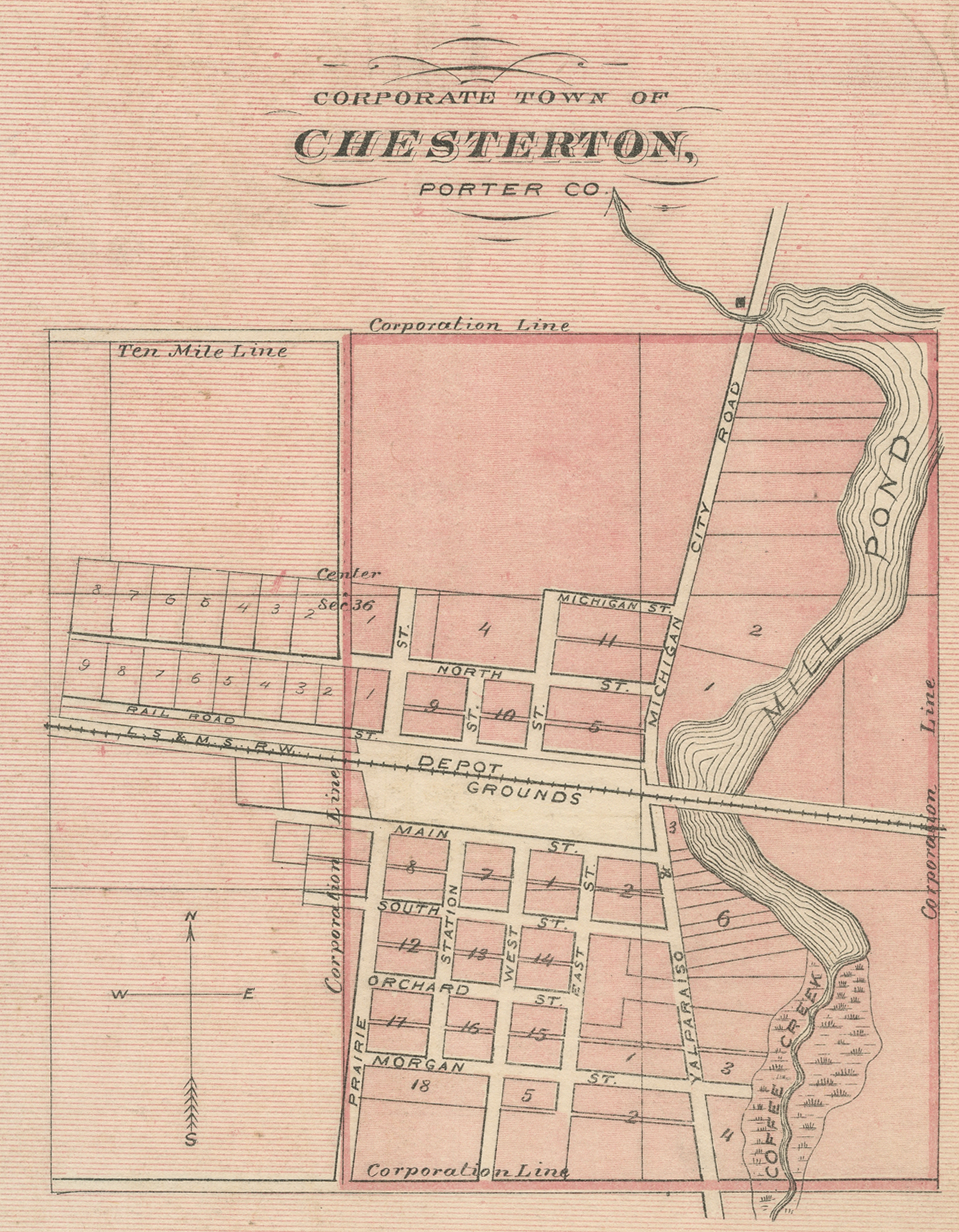
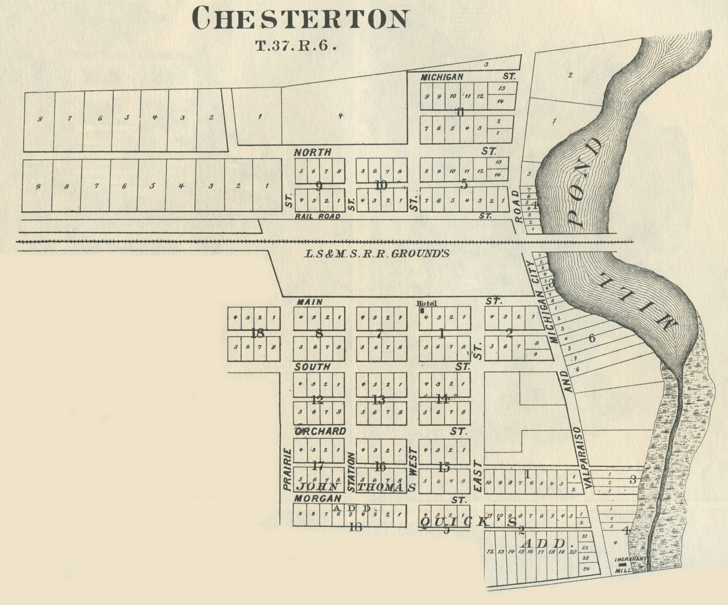
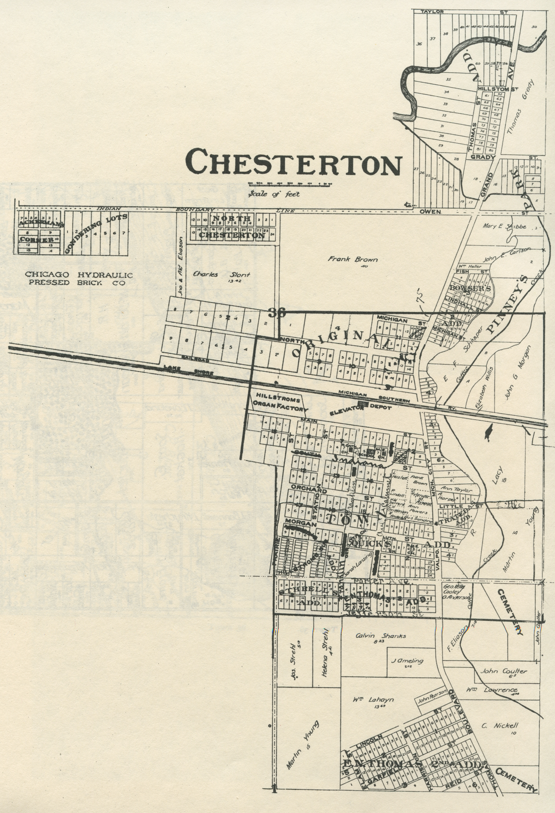
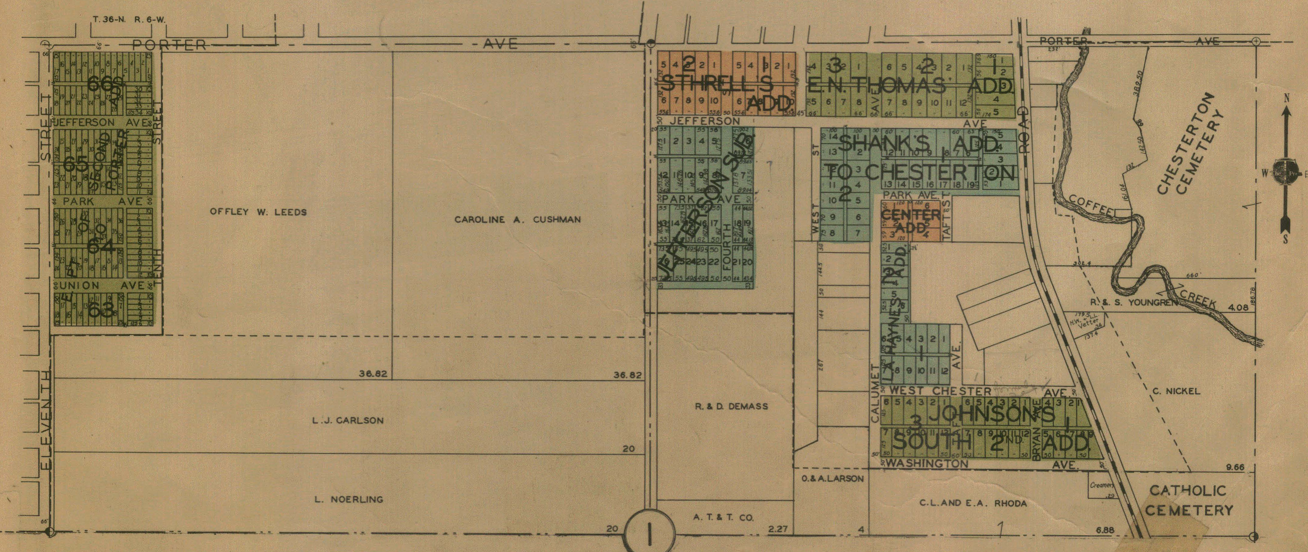
Chesterton, 1876 [Indiana Historical Atlas]
Chesterton, 1876
Chesterton, 1895
Chesterton - Part I, 1928
Chesterton - Part II, 1928
Chesterton - Part III, 1928
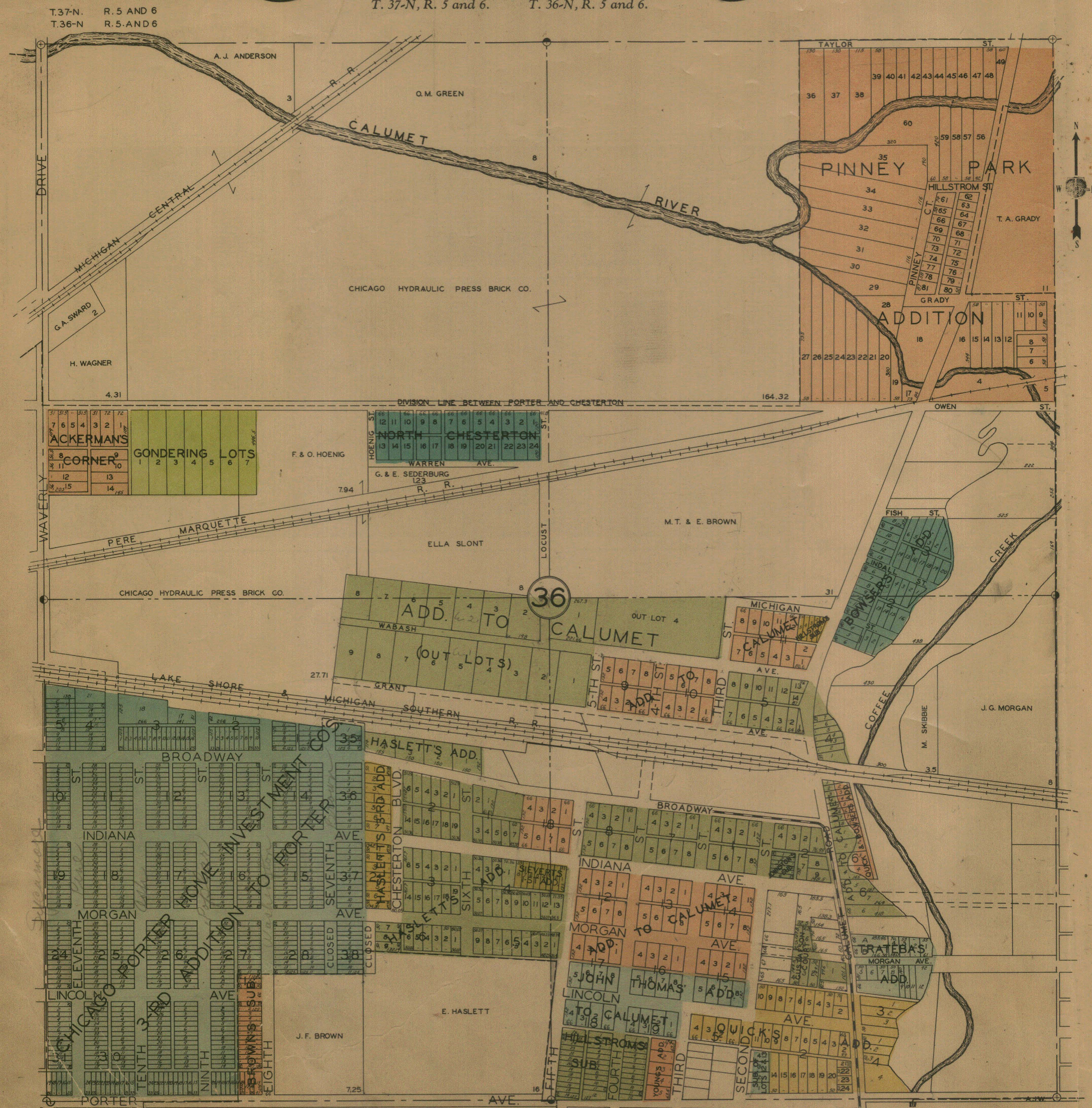
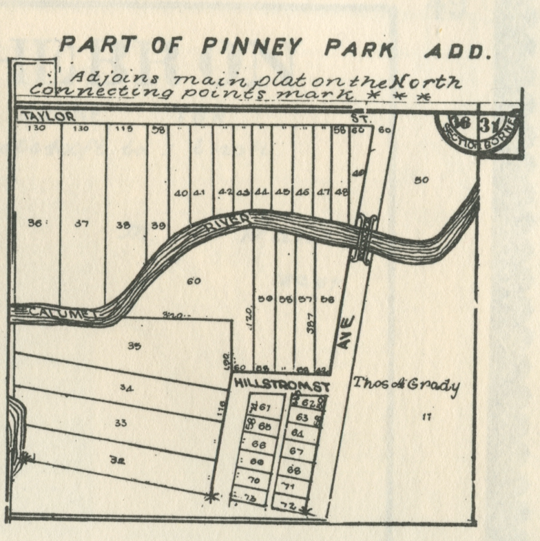
Chesterton - Pinney Park Addition, 1906
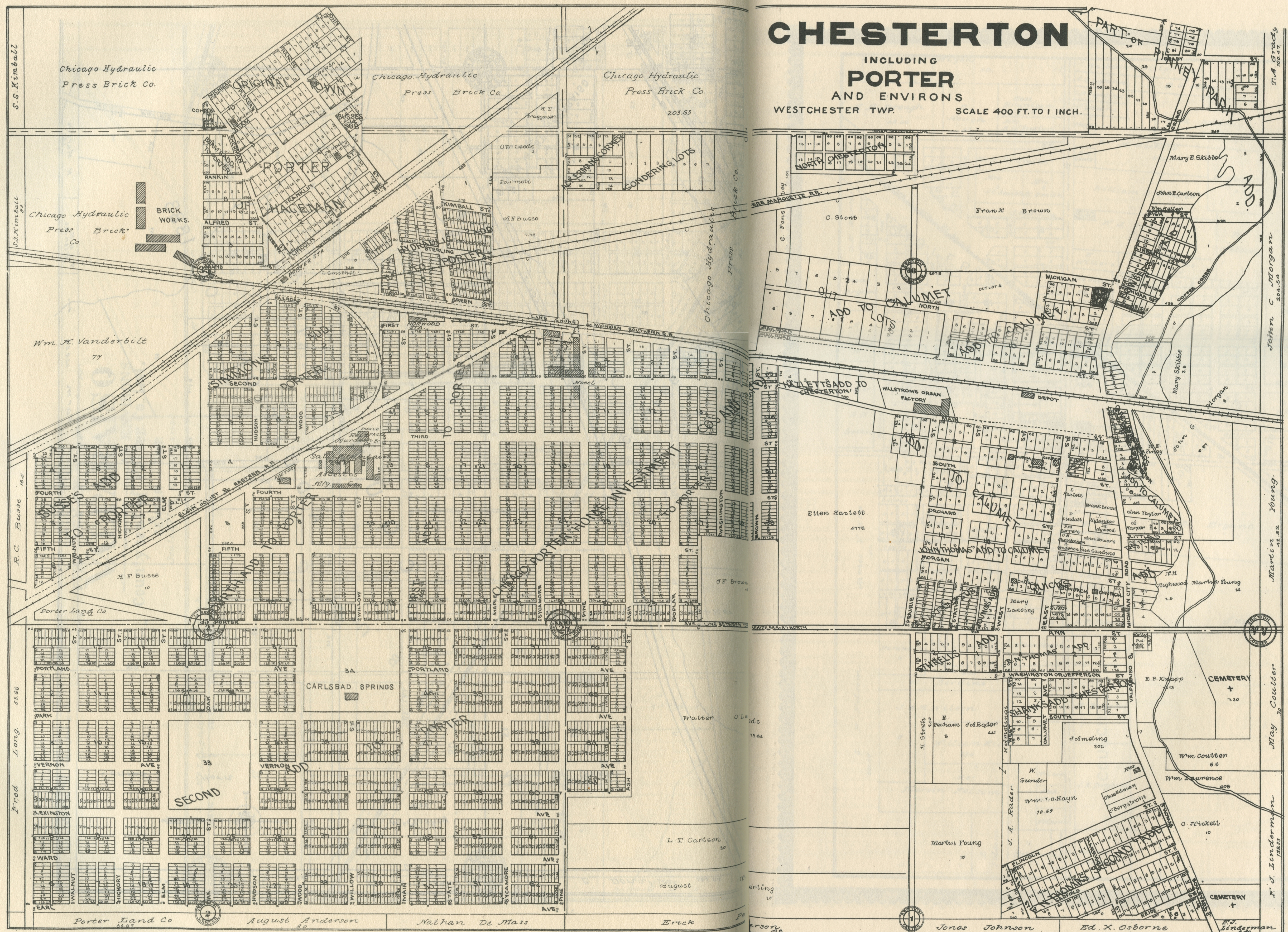
Chesterton and Porter, 1906
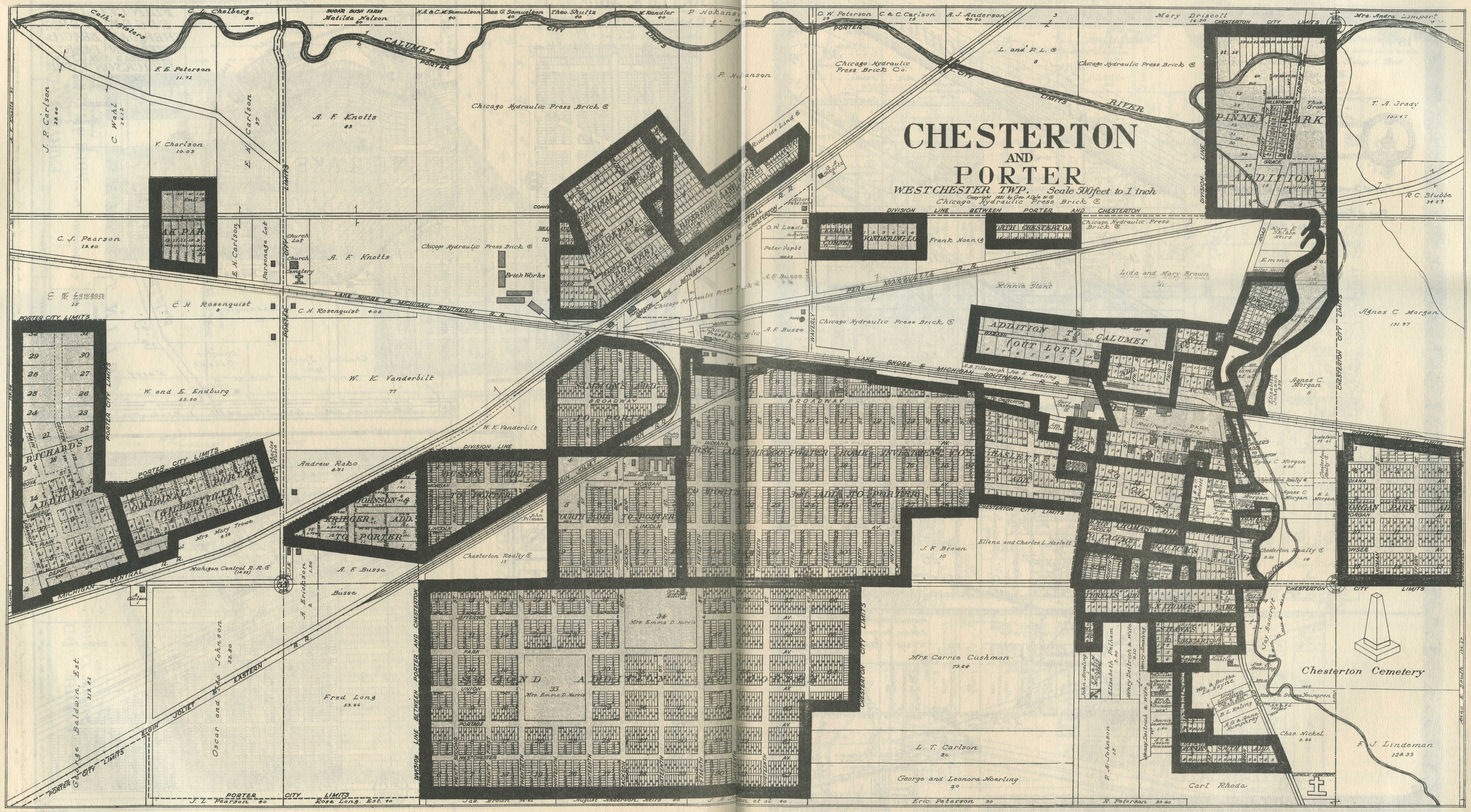
Chesterton and Porter, 1921
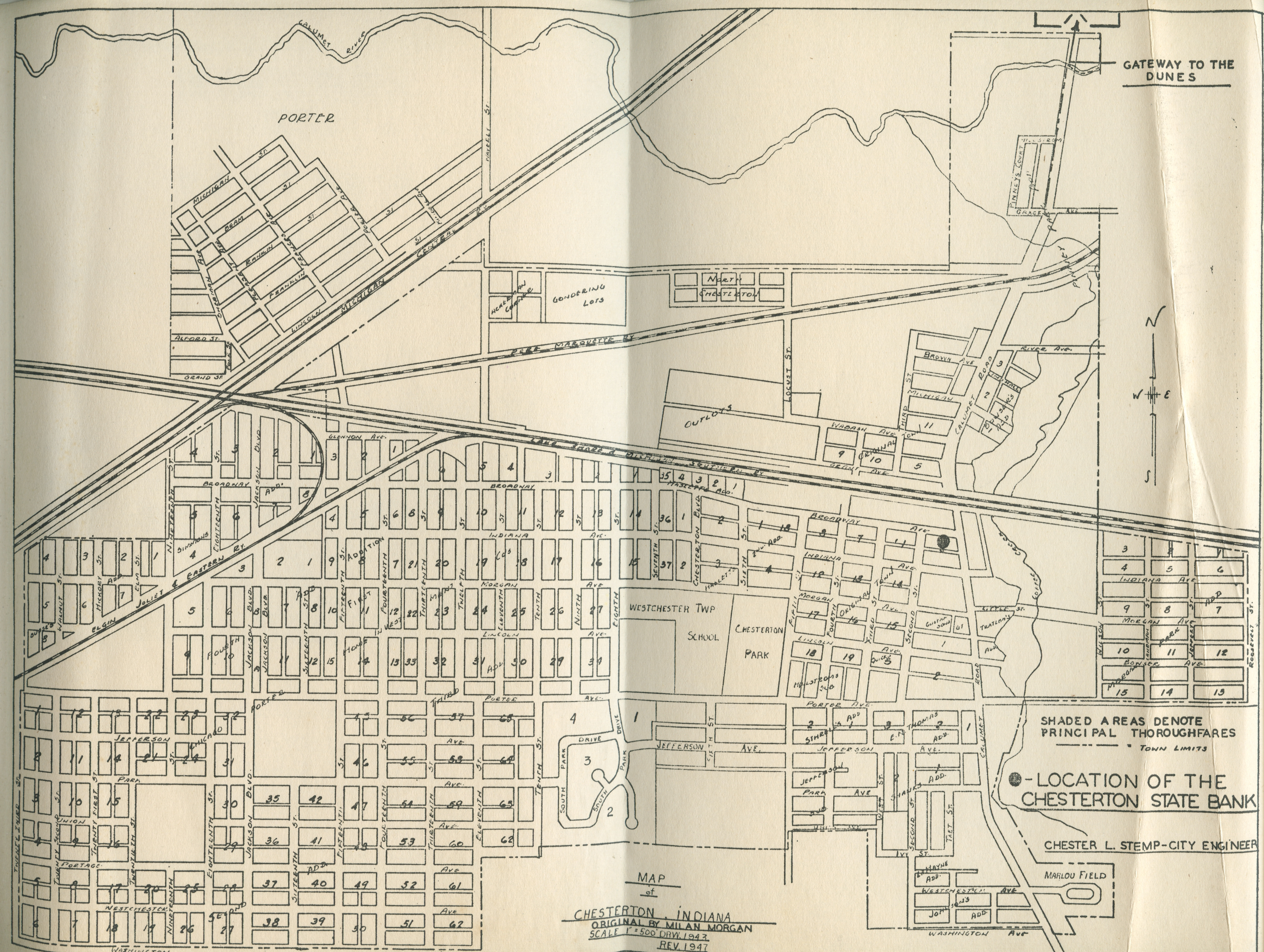
Chesterton and Porter, 1947
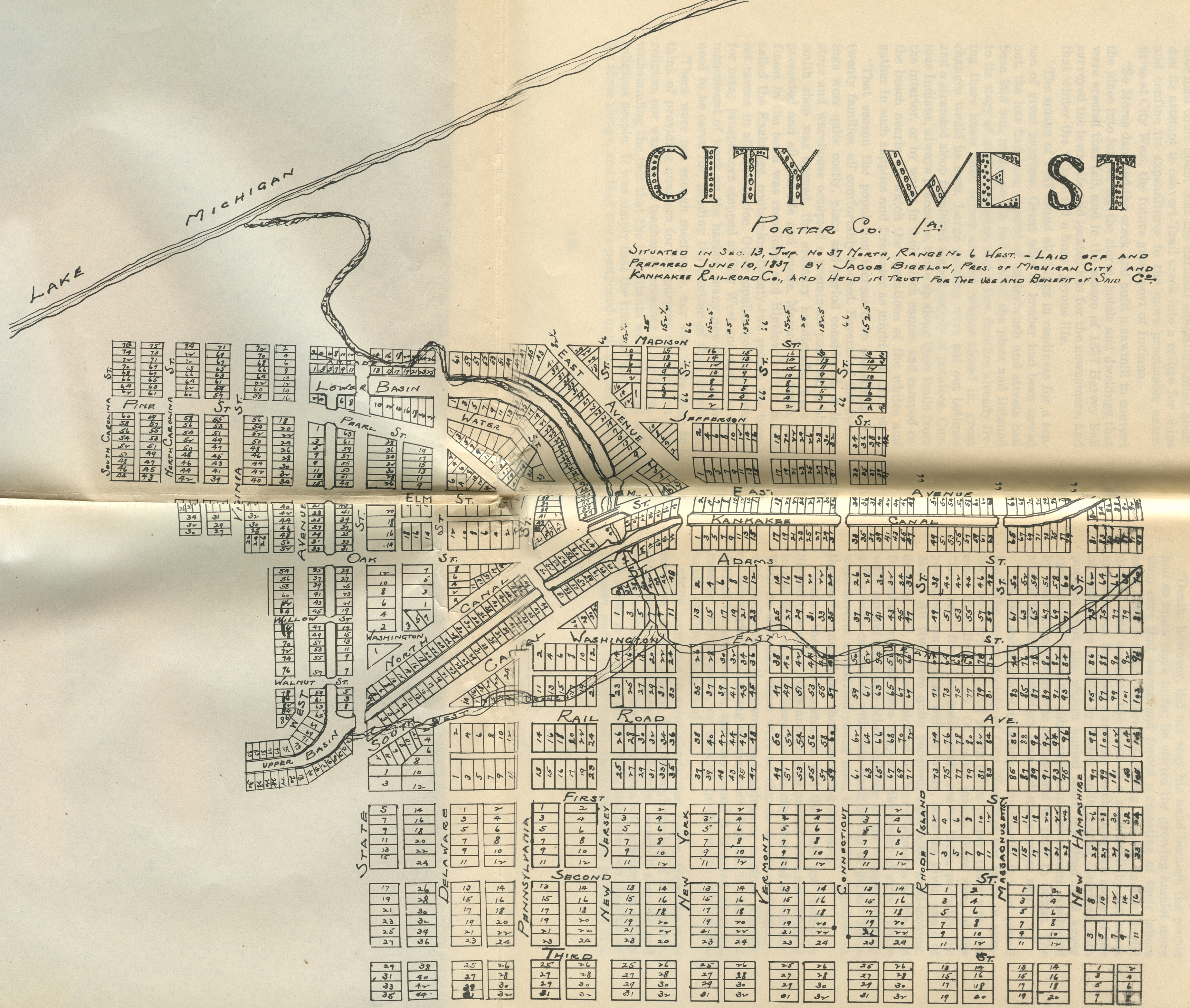
City
West, 1837
City West Addition, 1837
City West, 1837 [a "Dream
City"]
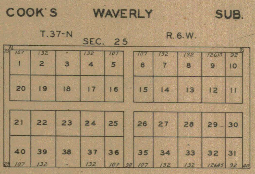
Cook's Waverly Addition, 1928
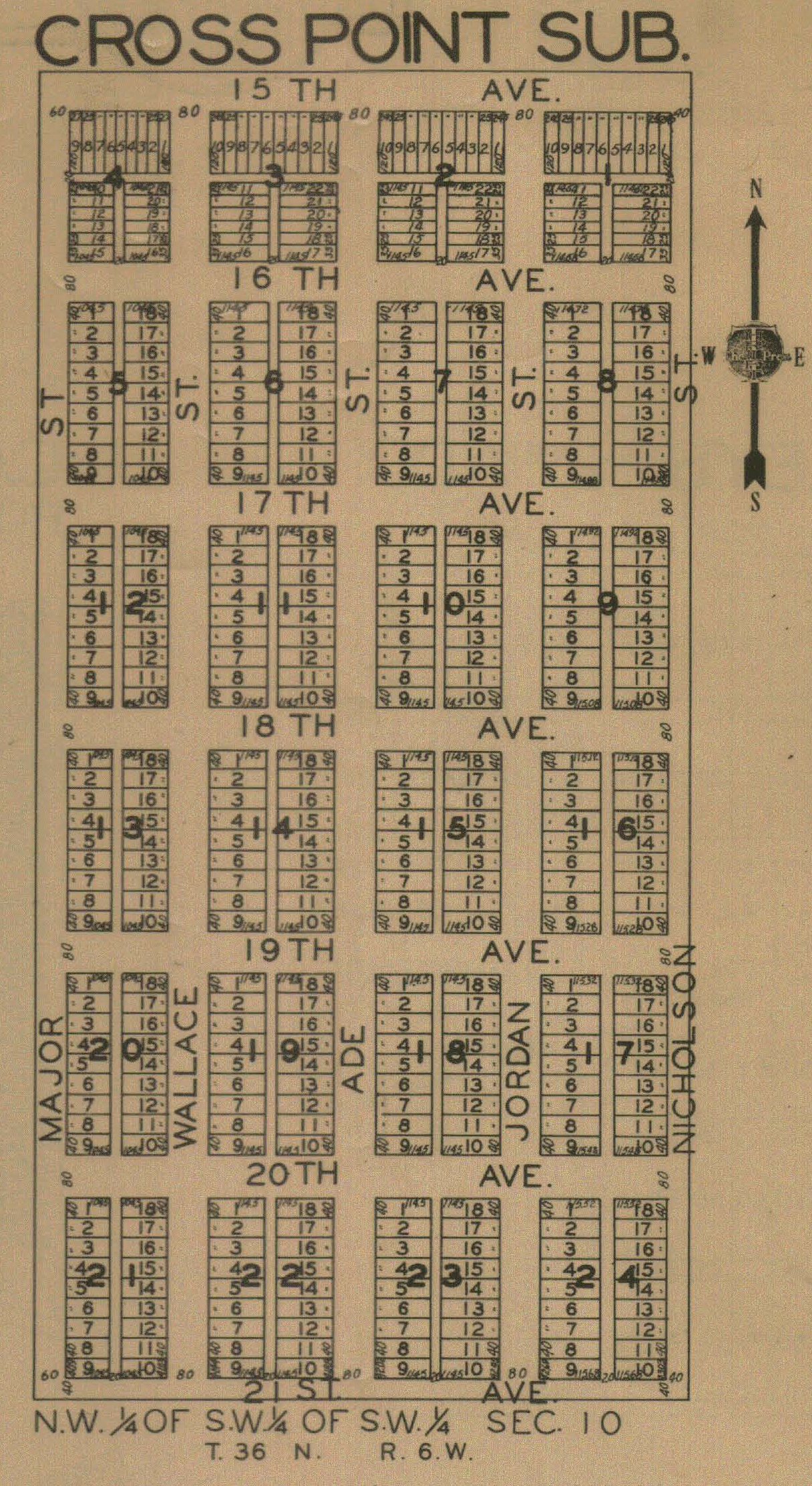
Cross
Point, 1928
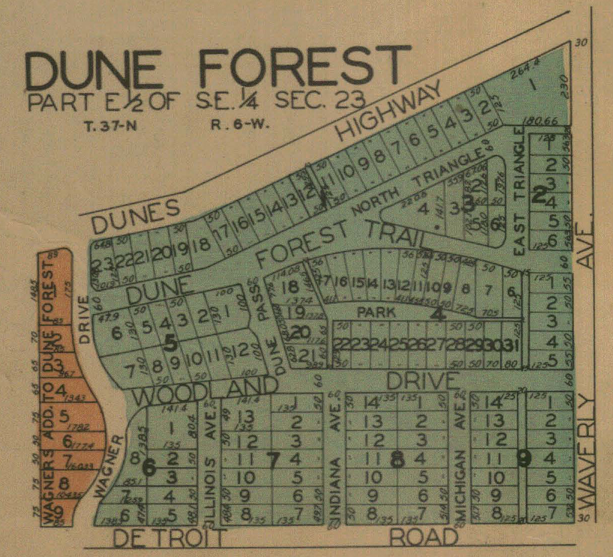
Dune
Forest, 1928
Dune
Park, 1906
Dune
Park, 1921
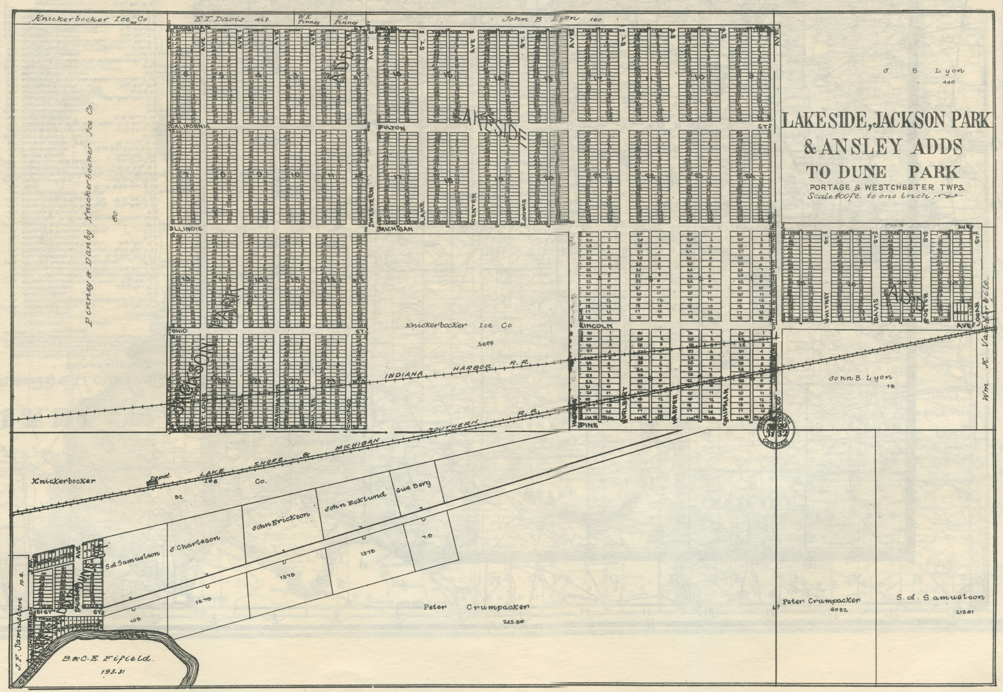
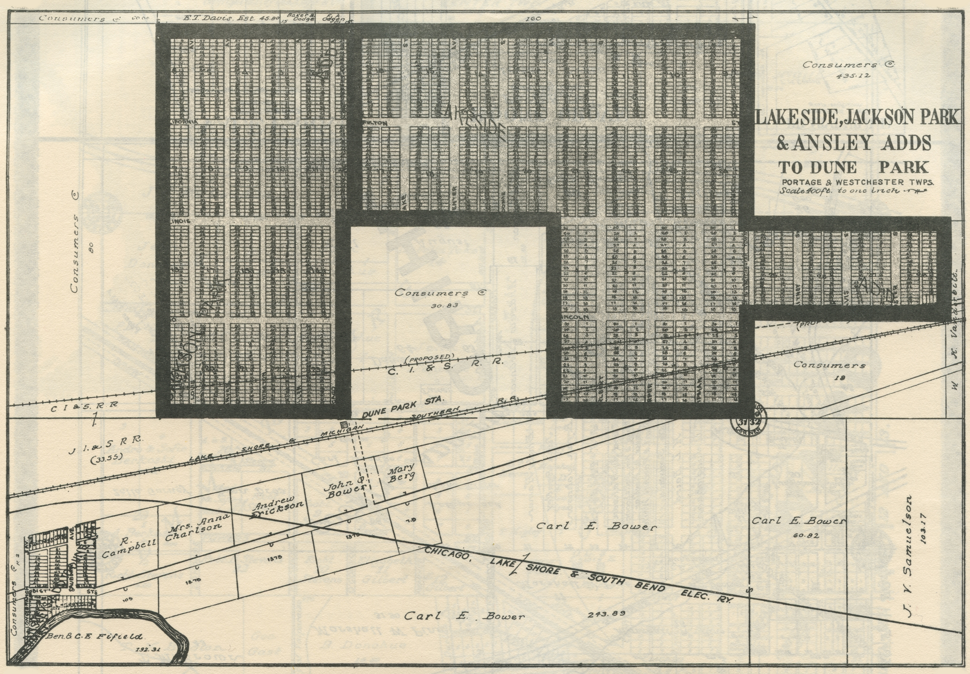
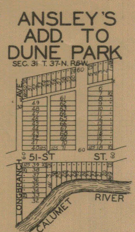
Dunes Park, Ansley's Addition, 1928
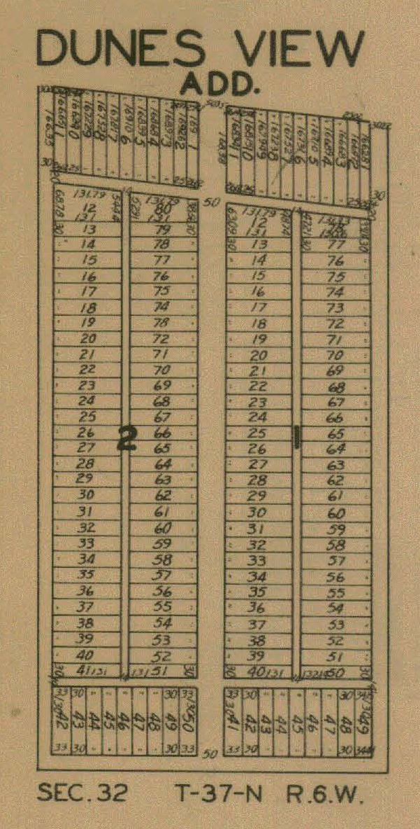
Dunes
View, 1928
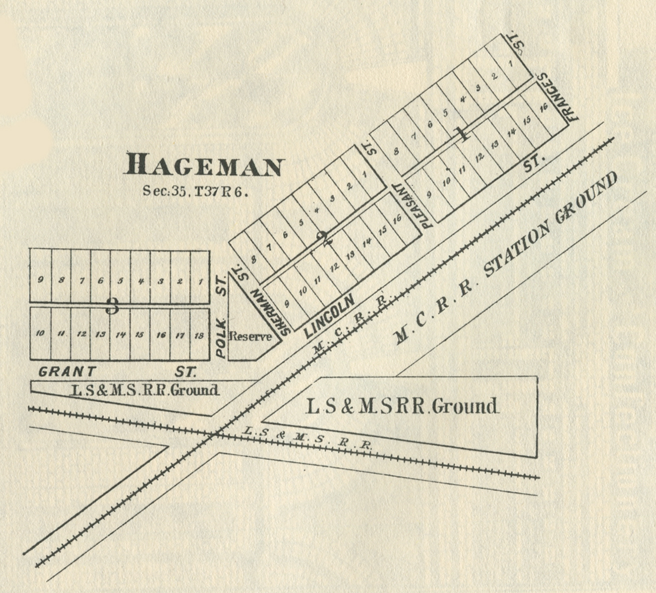
Hageman,
1876
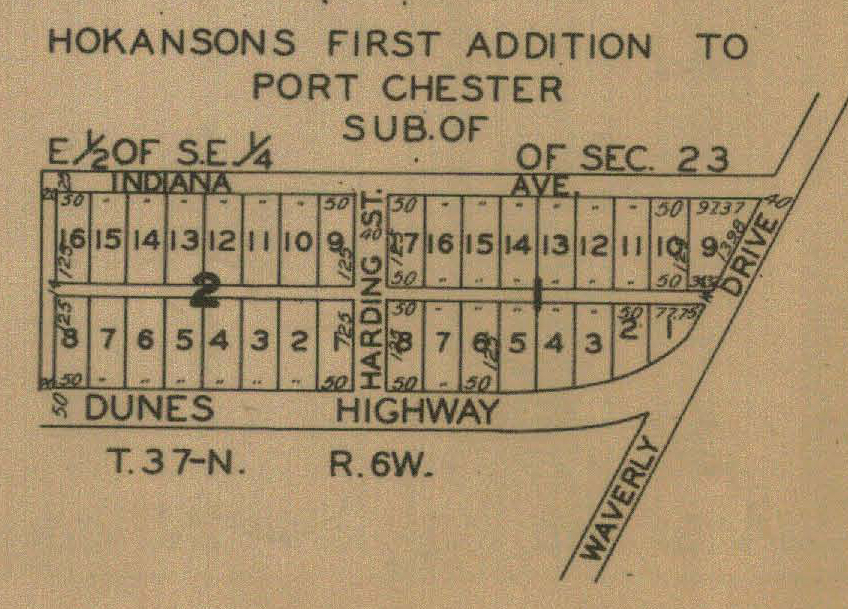
Hokanson's Port Chester, 1928
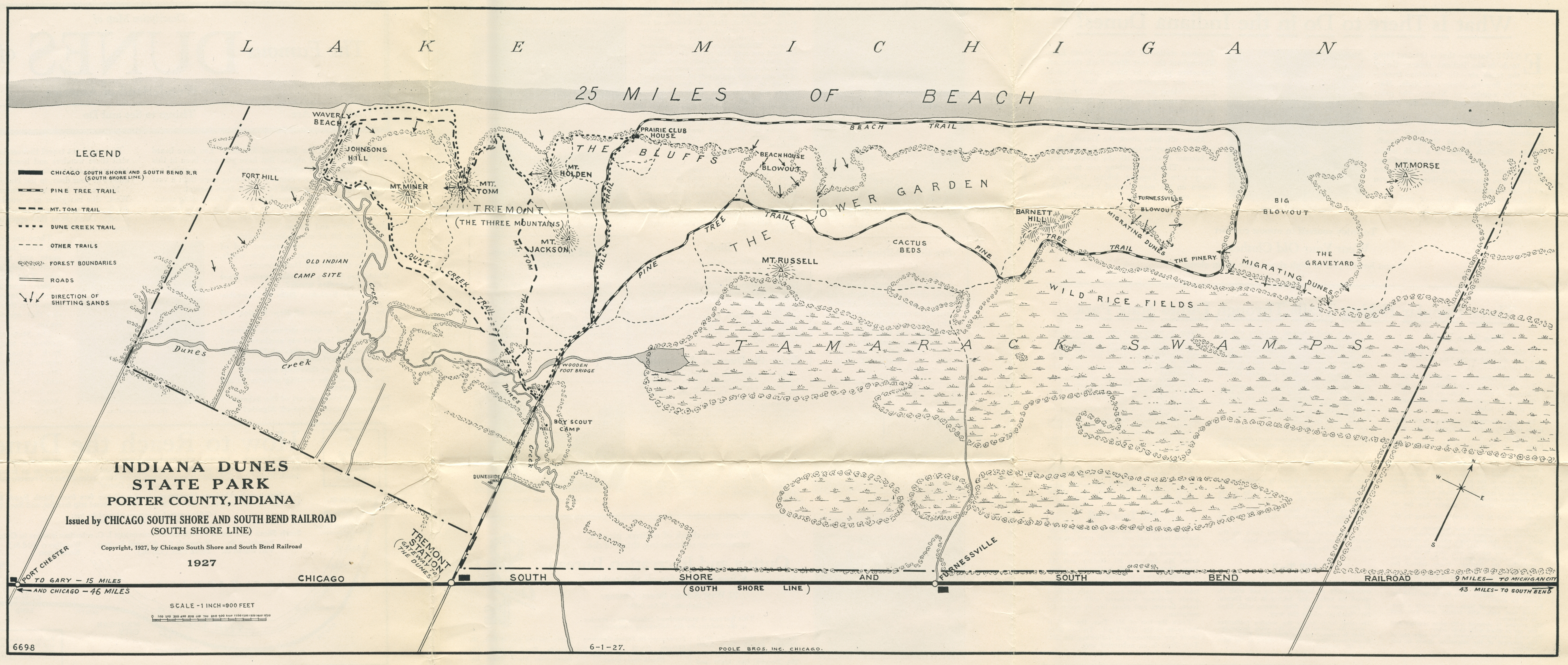
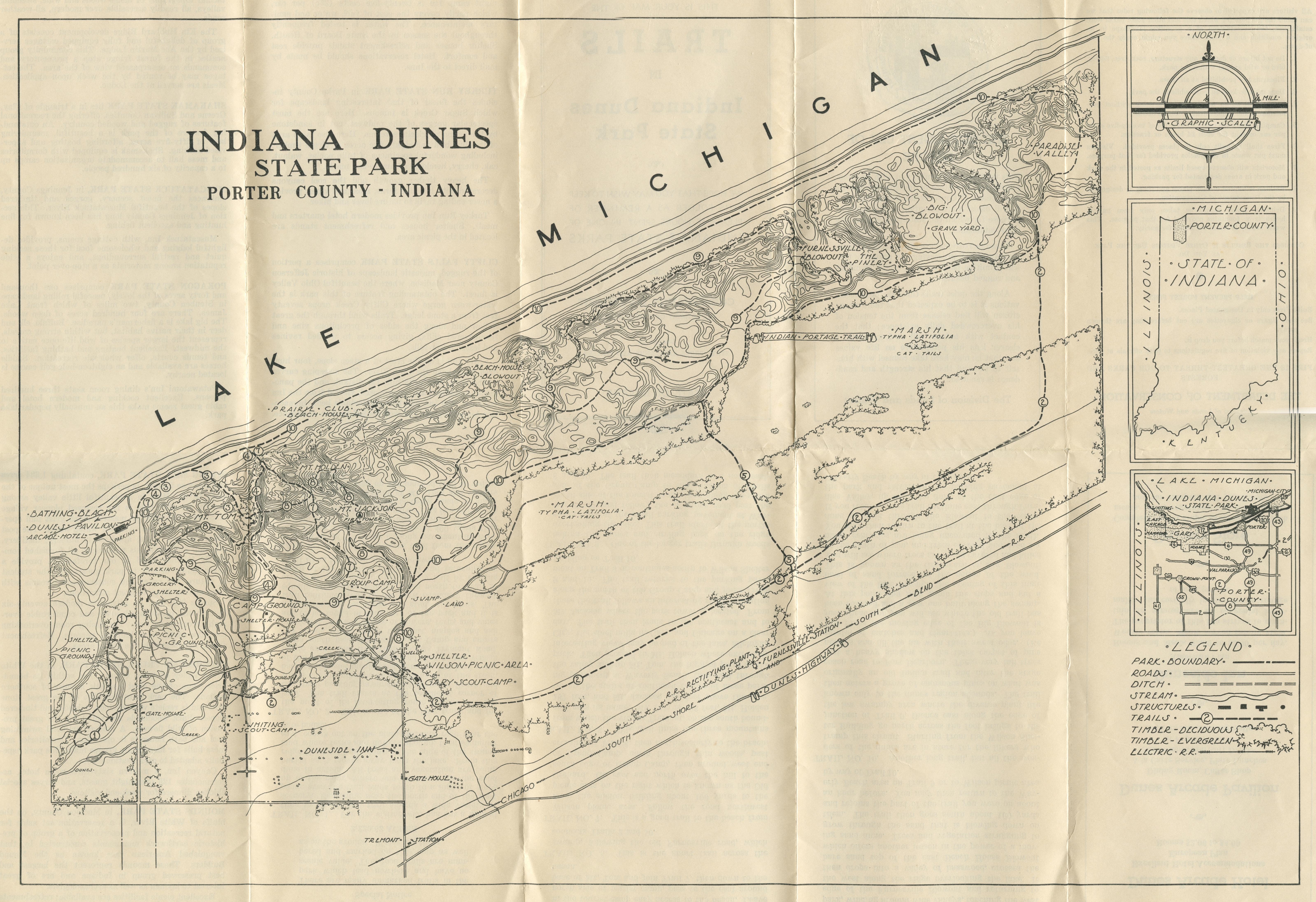
Indiana Dunes State Park Trails Map, 1927
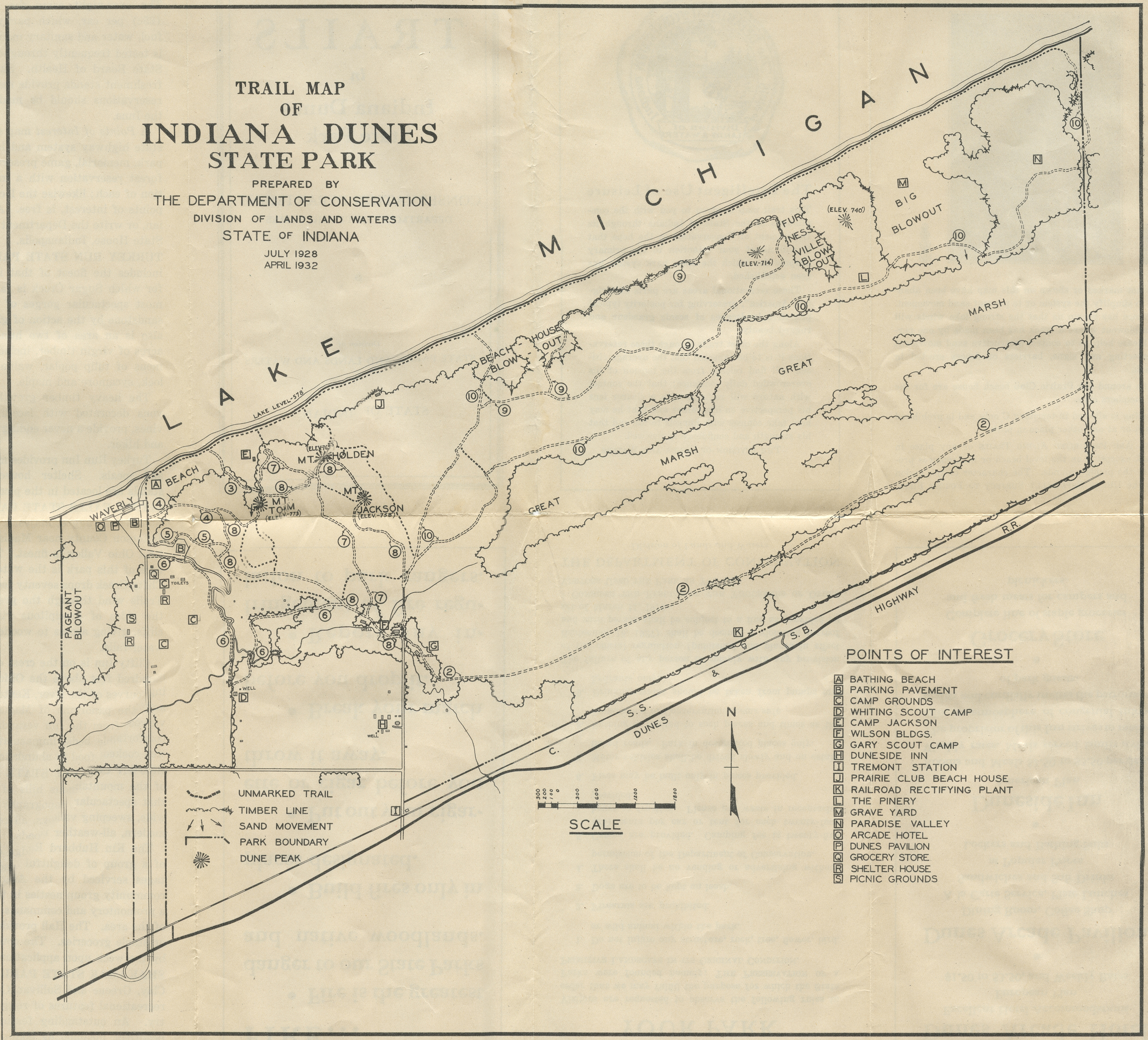
Indiana Dunes State Park Trails Map, 1932
Indiana Dunes State Park Trails Map, circa 1930s
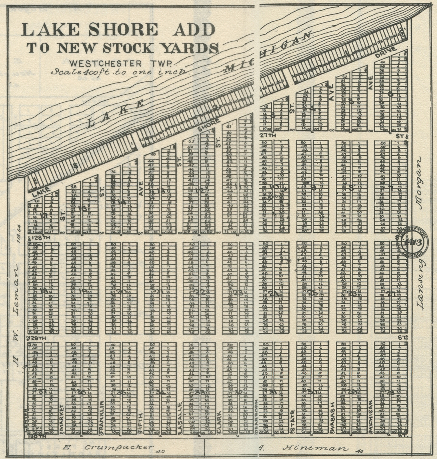
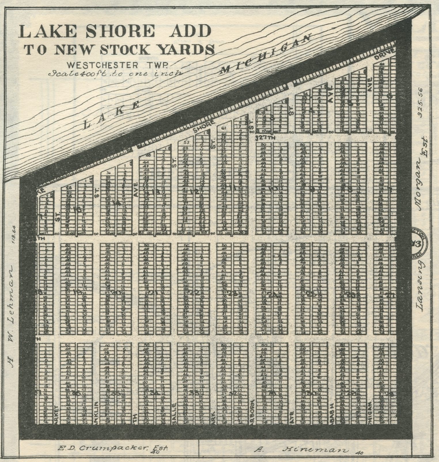
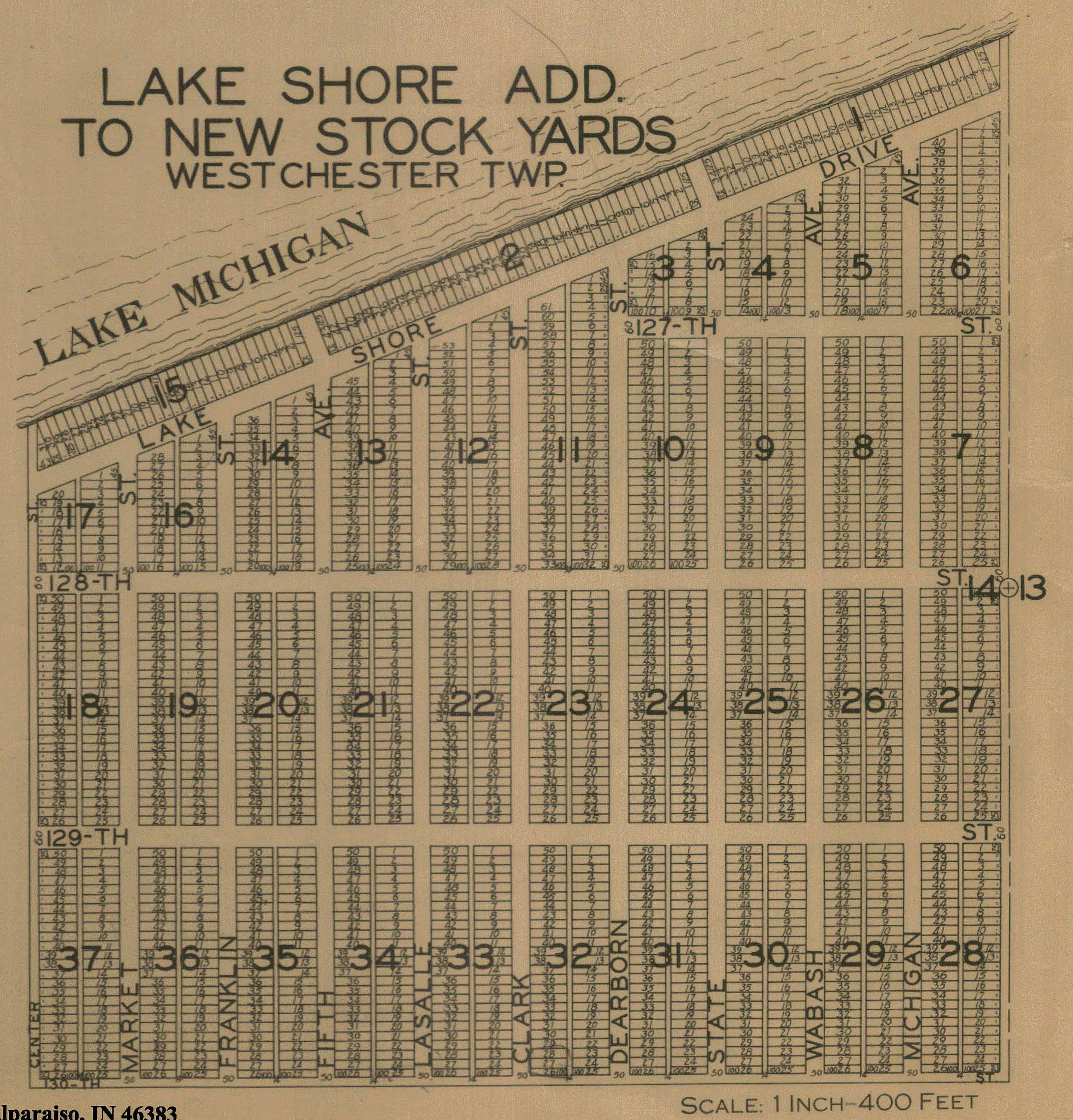
Lakeshore Addition, 1906
Lakeshore Addition, 1921
Lakeshore Addition, 1928
Lakeside Addition, 1928
Lakewood, 1892
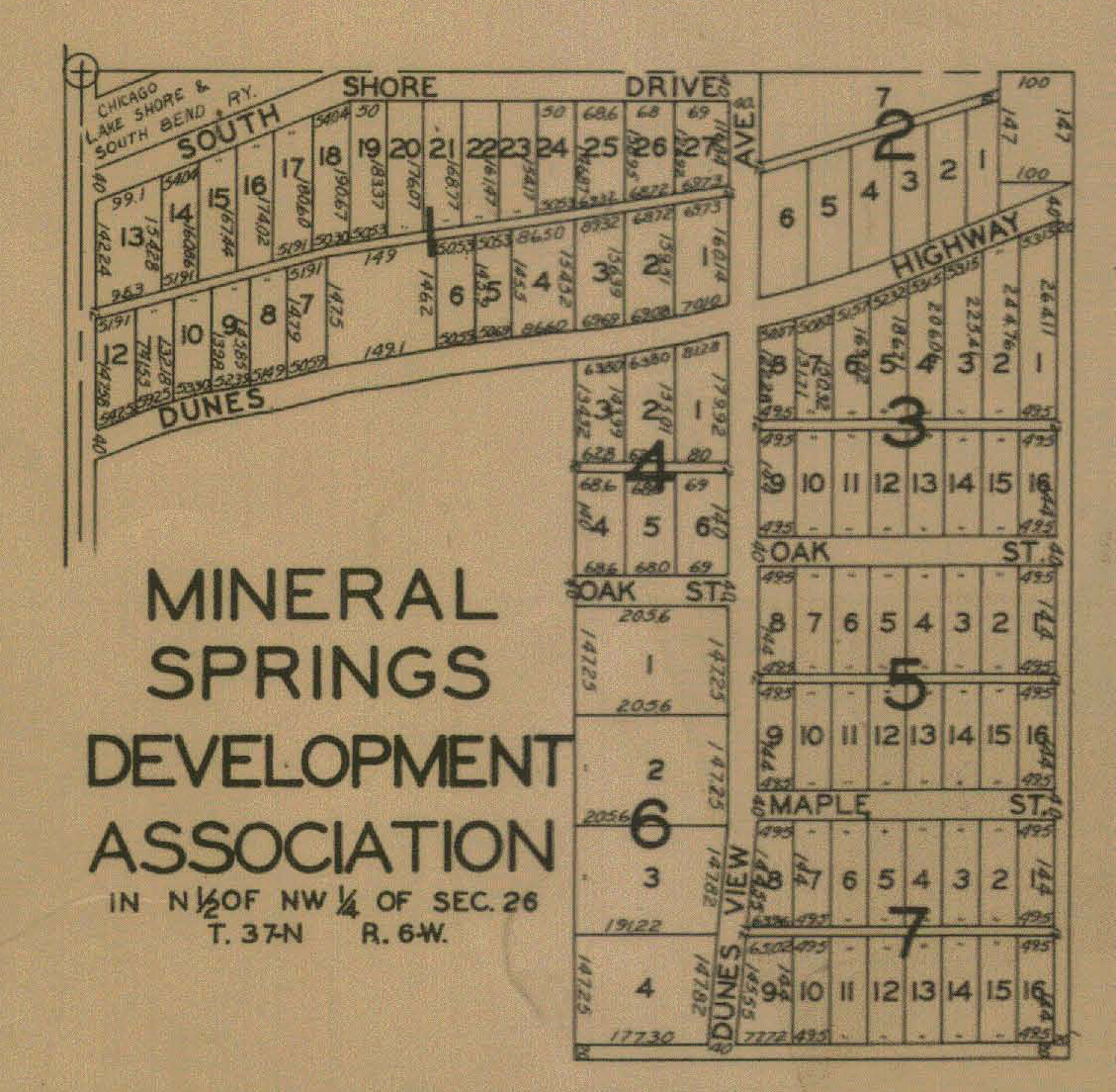
Mineral Springs Development Association, 1928
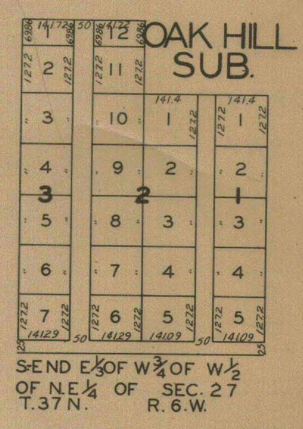
Oak
Hill, 1928
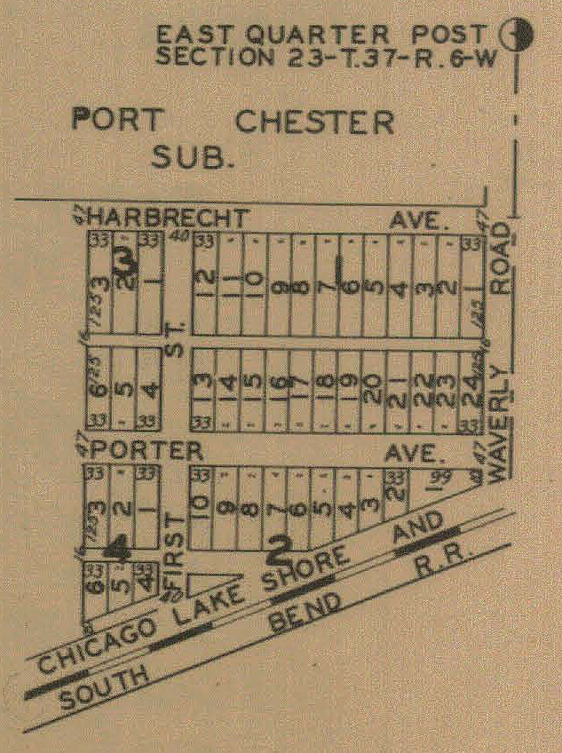
Port
Chester, 1928
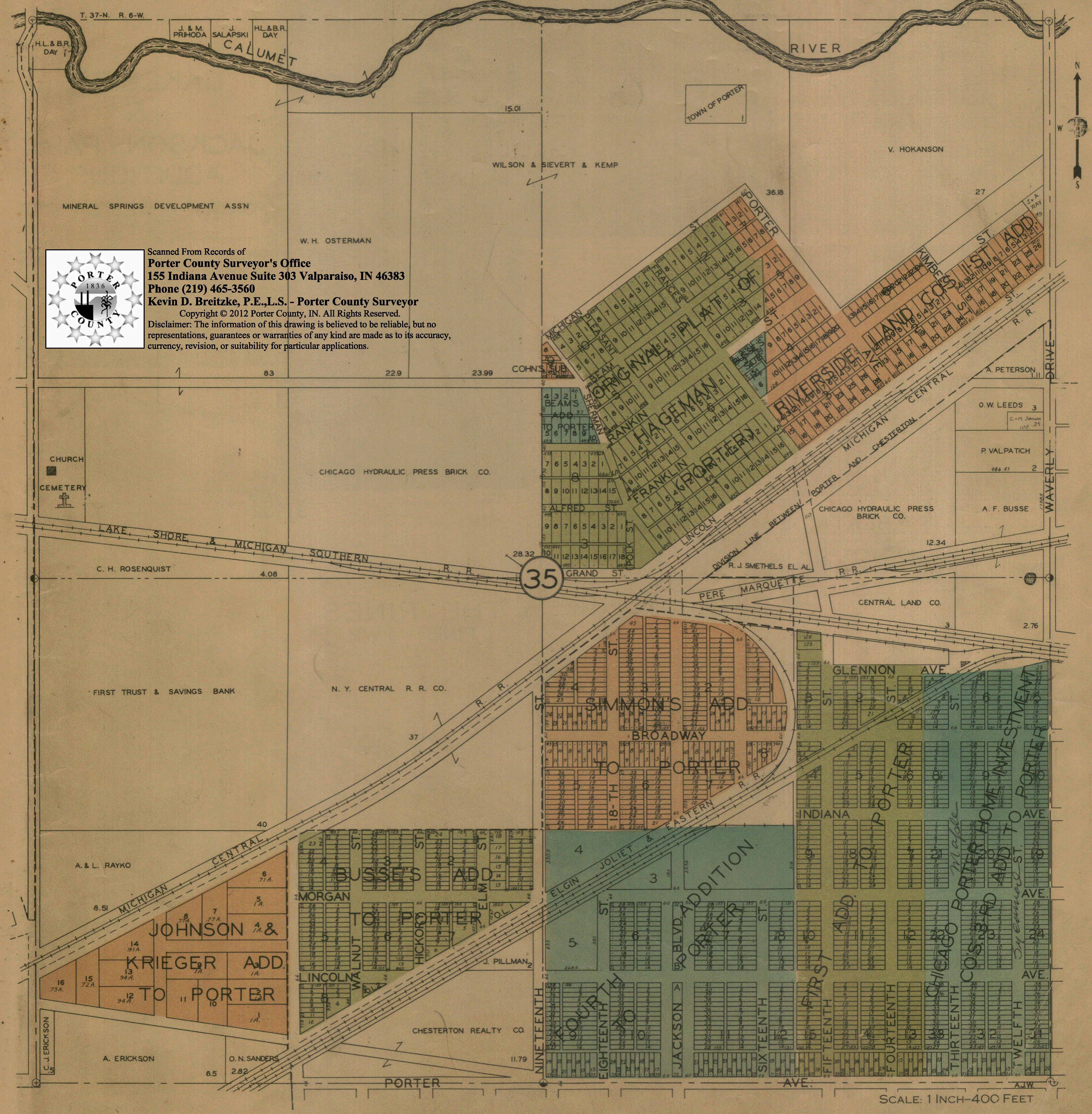
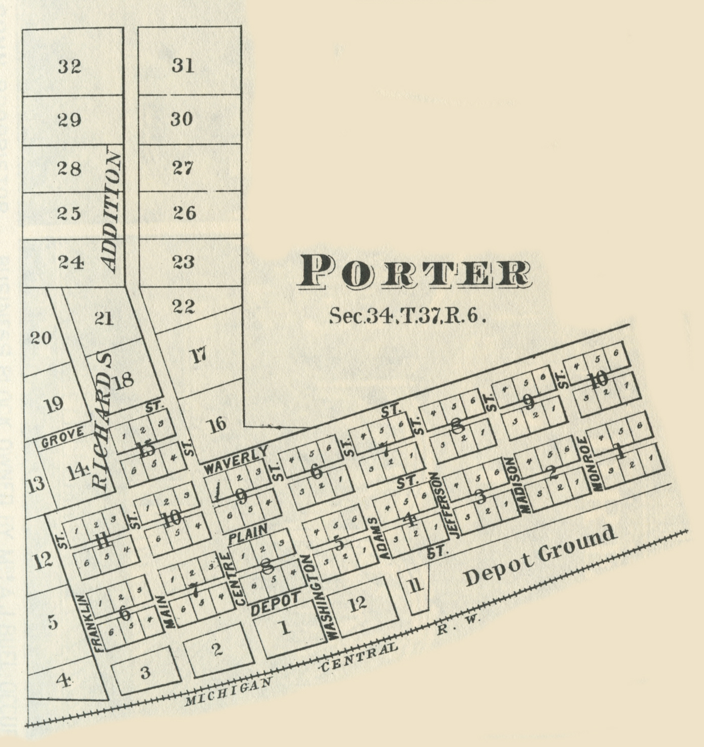
Porter,
1876
Porter,
1895
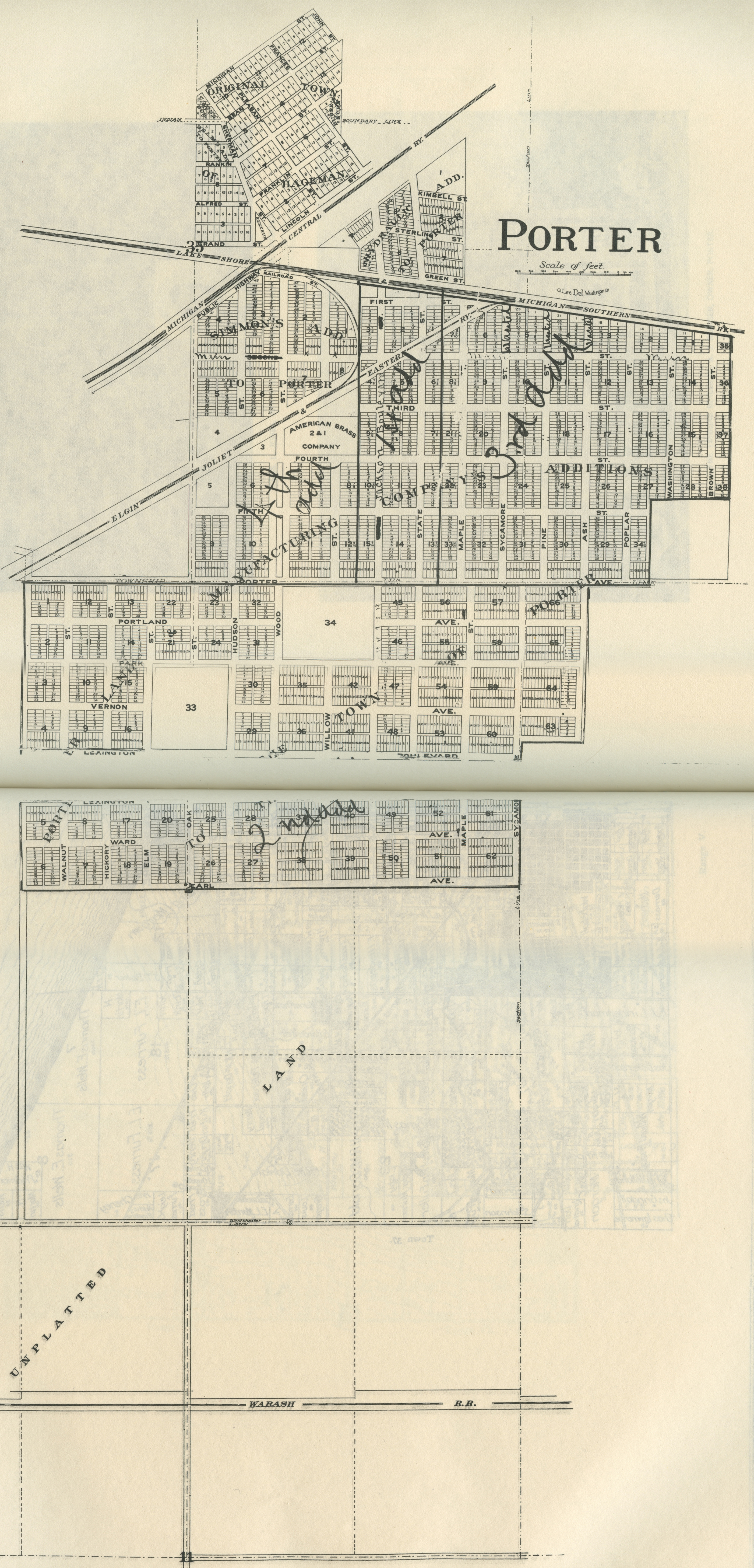
Porter -
Part I, 1928
Porter -
Part II, 1928
Porter -
Part III, 1928
Porter -
Part IV, 1928
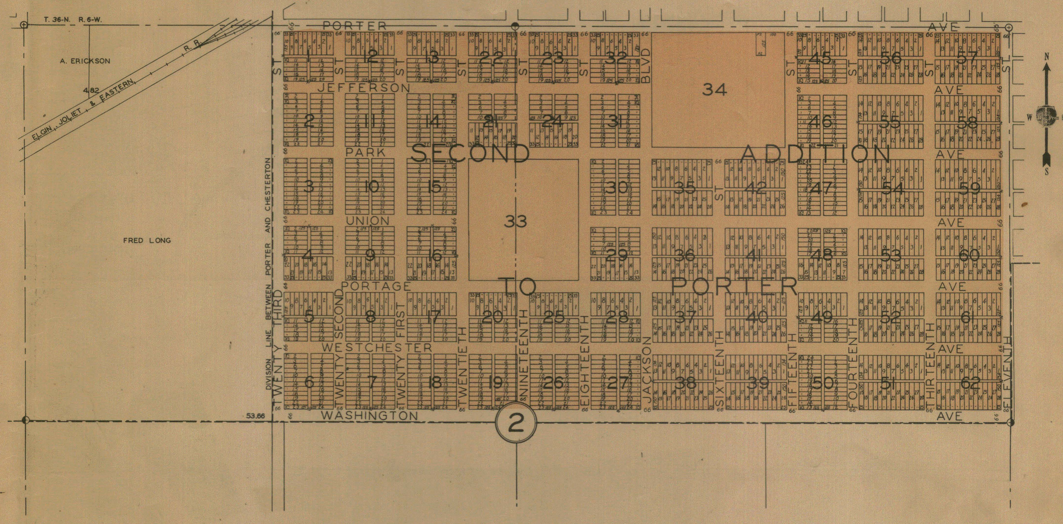
Porter and Chesterton, 1906
Porter and Chesterton, 1921
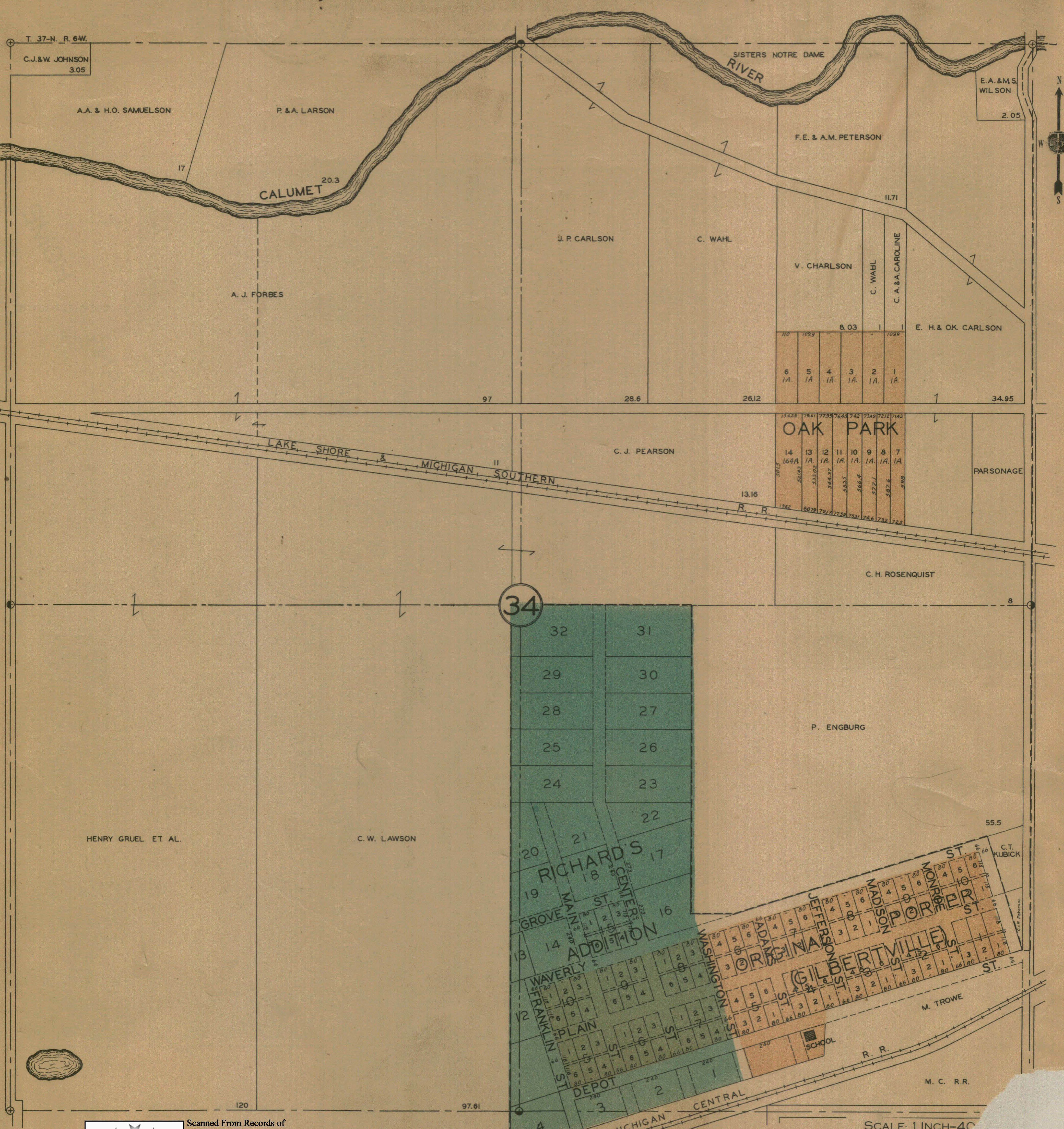
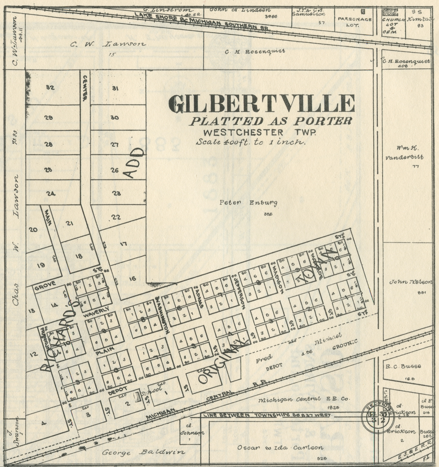
Porter - Gilbertville, 1906
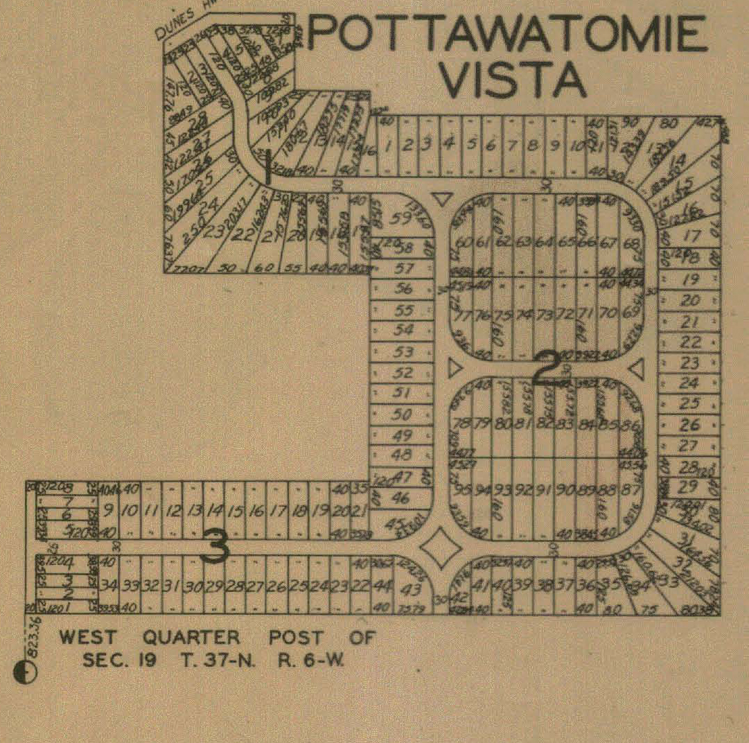
Pottawatomie Vista, 1928
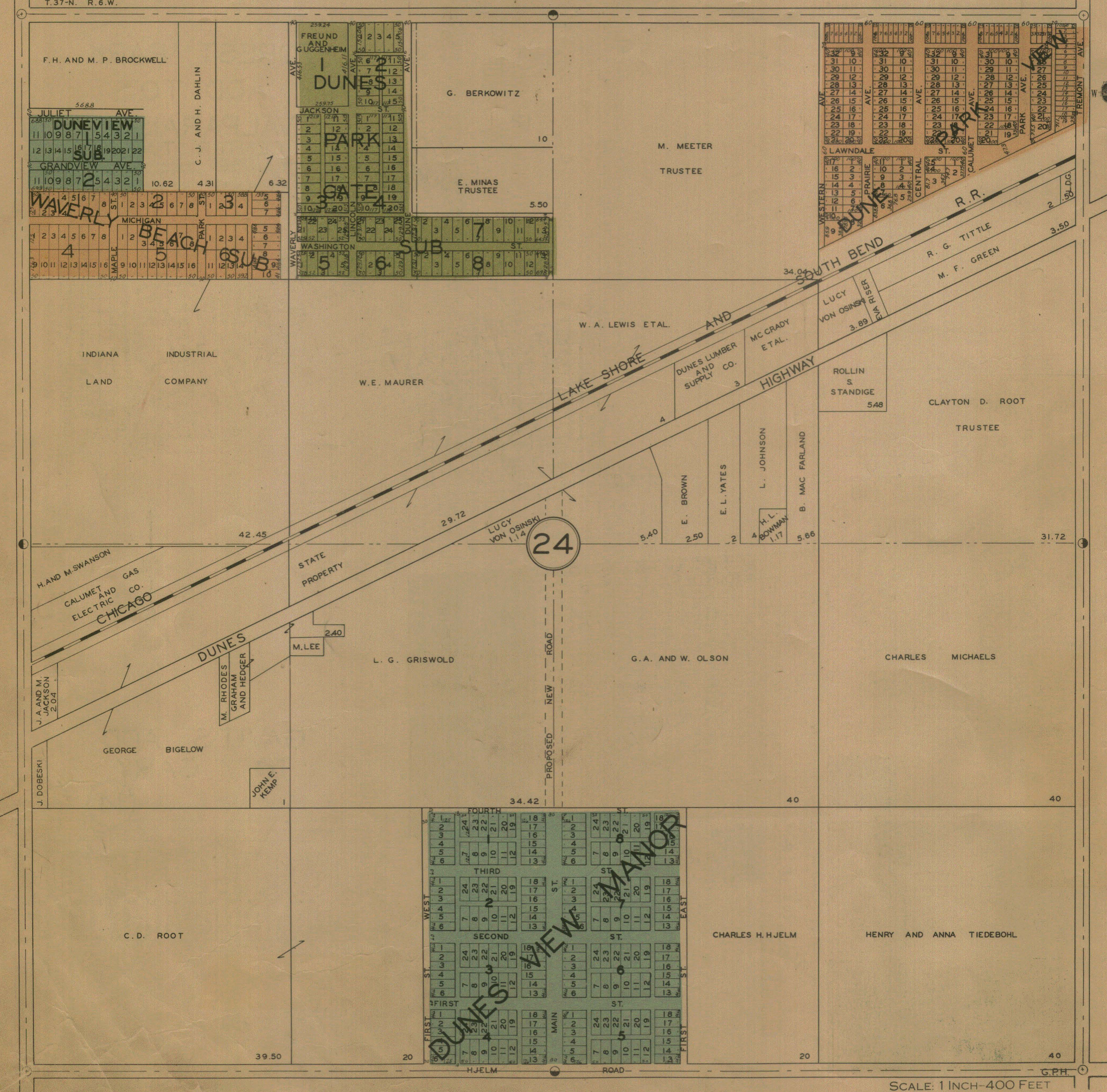
Section 24, 1928
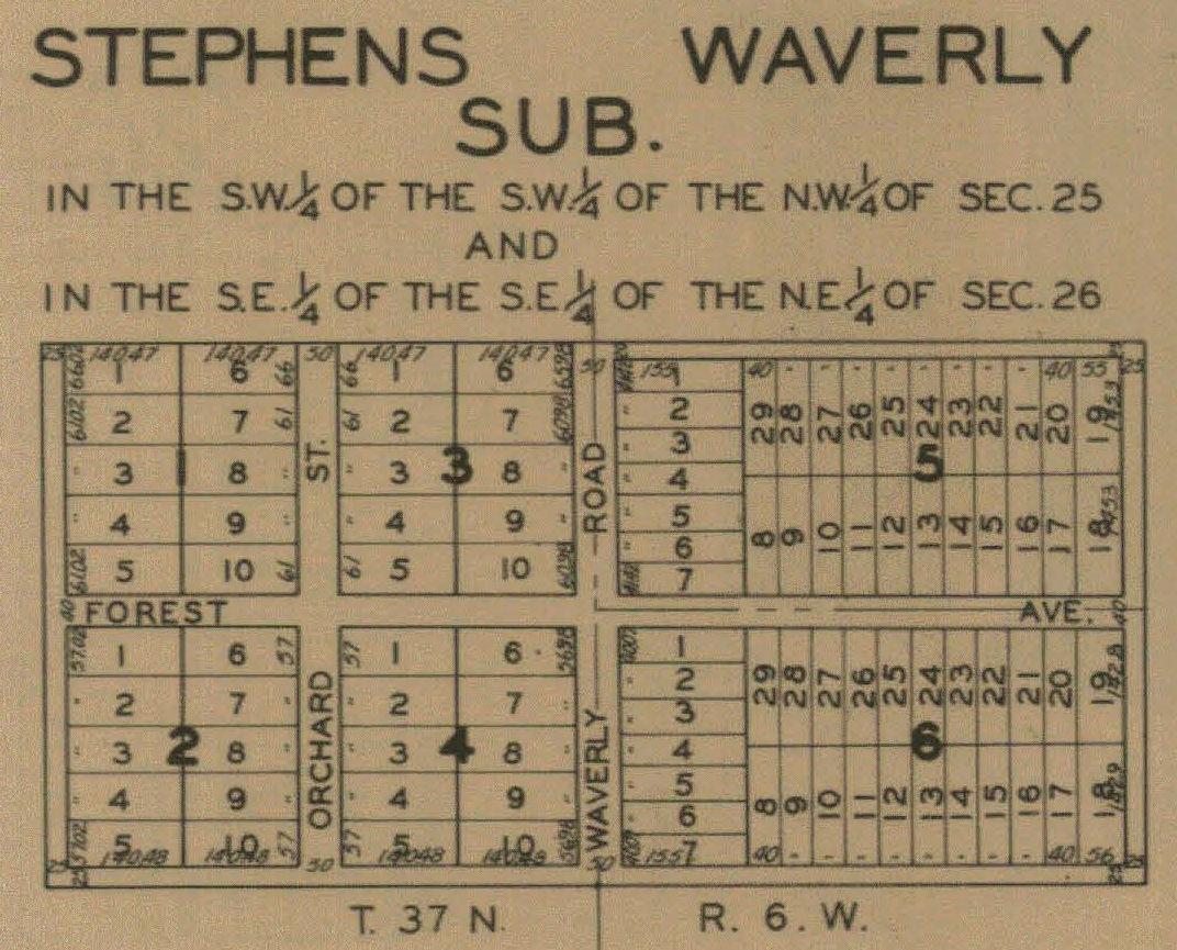
Stephen's Waverly Addition, 1928
Tremont,
1925
Source Citations:
A. I. Silander and Company. 1928. Plat Book: Porter County, Indiana.
Rockford, Illinois: The Thrift Press.
58 p.
Baskin, Forster and Company. 1876. Illustrated Historical Atlas of the
State
of Indiana. Chicago, Illinois:
Baskin, Forster and Company. 462 p.
Bowers, John O. 1929. "Dream Cities of The Calumet," in (pp.
174-198) History
of Lake County. Volume 10. Gary, Indiana: Lake
County Historical Association
(Calumet Press). 223 p.
Chesterton Retail Merchants' Association. 1948.
The Chesterton
Retail Merchants' Directory. Chesterton, Indiana: The
Chesterton Tribune. 112 p.
County Plat and Directory Company, Inc. 1969. Porter County, Indiana:
Official Farm Plat Book and Directory. LaPorte, Indiana: County
Plat and
Directory Company, Inc. 36 p.
Department of Conservation. 1932.
Trails in Indiana Dunes State
Park. Indianapolis, Indiana: Department of Conservation, State
of Indiana. 2 p.
George A. Ogle and Company. 1906. Standard Atlas of Porter County, Indiana:
Including a Plat Book of the Villages, Cities and Townships of the County.
Chicago, Illinois: George A. Ogle and Company. 55 p.
George A. Ogle and Company. 1921. Standard Atlas of Porter County, Indiana:
Including a Plat Book of the Villages, Cities and Townships of the County.
Chicago, Illinois: George A. Ogle and Company. 61 p.
Hardesty, A. G. 1876. Illustrated Historical Atlas of Porter County, Indiana.
Valparaiso, Indiana: A. G. Hardesty. 90 p.
History Committee. 1990.
Charter Centennial: Hebron, Indiana,
1890-1990. Hebron, Indiana: Star Printing. 120 p.
Kouts Centennial Committee. 1965.
Kouts Is Five In Score
-- Ready For
A
Hundred More. Kouts, Indiana: Kouts Centennial Committee. 181 p.
Kraft and Radcliffe. 1893.
Valparaiso, Porter County, Ind. City
Directory, 1893. Chicago, Illinois: Kraft and Radcliffe.
Lee and Lee. 1895. Lee and Lee's Atlas of Porter County, Indiana.
Chicago,
Illinois: Lee and Lee. 81 p.
Neeley, George E. 1989. Valparaiso: A Pictorial History. St. Louis,
Missouri:
G. Bradley Publishing, Inc. 200 p.
Outdoor and Recreation Bureau. 1927.
Descriptive Map of the
Famous Dunes of Indiana: The Wonderland of America.
Chicago, Illinois: Poole Brothers,
Inc. 6 p.
Porter County Abstract Company, Inc. Circa 1938. Plat Book of Porter
County,
Indiana. Valparaiso, Indiana: Porter County Abstract
Company, Inc. 20 p.
Porter County Surveyor's Office. Porter County, Indiana.
Town and Country Publishing Company, Inc. 1973. Porter County, Indiana:
Plat Book and Index of Owners. LaPorte, Indiana: Town and Country
Publishing
Company, Inc. 48 p.
Town and Country Publishing Company, Inc. 1976. Porter County, Indiana:
Plat Book, Index of Owners, City Street Maps. LaPorte, Indiana: Town
and Country Publishing
Company, Inc. 56 p.
Town and Country Publications, Inc. 1988. Porter County, Indiana:
Official
Plat Book 1988. LaPorte, Indiana: Town and Country Publications,
Inc.
64 p.
City, village, and addition plat maps prepared for web by Steven R. Shook, March,
April, and May
2012, January 2013, and December 2014