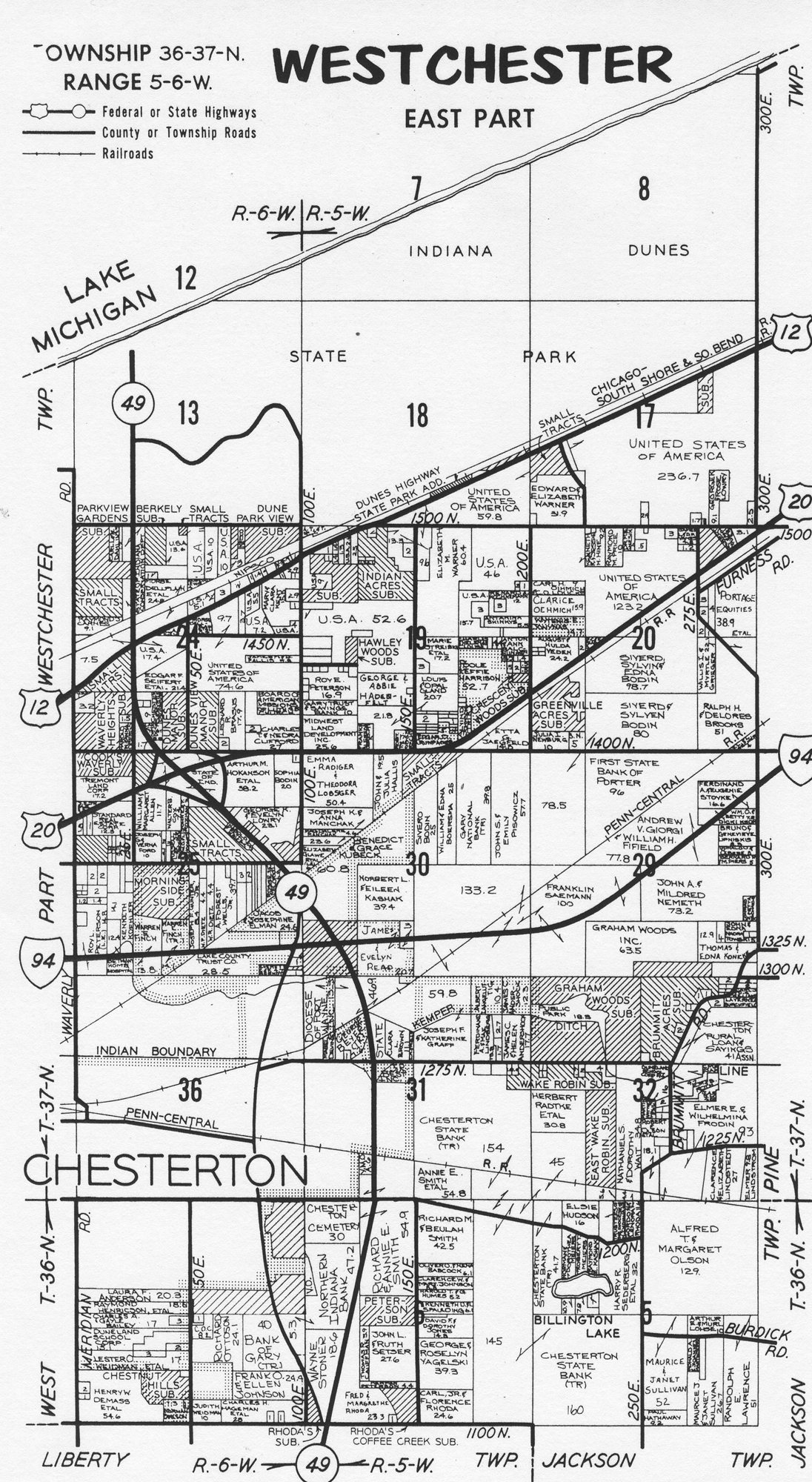
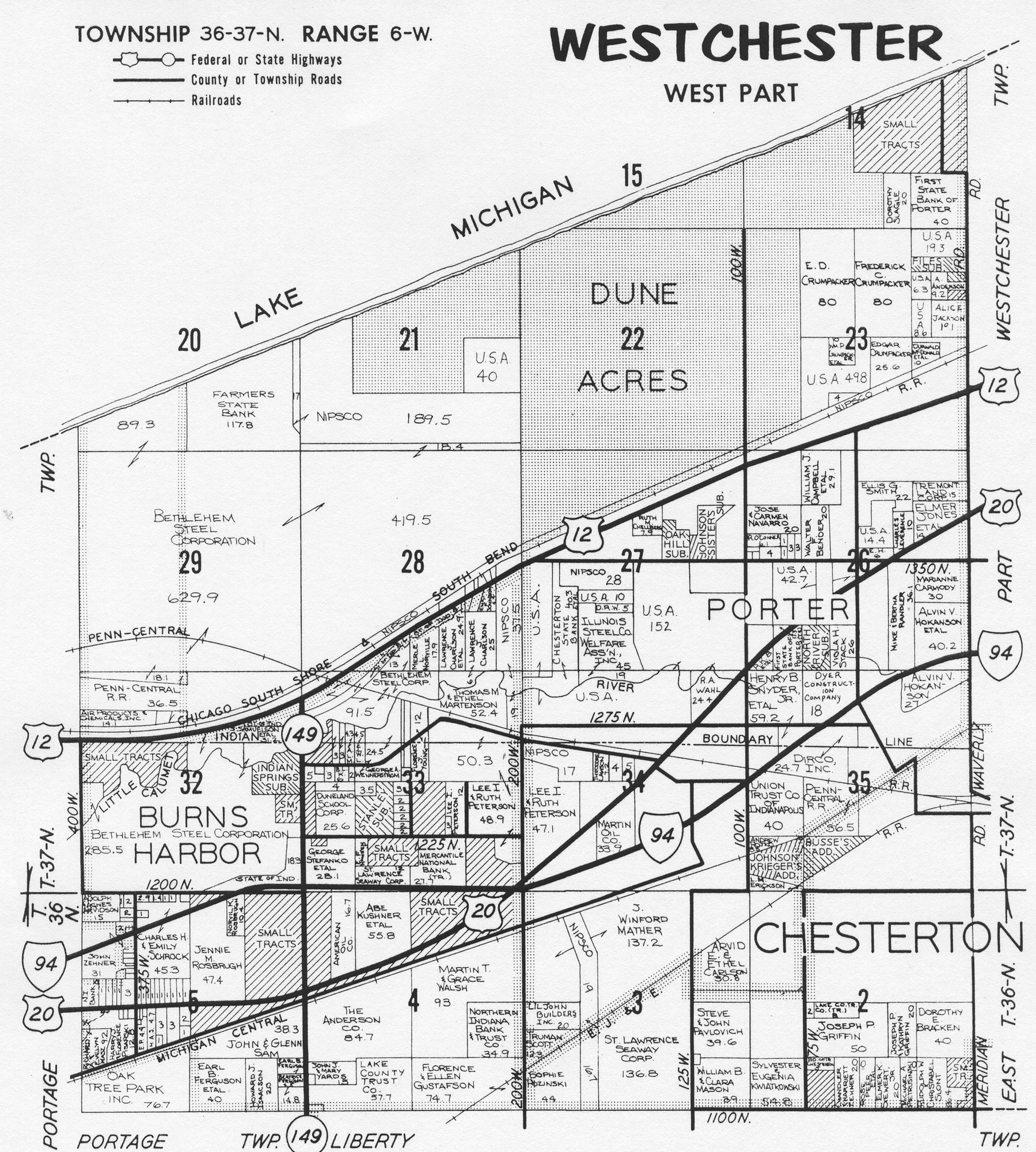
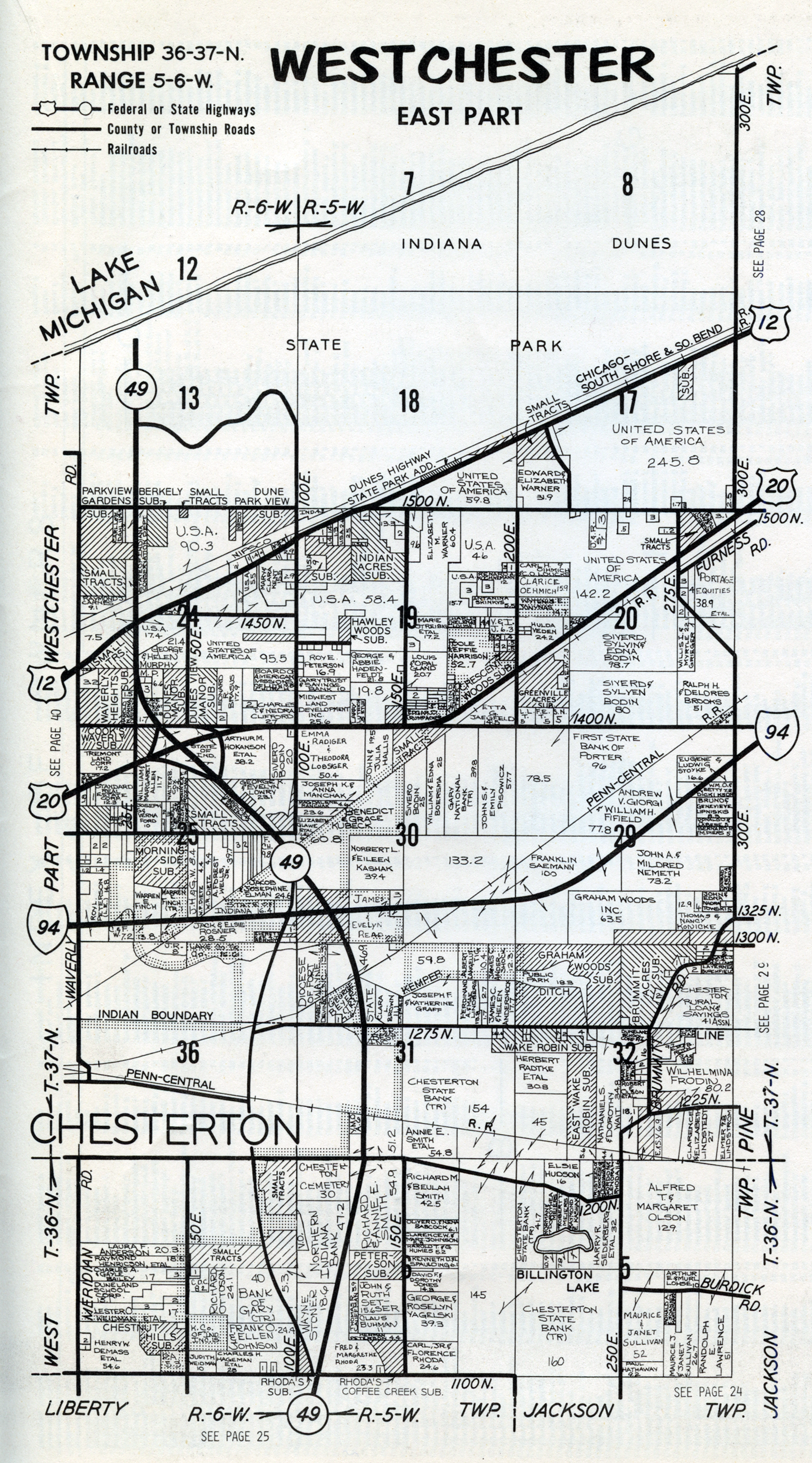
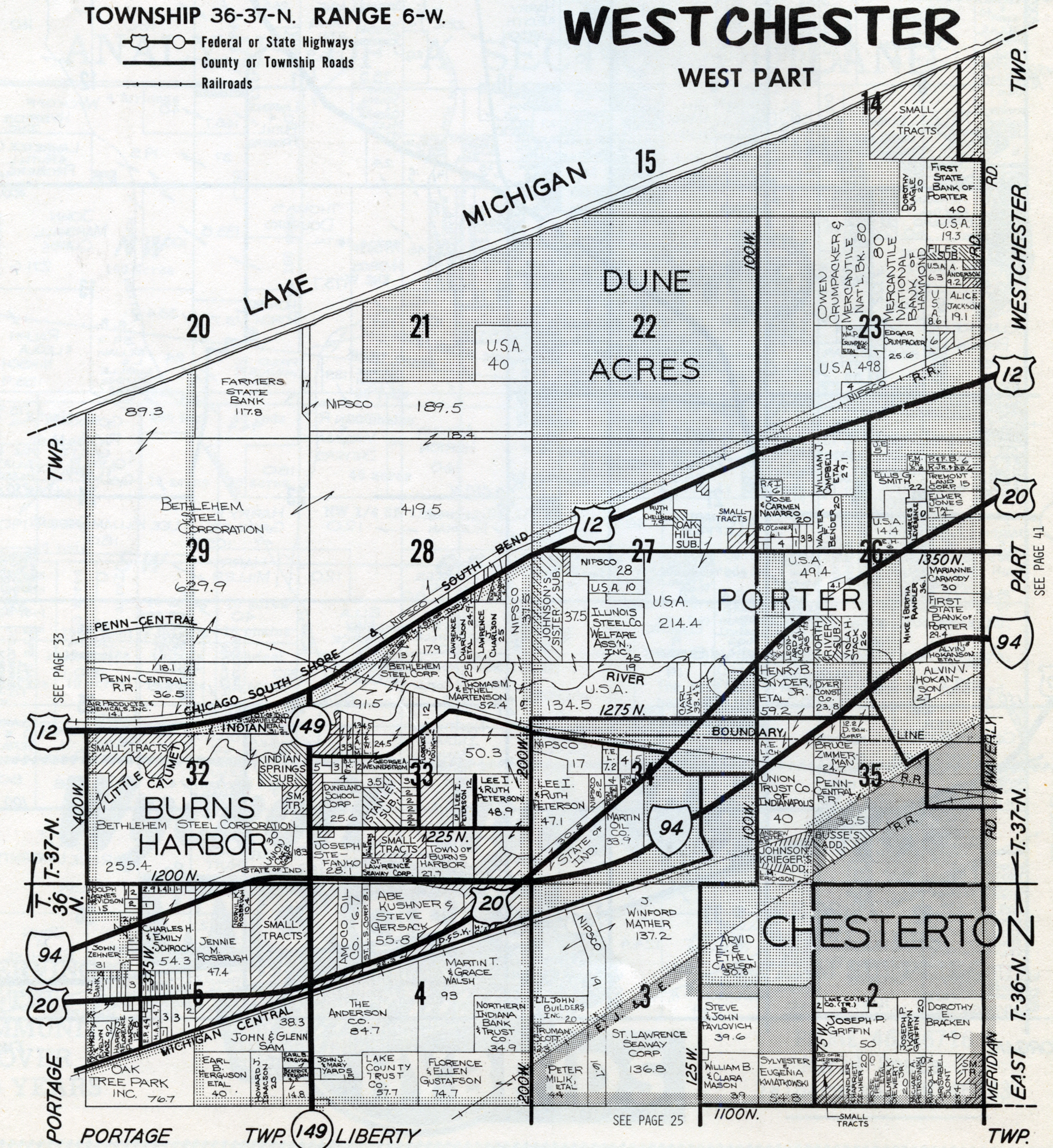
Westchester Township MapsWestchester Township, Porter County plat maps . . . .
The following are Westchester Township, Porter
County, Indiana, maps available on this website. Click the links below to access
full size images. Note that several of these images are large files and may take
considerable time to load on slower Internet connections, such as dialup.
Original Land Patents
1876
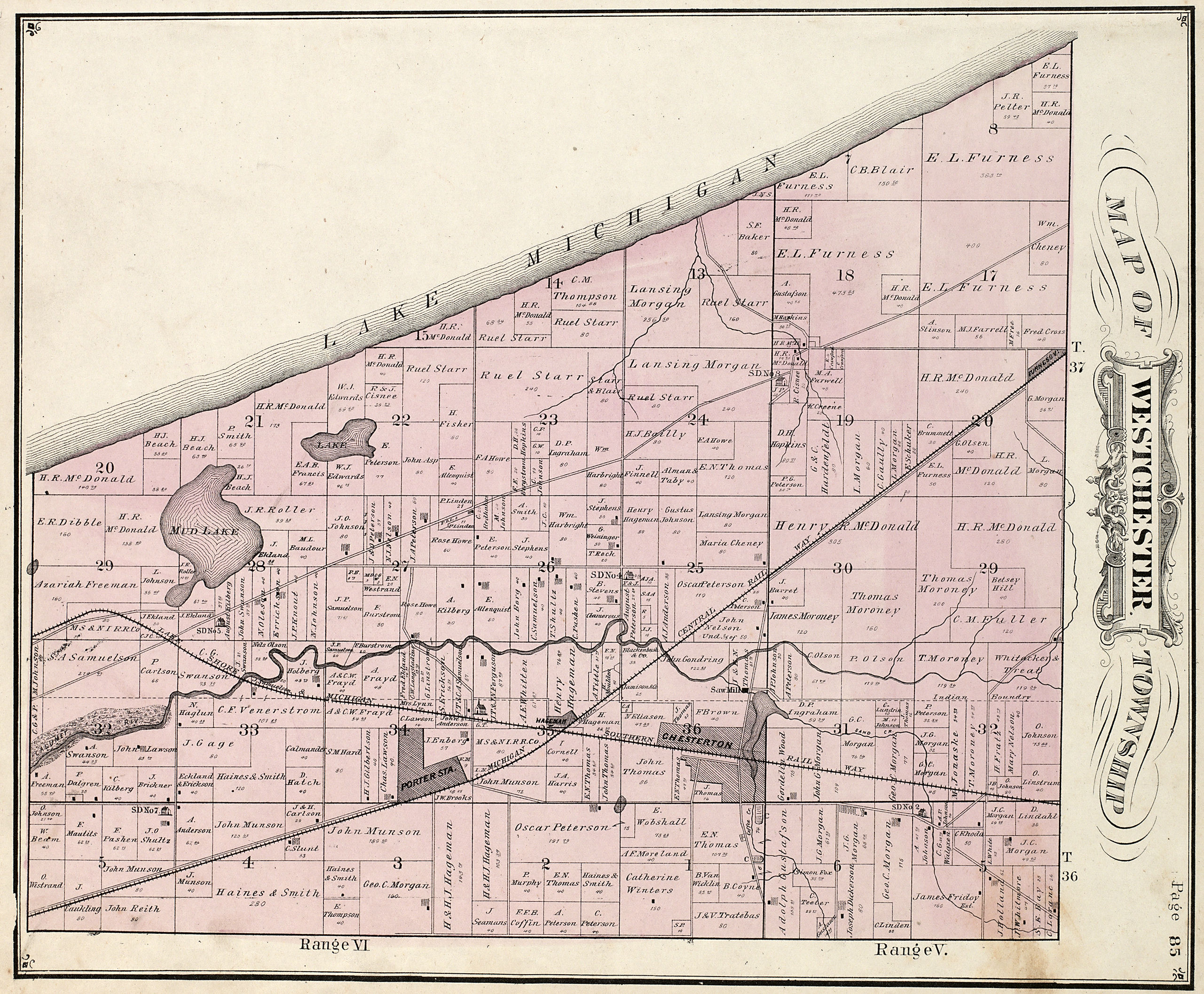
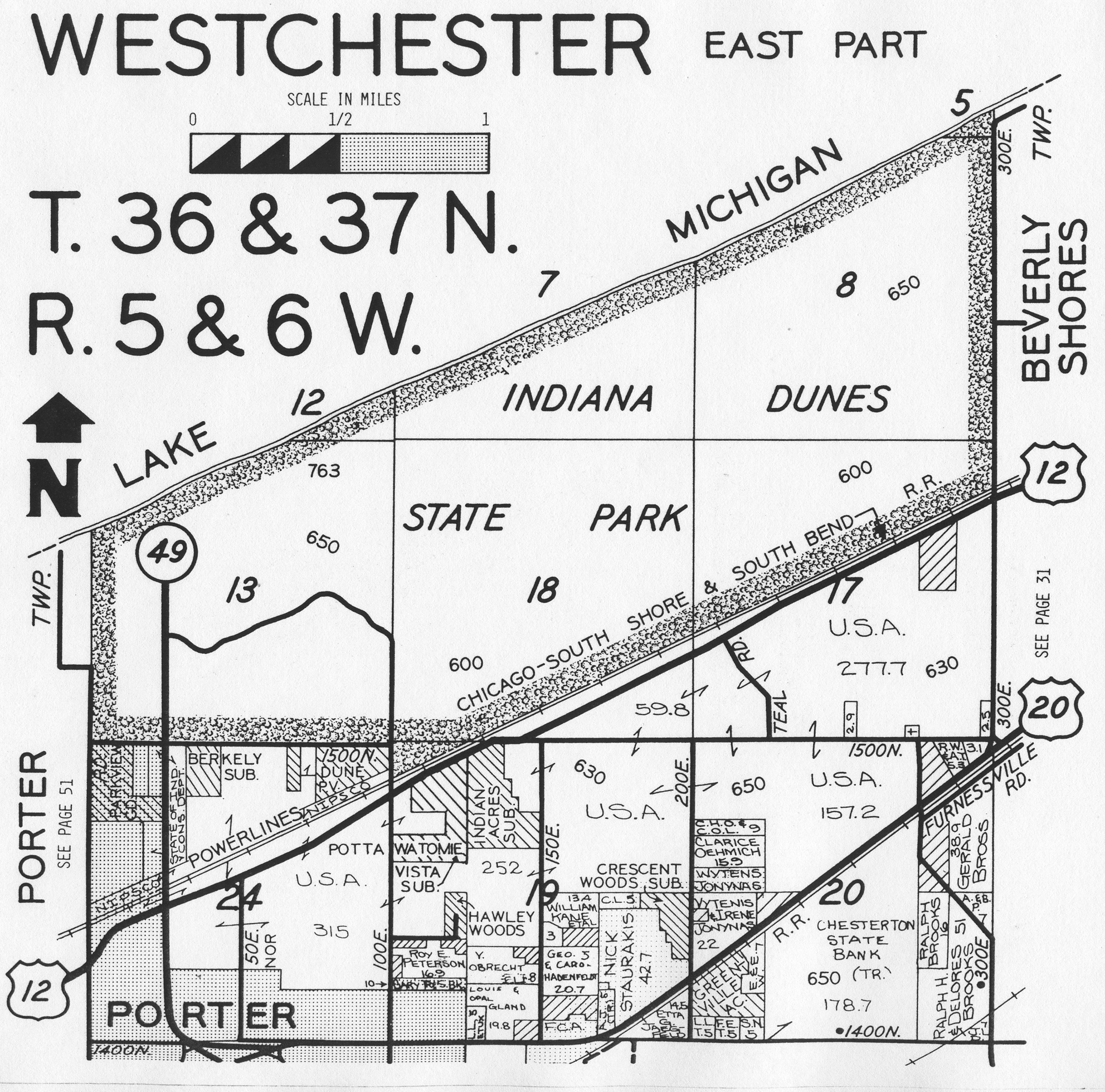
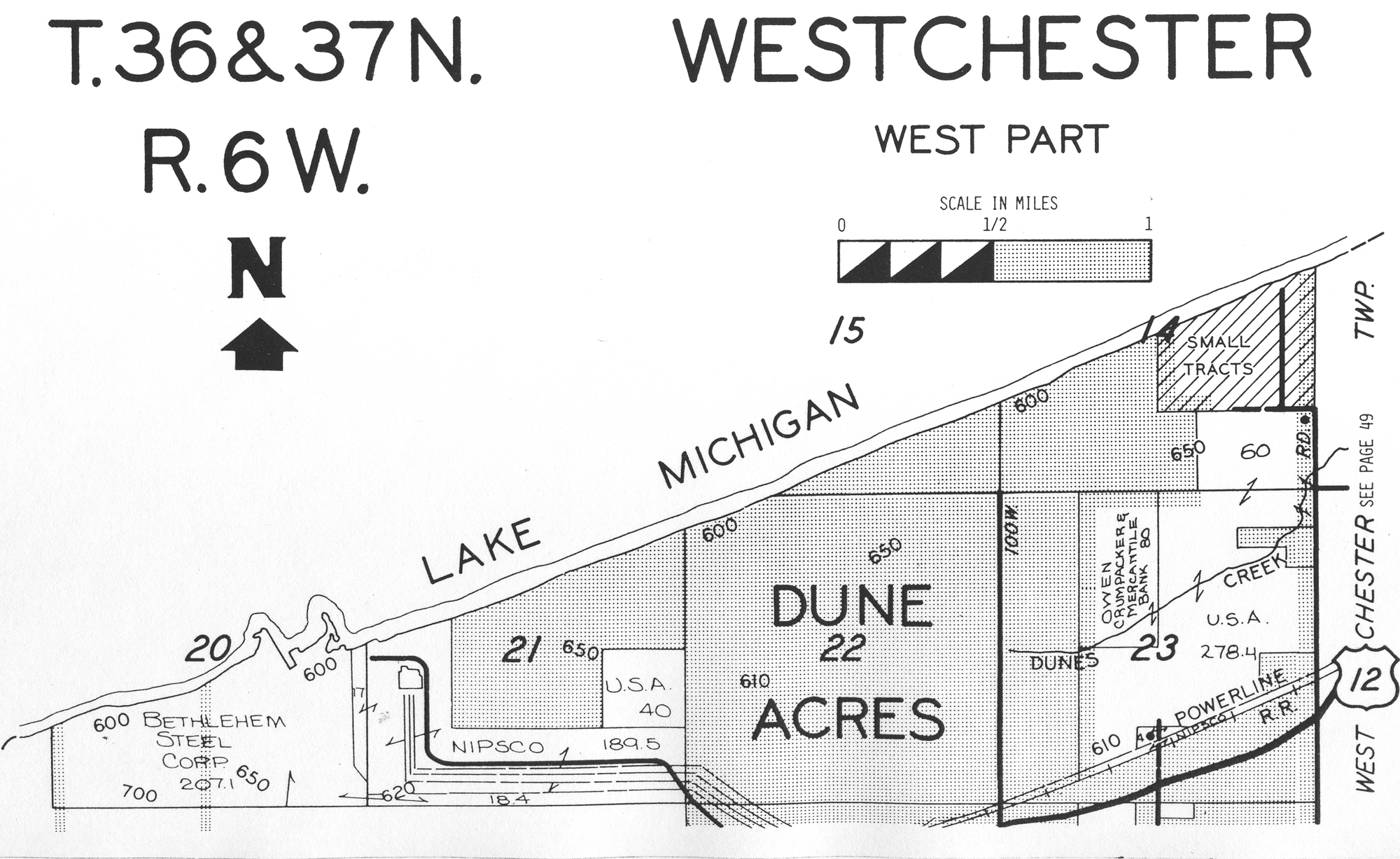
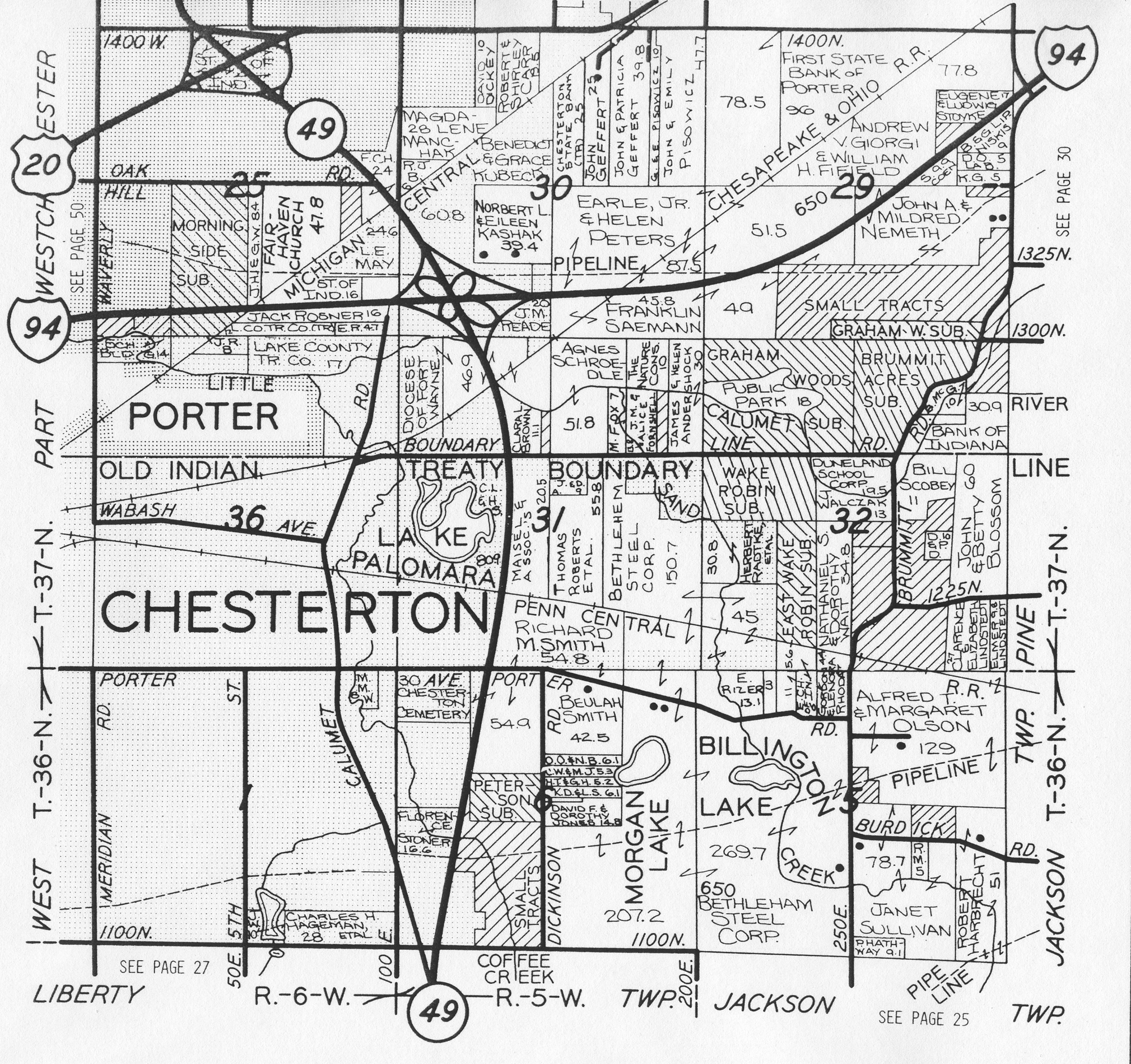
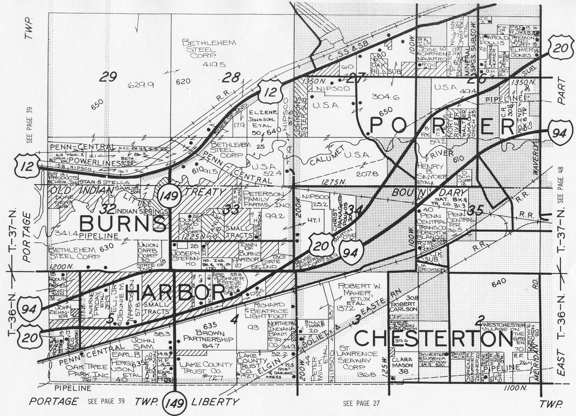
Plat Map
1895 Plat Map (East Half)
1895 Plat Map (West Half)
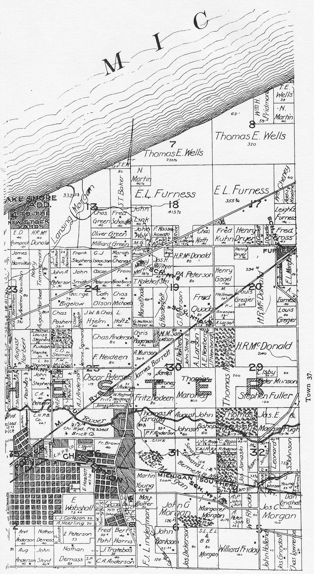
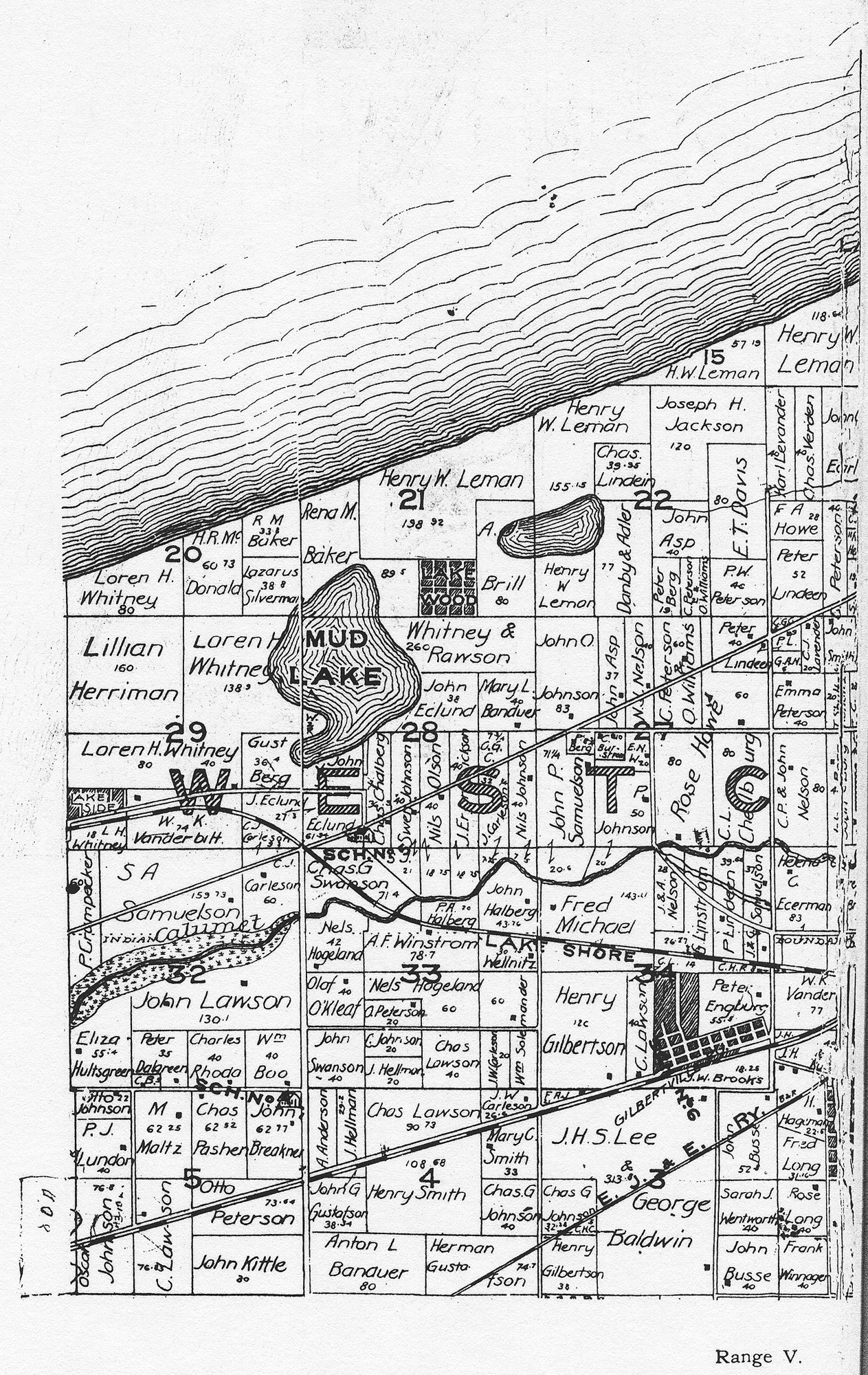
1906
Plat Map
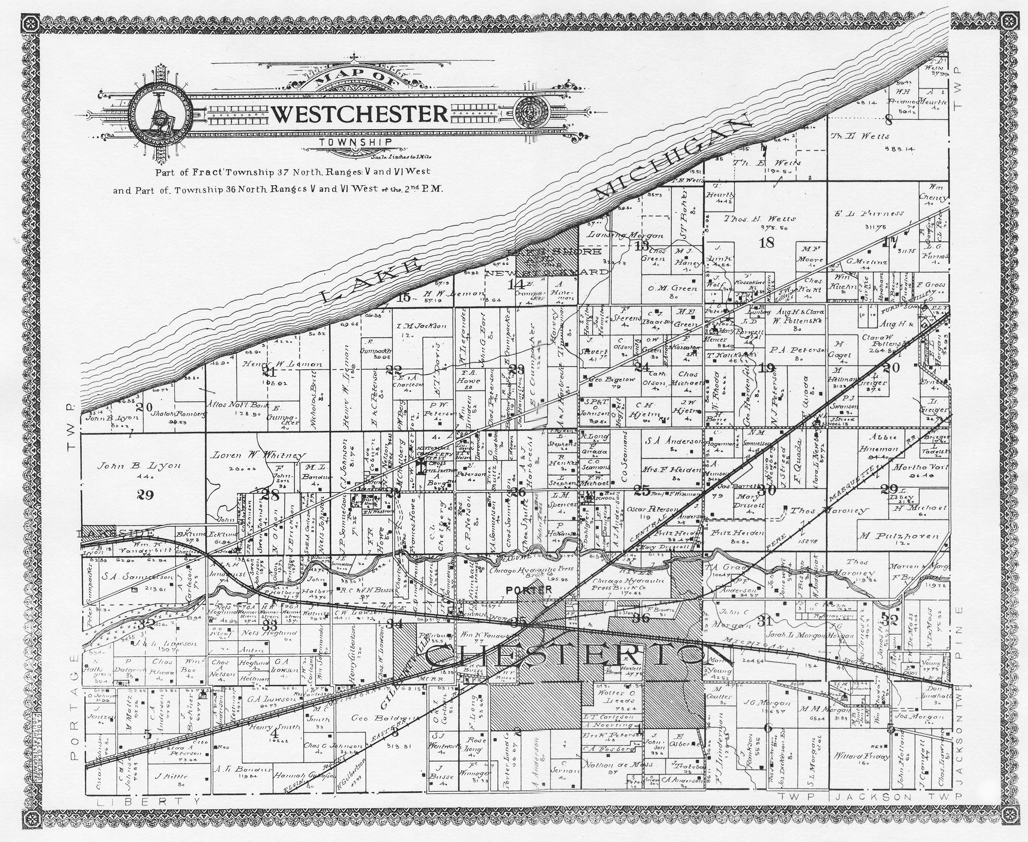
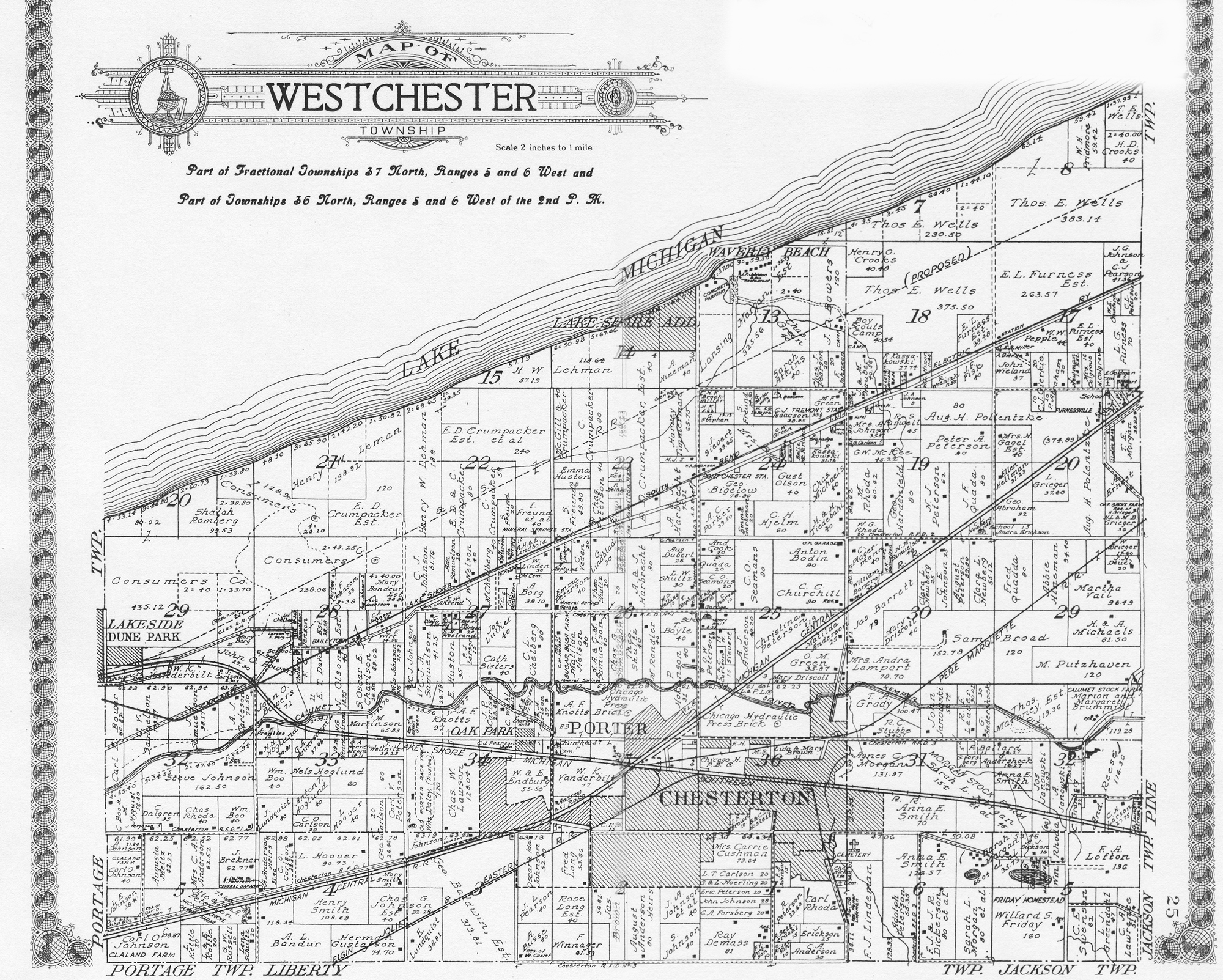
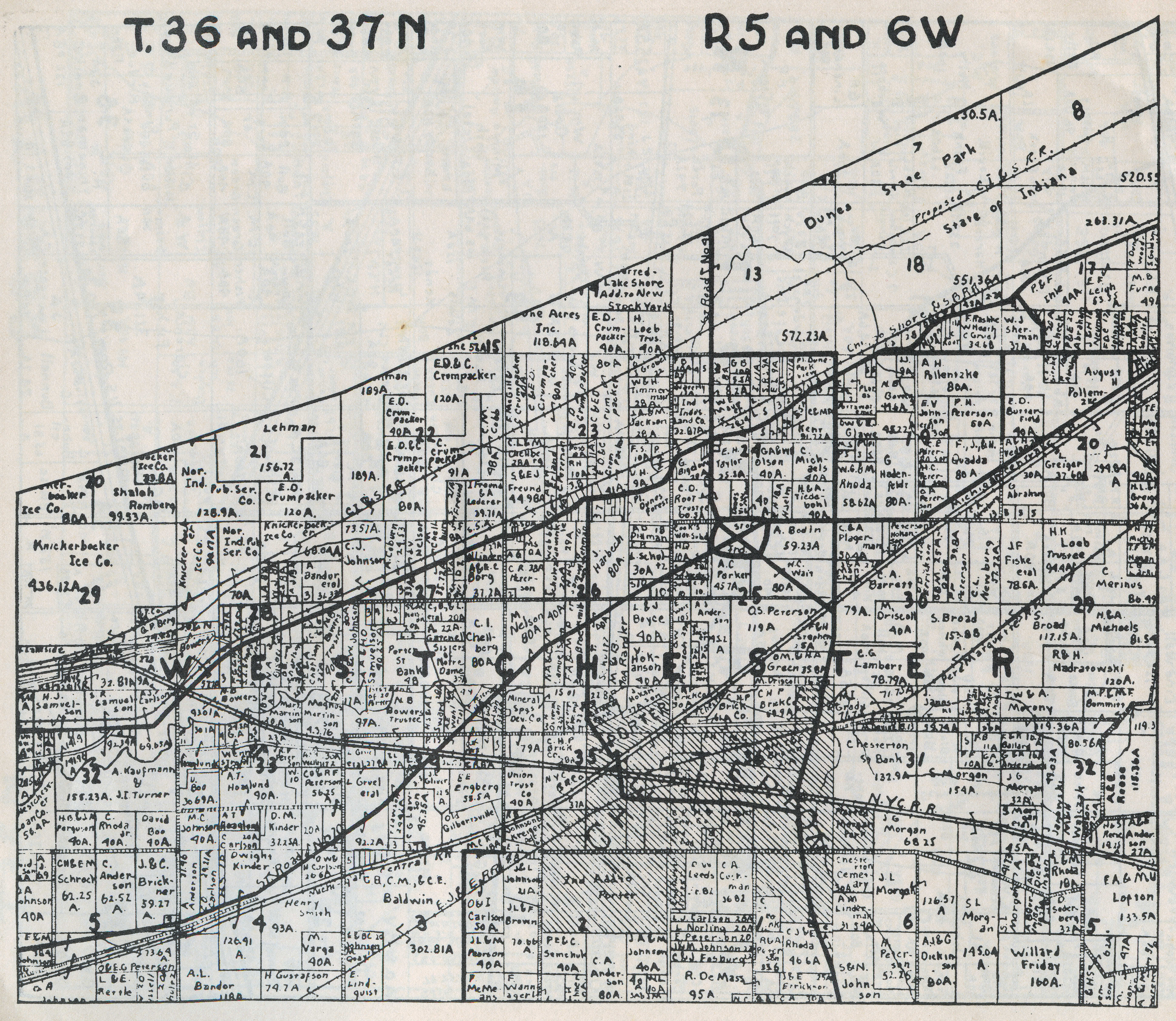
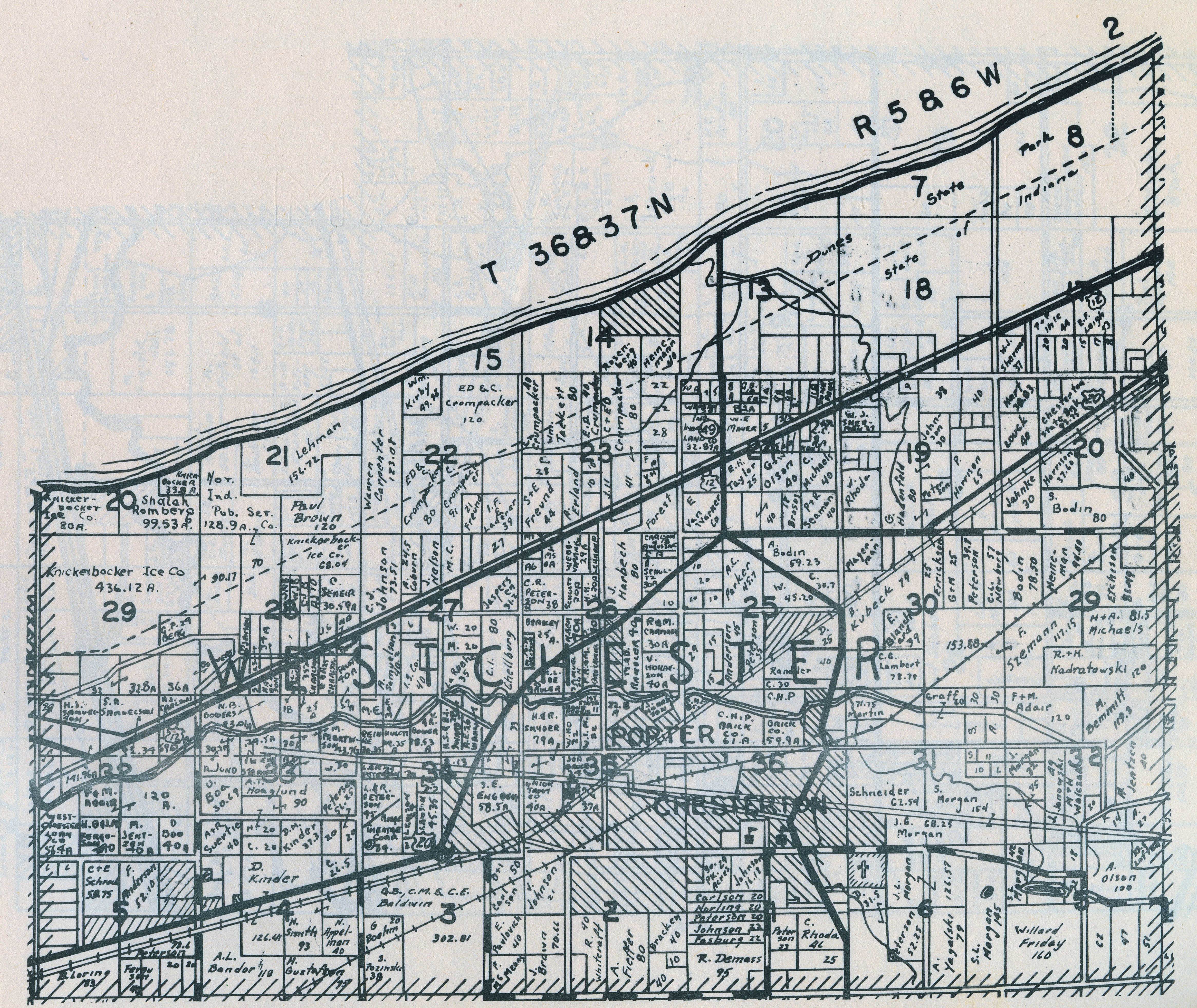
1921
Plat Map
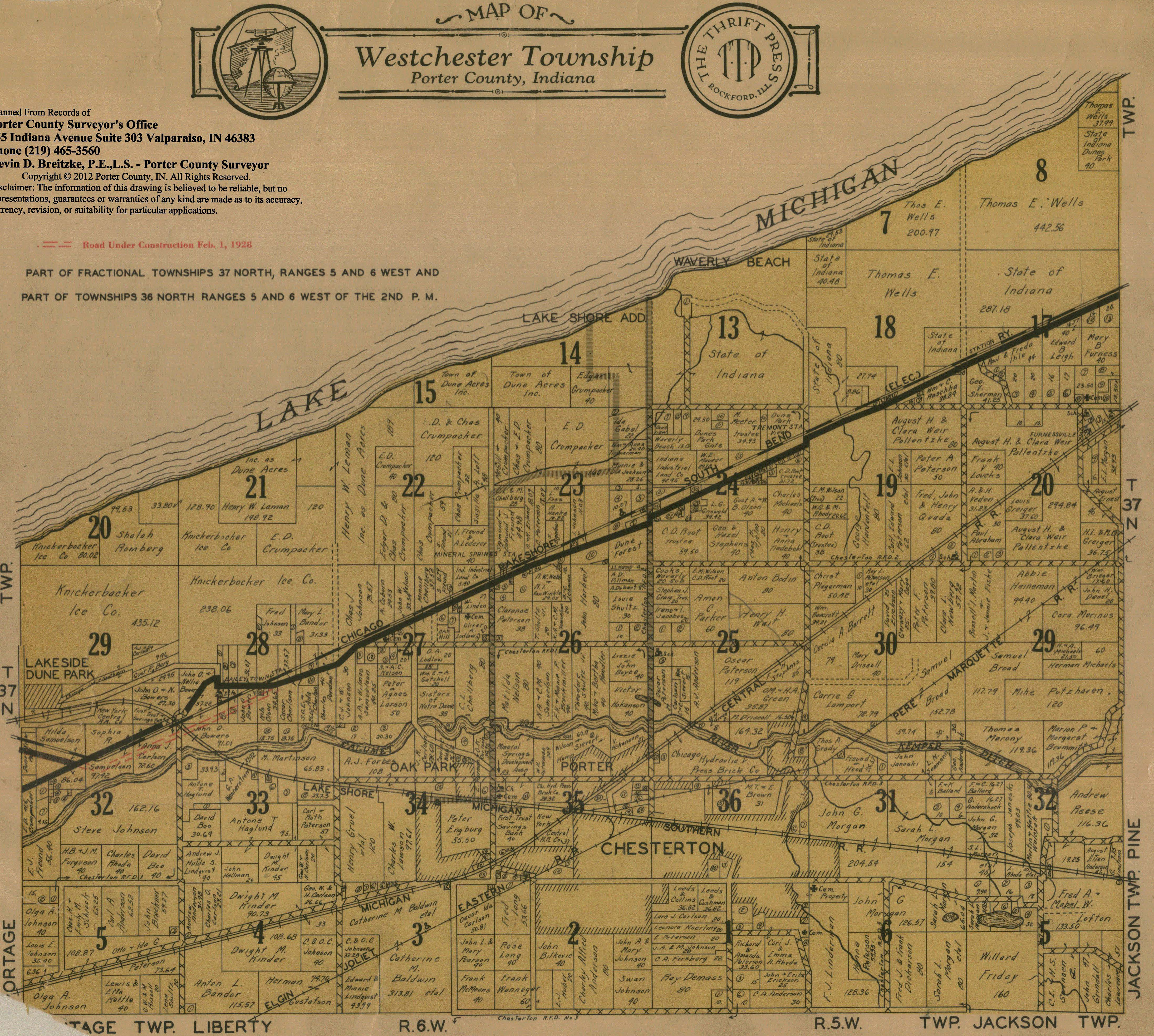
1928
Plat Map
1929 Plat
Map
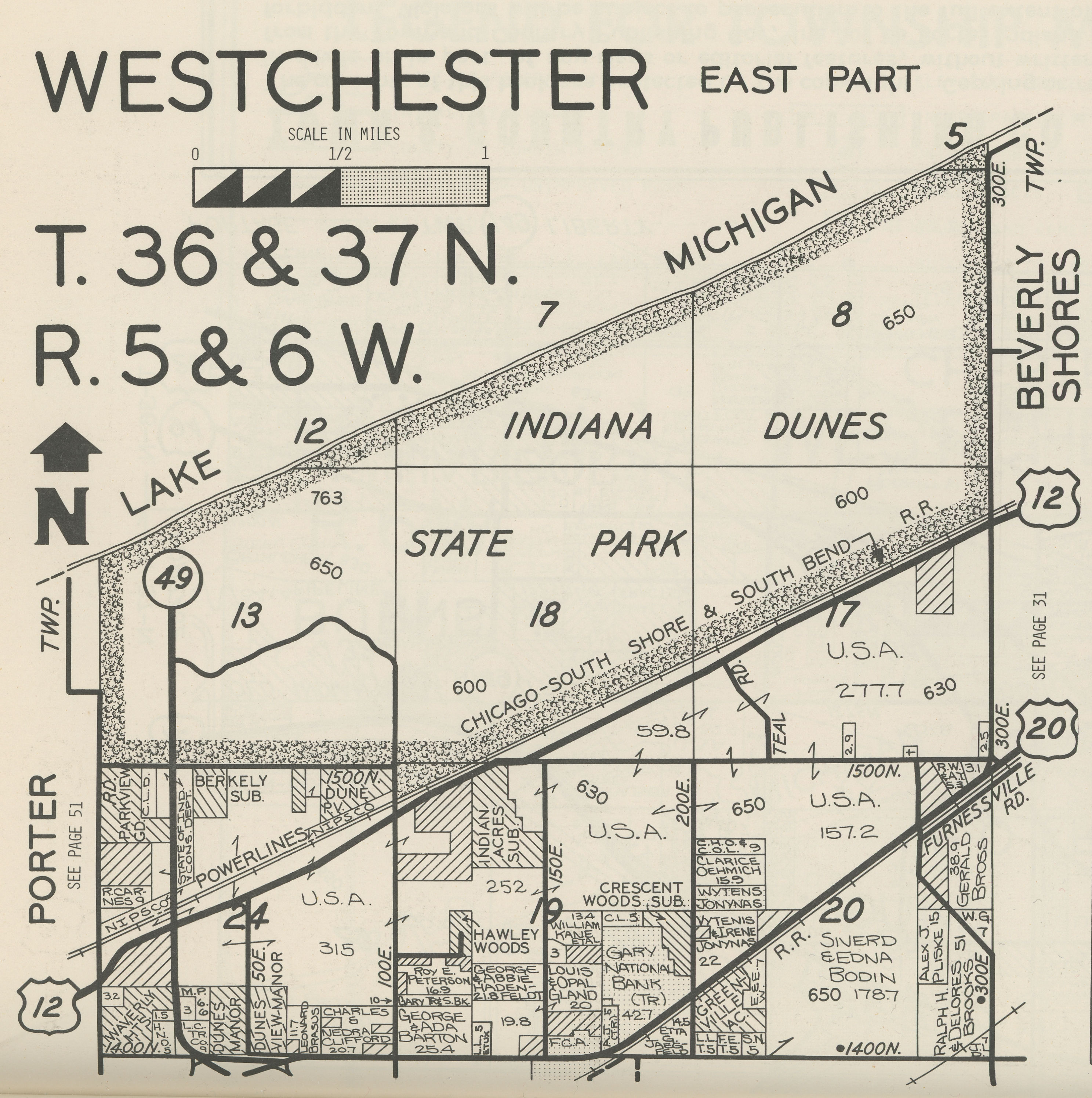
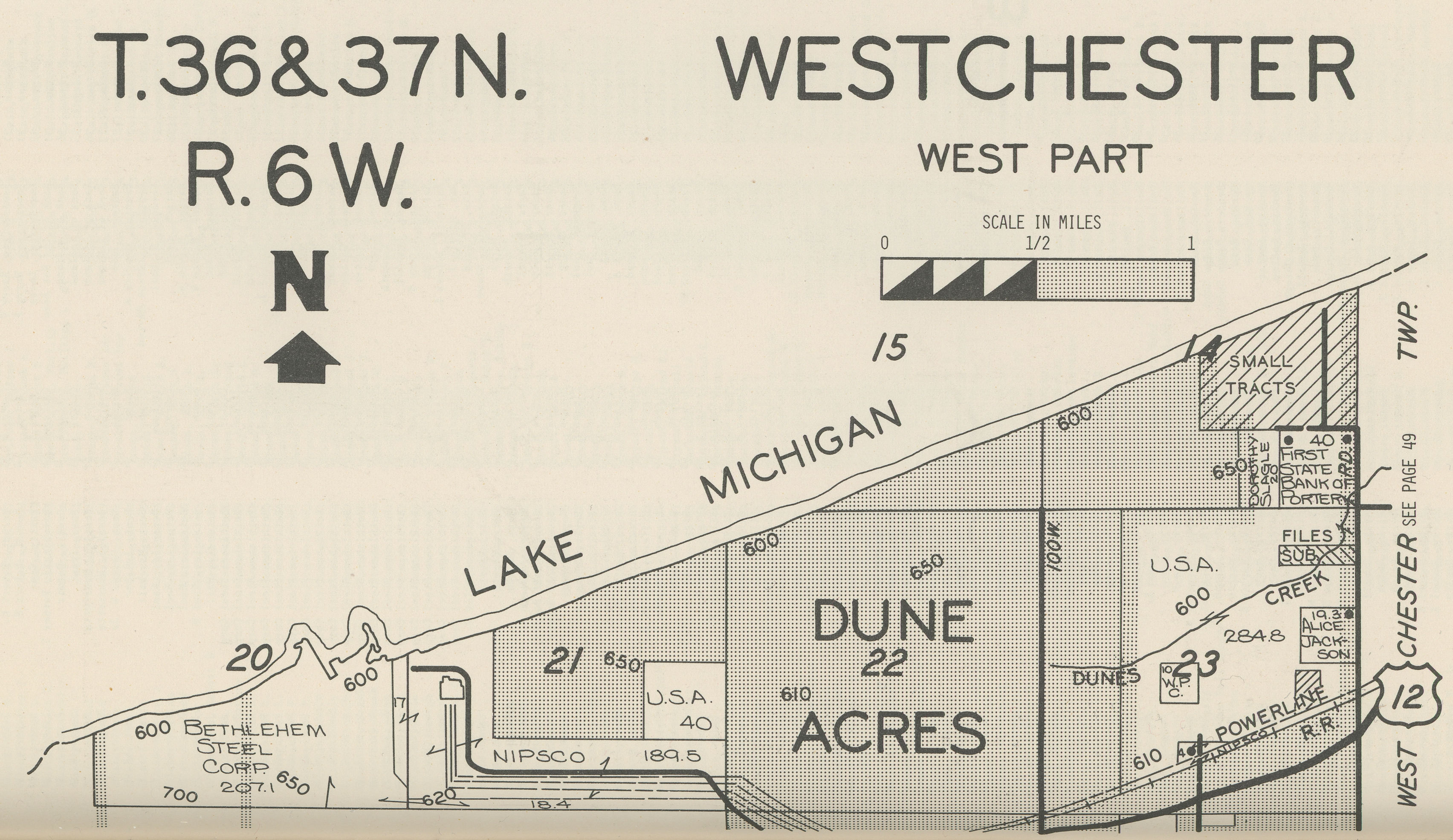
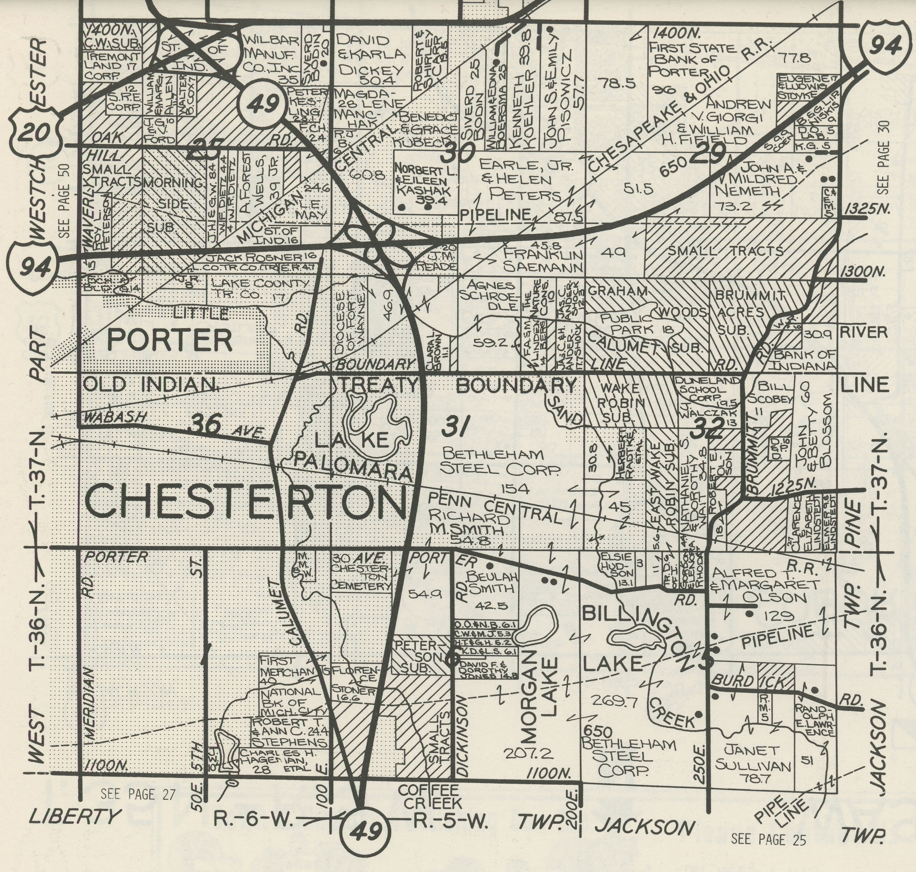
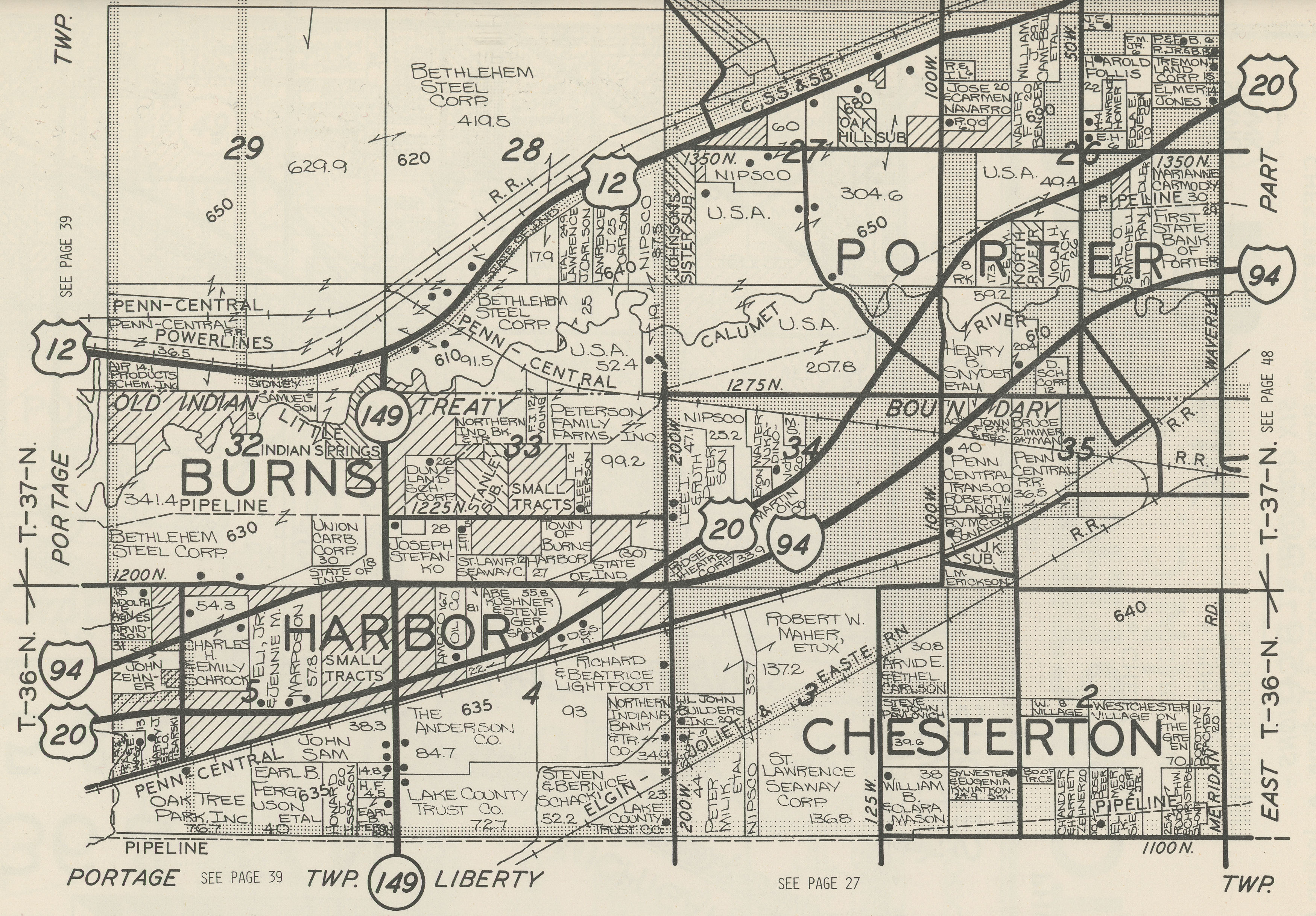
1938 Plat Map
1941 Plat
Map
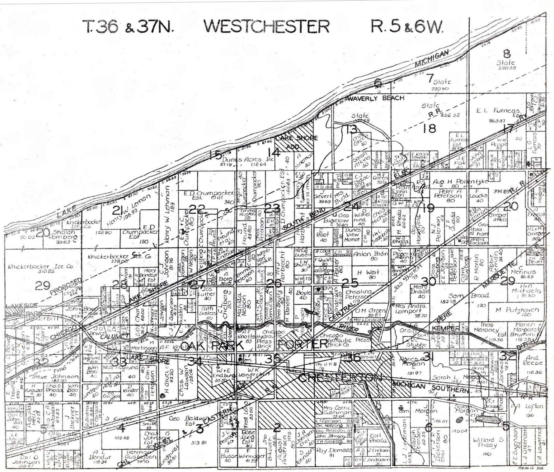
1948 Plat
Map
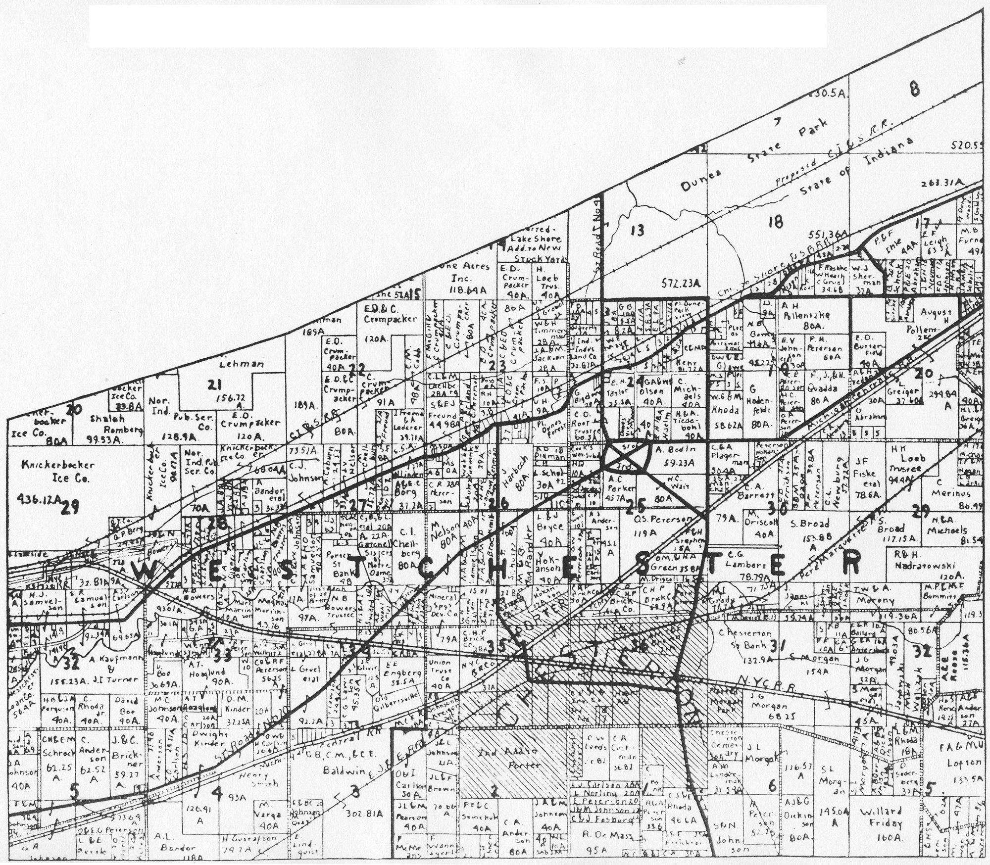
1958 Plat
Map
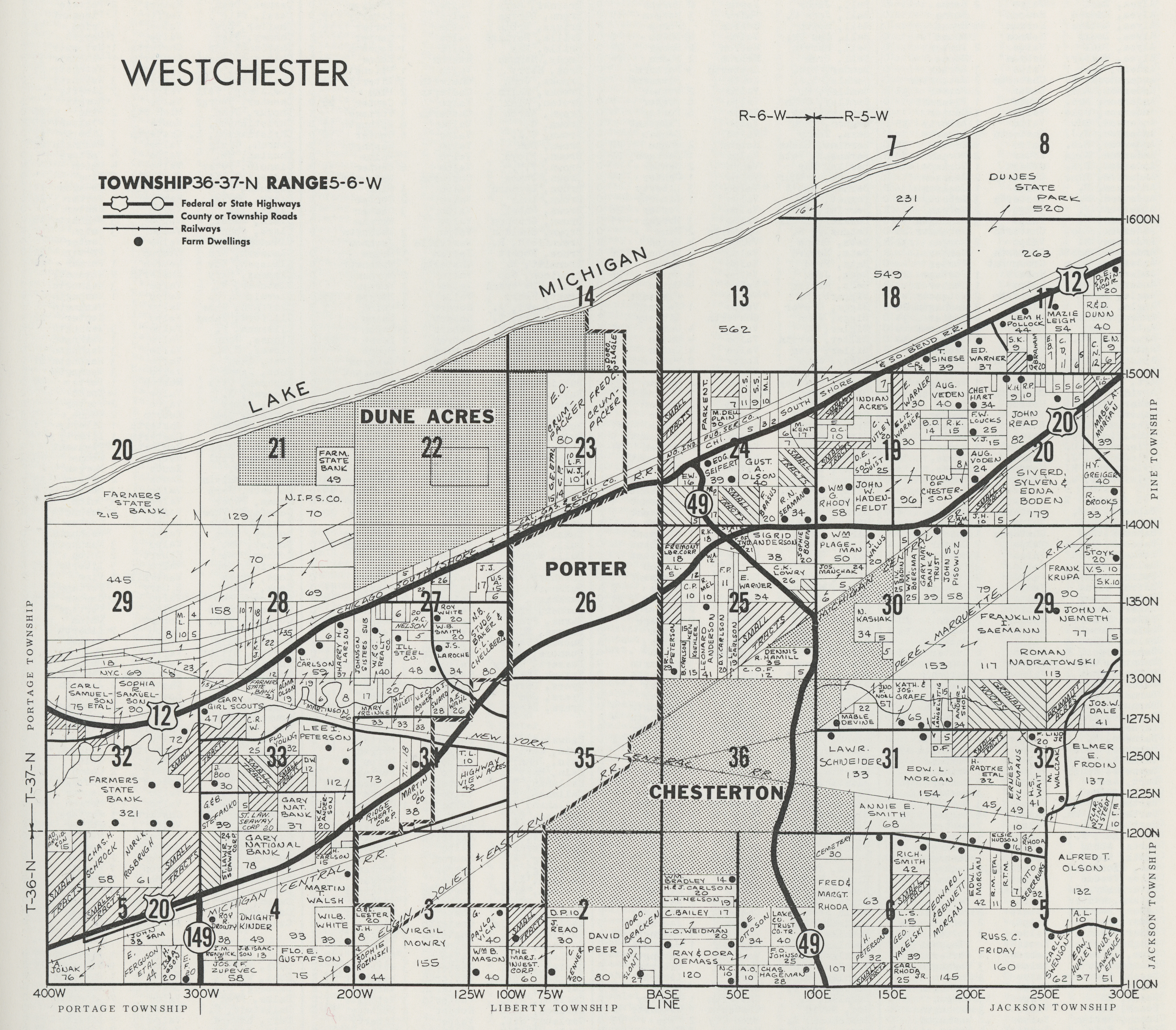
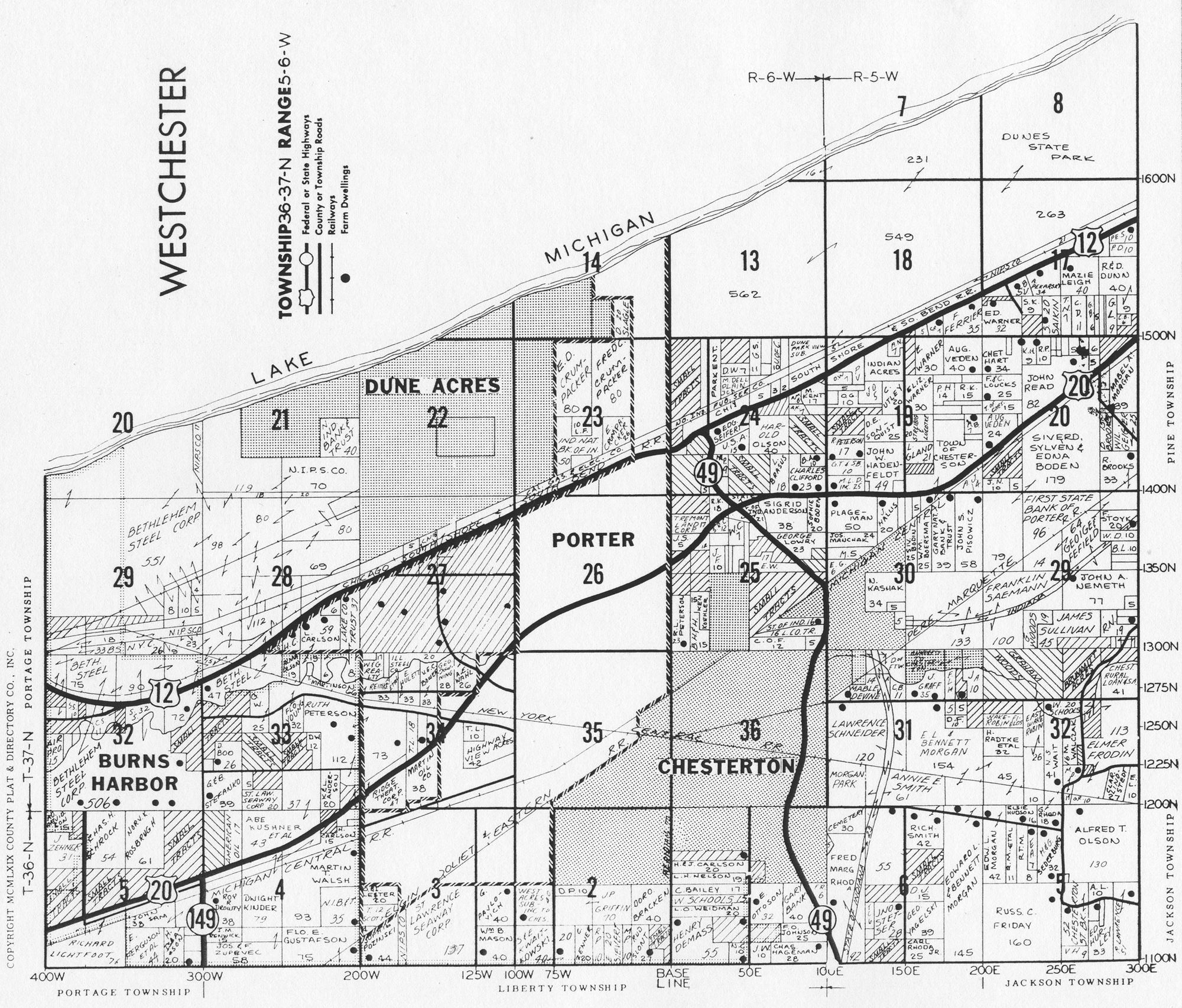
1969
Plat Map
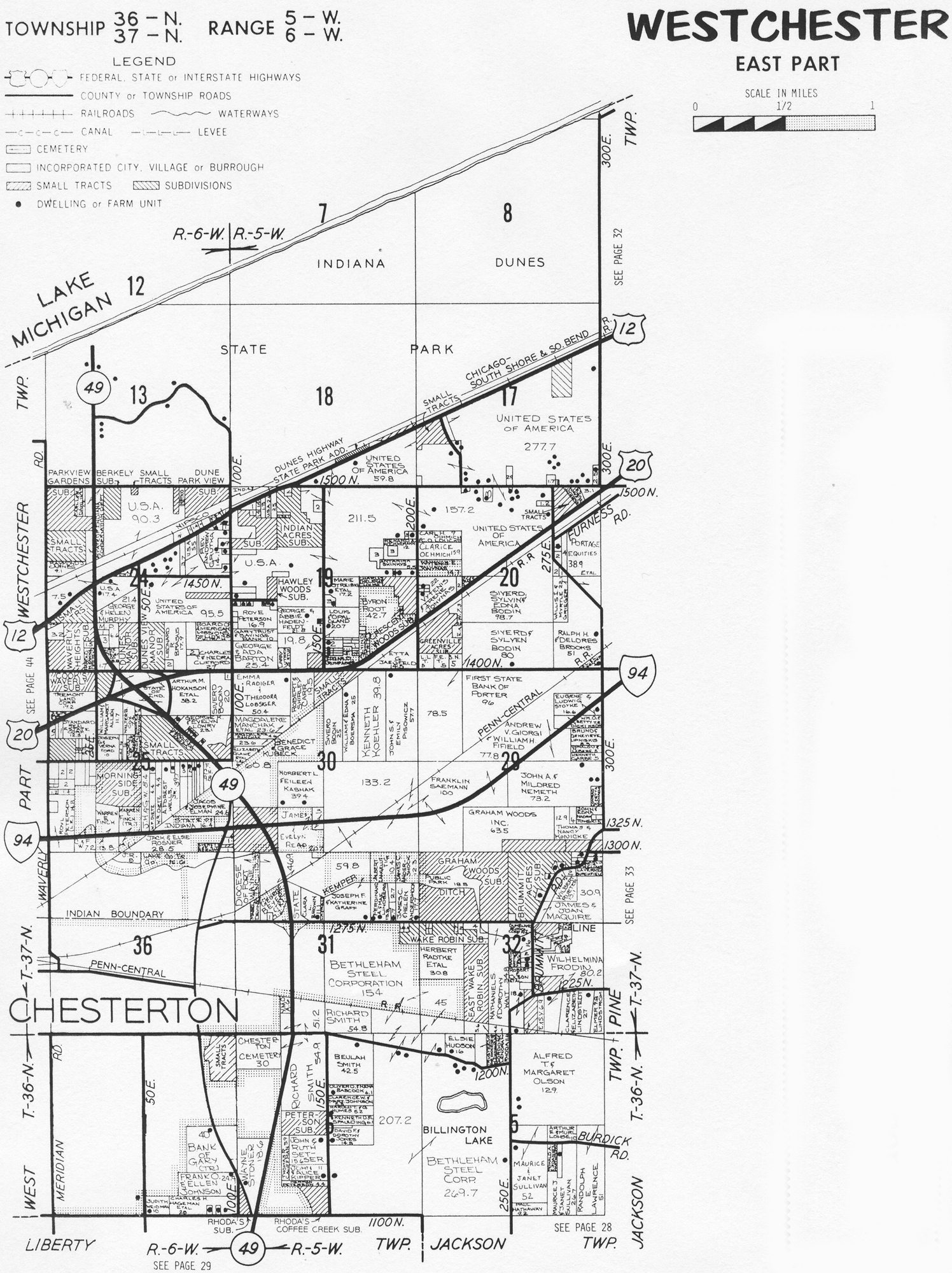
1973 Plat Map (East Half)
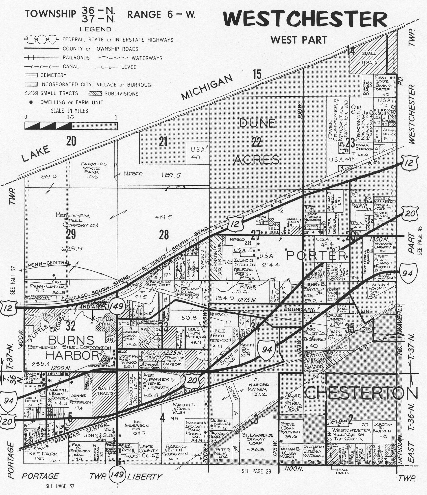
1973 Plat Map (West Half)
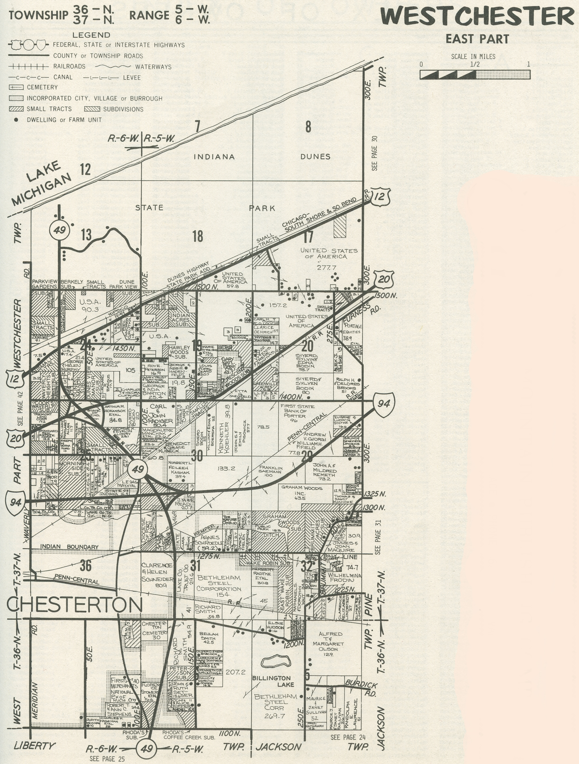
1974 Plat Map (East Half)
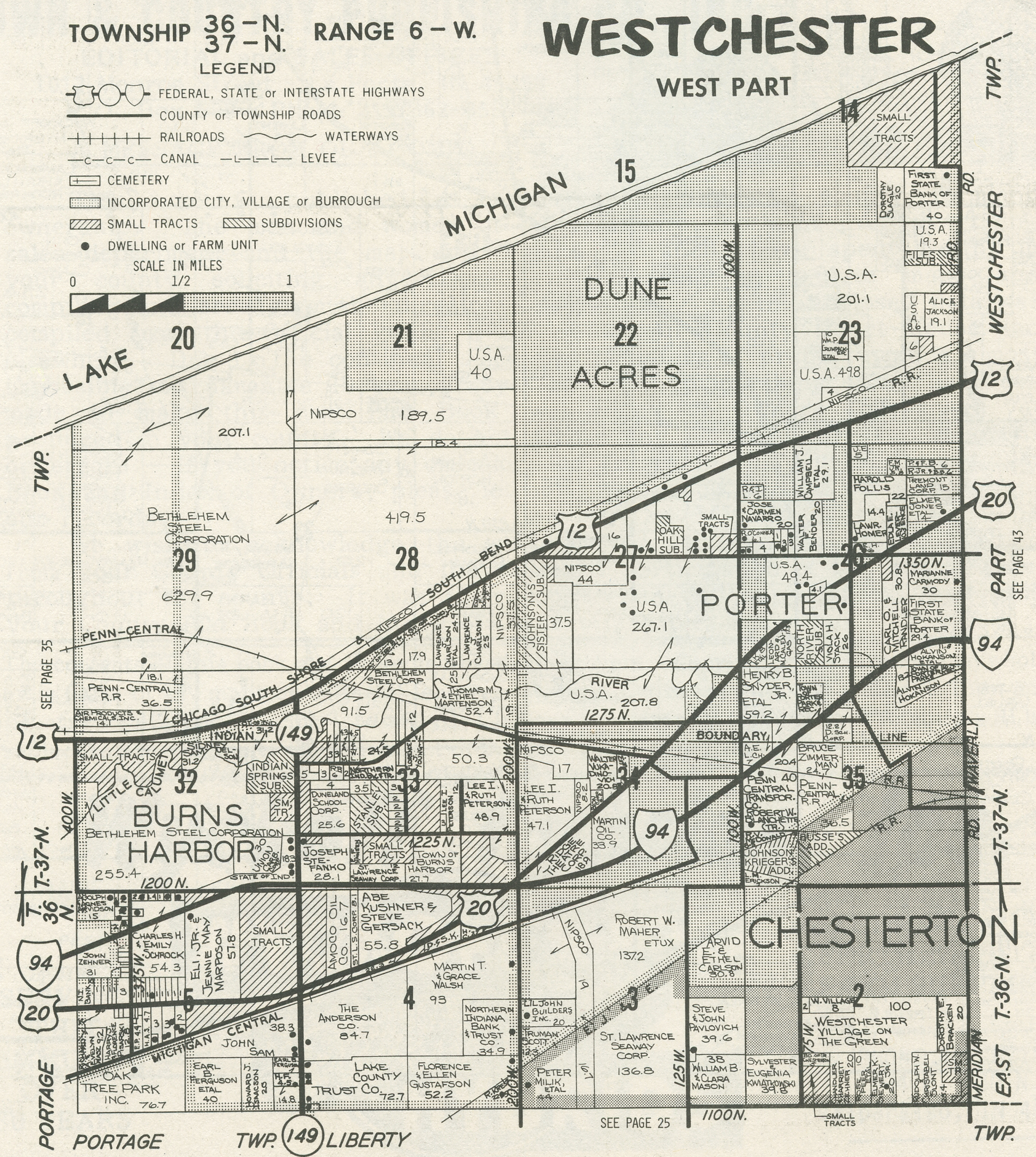
1974 Plat Map (West Half)
1976 Plat Map (East
Half)
1976 Plat Map (West
Half)
1979 Plat Map (East Half)
1979 Plat Map (West Half)
1982 Plat Map (Northeast Quadrant)
1982 Plat Map (Northwest Quadrant)
1982 Plat Map (Southeast Quadrant)
1982 Plat Map (Southwest Quadrant)
1984 Plat Map (Northeast Quadrant)
1984 Plat Map (Northwest Quadrant)
1984 Plat Map (Southeast Quadrant)
1984 Plat Map (Southwest Quadrant)
1988 Plat Map (Northeast Quadrant)
1988 Plat Map (Northwest Quadrant)
1988 Plat Map (Southeast Quadrant)
1988 Plat Map (Southwest Quadrant)
Westchester Township Town and Village Plats
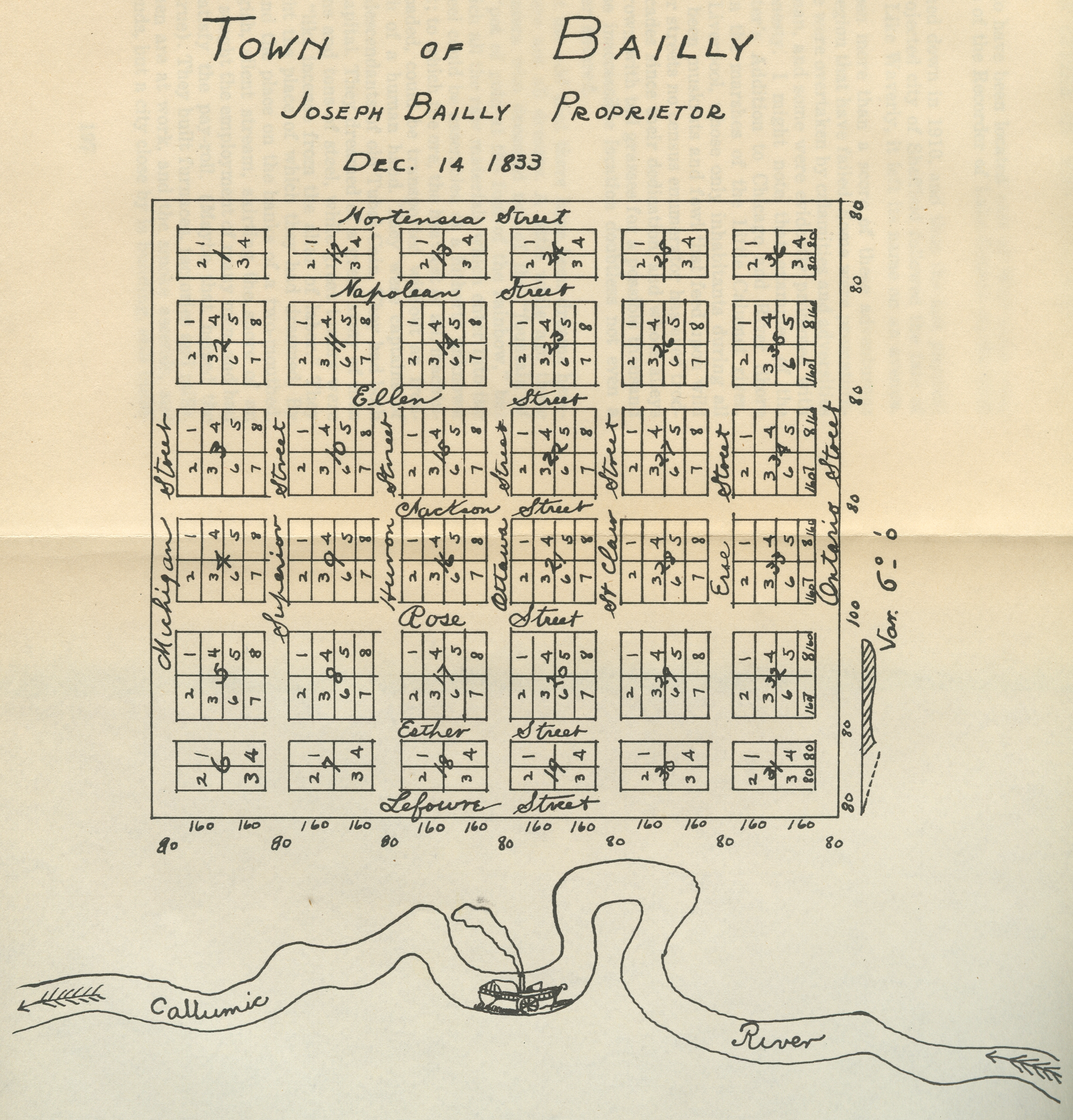
Bailly, 1833 [a "Dream
City"]
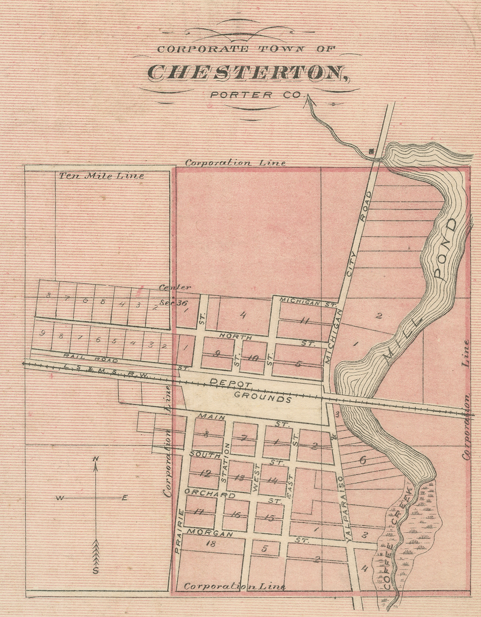
Chesterton, 1876 [Indiana Historical Atlas]
Chesterton, 1876
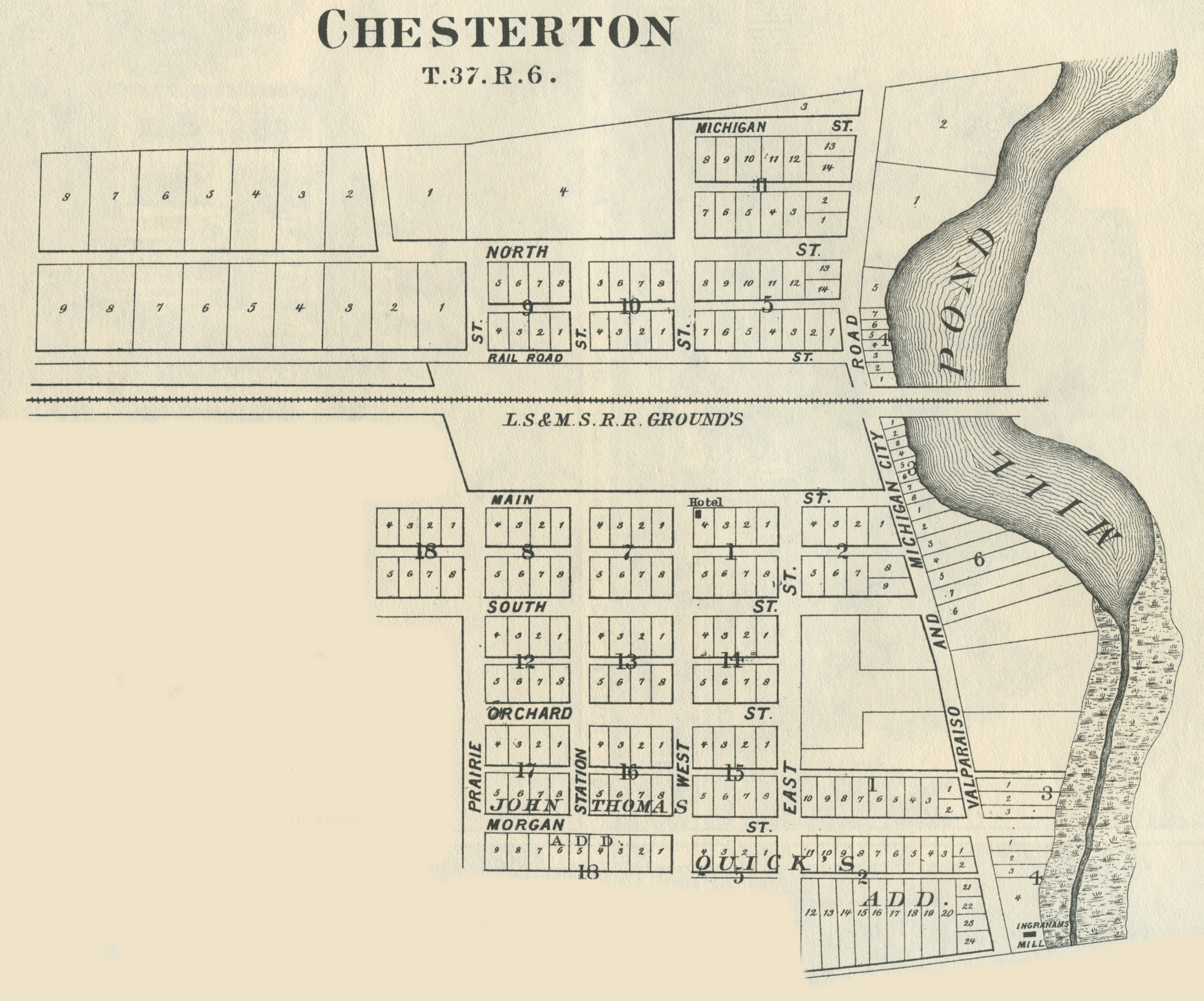
Chesterton, 1895
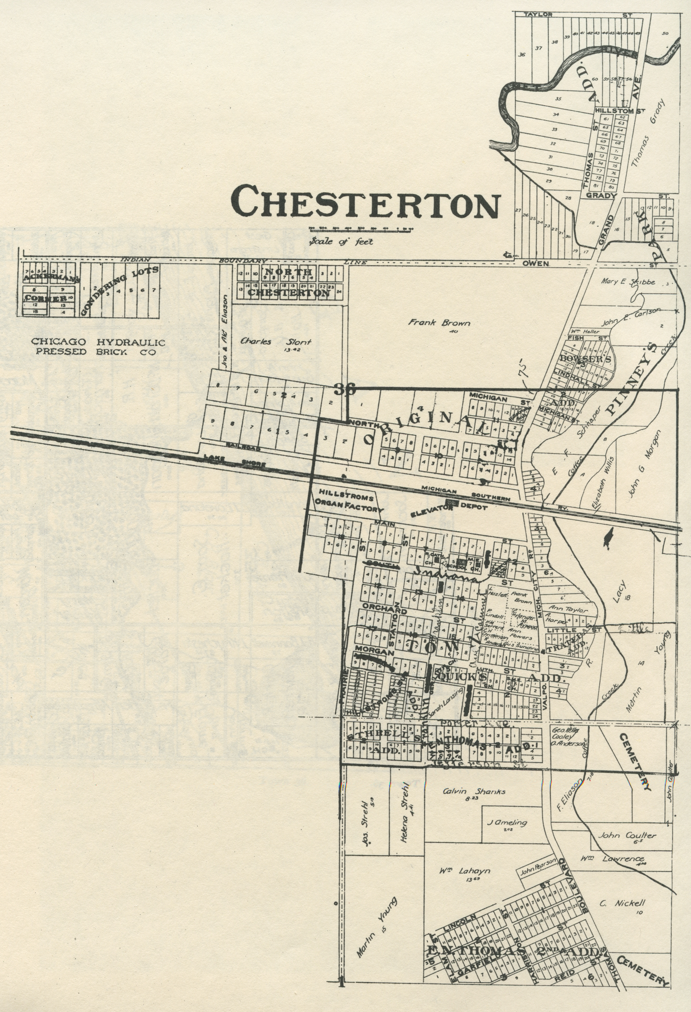
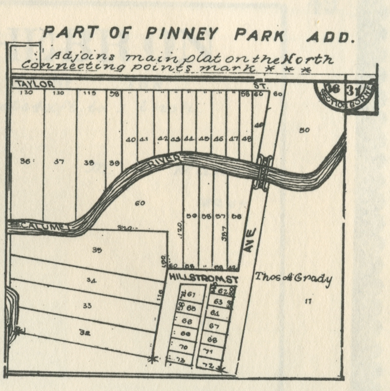
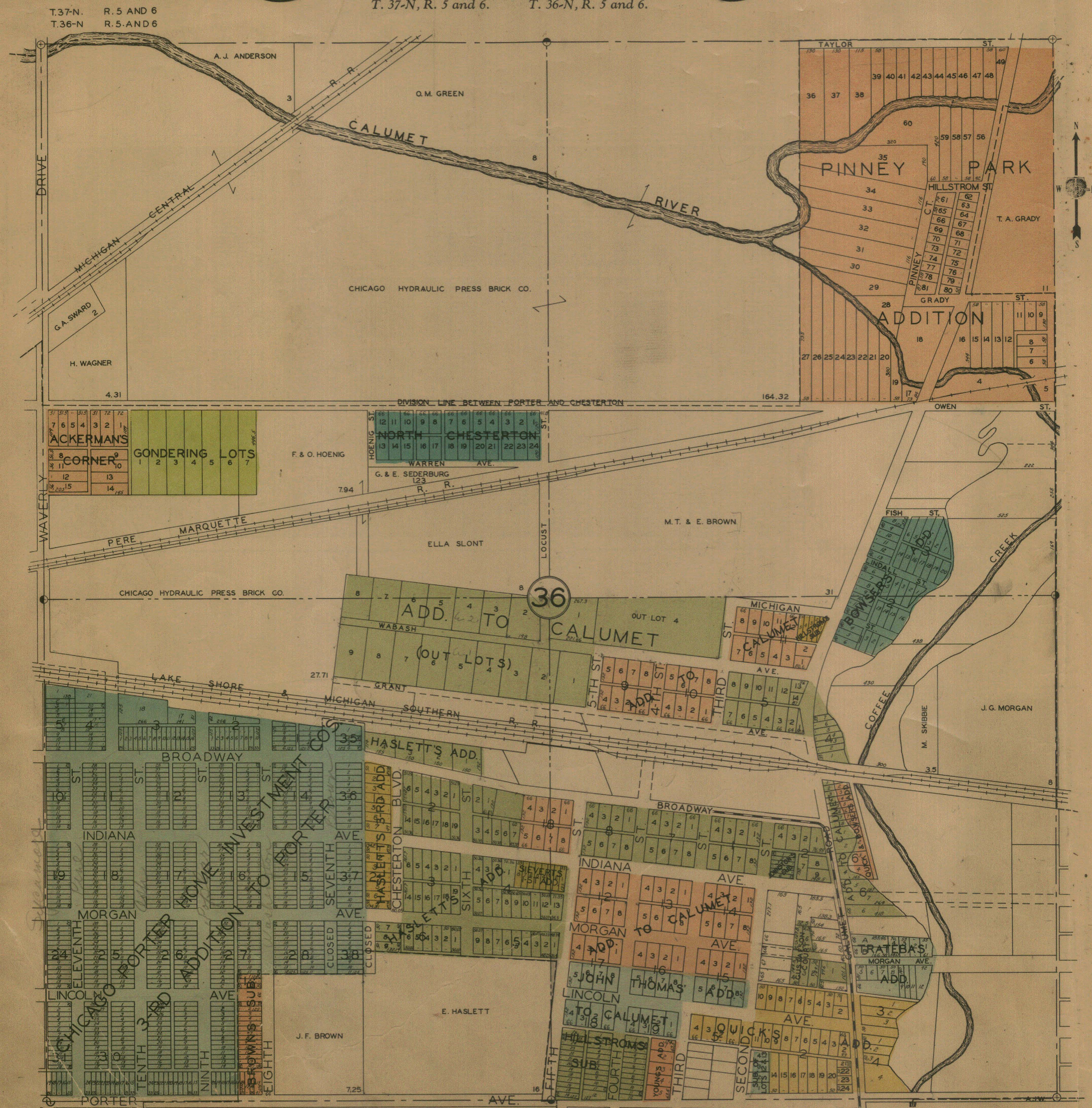
Chesterton - Pinney Park Addition, 1906
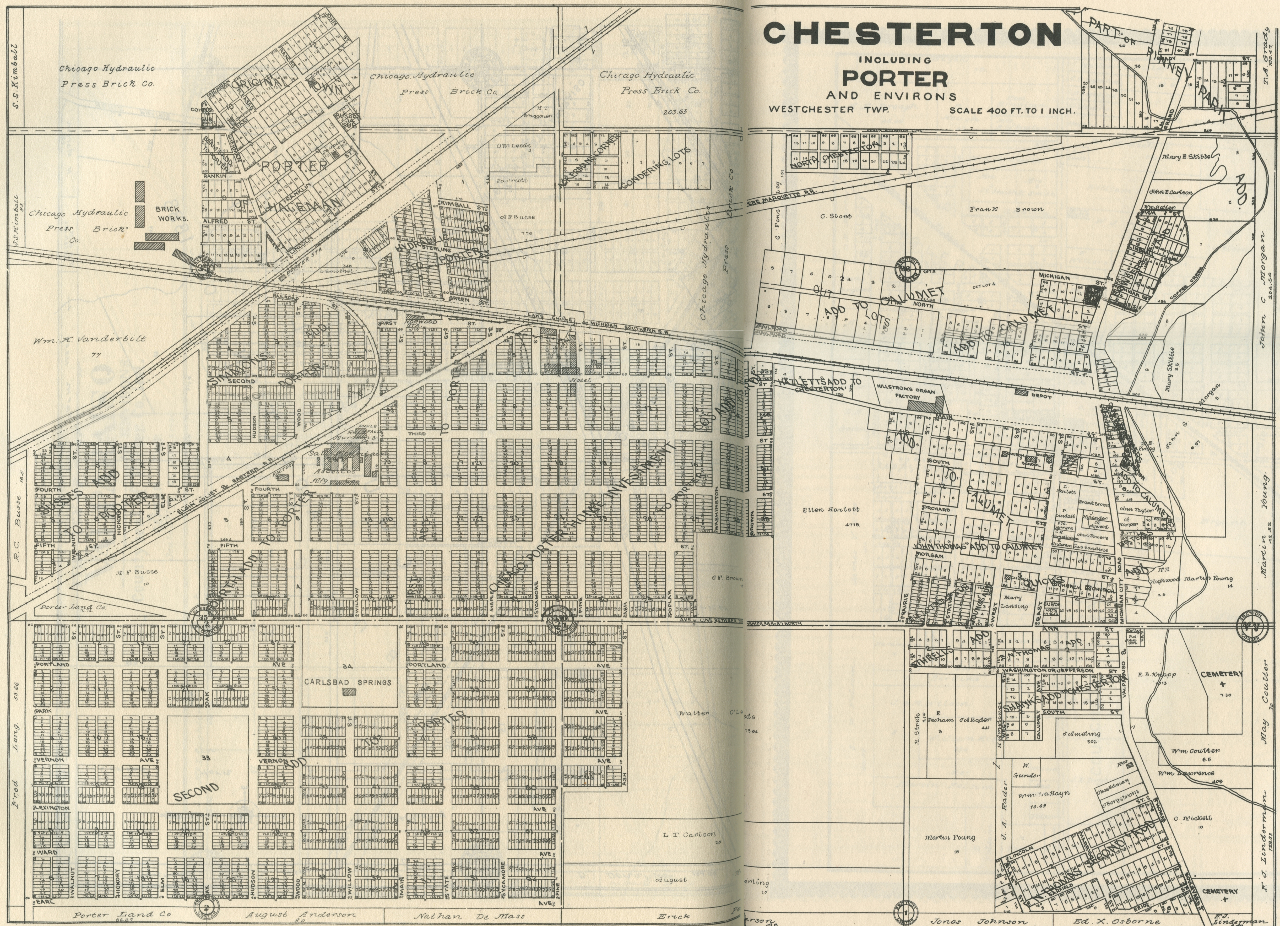
Chesterton and Porter, 1906
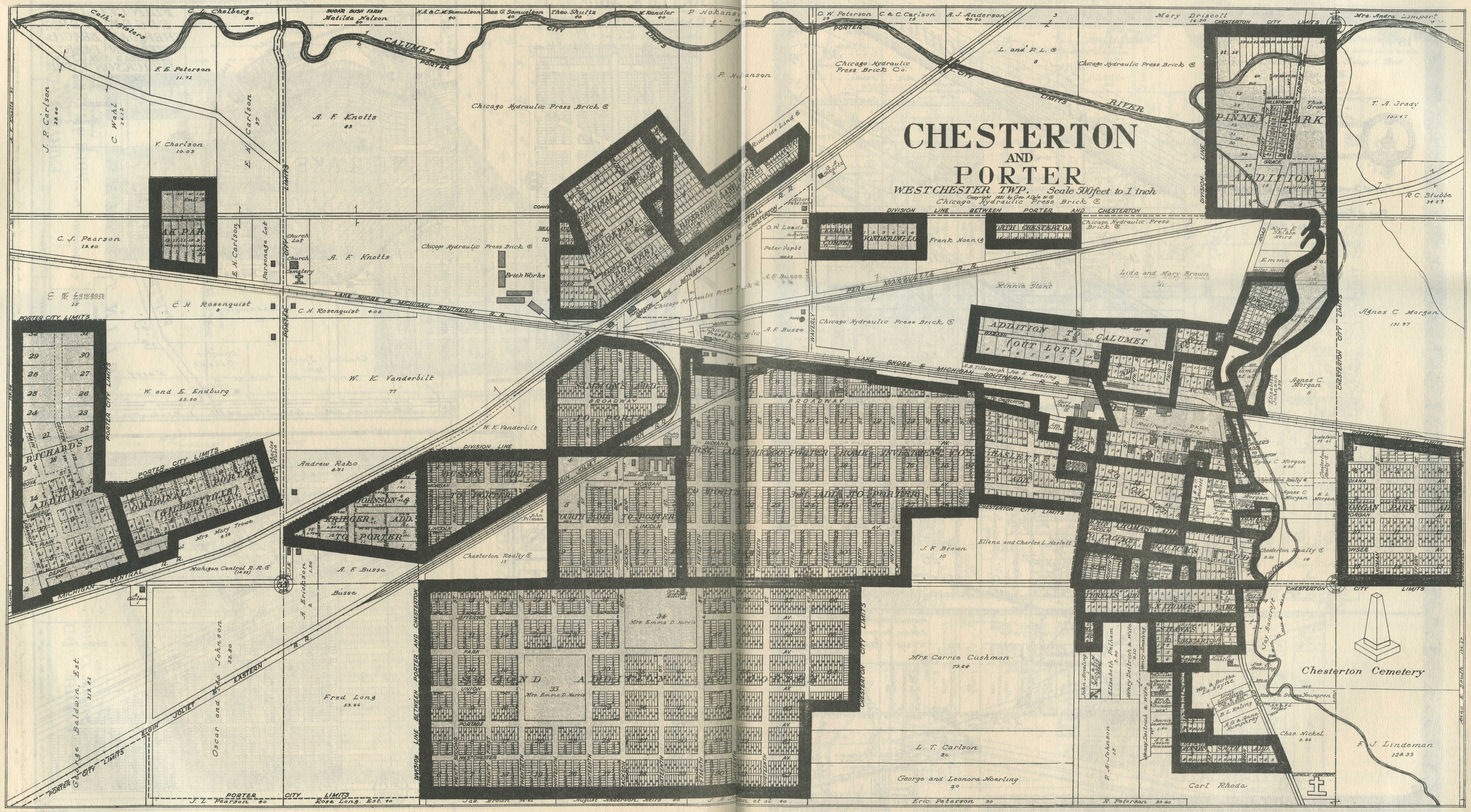
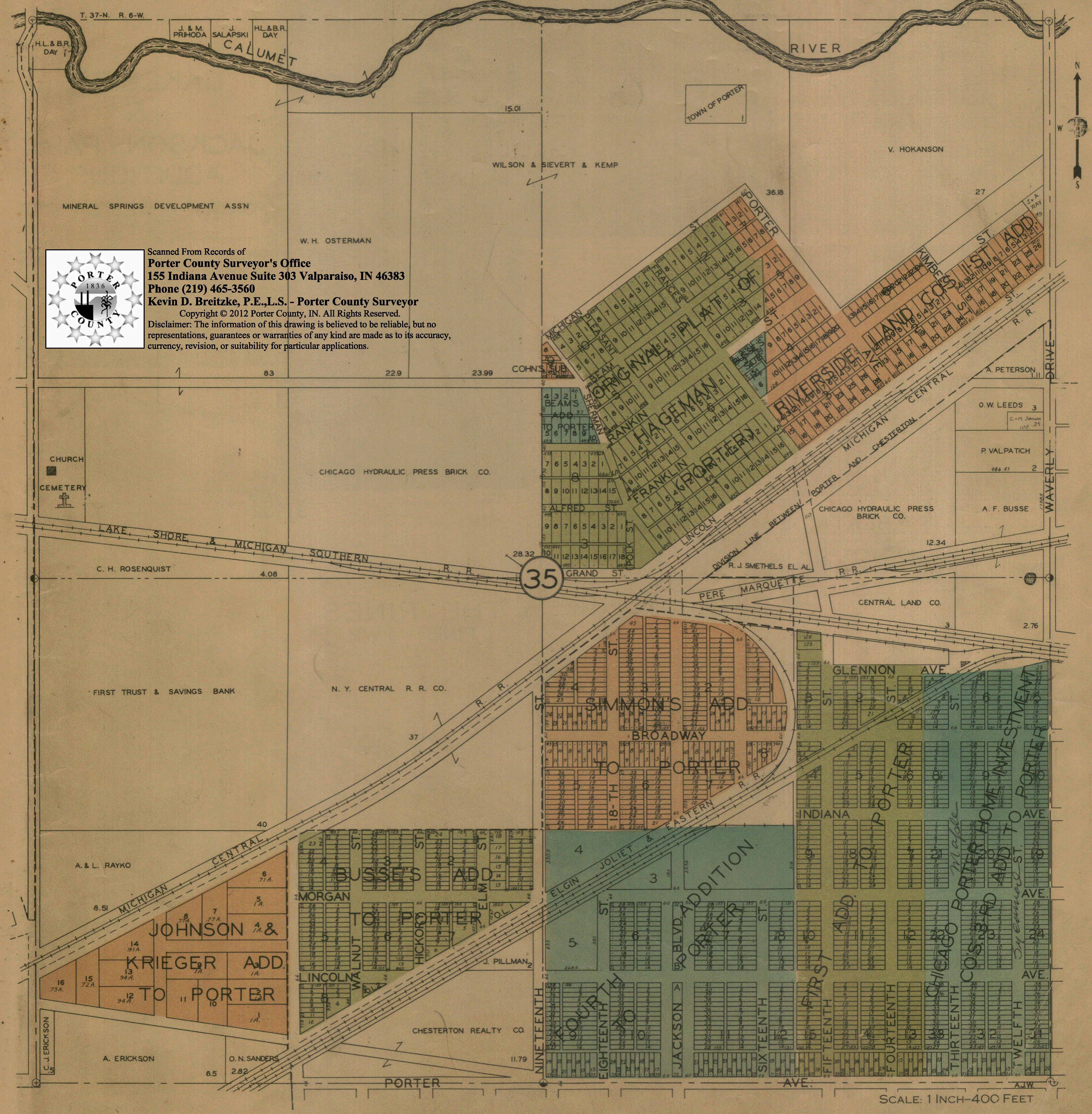
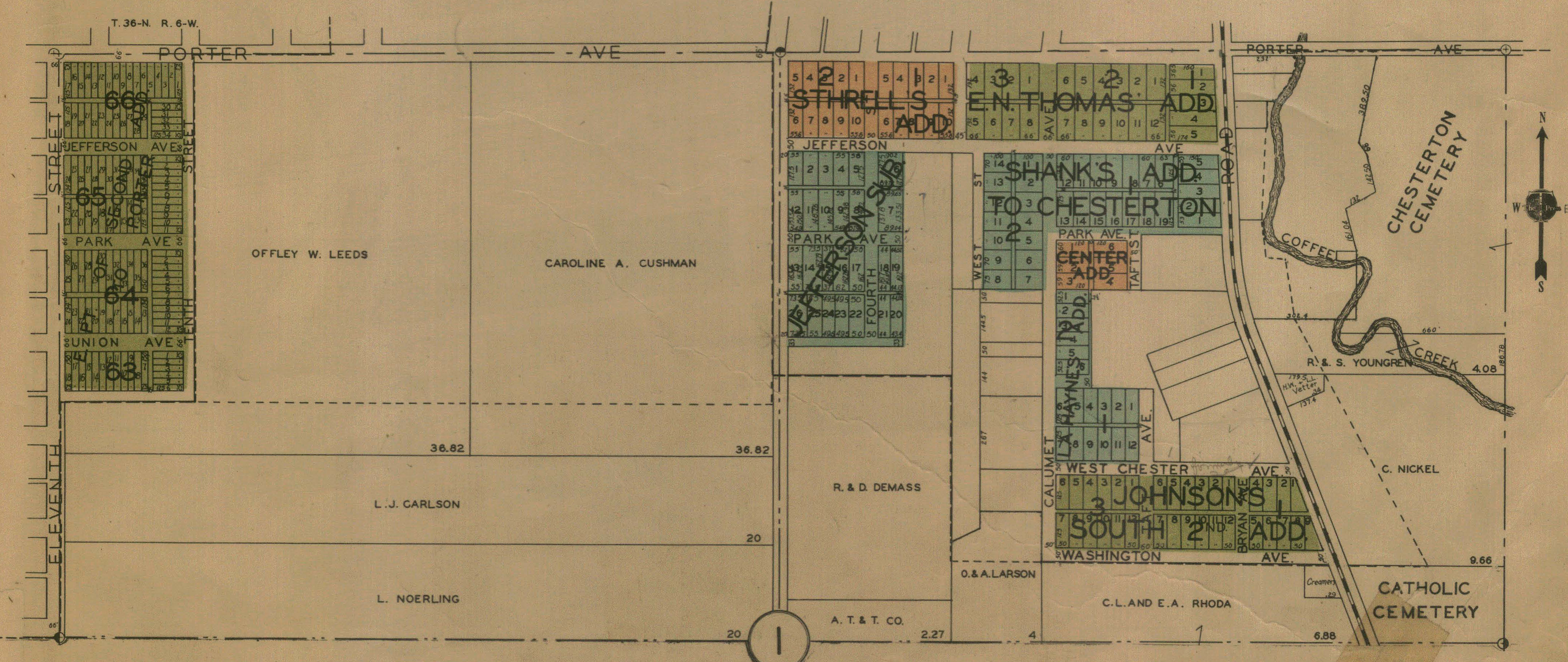
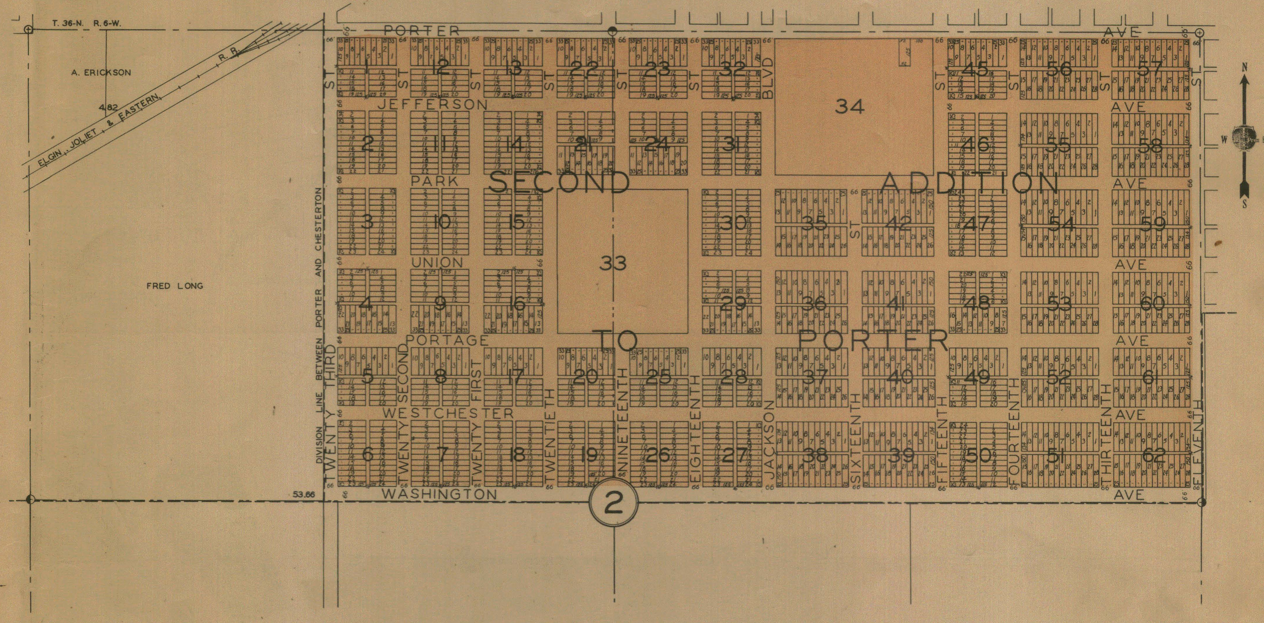
Chesterton and Porter, 1921
Chesterton - Part I, 1928
Chesterton - Part II, 1928
Chesterton - Part III, 1928
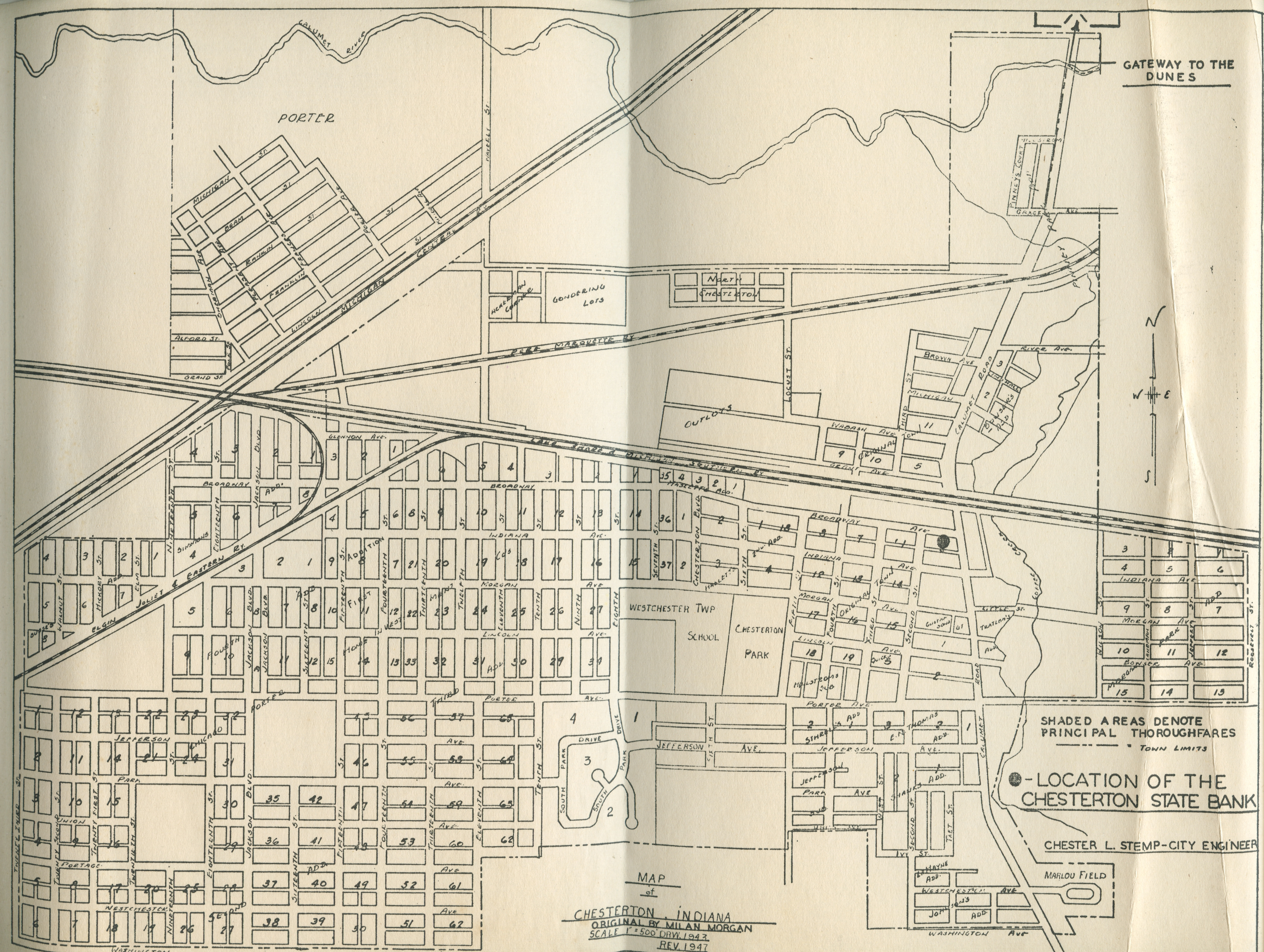
Chesterton and Porter, 1947
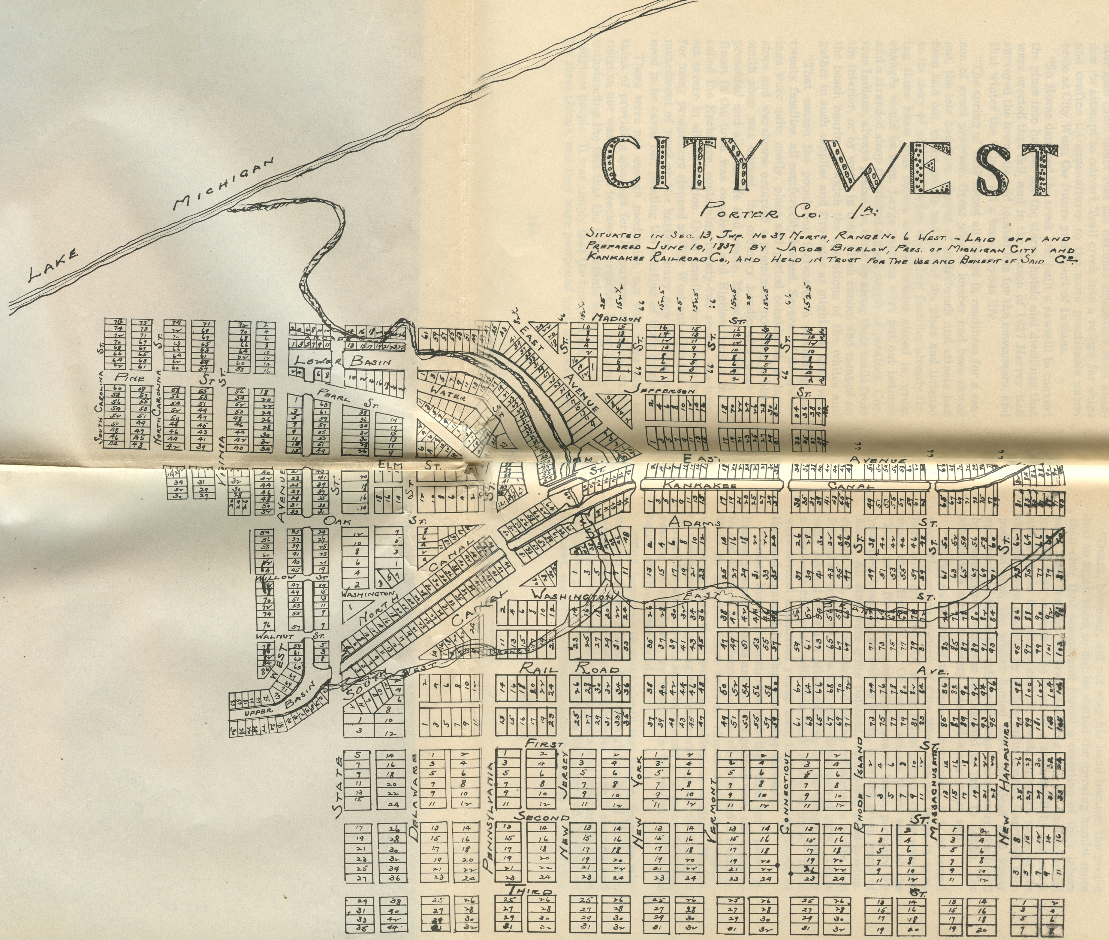
City West, 1837
City West Addition, 1837
City West, 1837 [a "Dream
City"]
City
West, Department of War, 1837
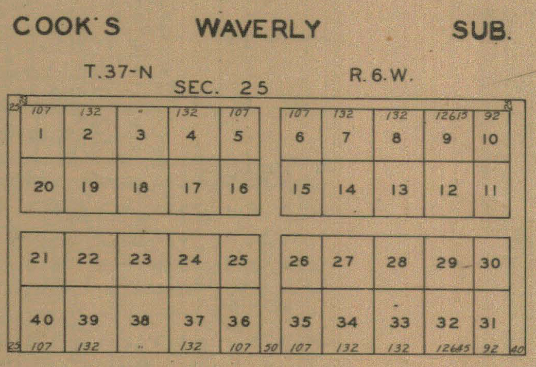
Cook's Waverly Addition, 1928
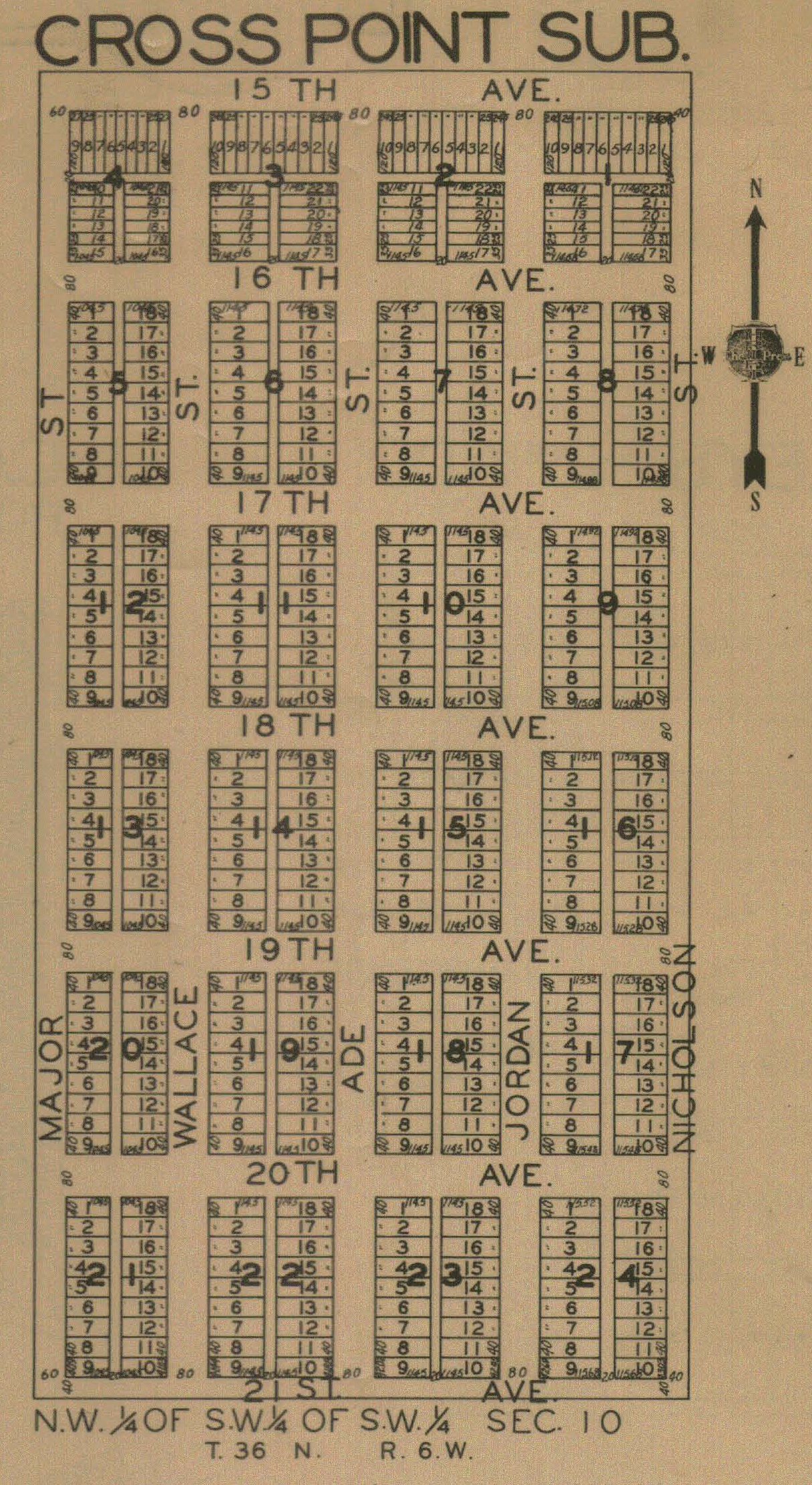
Cross Point, 1928
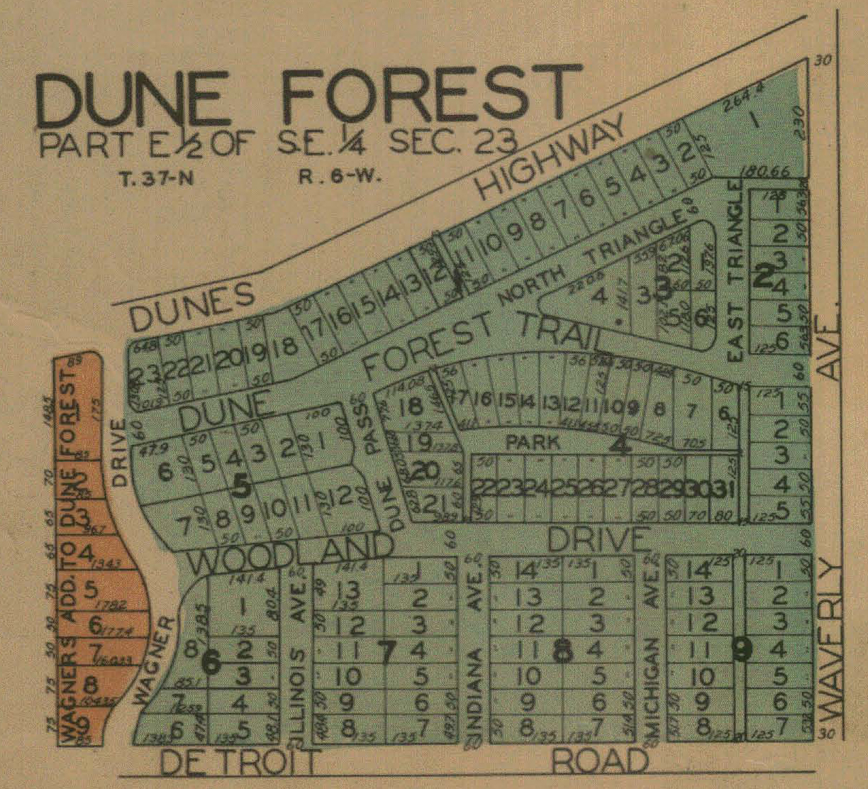
Dune Forest, 1928
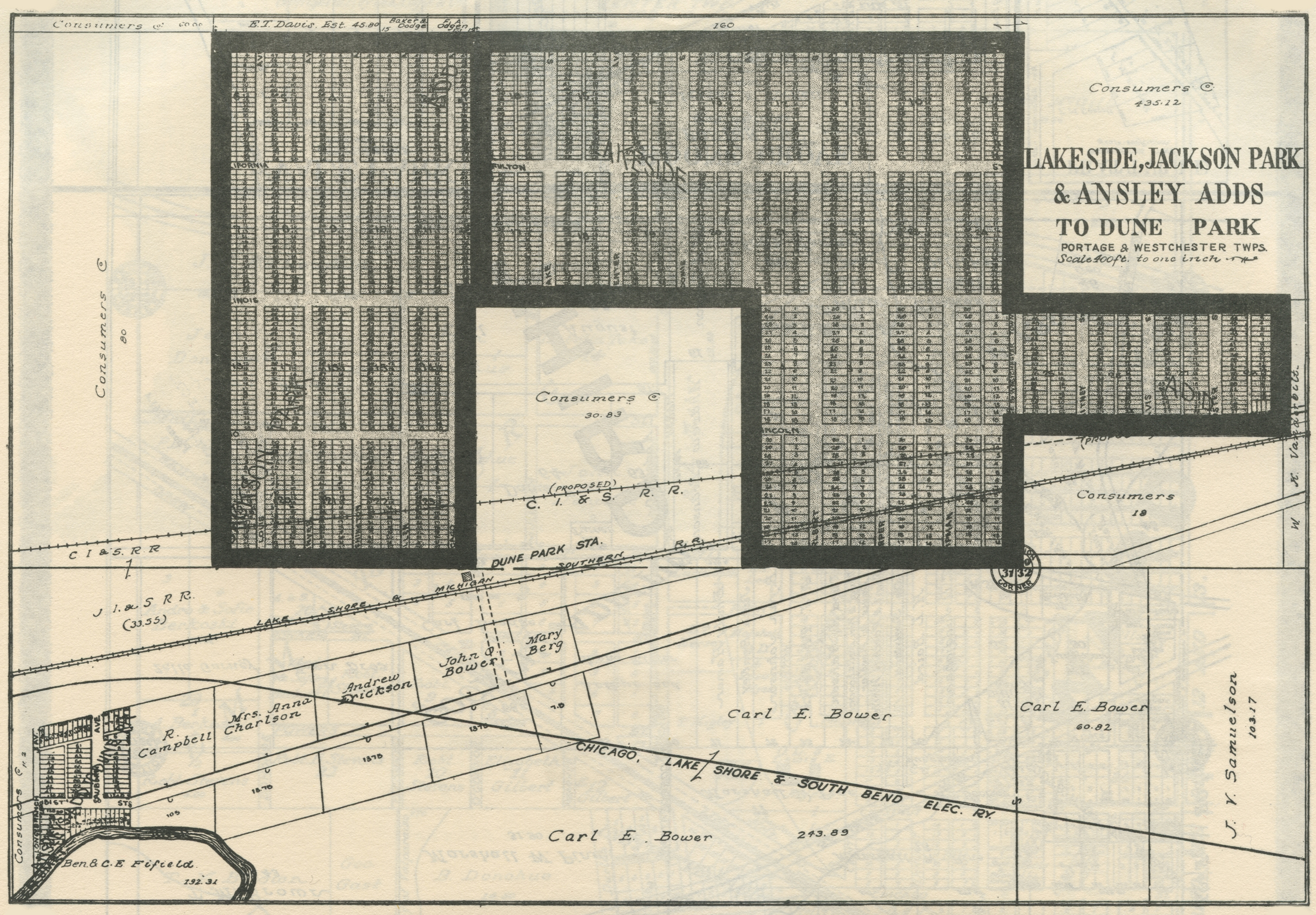
Dune
Park, 1906
Dune
Park, 1921
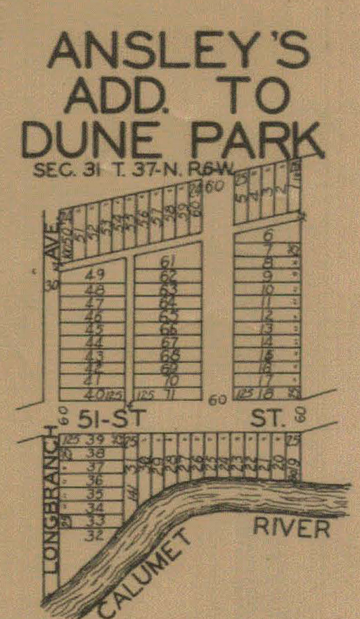
Dunes Park, Ansley's Addition, 1928
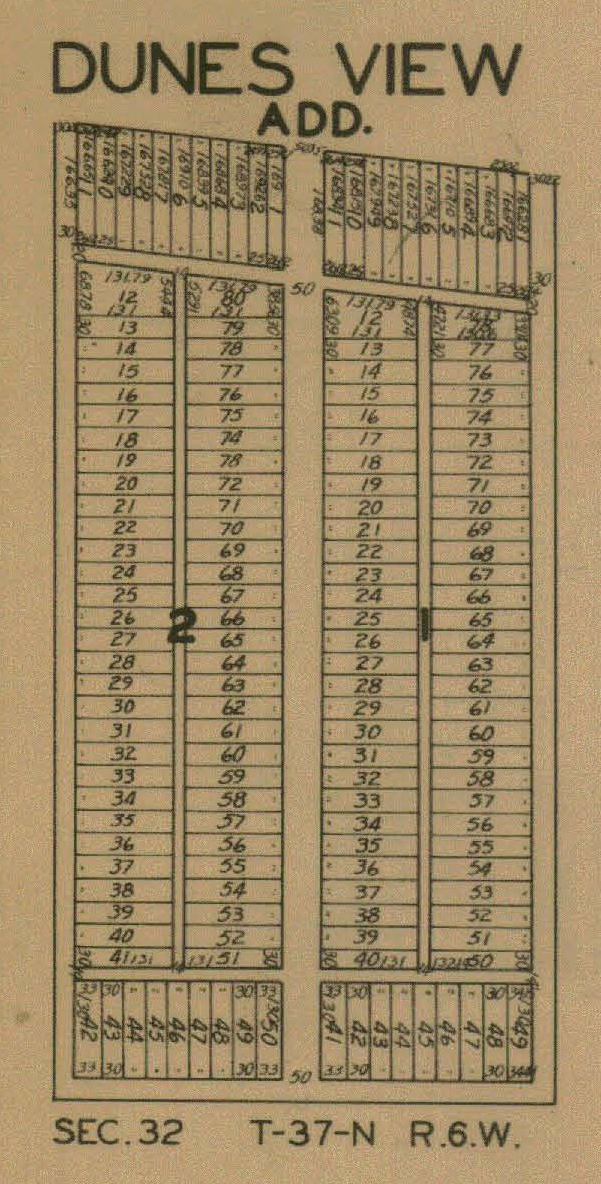
Dunes View, 1928
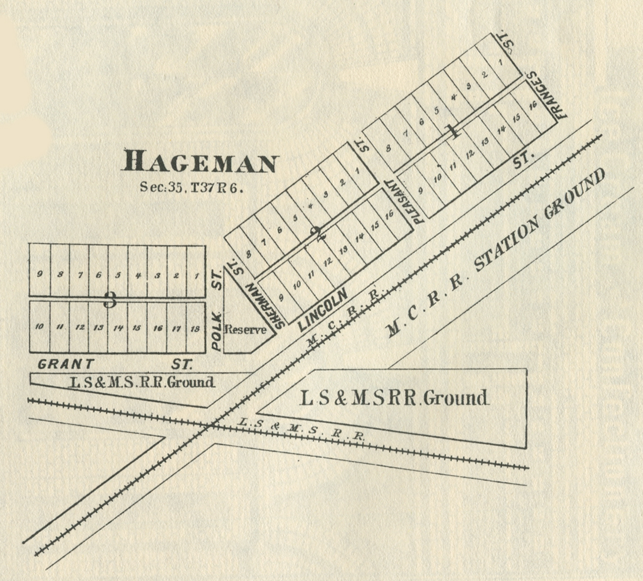
Hageman,
1876
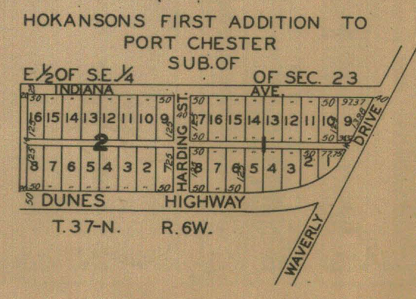
Hokanson's Port Chester, 1928
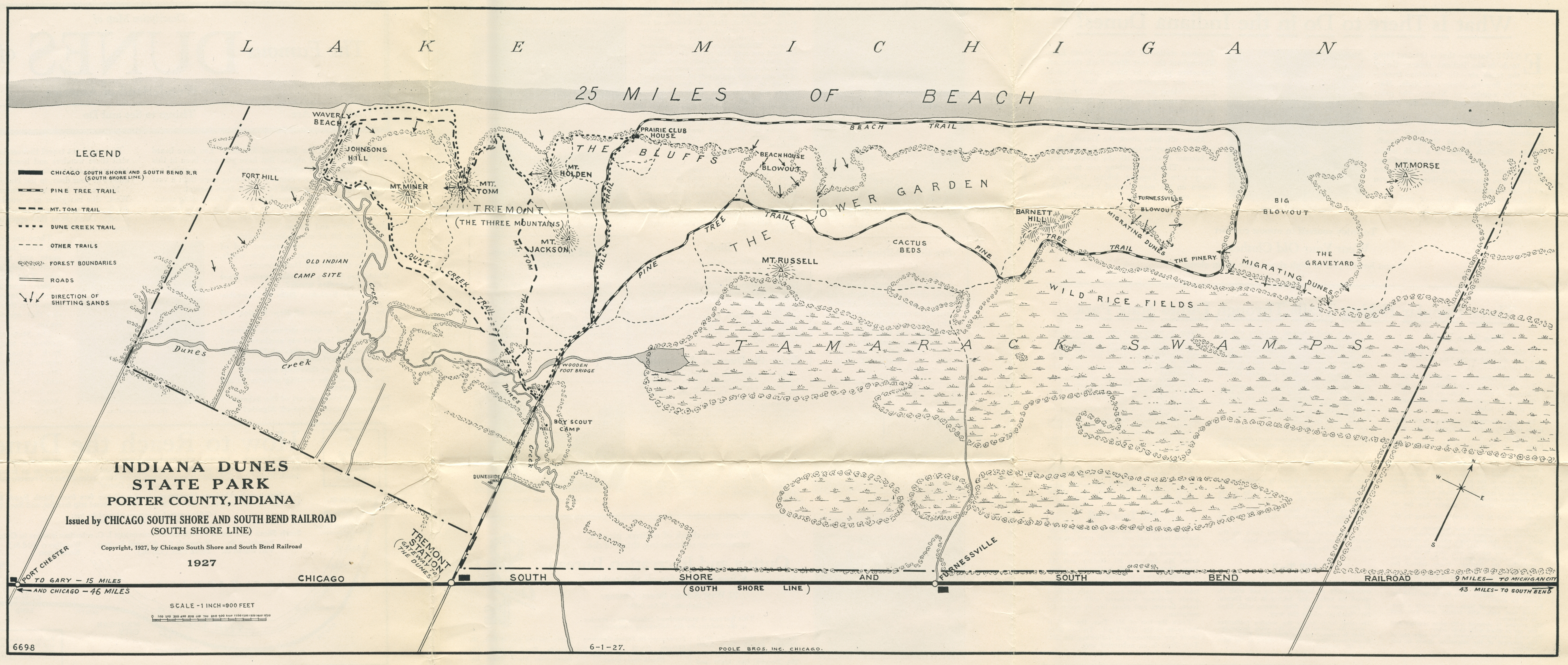
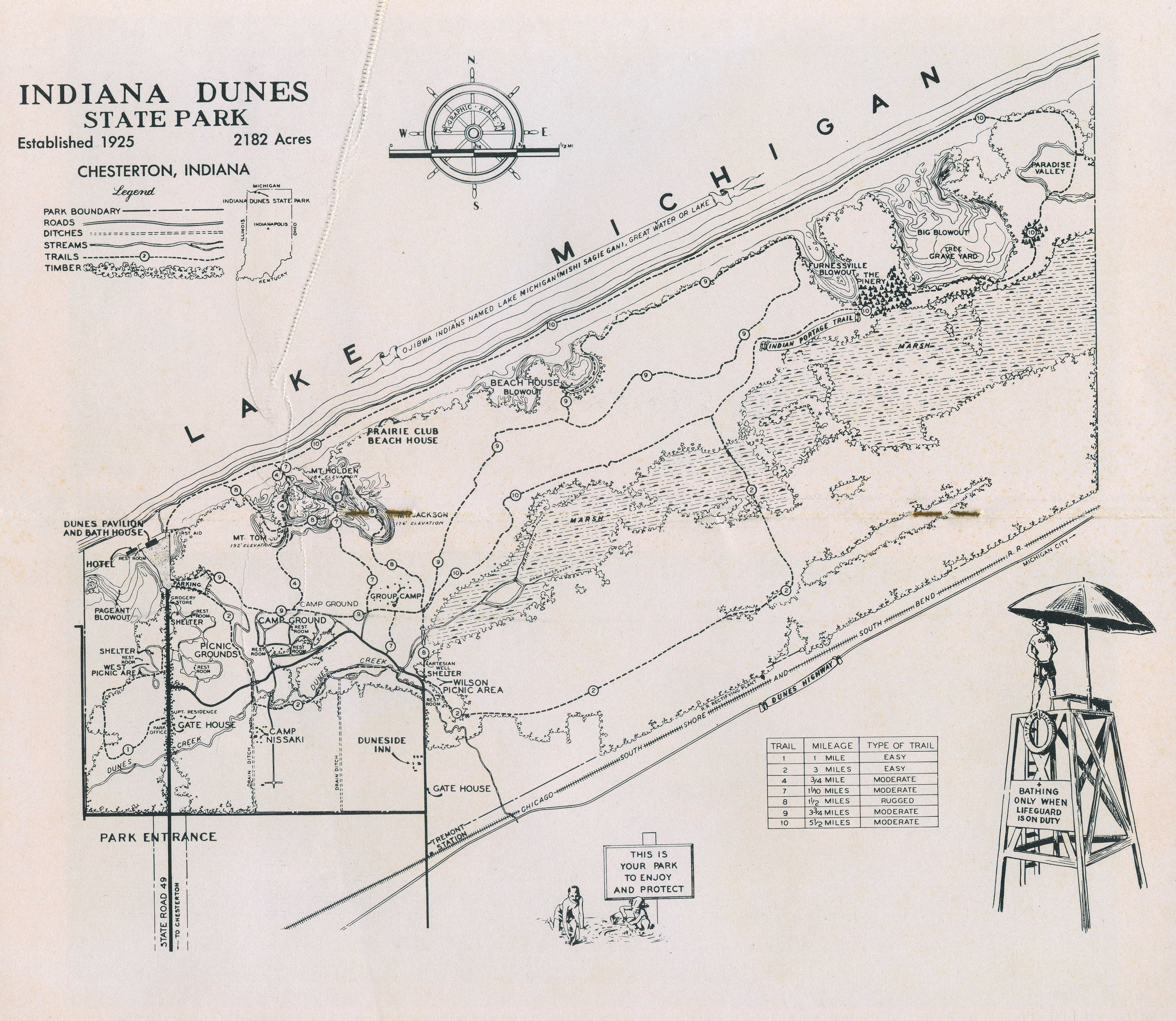
Indiana Dunes State Park Trails Map, 1927
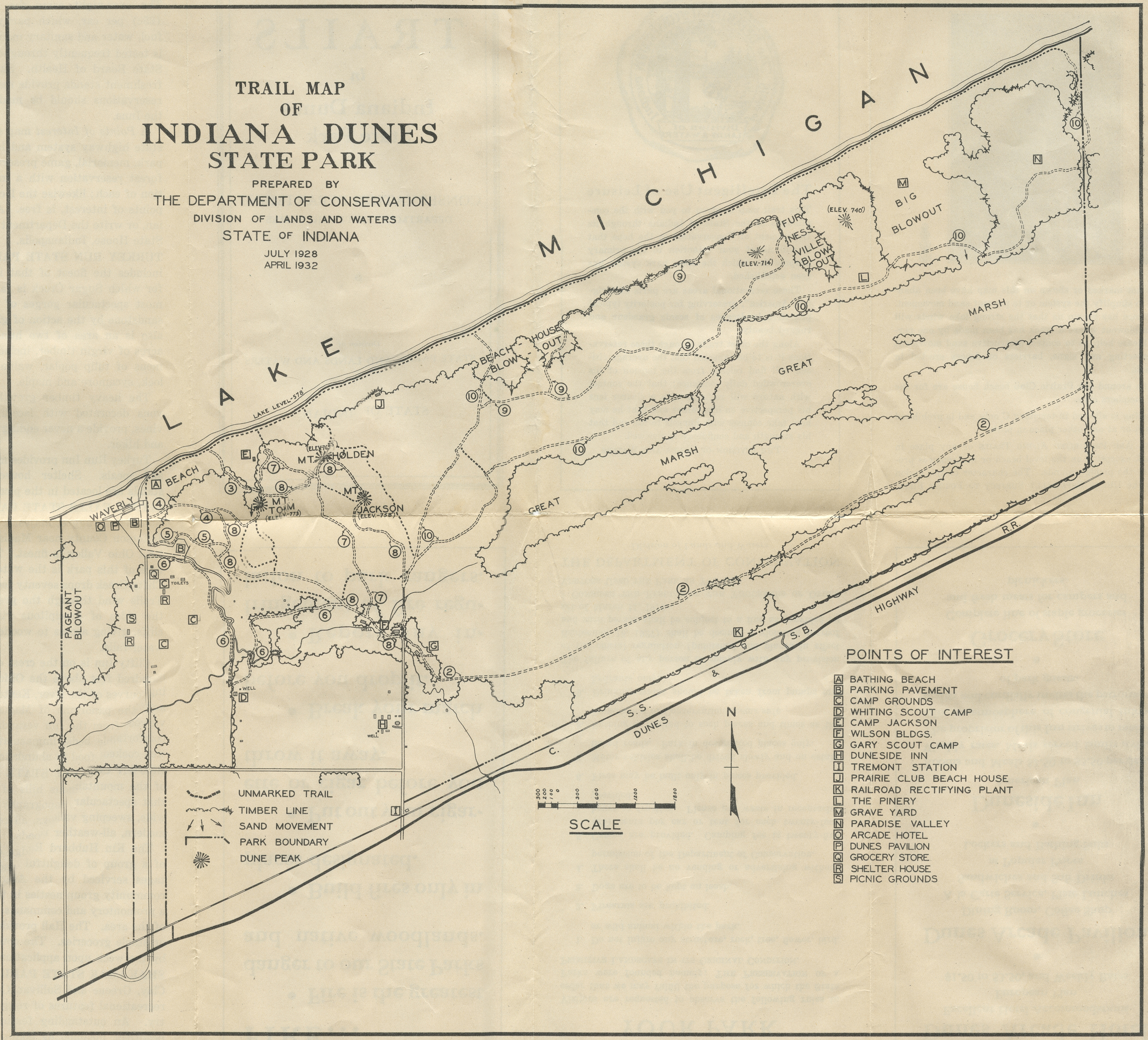
Indiana Dunes State Park Trails Map, 1932
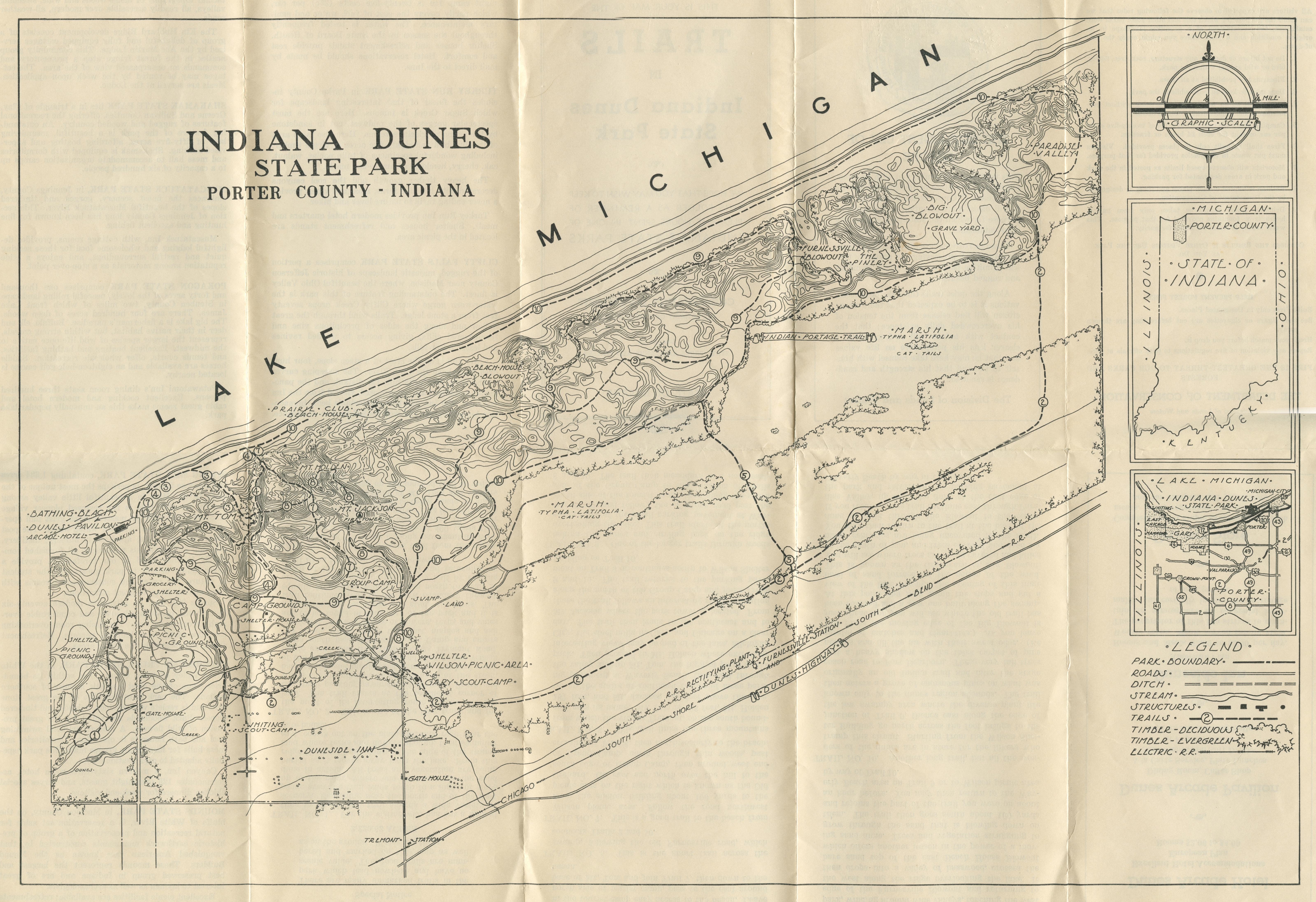
Indiana Dunes State Park Trails Map, circa 1930s
Indiana Dunes State Park Trails Map, circa 1940s
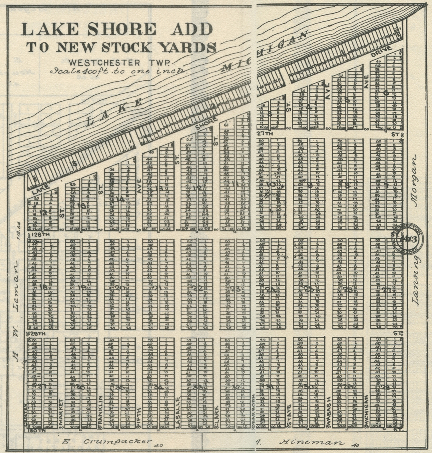
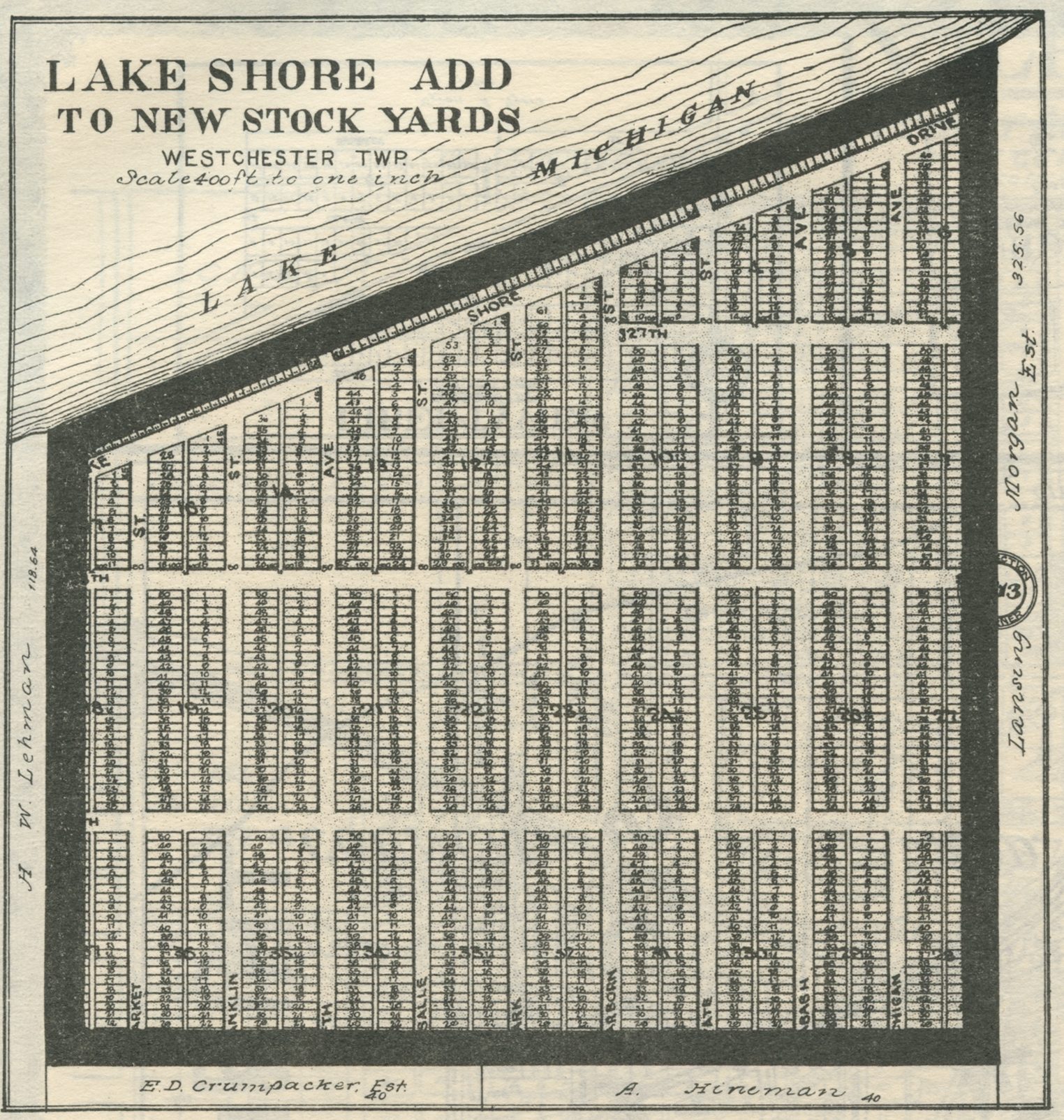
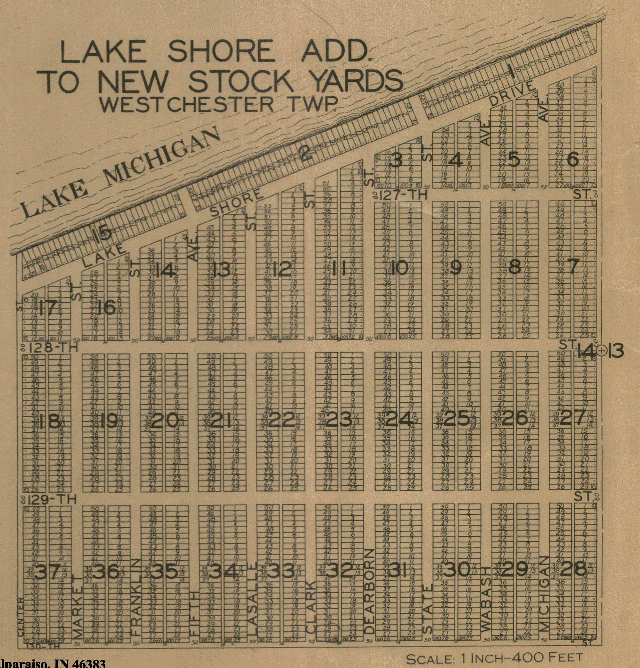
Lakeshore Addition, 1906
Lakeshore Addition, 1921
Lakeshore Addition, 1928
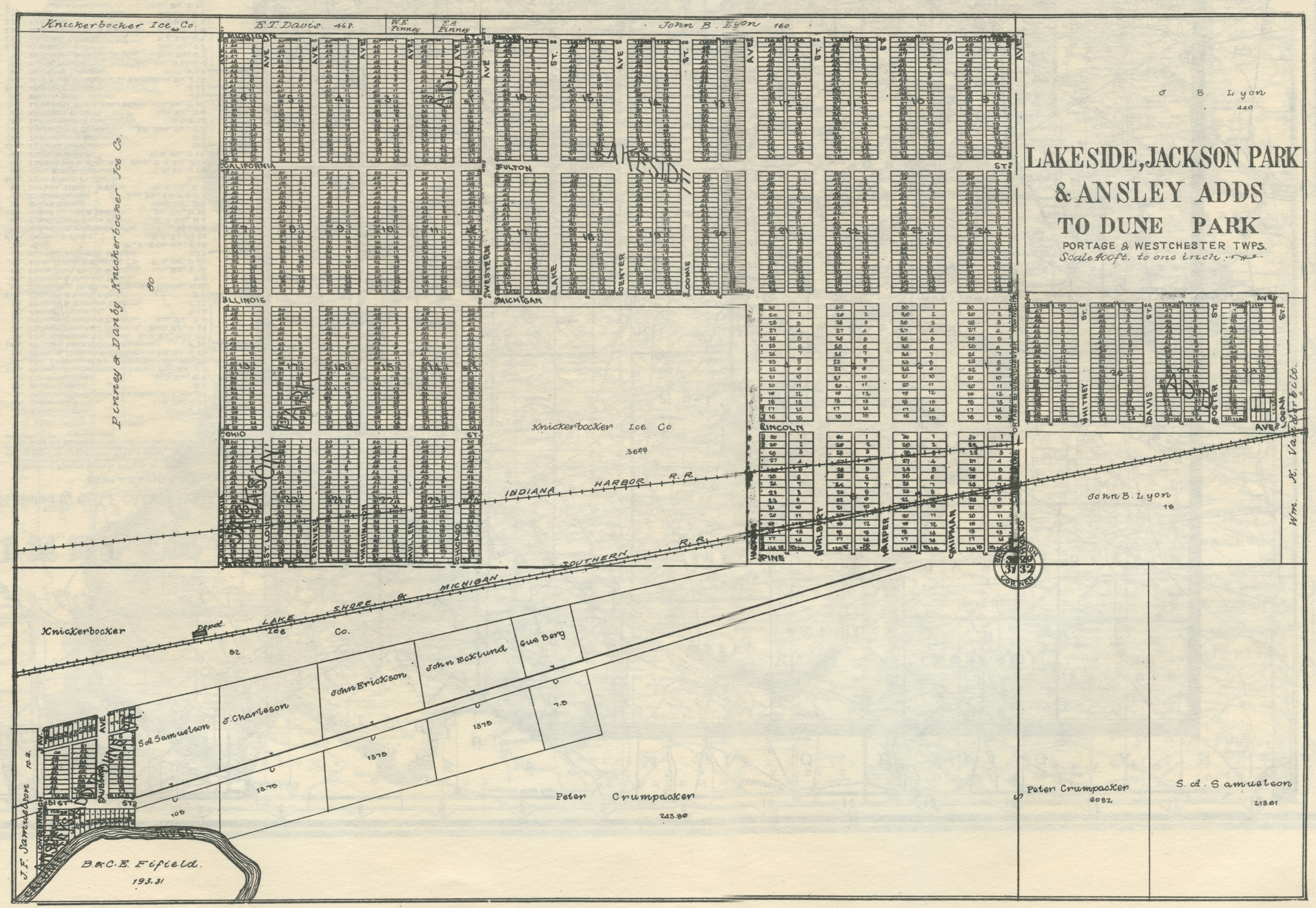
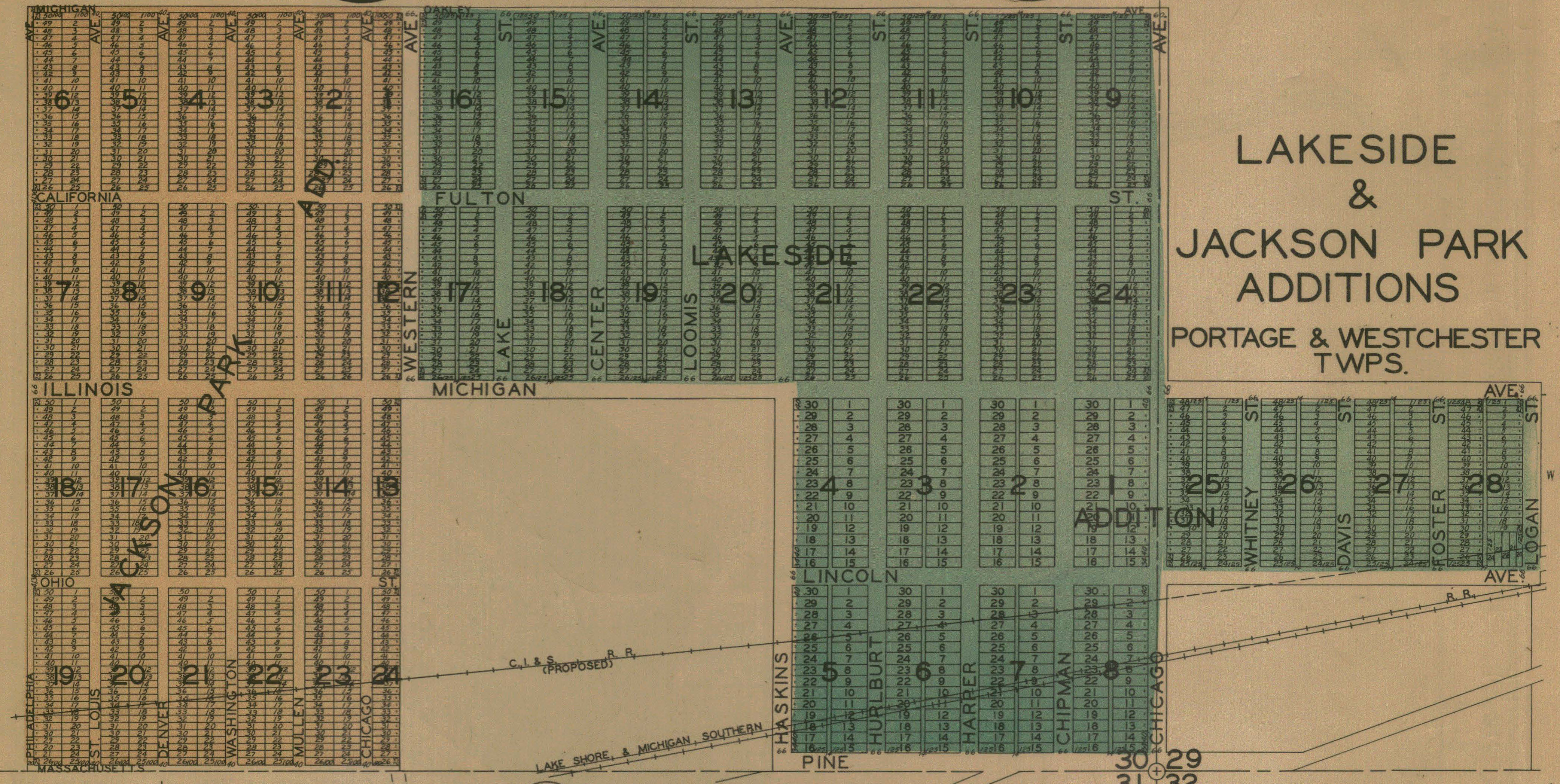
Lakeside Addition, 1928
Lakewood, 1892
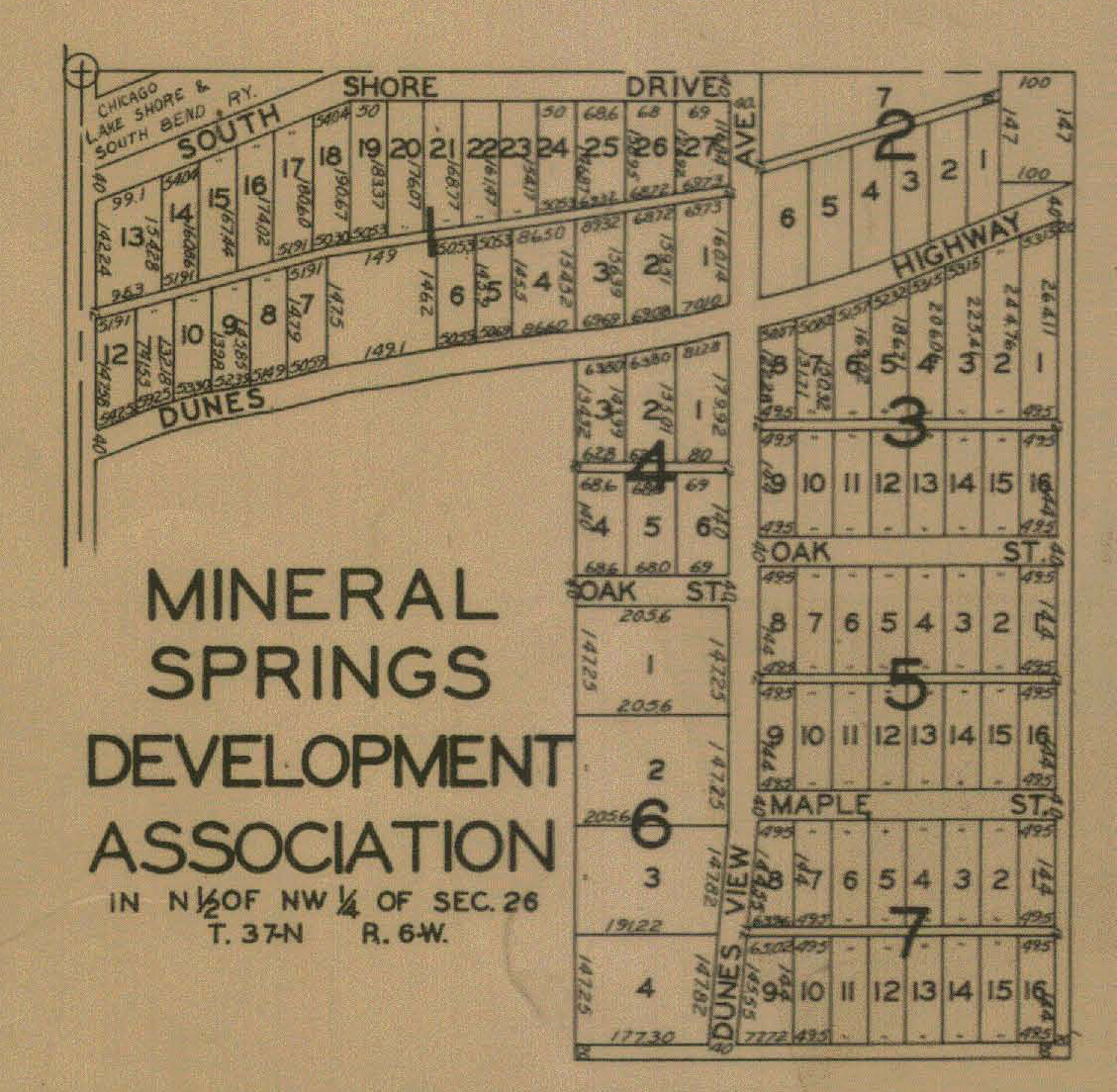
Mineral Springs Development Association, 1928
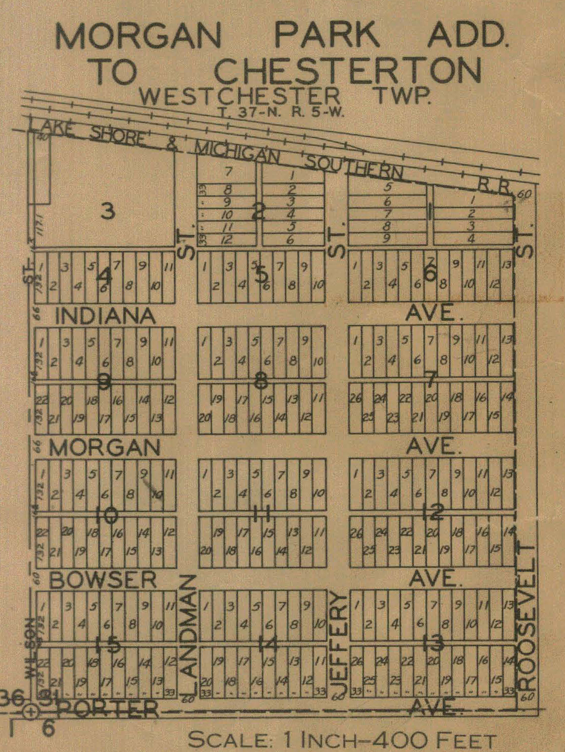
Morgan Park Addition, 1928
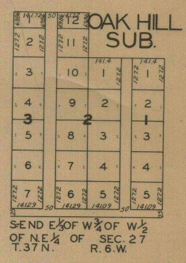
Oak Hill, 1928
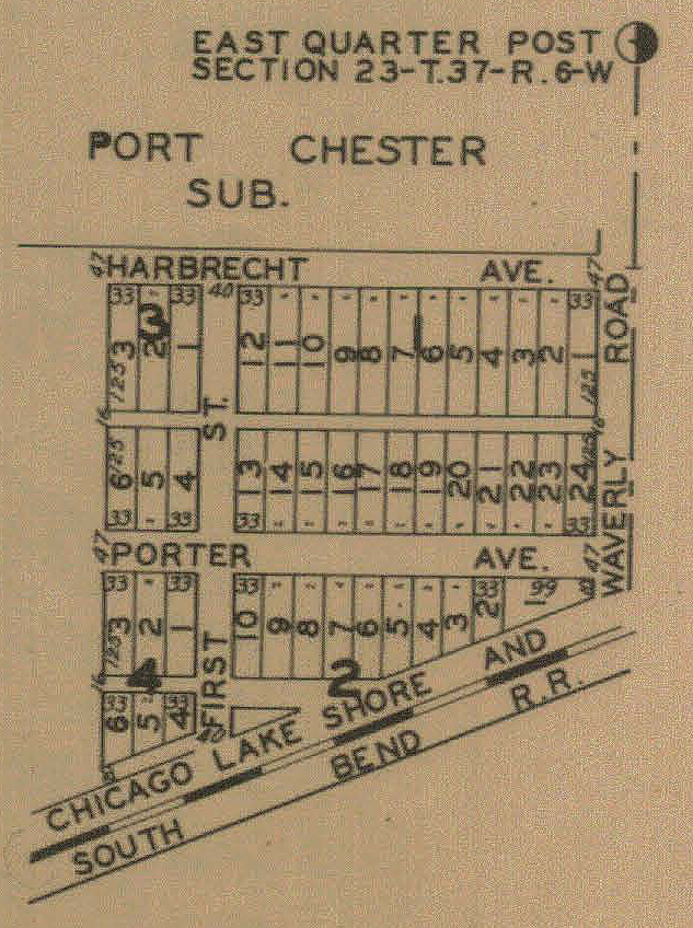
Port Chester, 1928
Porter,
1876
Porter,
1895
Porter and Chesterton, 1906
Porter and Chesterton, 1921
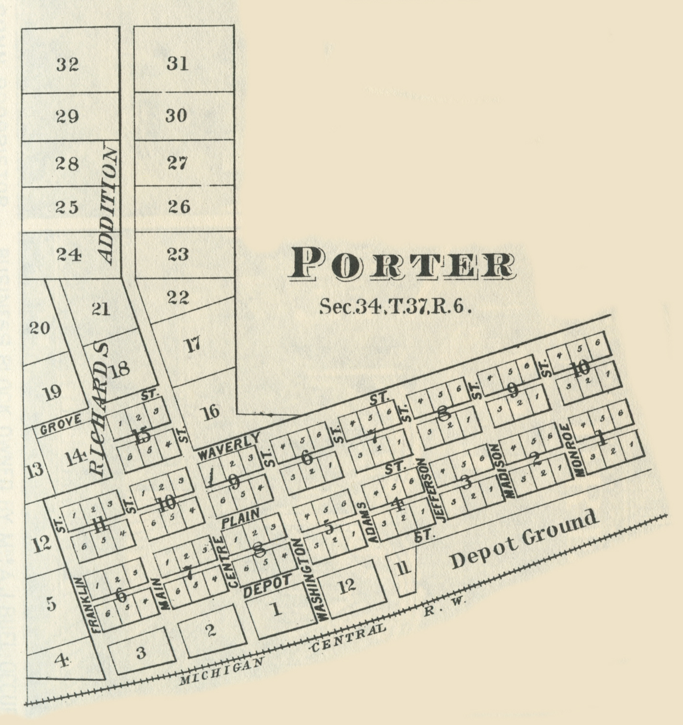
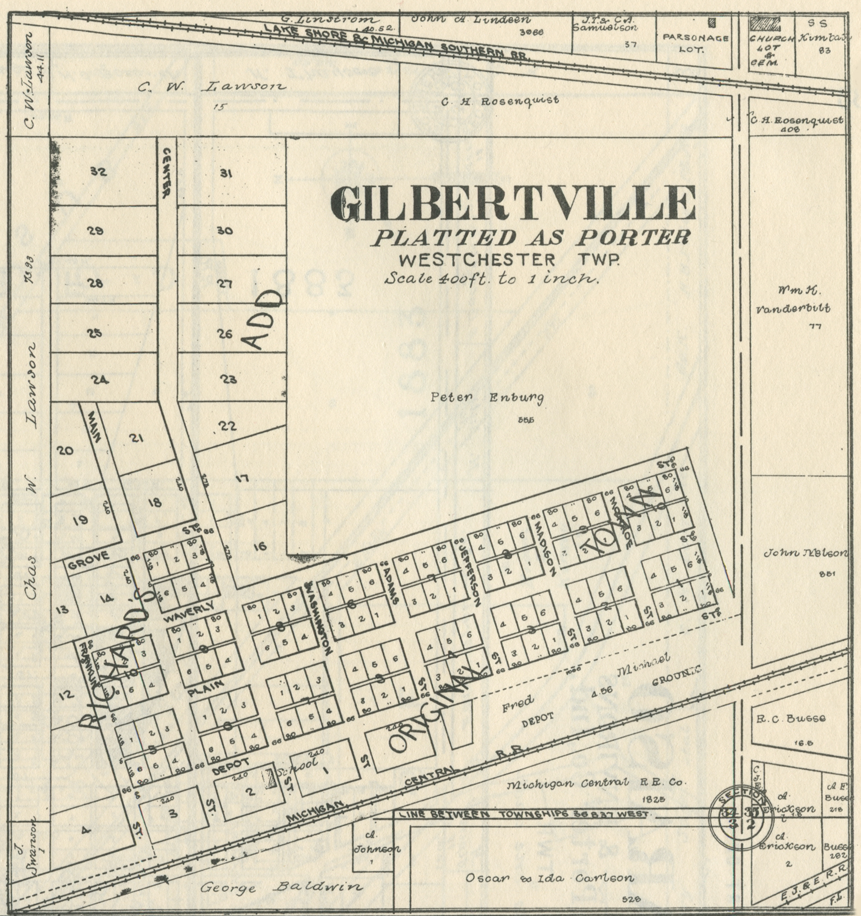
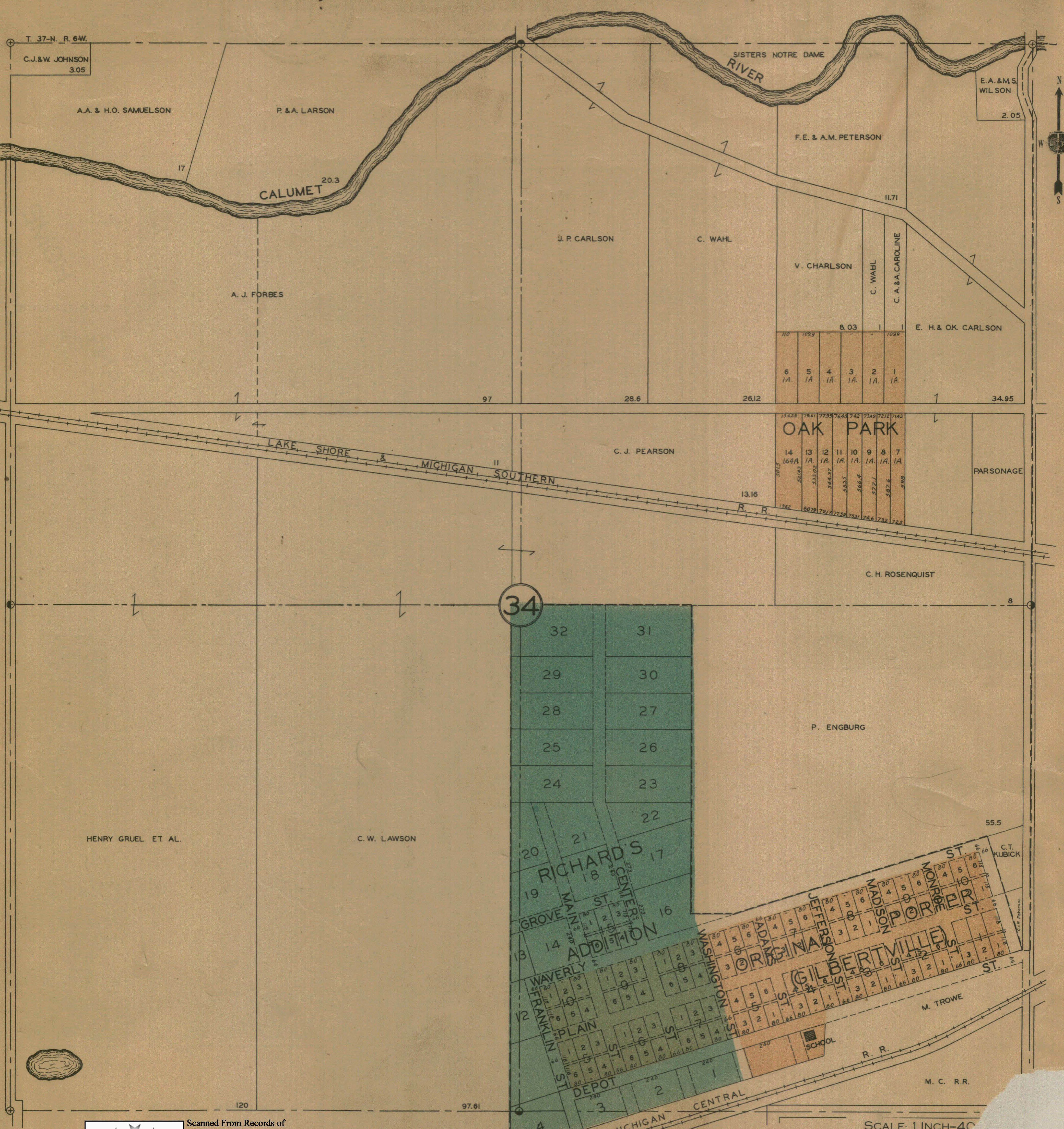
Porter - Gilbertville, 1906
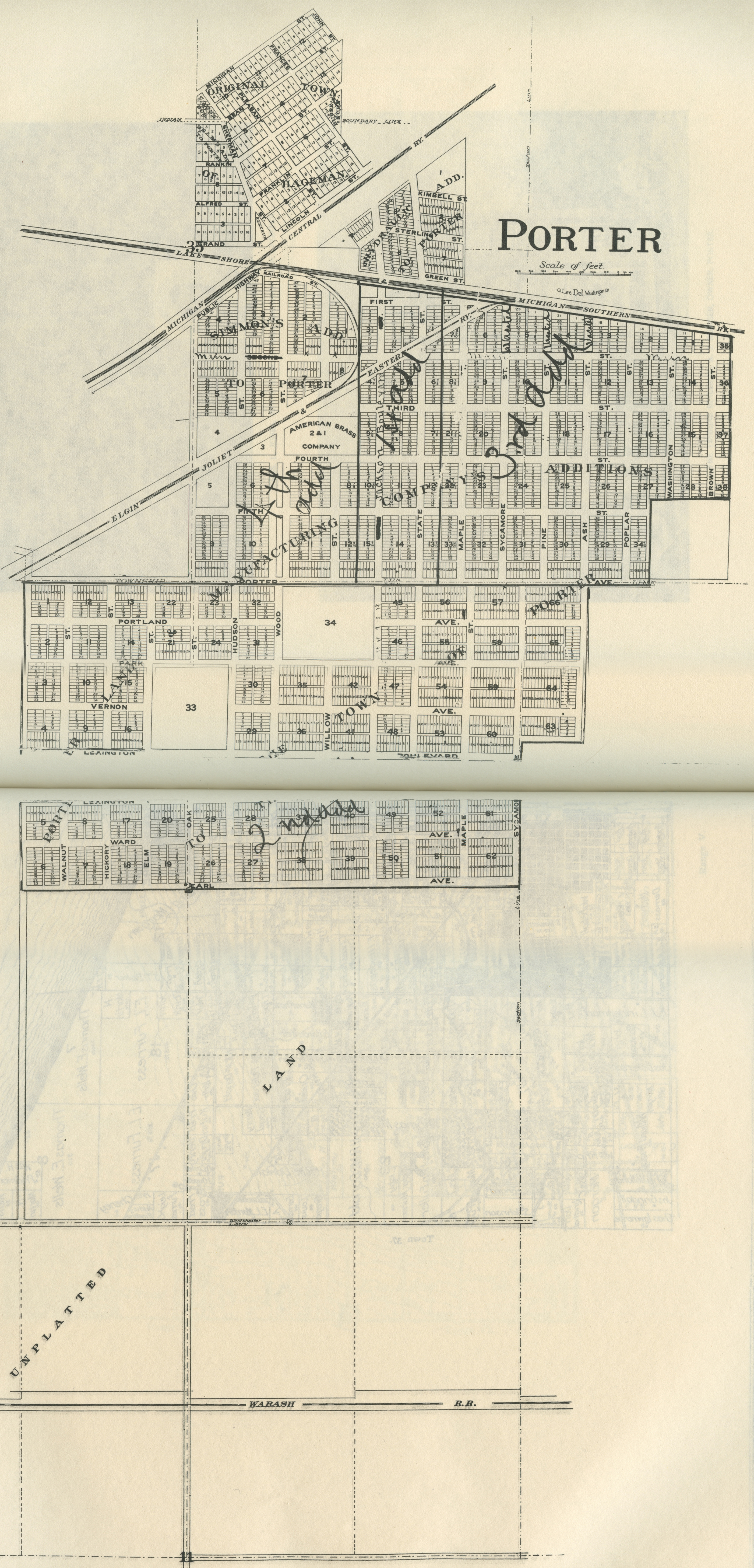
Porter - Part 1, 1928
Porter - Part II, 1928
Porter - Part III, 1928
Porter - Part IV, 1928
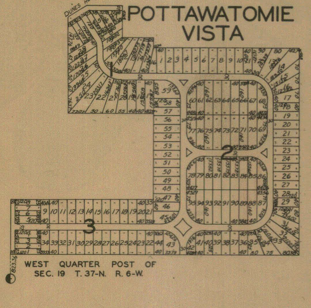
Pottawatomie Vista, 1928
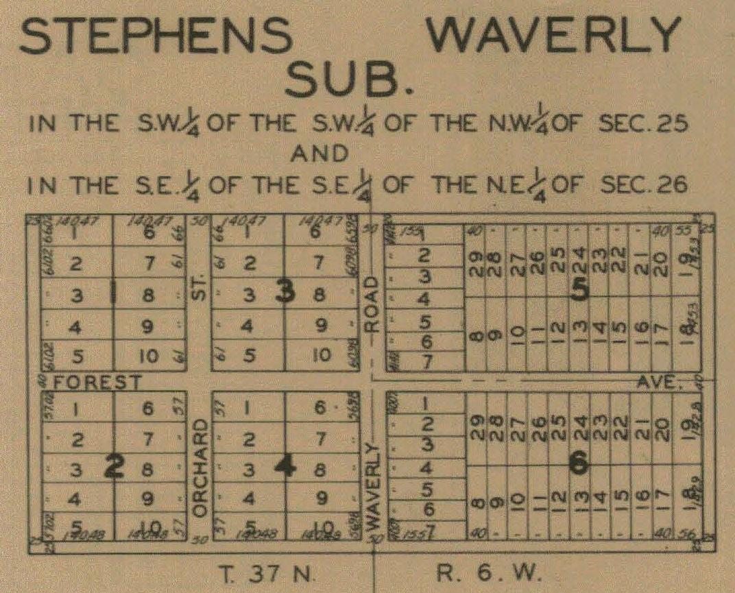
Stephen's Waverly Addition, 1928
Tremont, 1925
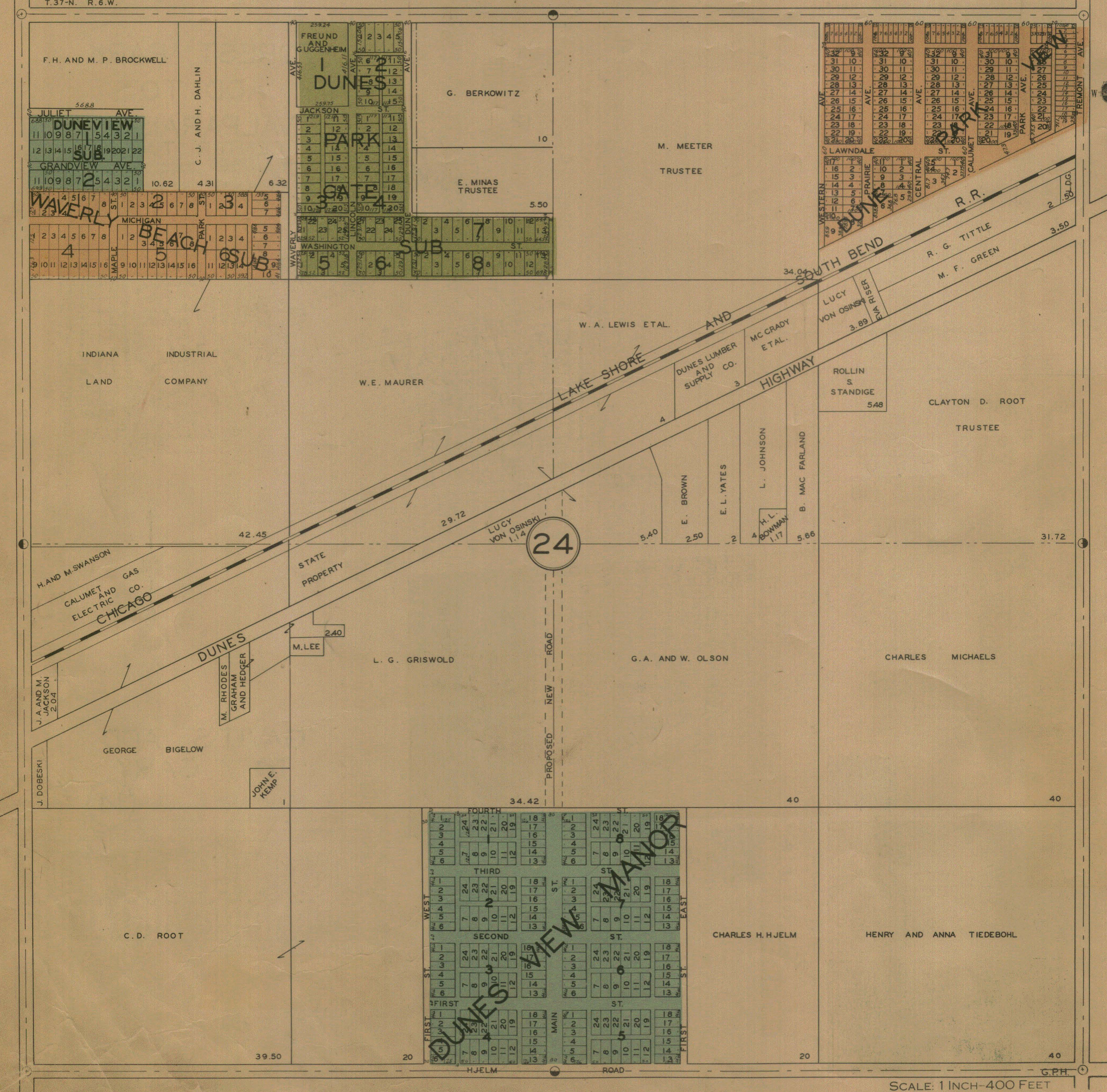
Westchester Township - Section 24, 1928
Also see:
1956 Drury's Porter County Aerial Images for Westchester Township