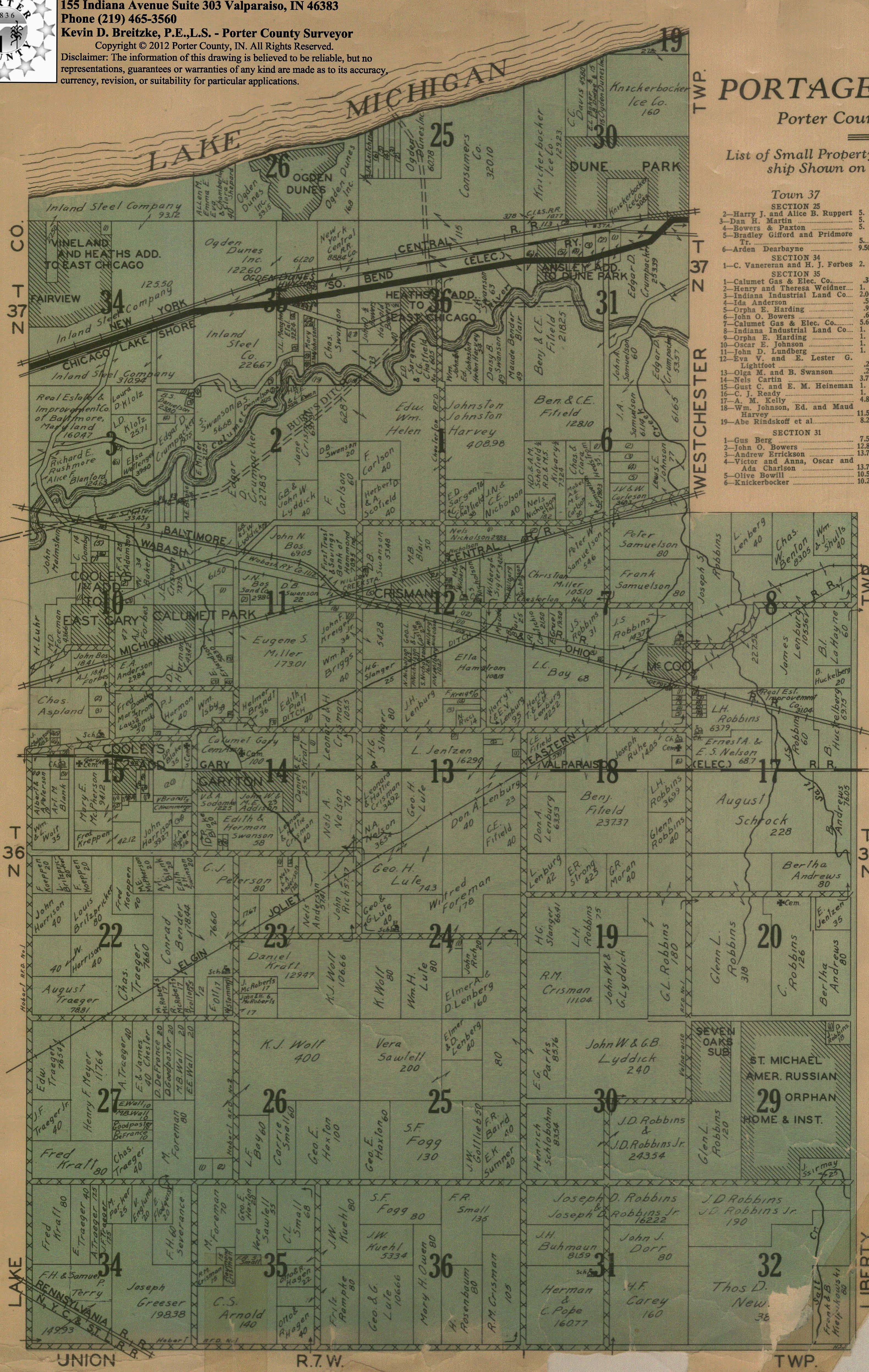
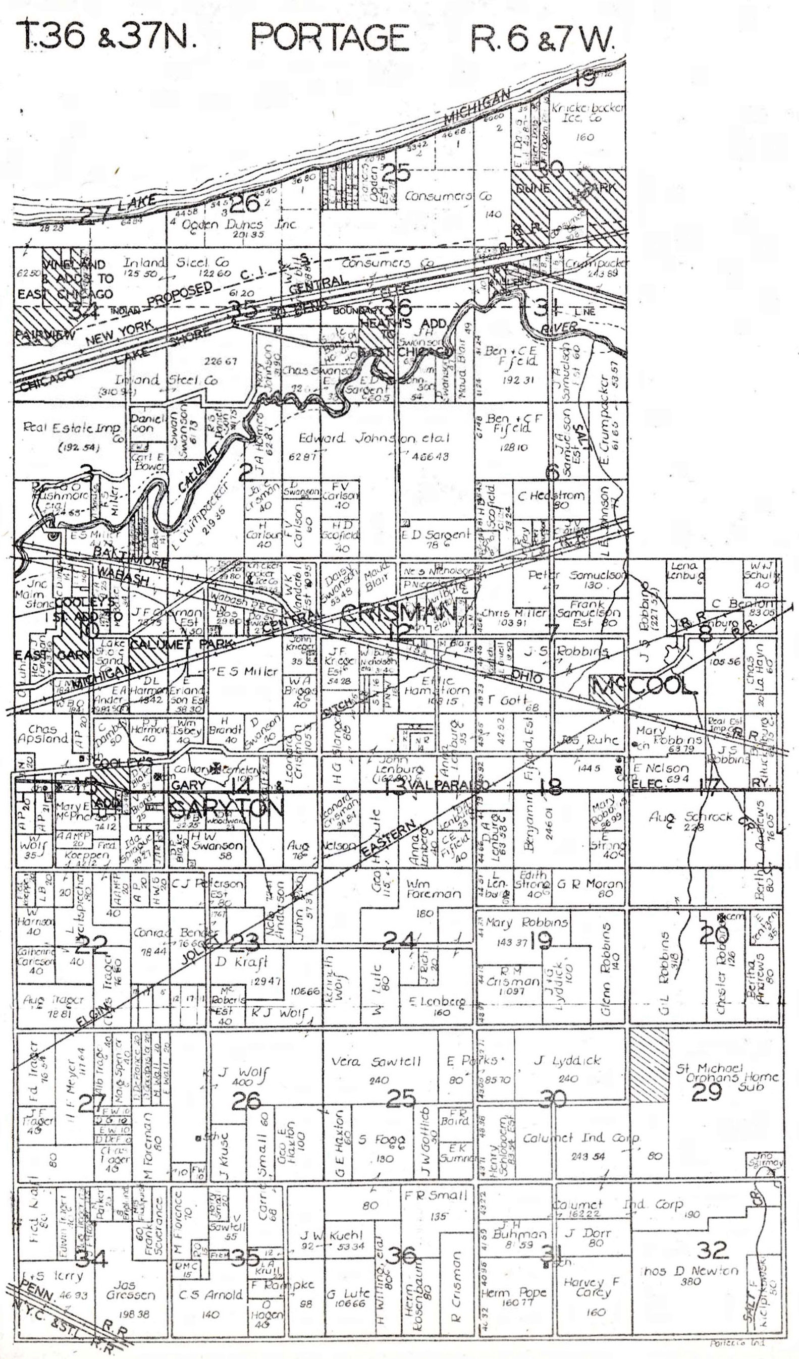
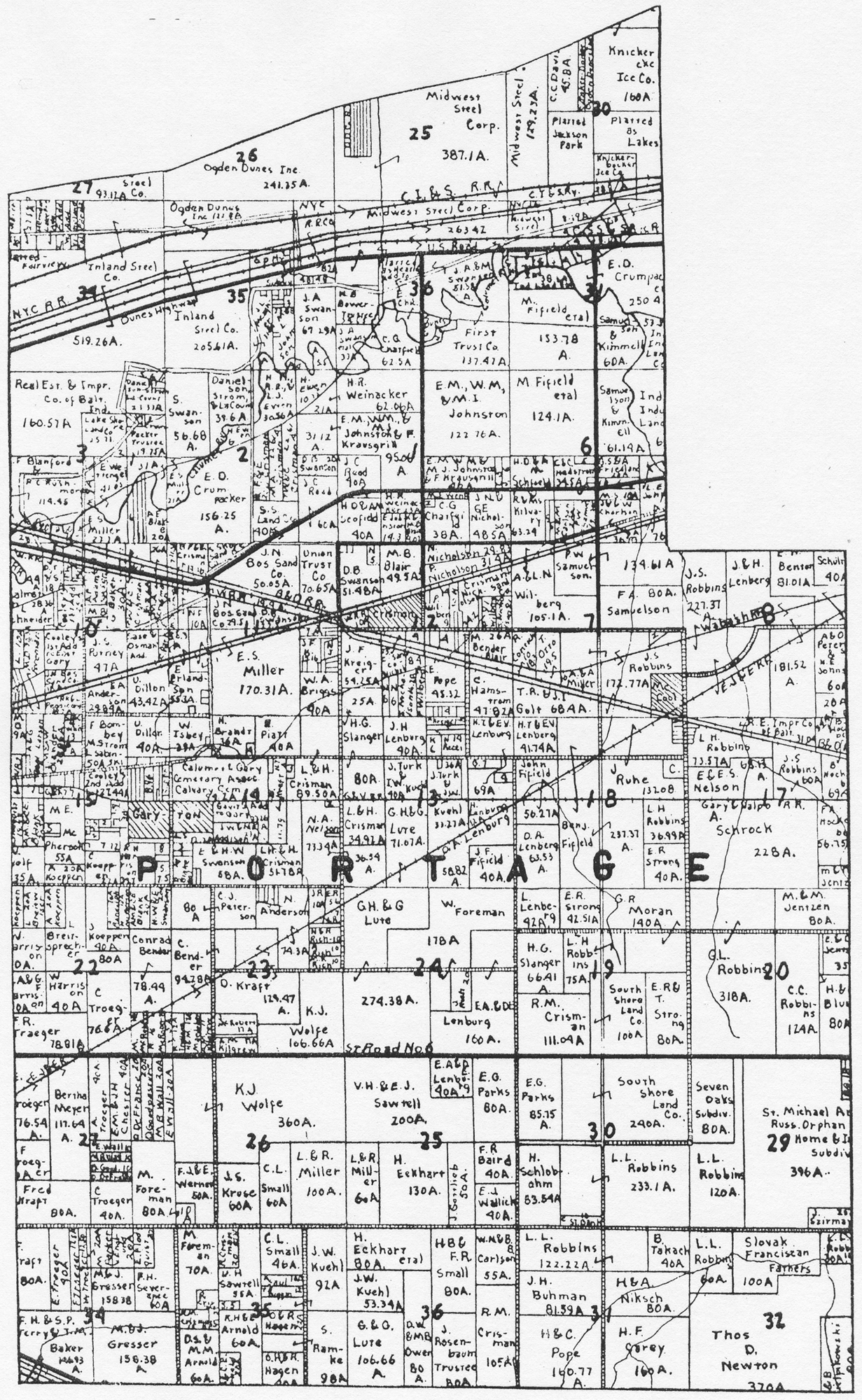
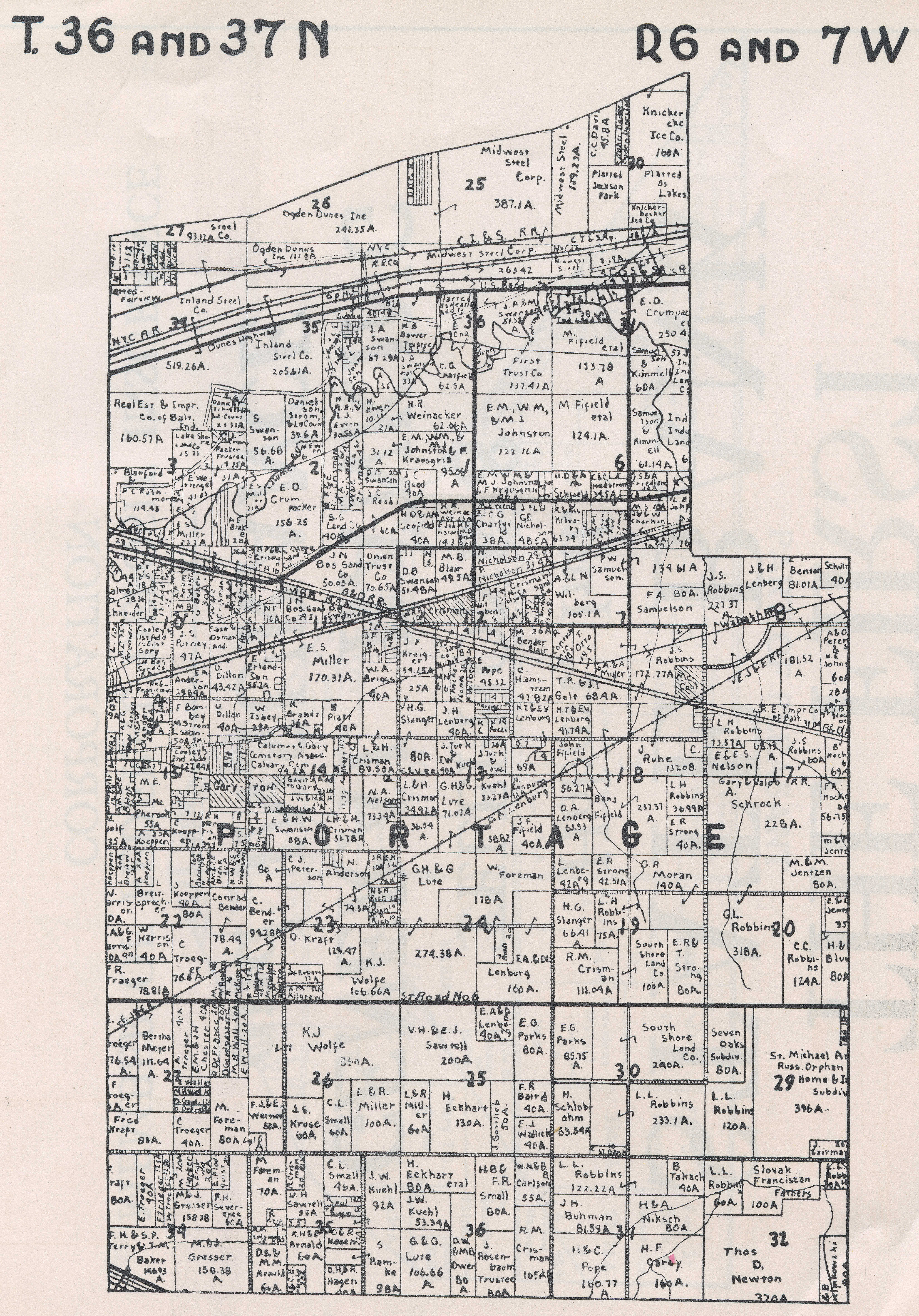
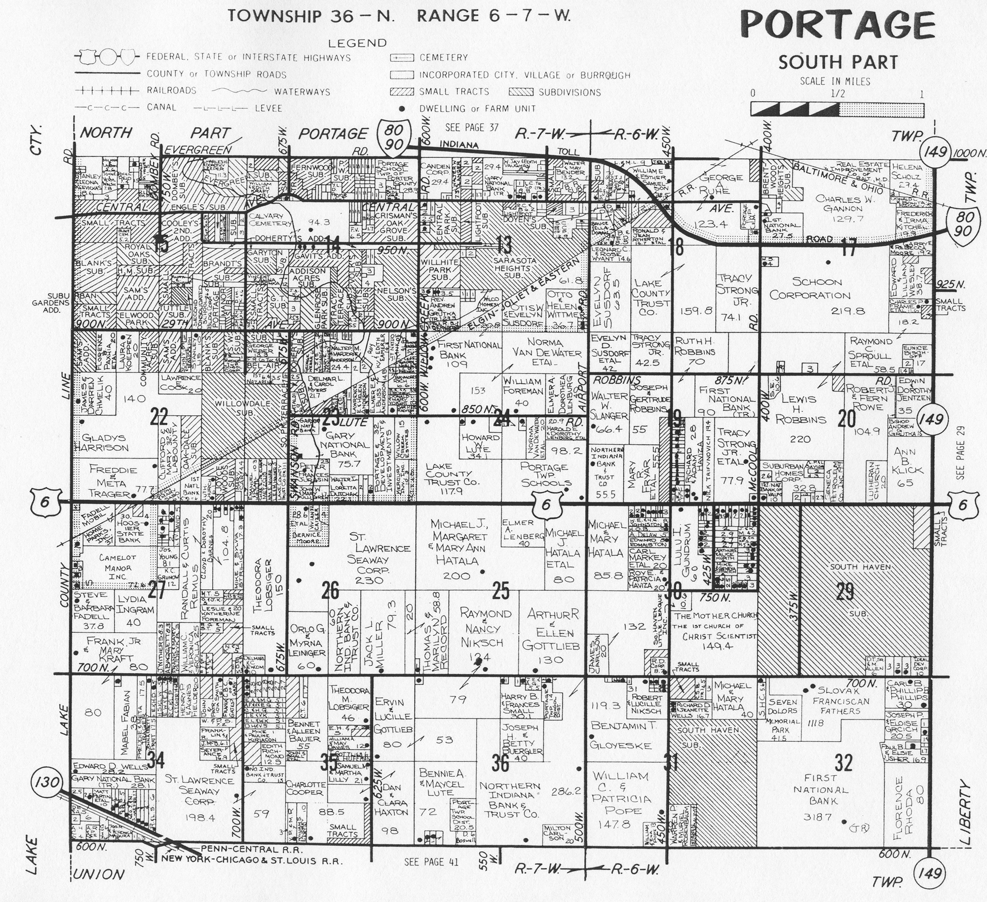
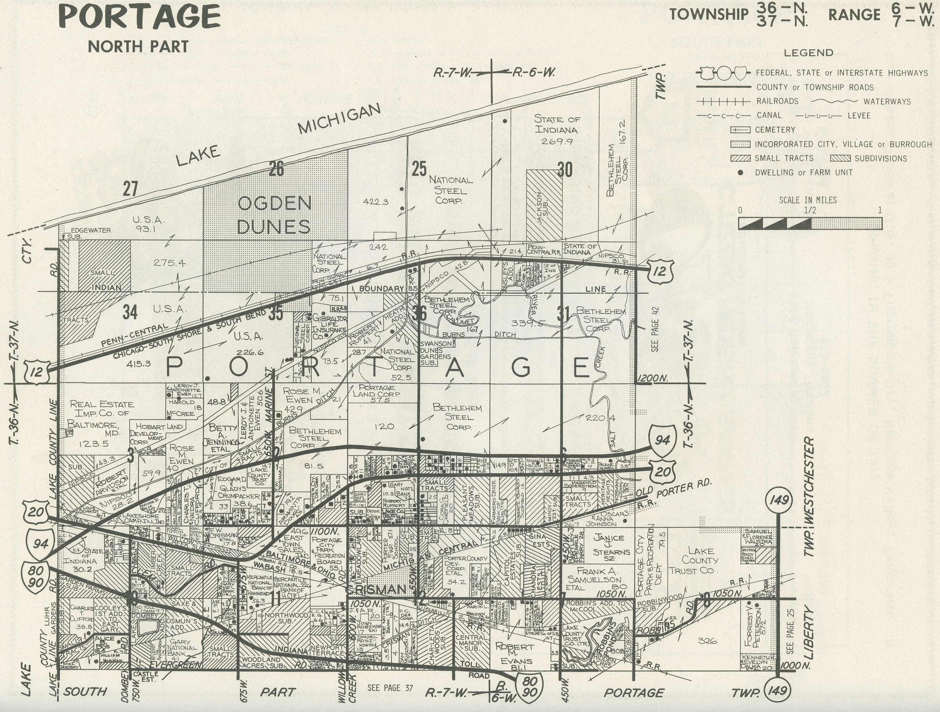
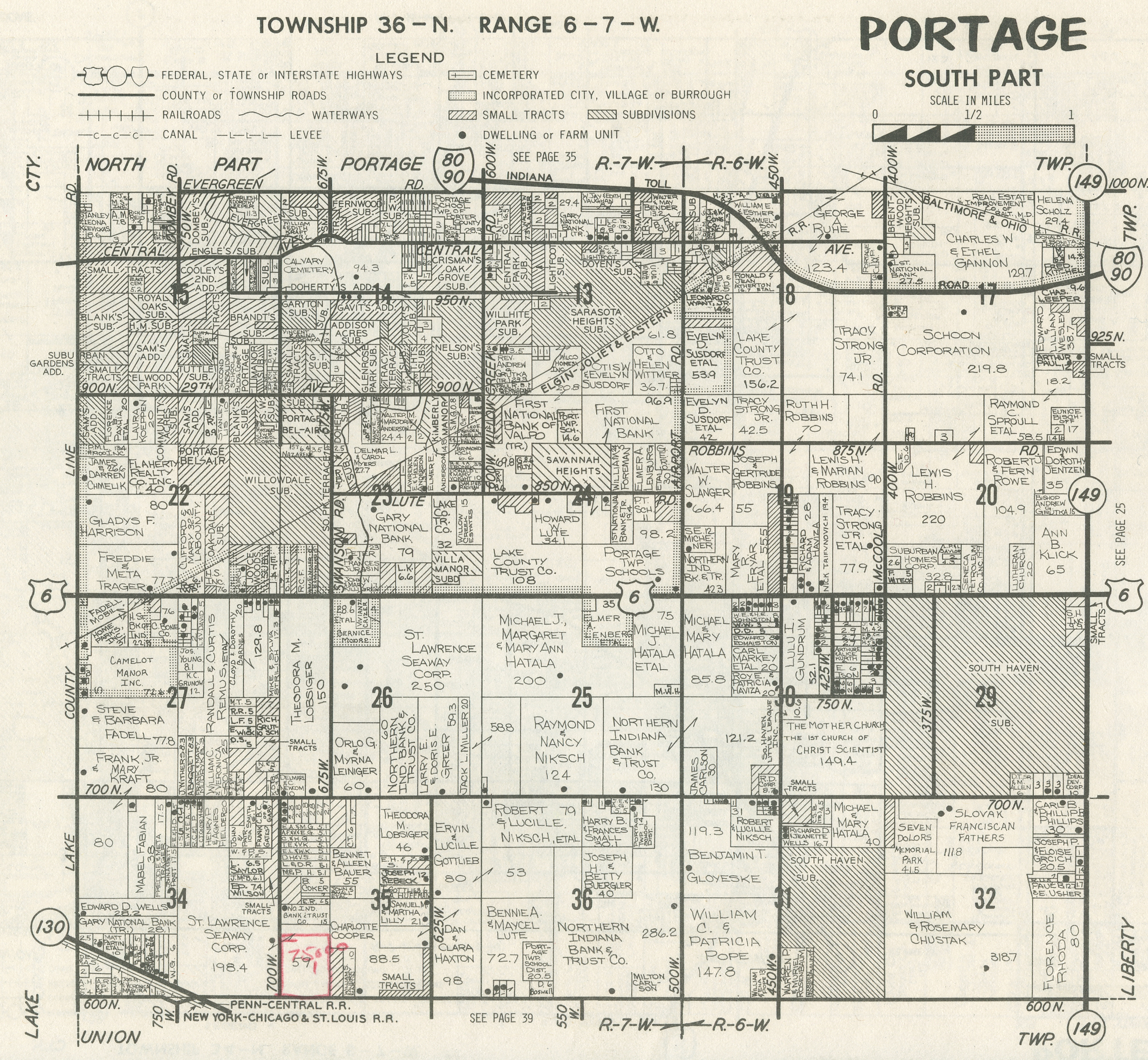
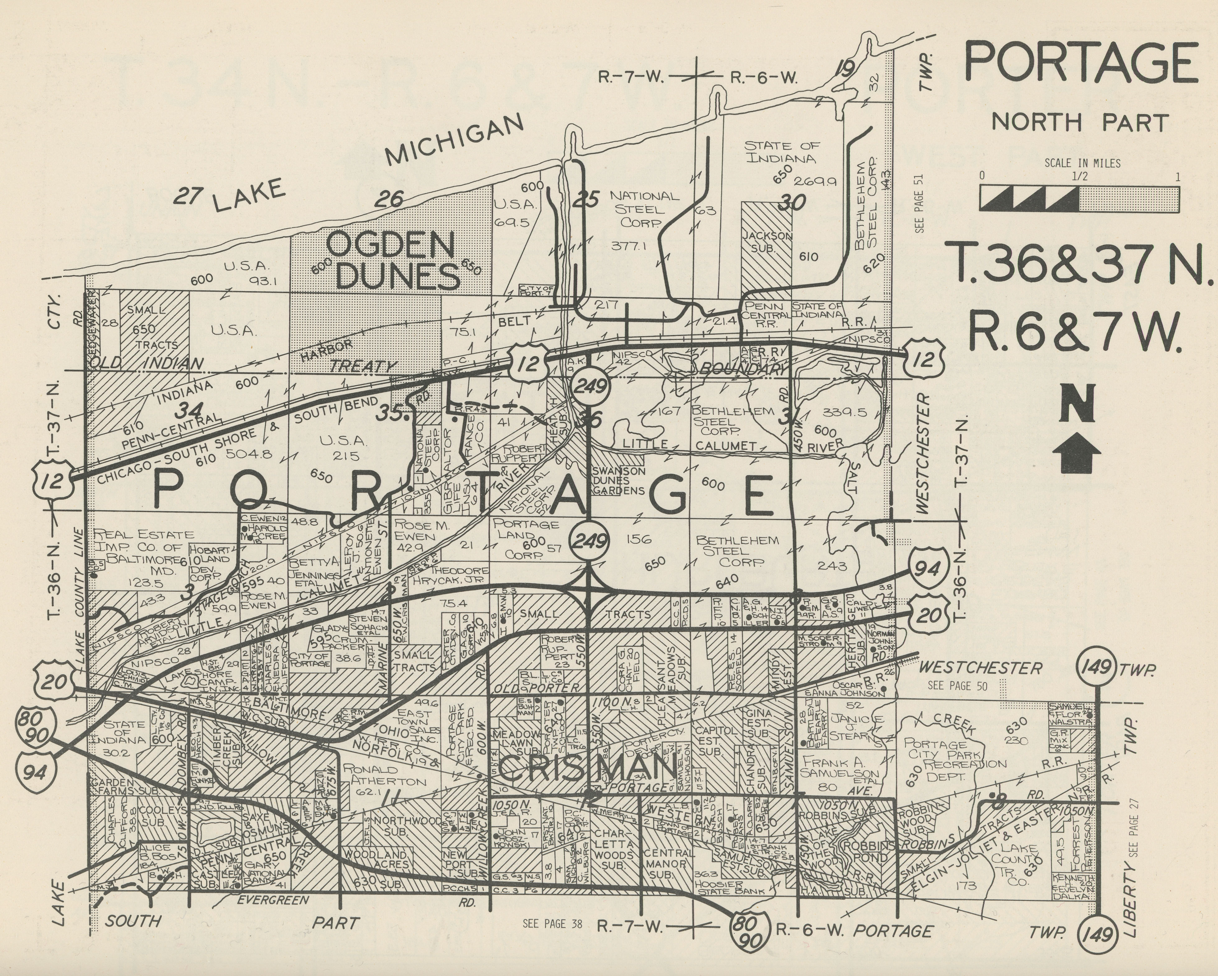
Portage Township MapsPortage Township, Porter County plat maps . . . .
The following are Portage Township, Porter County,
Indiana, maps available on this website. Click the links below to access
full size images. Note that several of these images are large files and may take
considerable time to load on slower Internet connections, such as dialup.
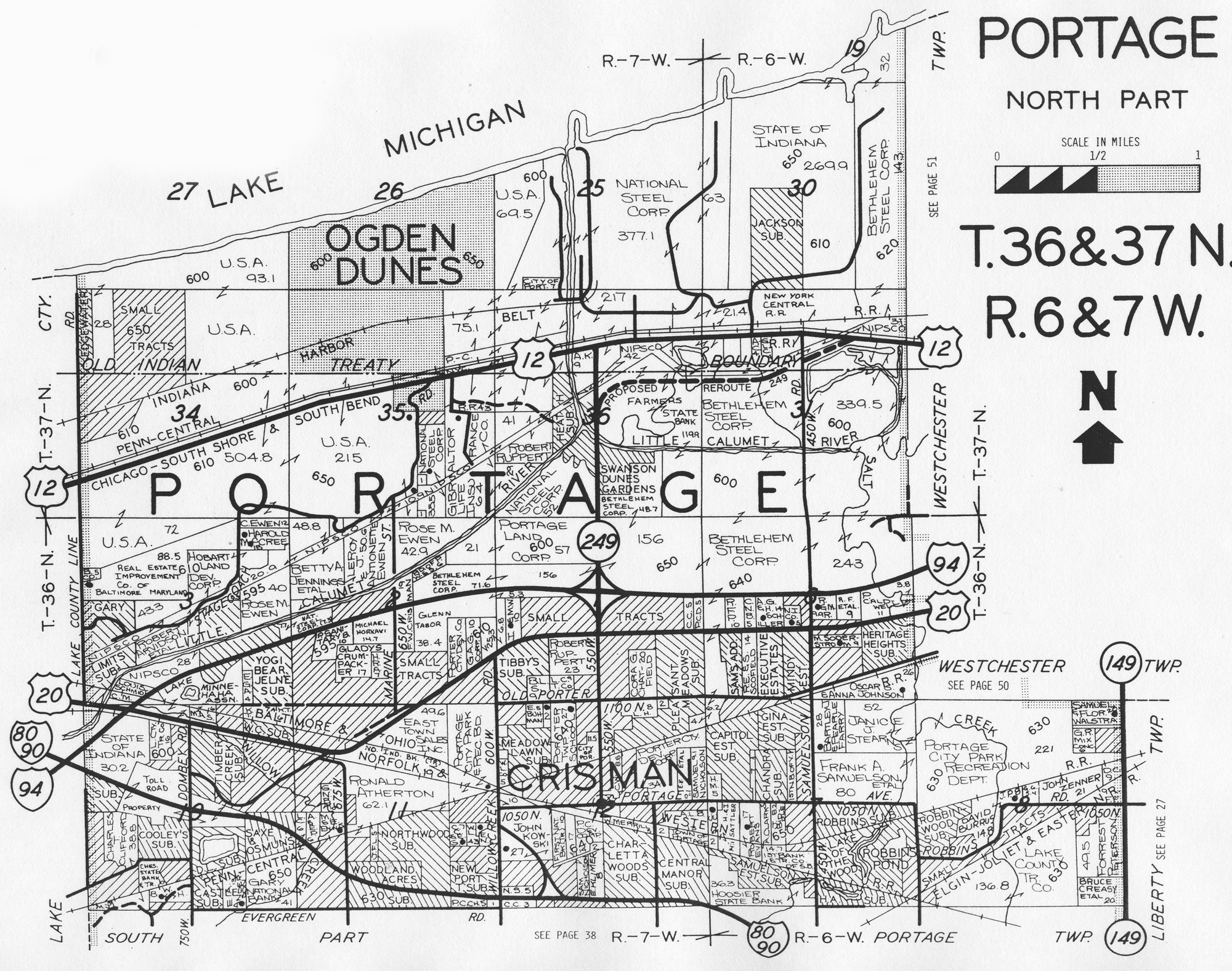
Original Land Patents (North Half)
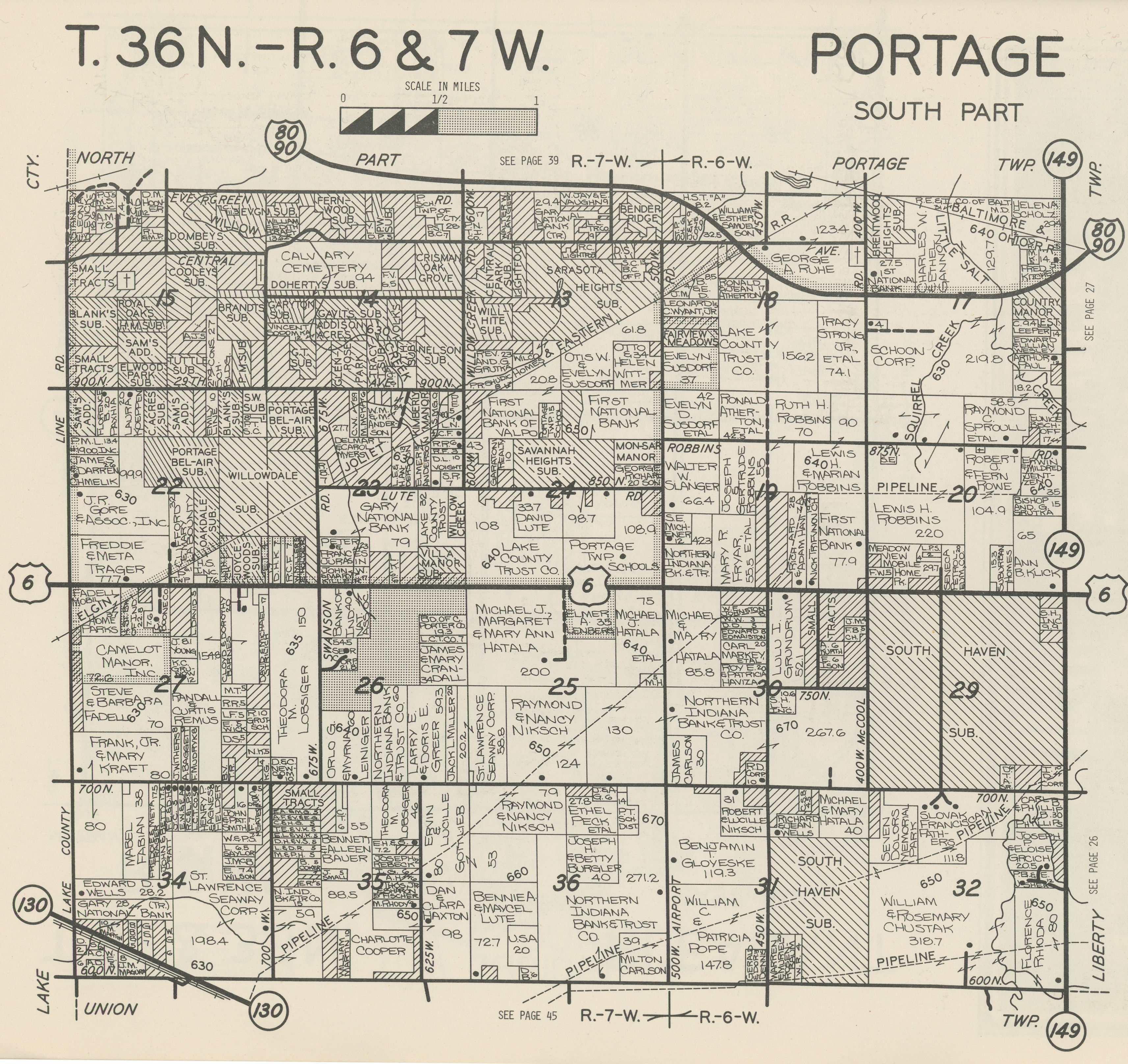
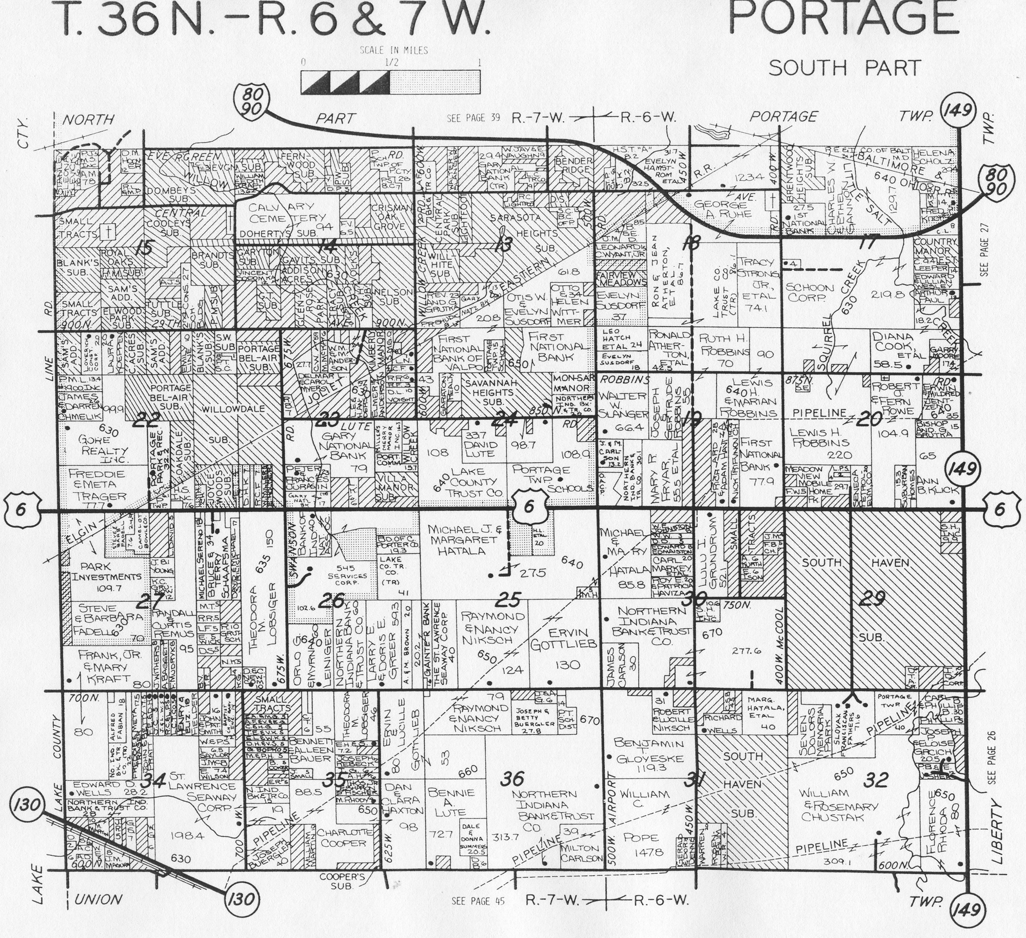
Original Land Patents (South Half)
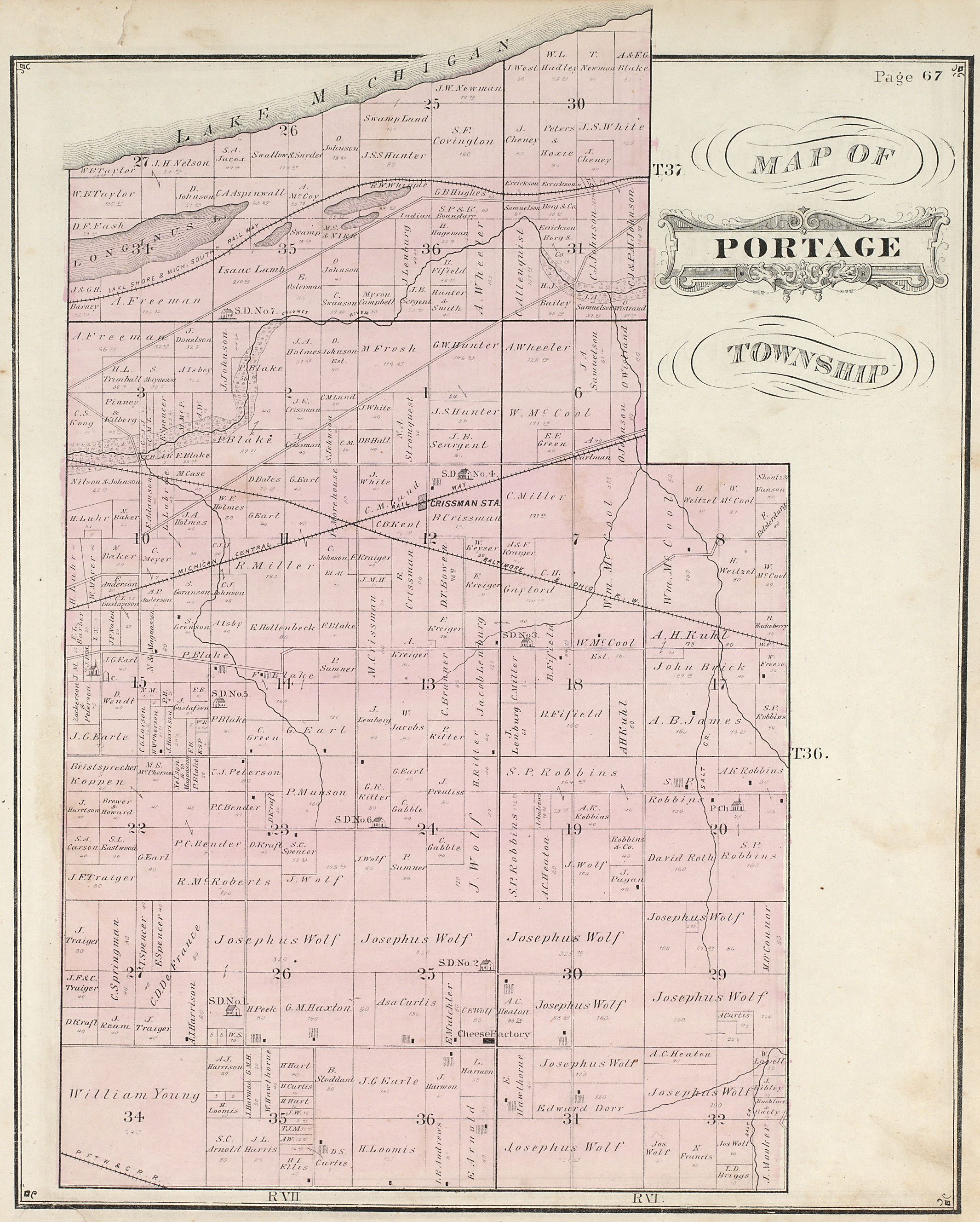
1876 Plat
Map
1895 Plat
Map
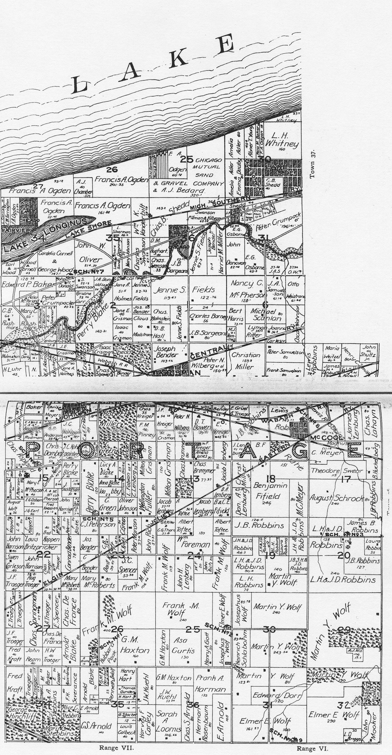
1906 Plat
Map
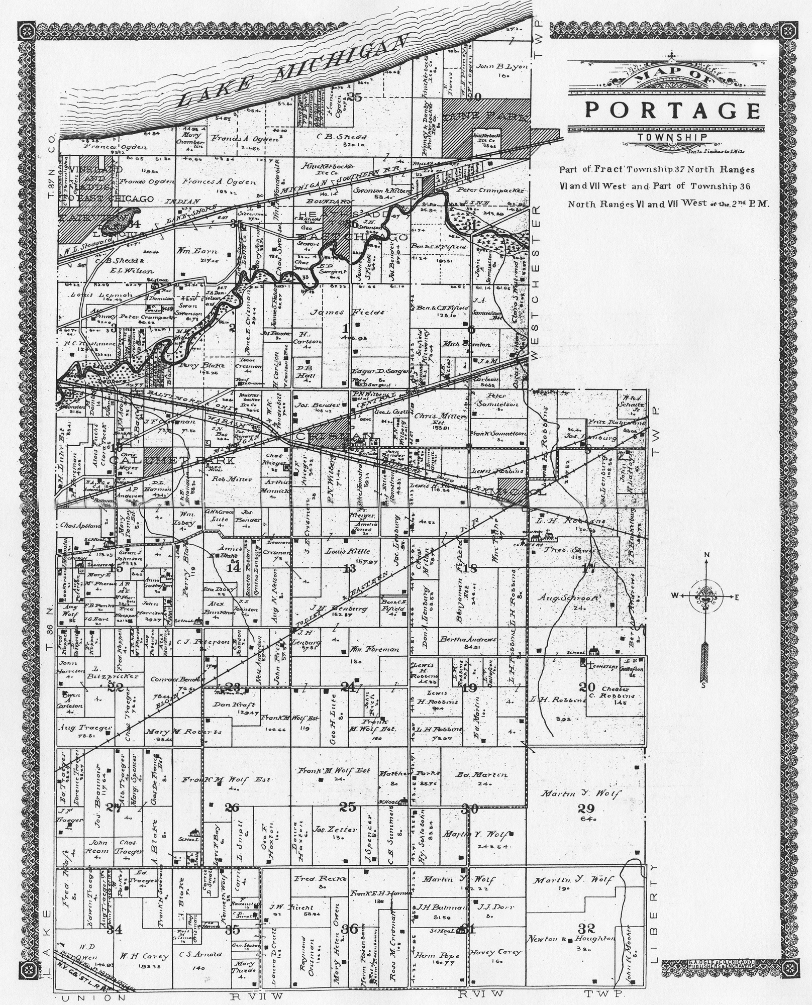
1921 Plat
Map
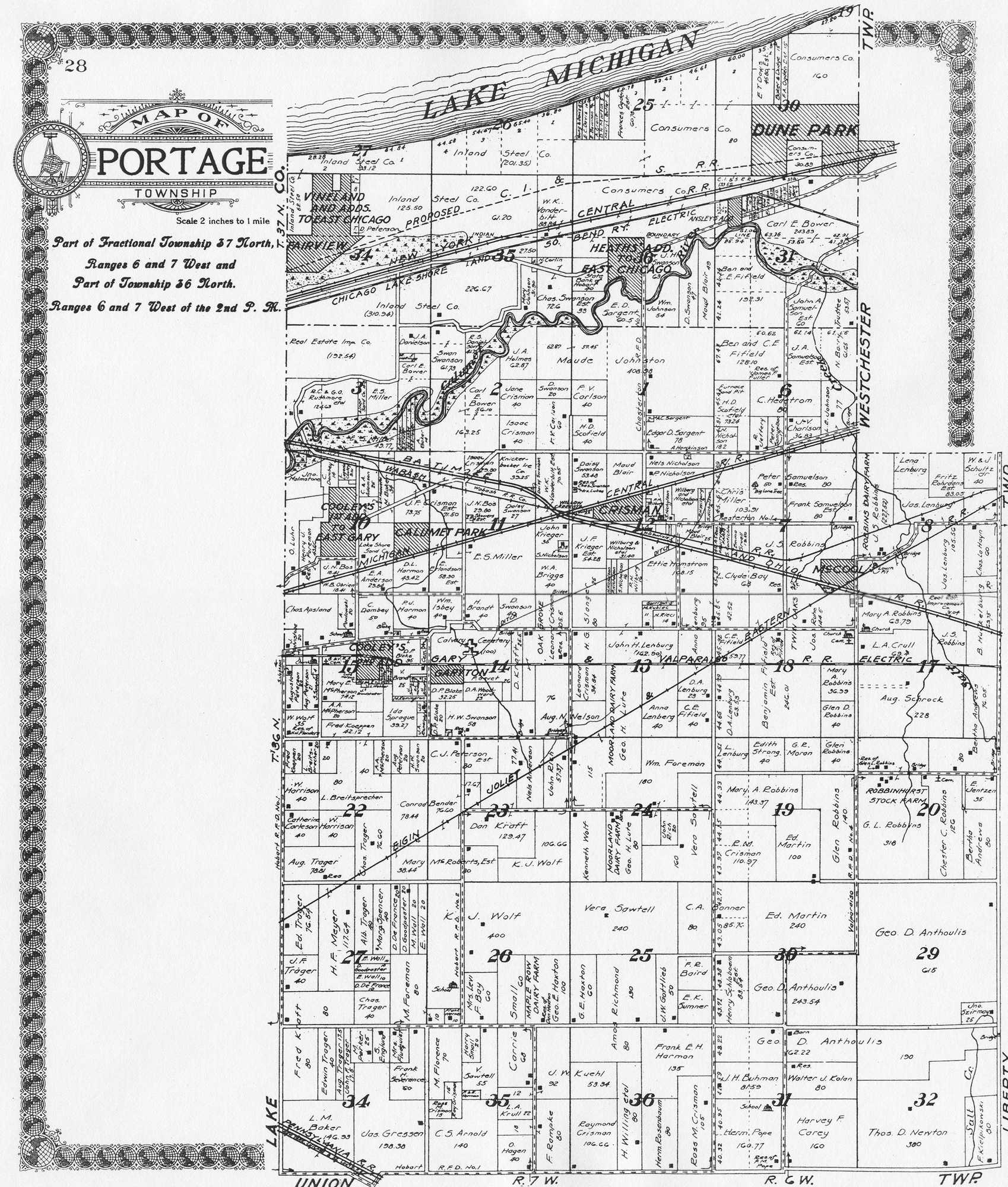
1928 Plat
Map
1929 Plat Map
1938 Plat Map
1941 Plat Map
1948 Plat Map
1958 Plat Map
1969 Plat
Map
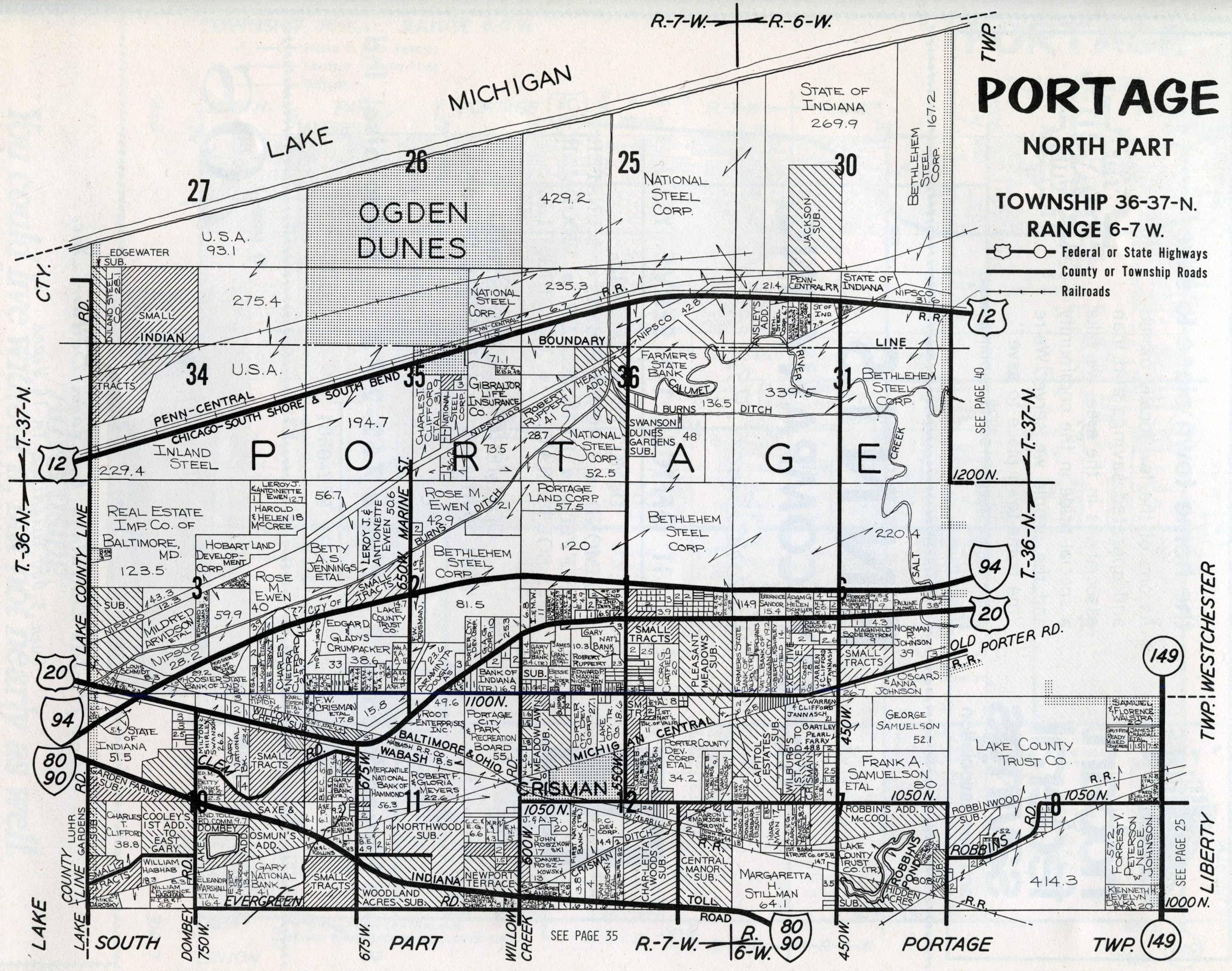
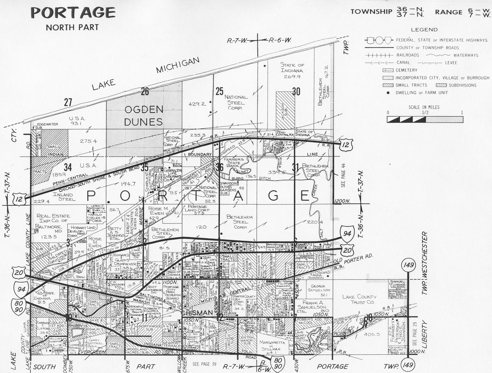
1973
Plat Map (North Half)
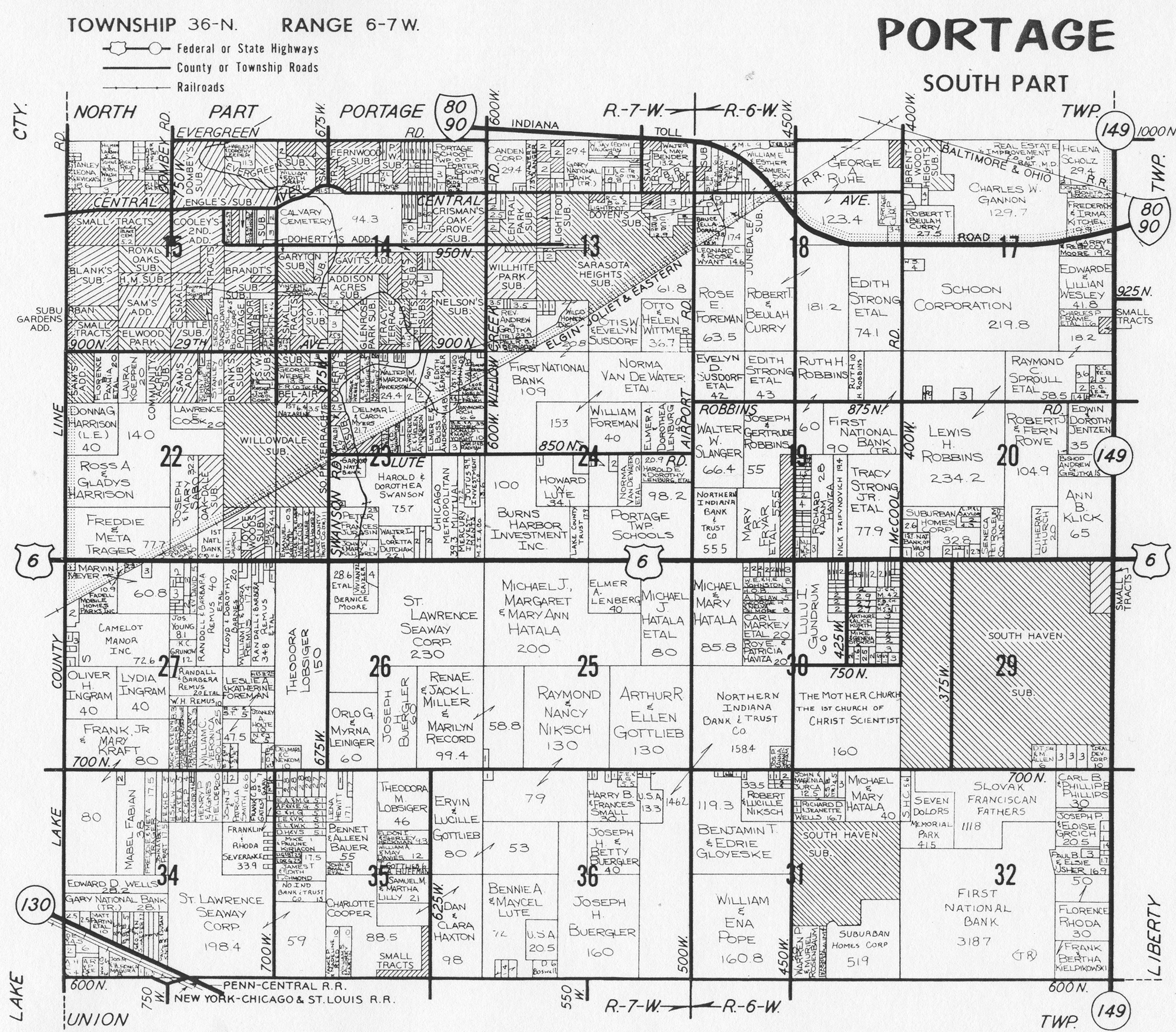
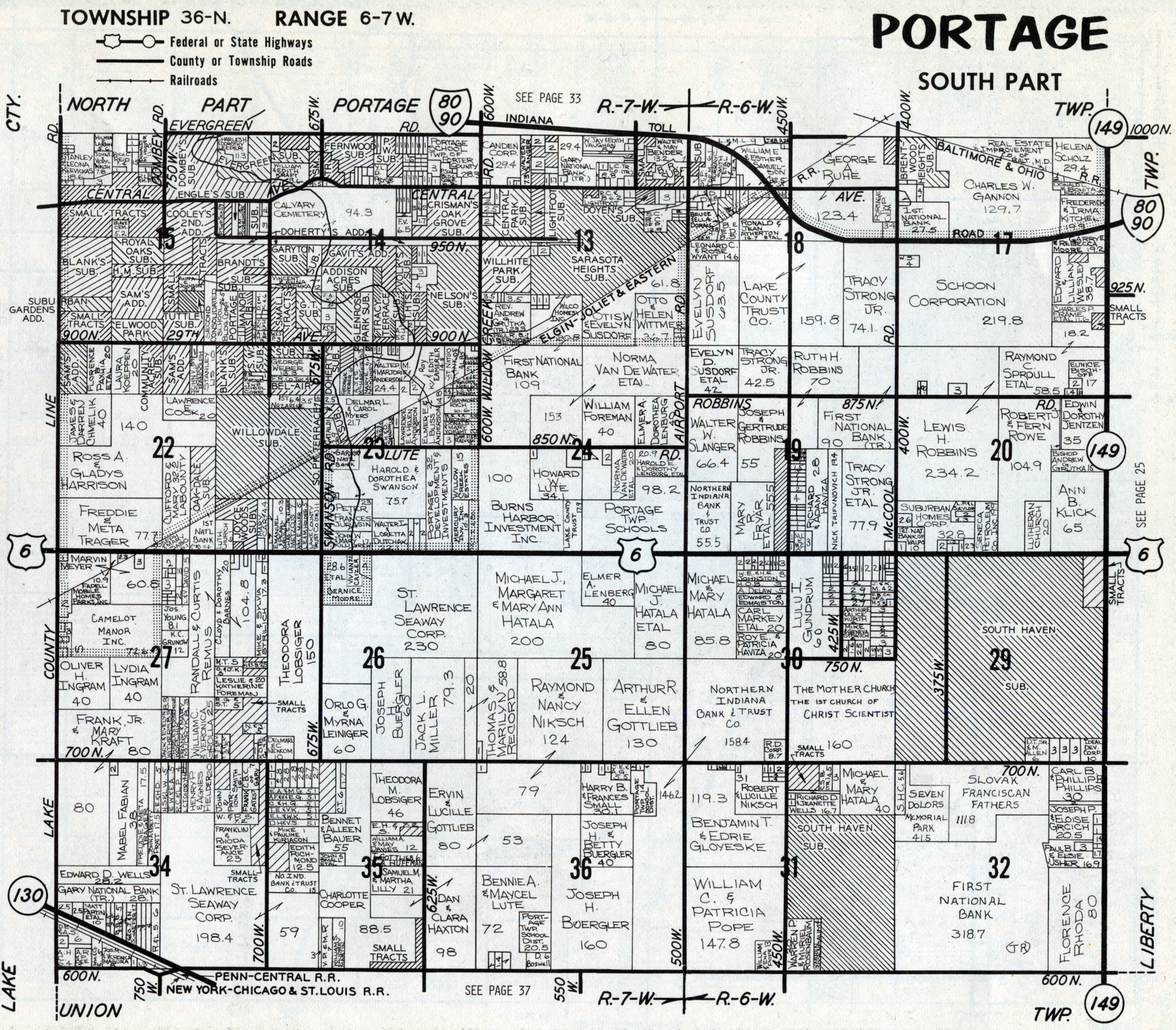
1973
Plat Map (South Half)
1974 Plat Map (North Half)
1974
Plat Map (South Half)
1976 Plat Map (North
Half)
1976 Plat Map (South
Half)
1979
Plat Map (North Half)
1979
Plat Map (South Half)
1982 Plat
Map (North Half)
1982 Plat
Map (South Half)
1984 Plat
Map (North Half)
1984 Plat
Map (South Half)
1988 Plat Map (North Half)
1988 Plat Map (South Half)
Portage Township Town and Village Plats
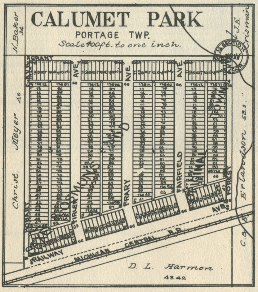
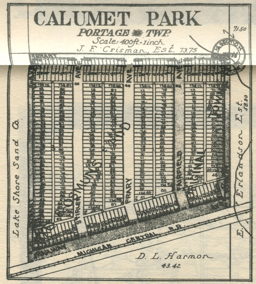
Calumet Park, 1906
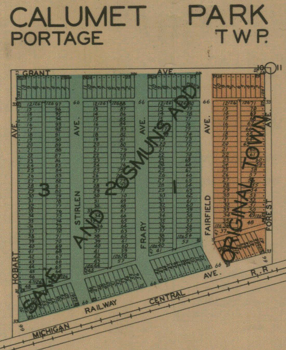
Calumet Park, 1921
Calumet Park, 1928
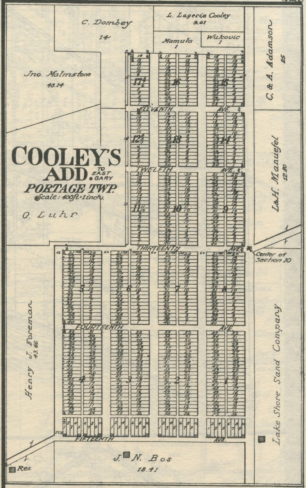
Cooley's Addition to East Gary, 1921
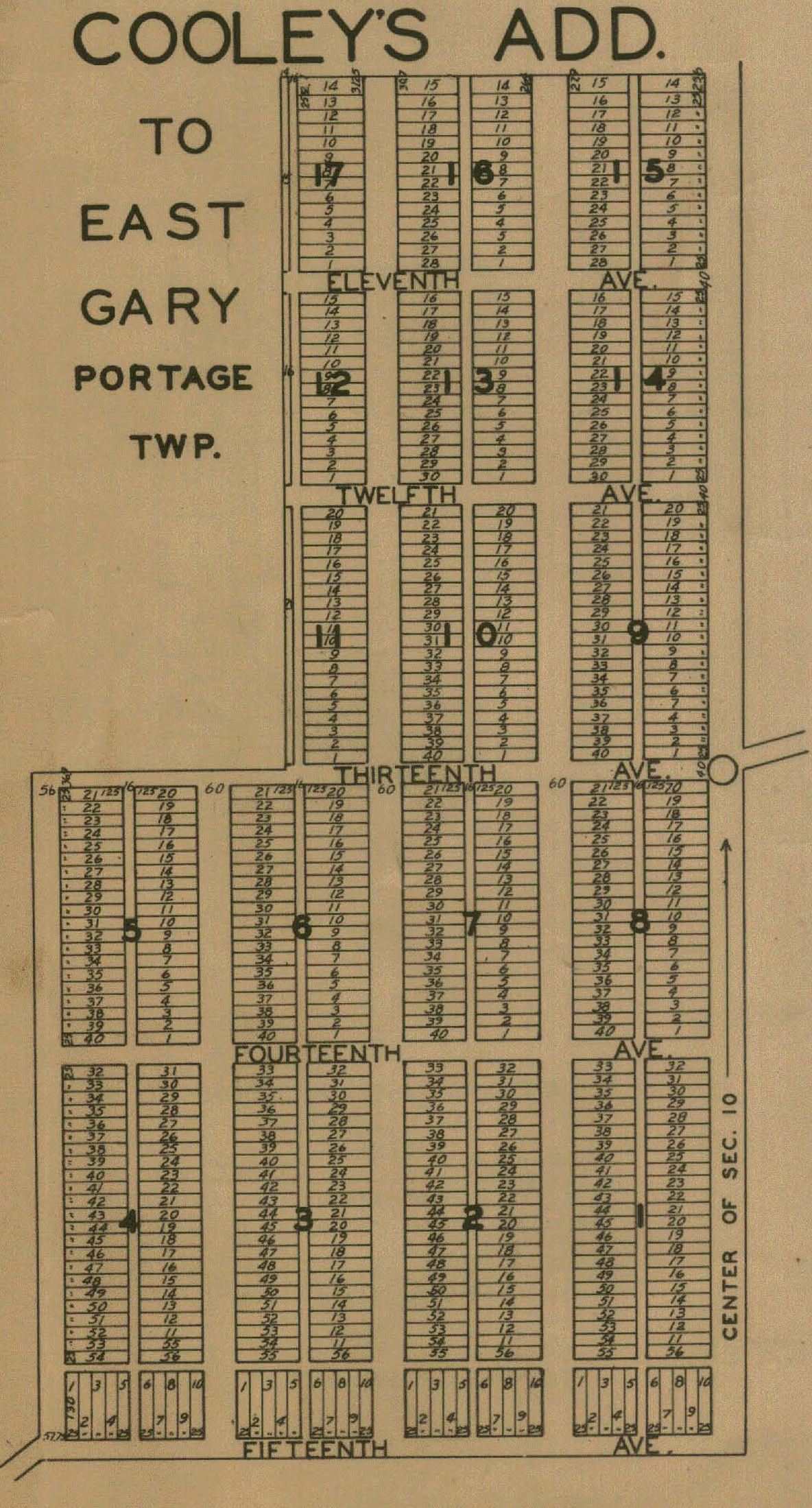
Cooley's Addition, 1928
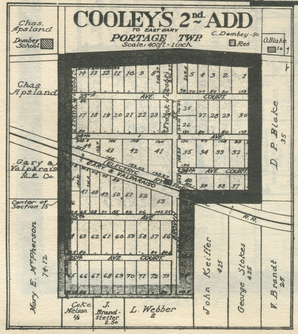
Cooley's Second Addition to East Gary, 1921
Cooley's Second Addition, 1928
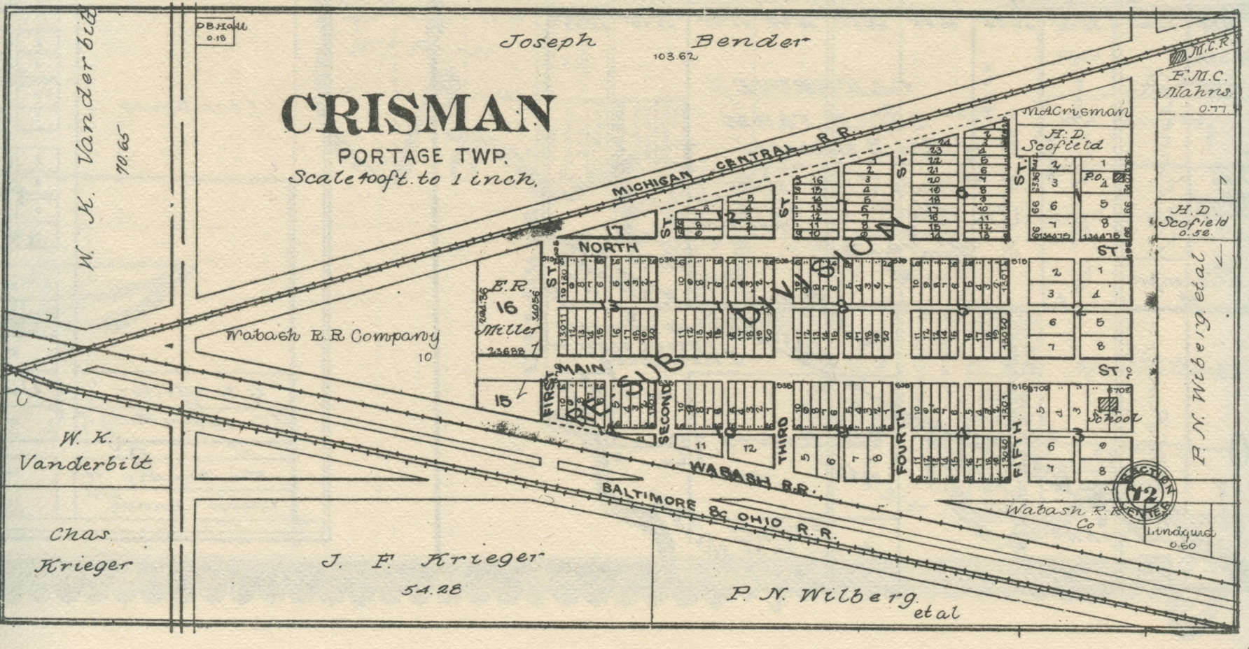
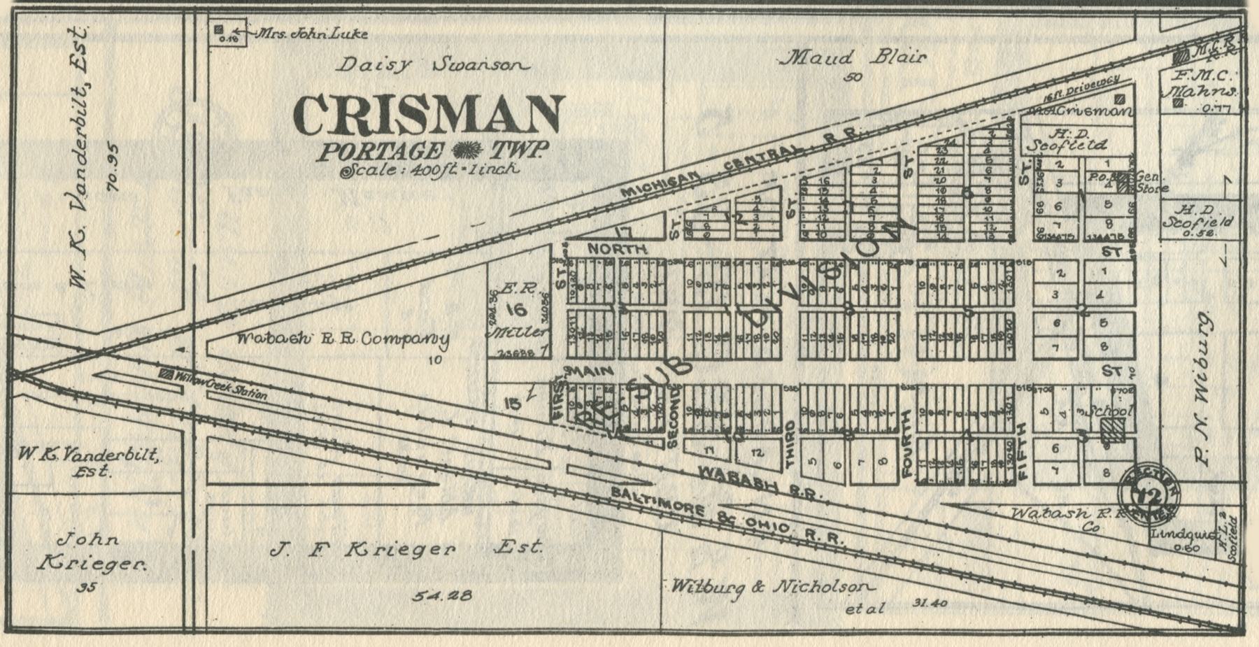
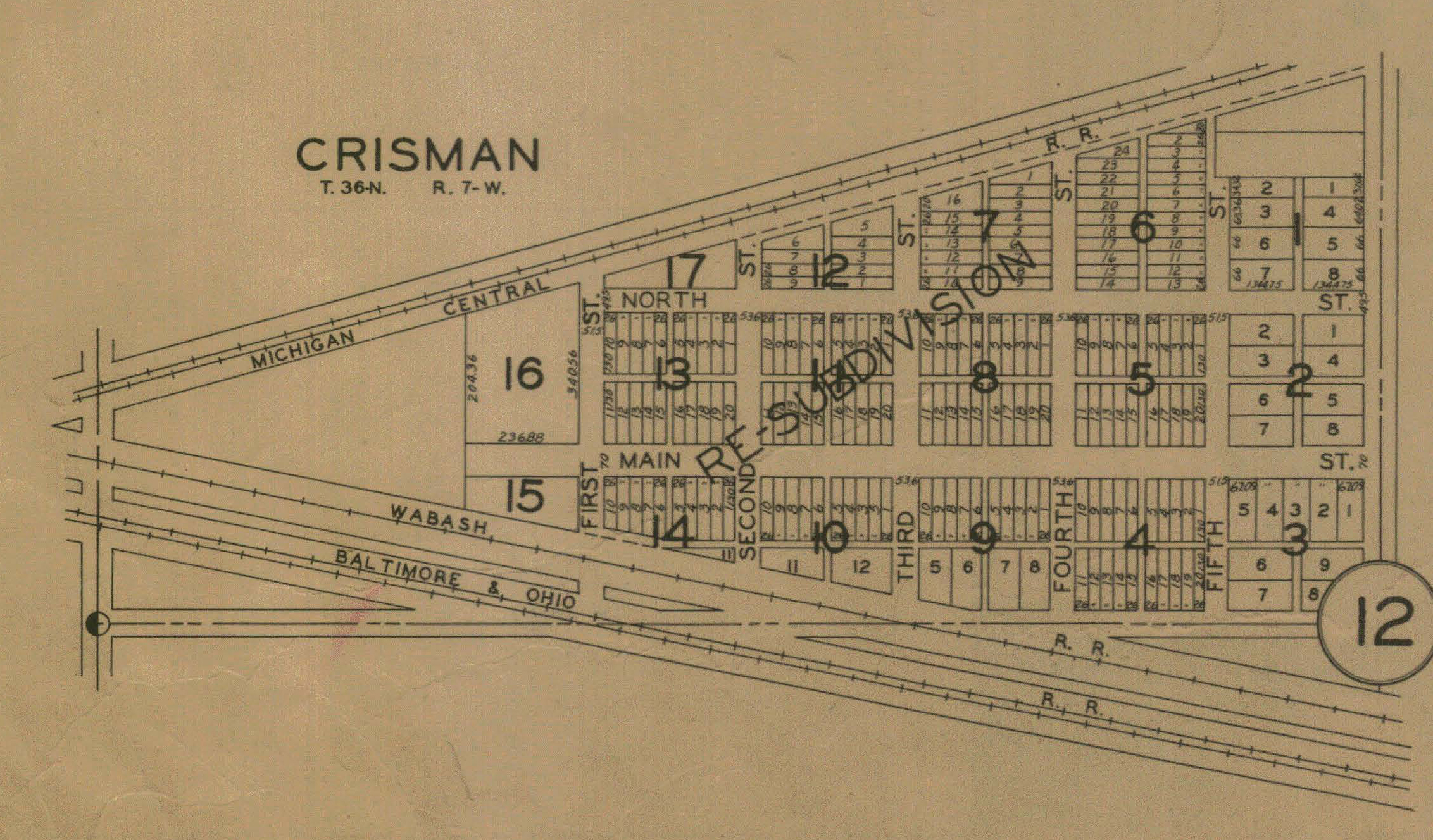
Crisman, 1906
Crisman, 1921
Crisman, 1928
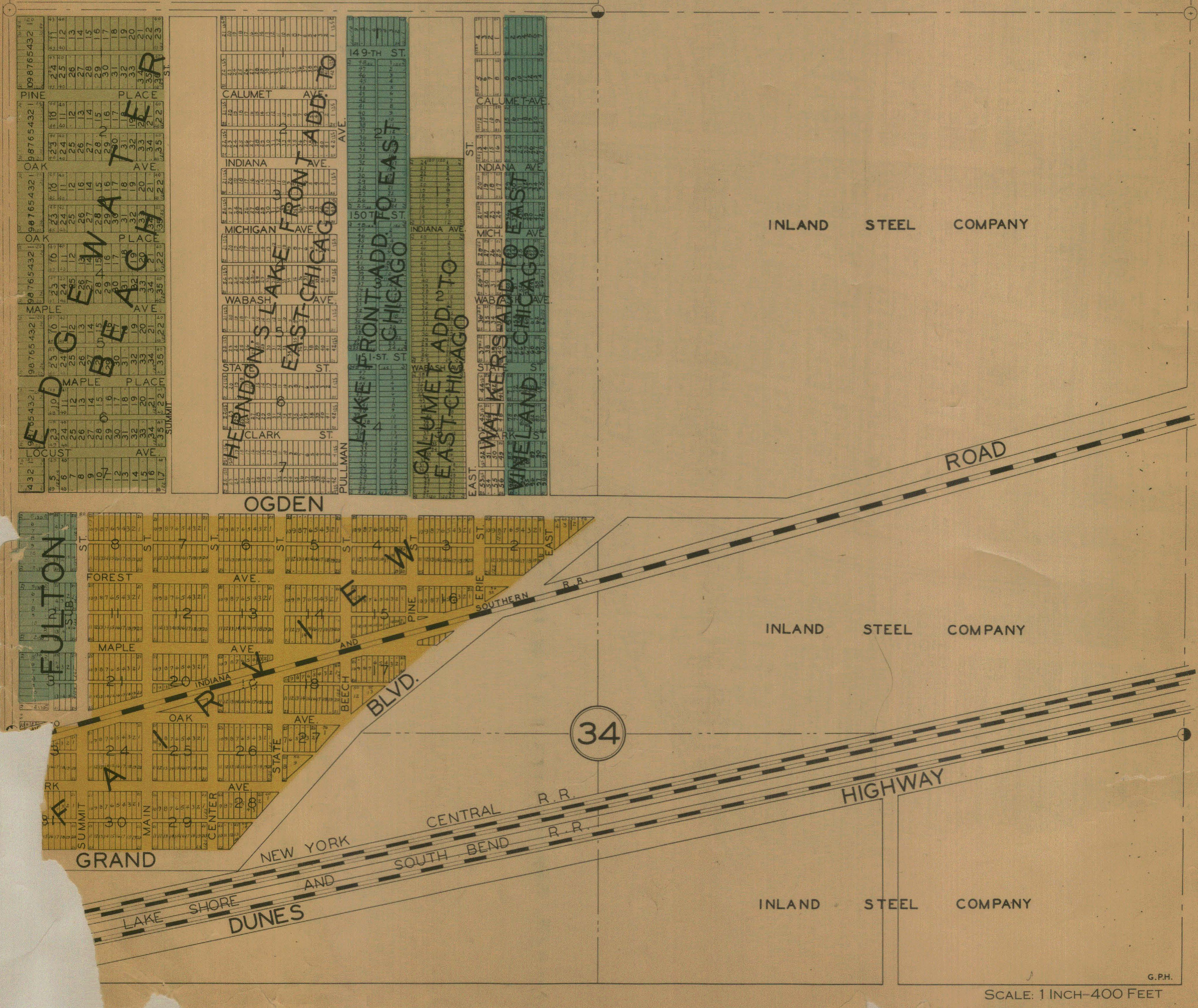
Fairview, 1928
Fairview, no date
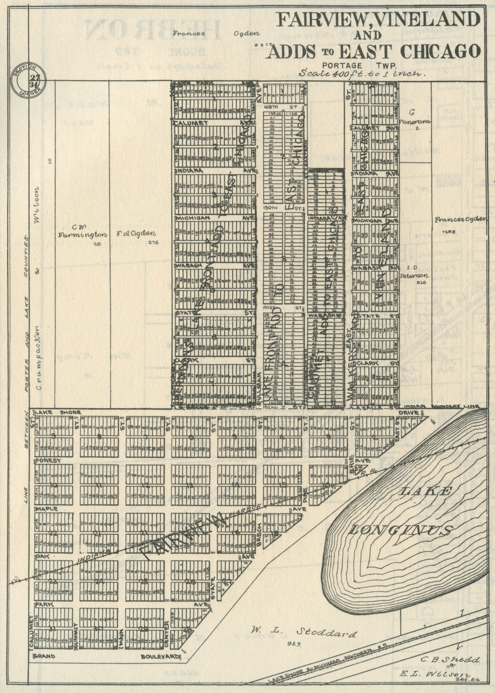
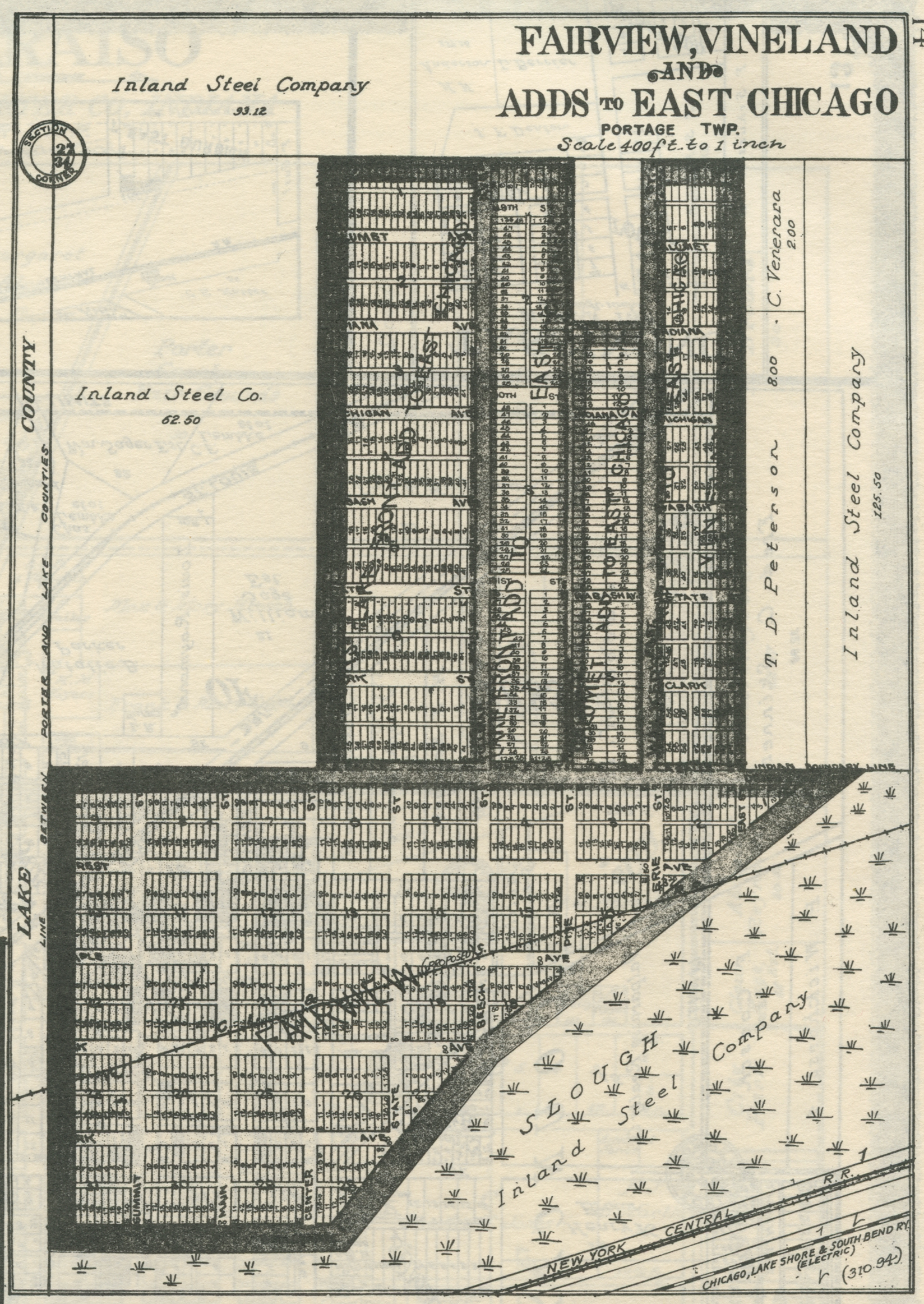
Fairview and Vineland Additions to East Chicago, 1906
Fairview and Vineland Additions to East Chicago, 1921
Fairview and Vineland Additions, 1928
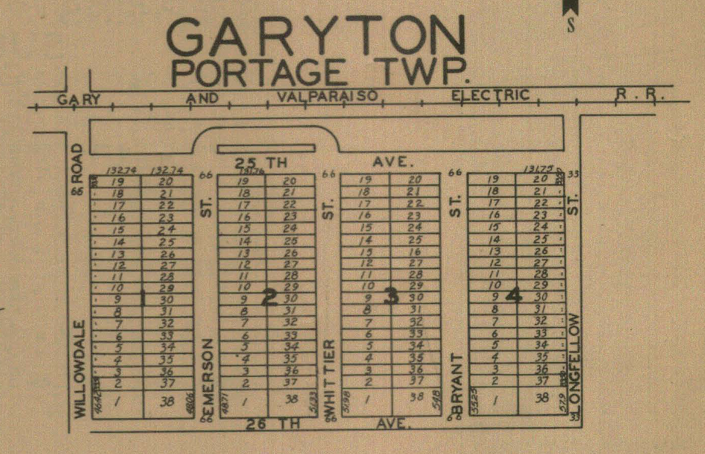
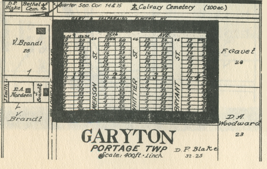
Garyton, 1921
Garyton, 1928
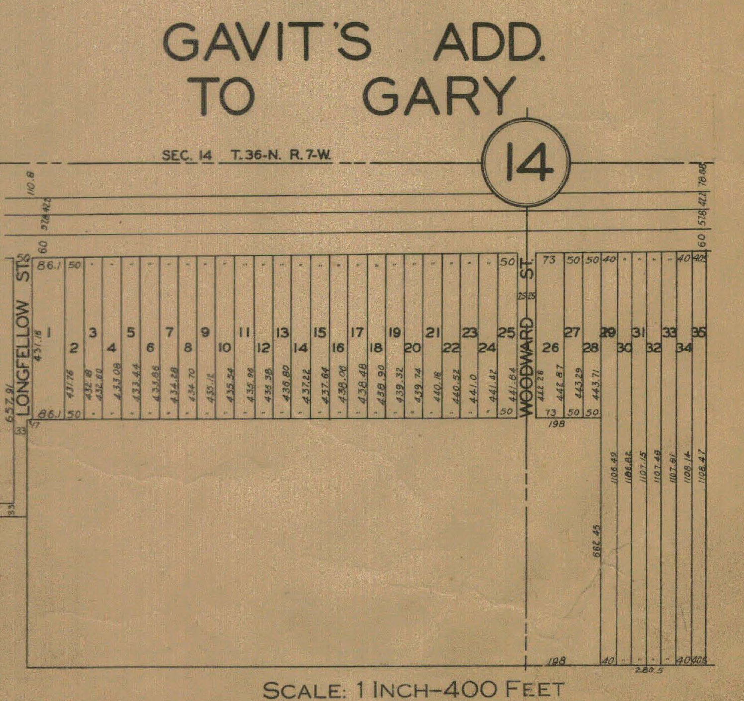
Gavit's Addition, 1928
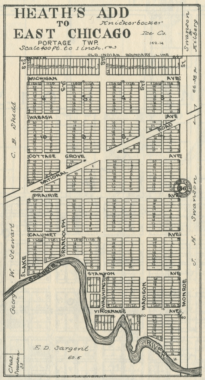
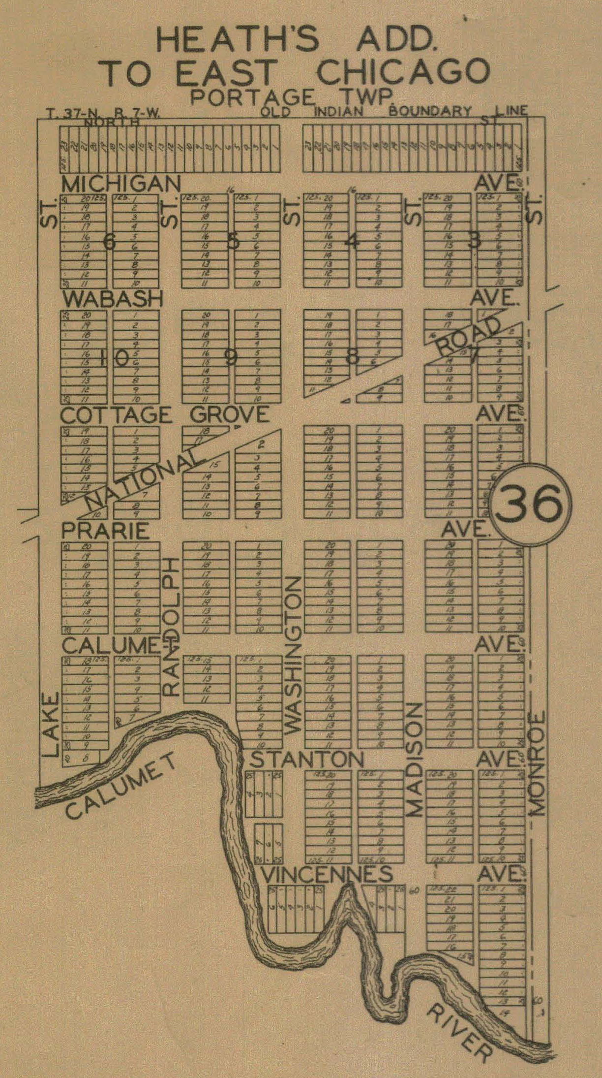
Heath's Addition to East Chicago, 1906
Heath's Addition to East Chicago, 1921
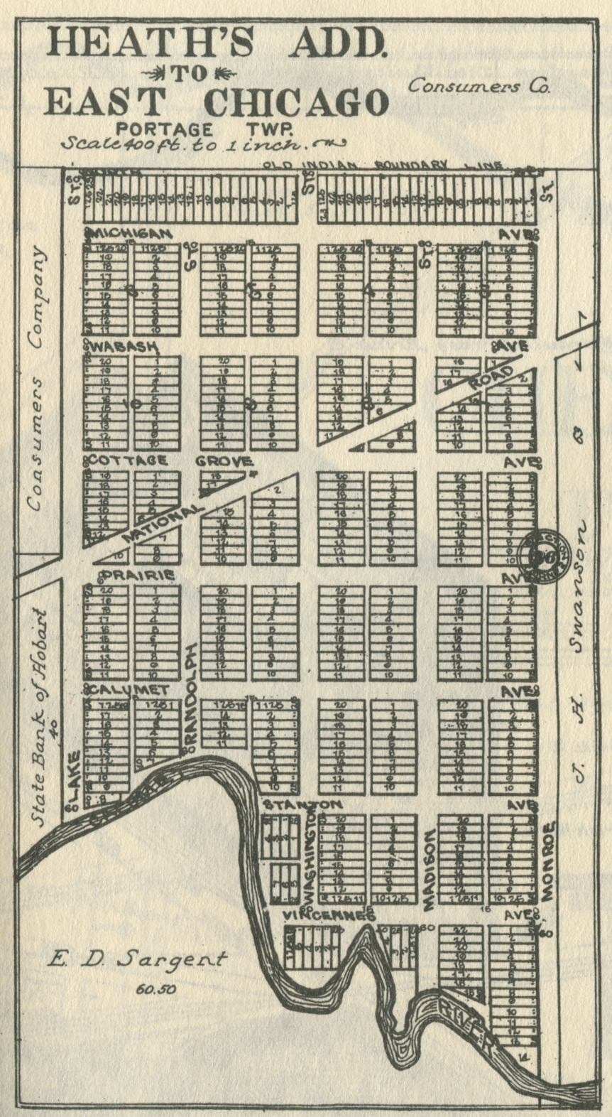
Heath's Addition, 1928
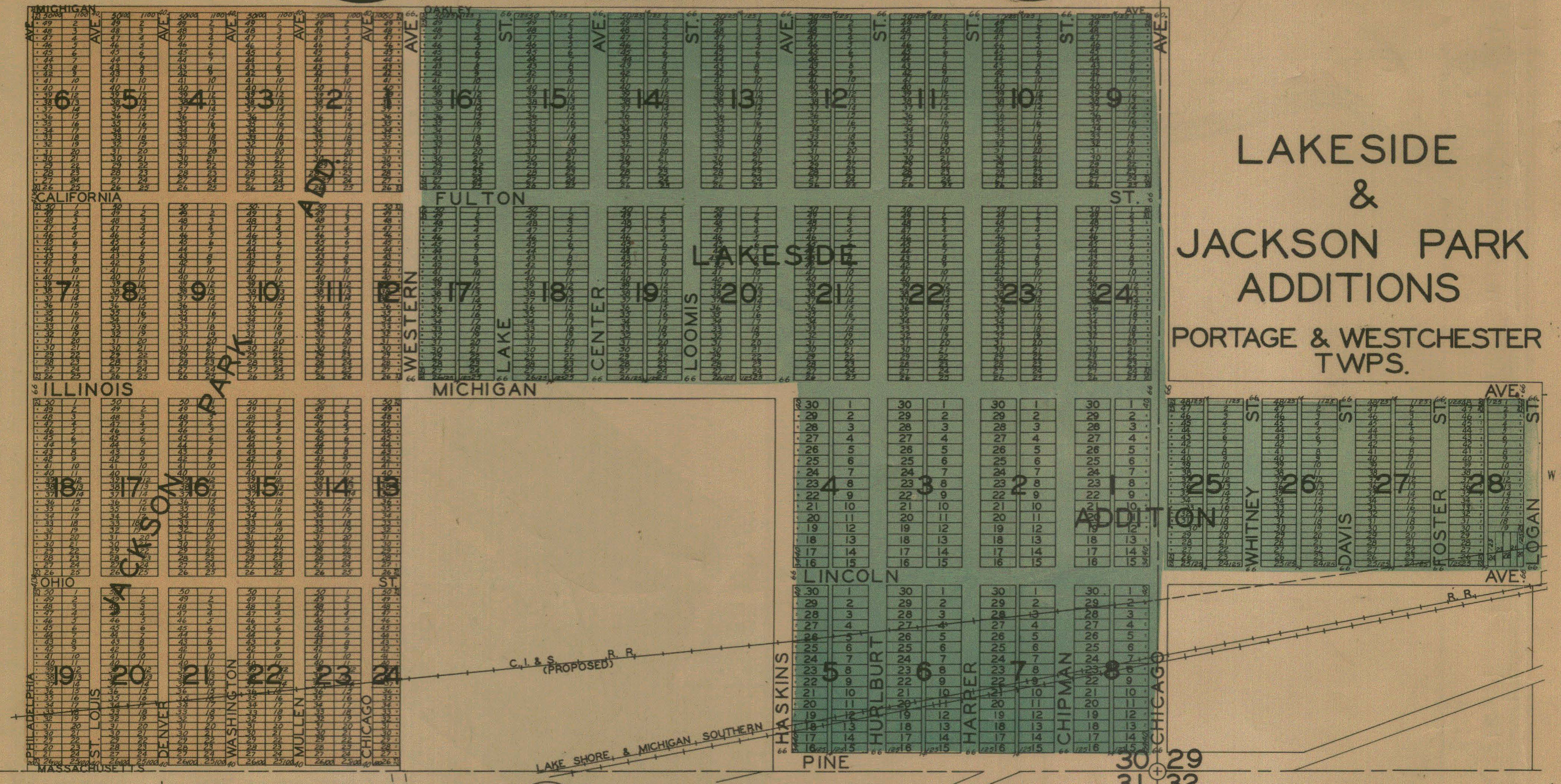
Jackson Park Addition, 1928
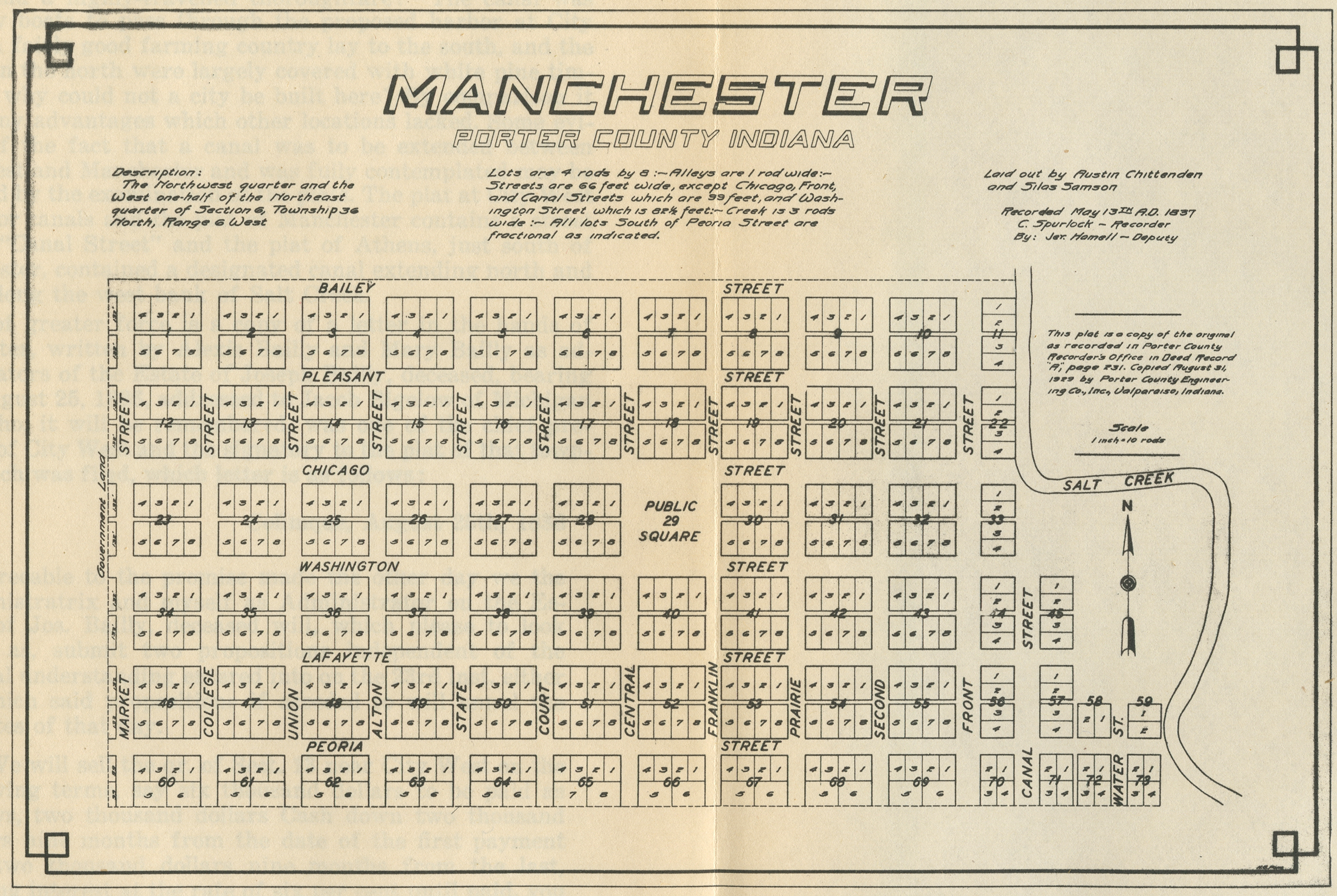
Manchester, 1837 [a "Dream
City"]
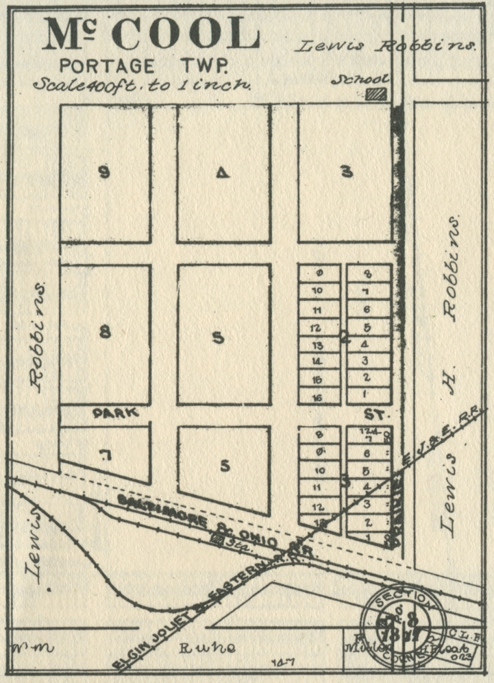
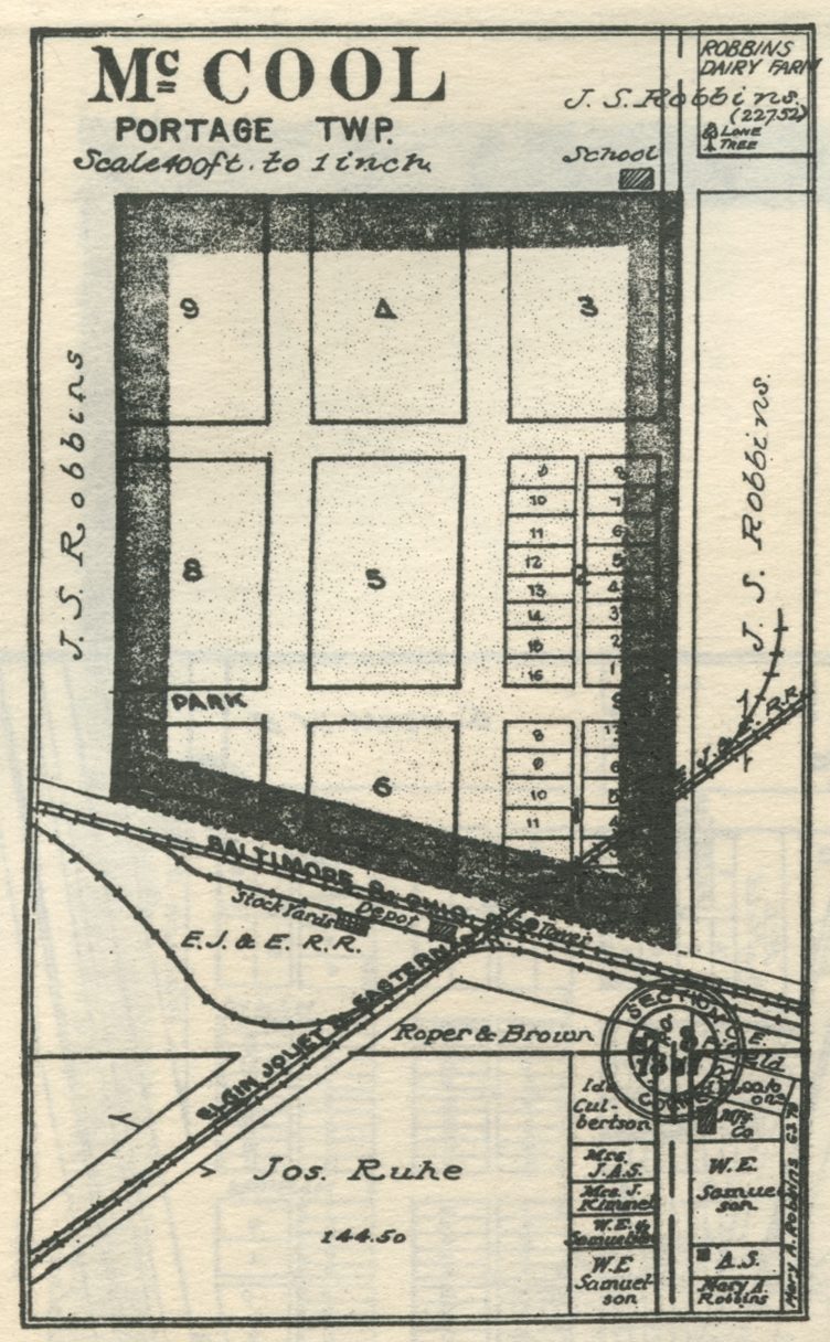
McCool, 1892
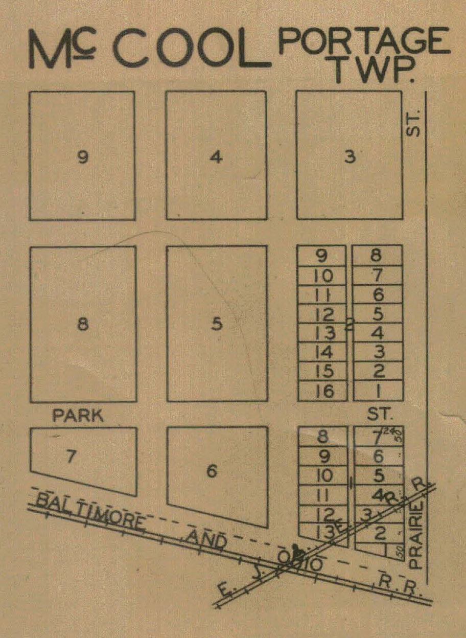
McCool, 1906
McCool, 1921
McCool, 1928
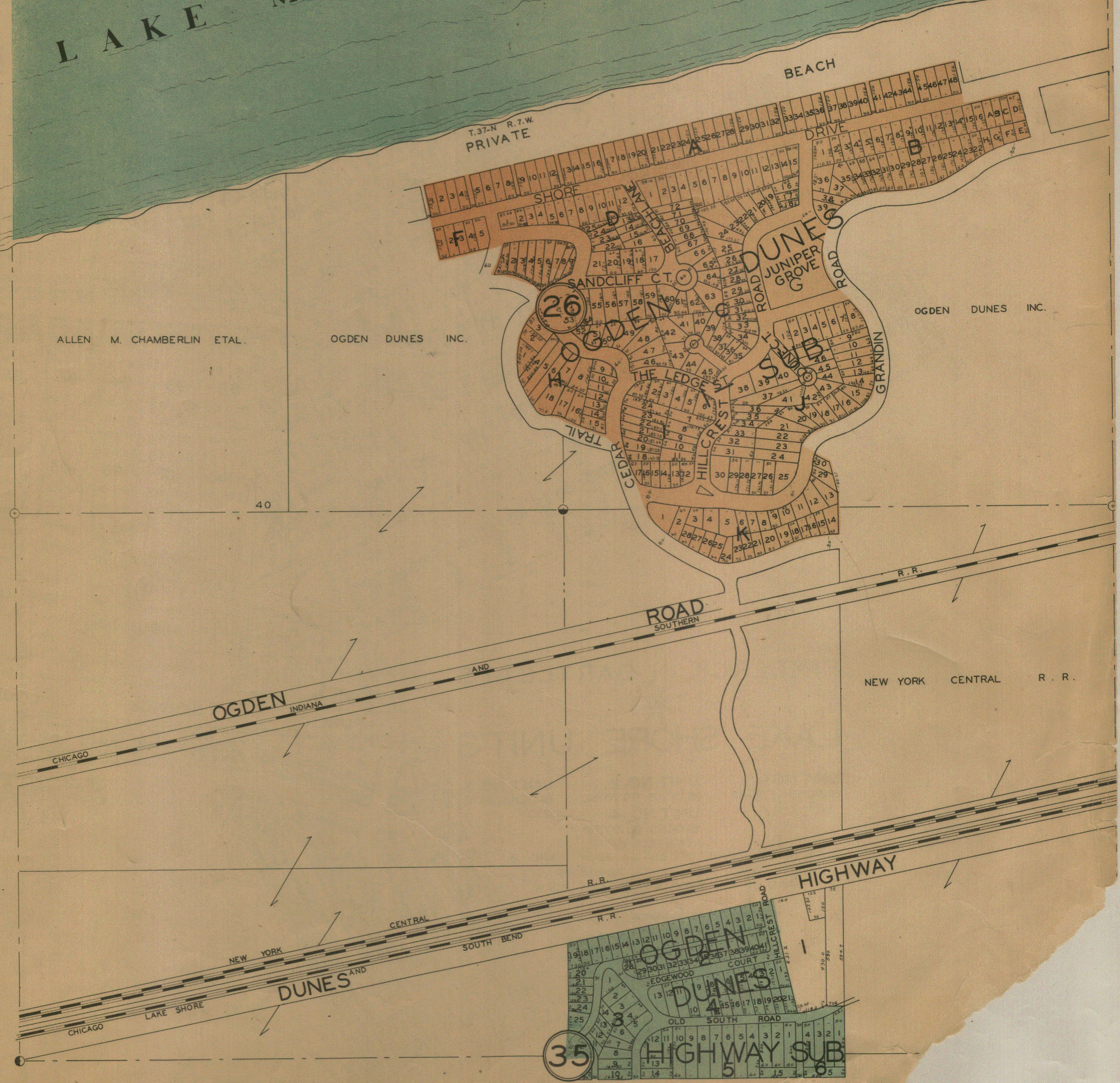
Ogden Dunes, 1928
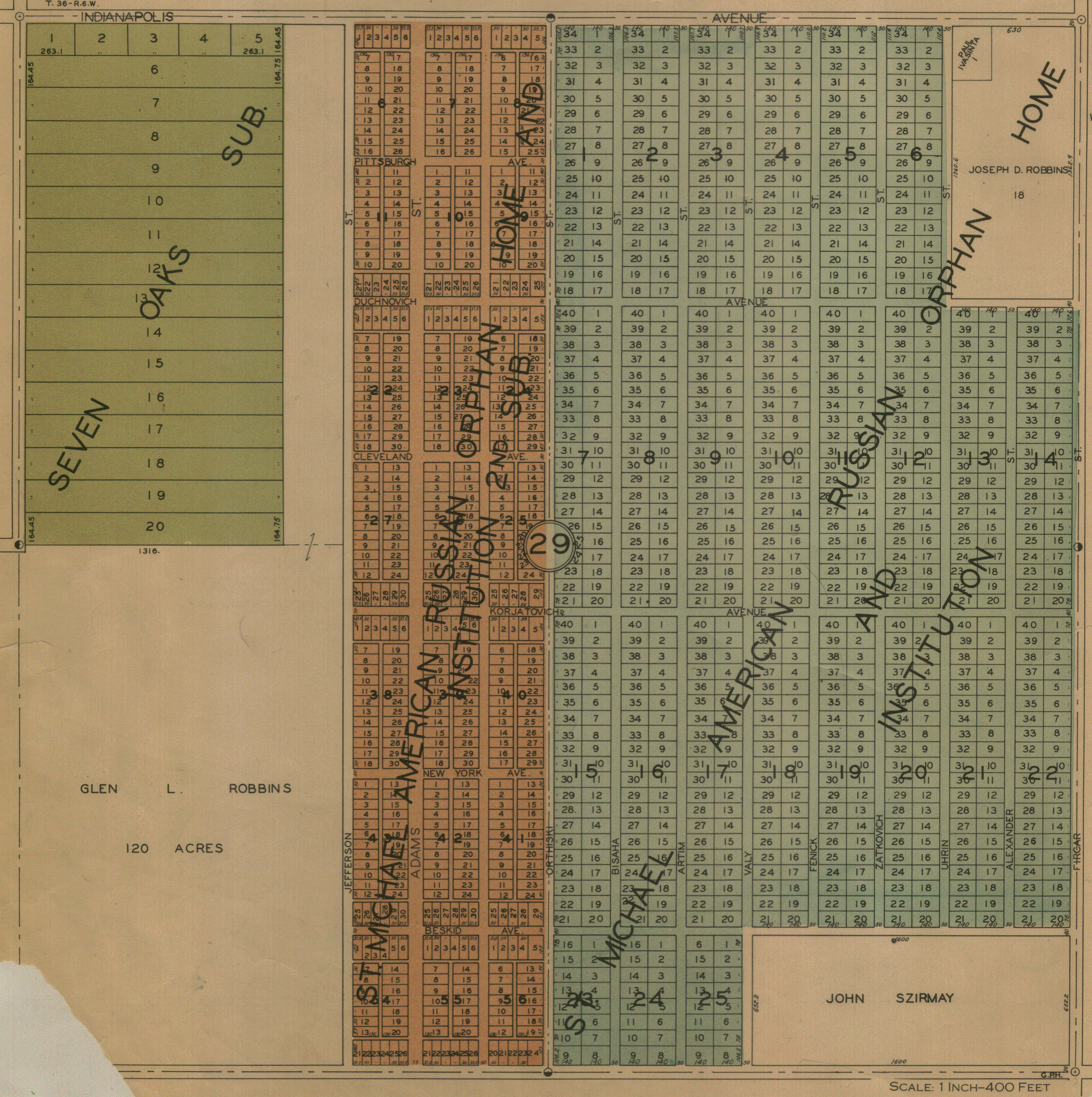
Seven Oaks and St. Michael's, 1928
Also see:
1956 Drury's Porter County Aerial Images for Portage Township