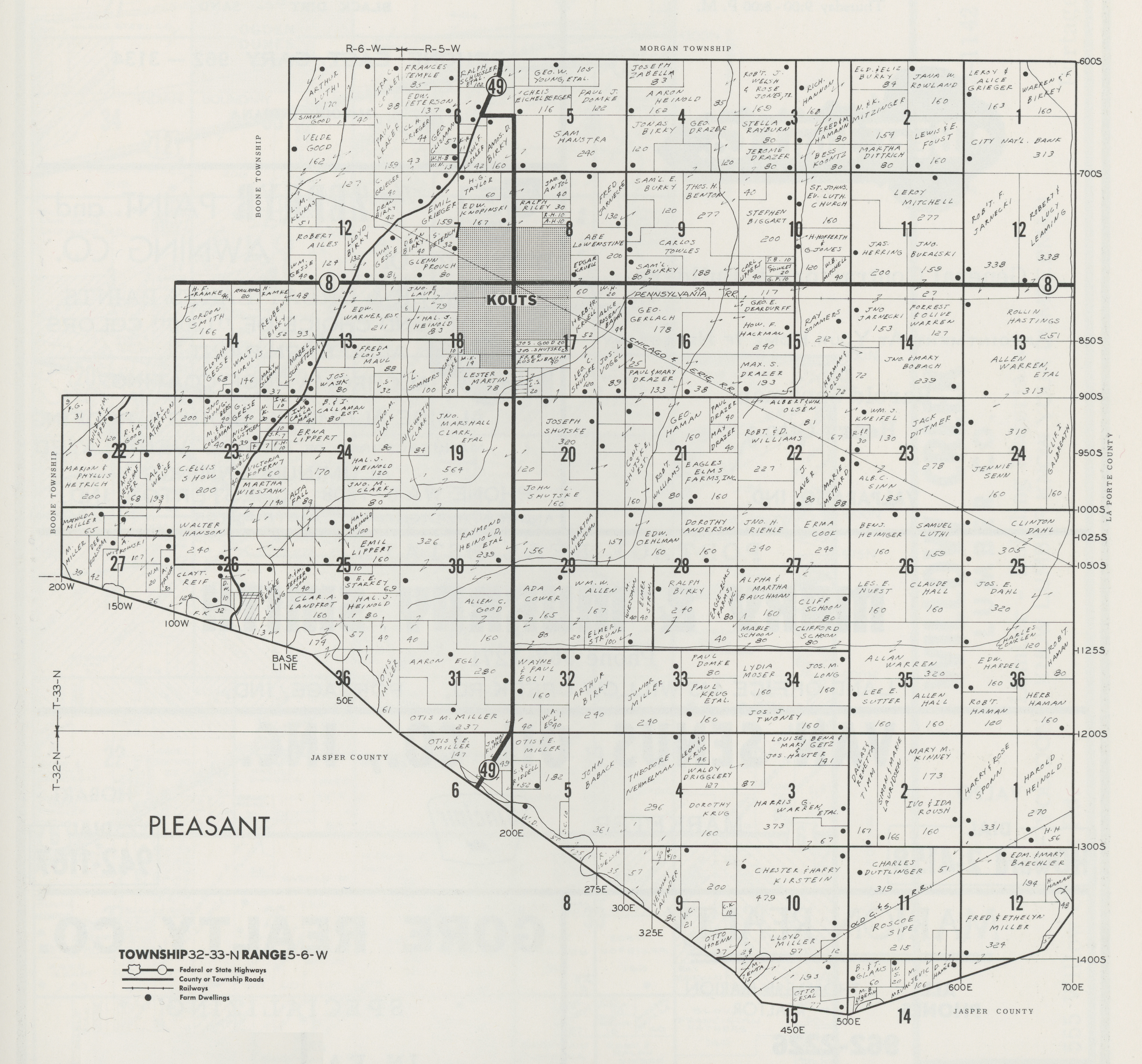
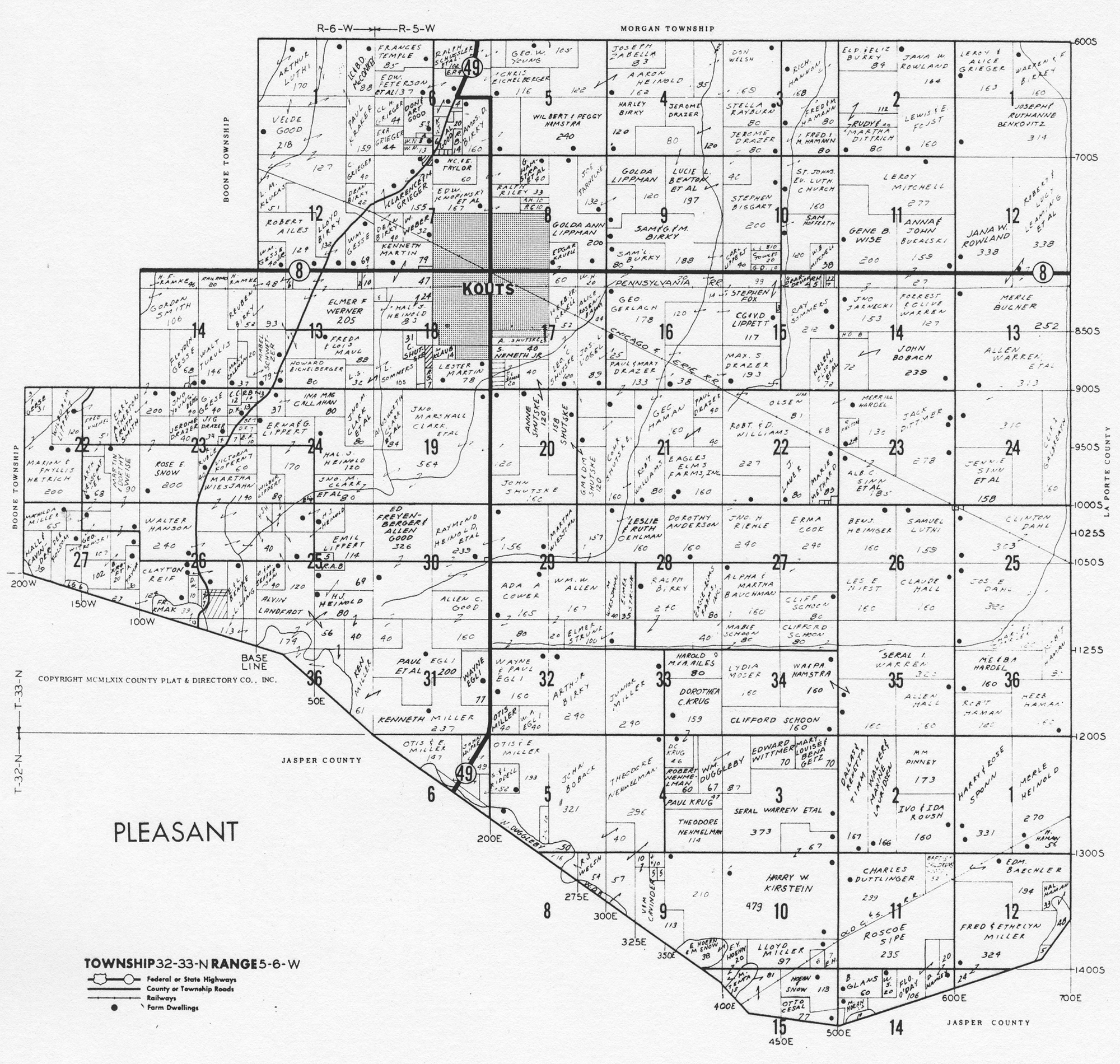
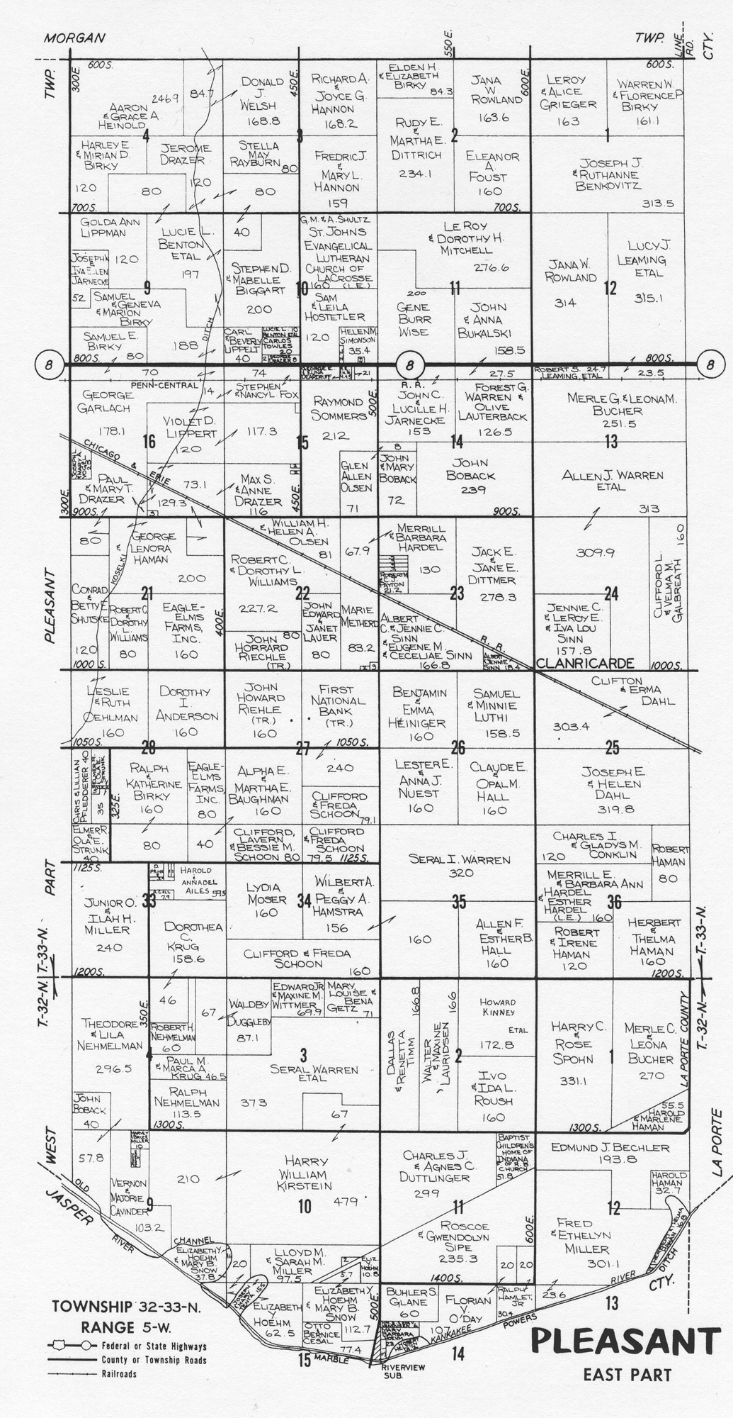
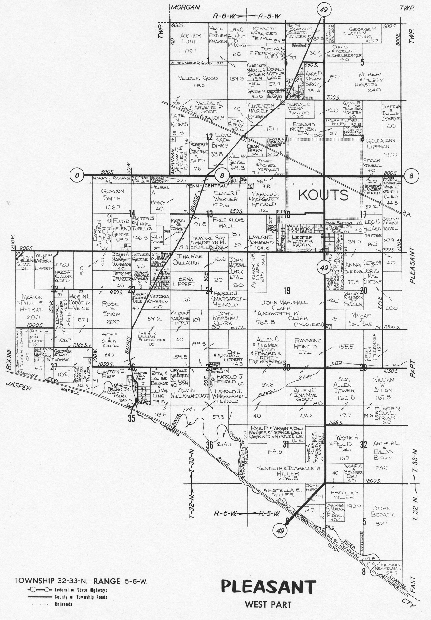
Pleasant Township MapsPleasant Township, Porter County plat maps . . . .
The following are Pleasant Township, Porter County,
Indiana, maps available on this website. Click the links below to access
full size images. Note that several of these images are large files and may take
considerable time to load on slower Internet connections, such as dialup.
Original Land Patents
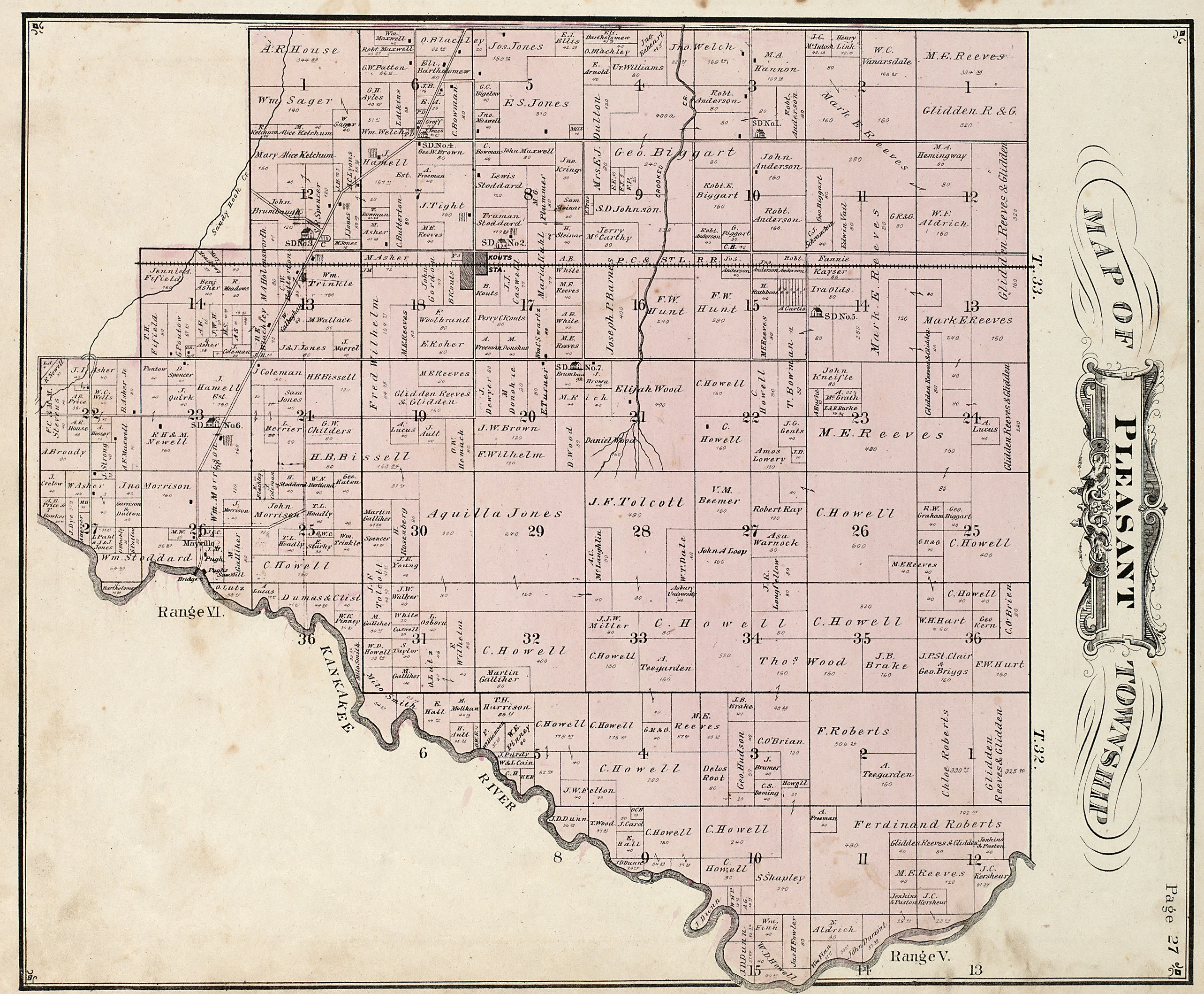
1876 Plat
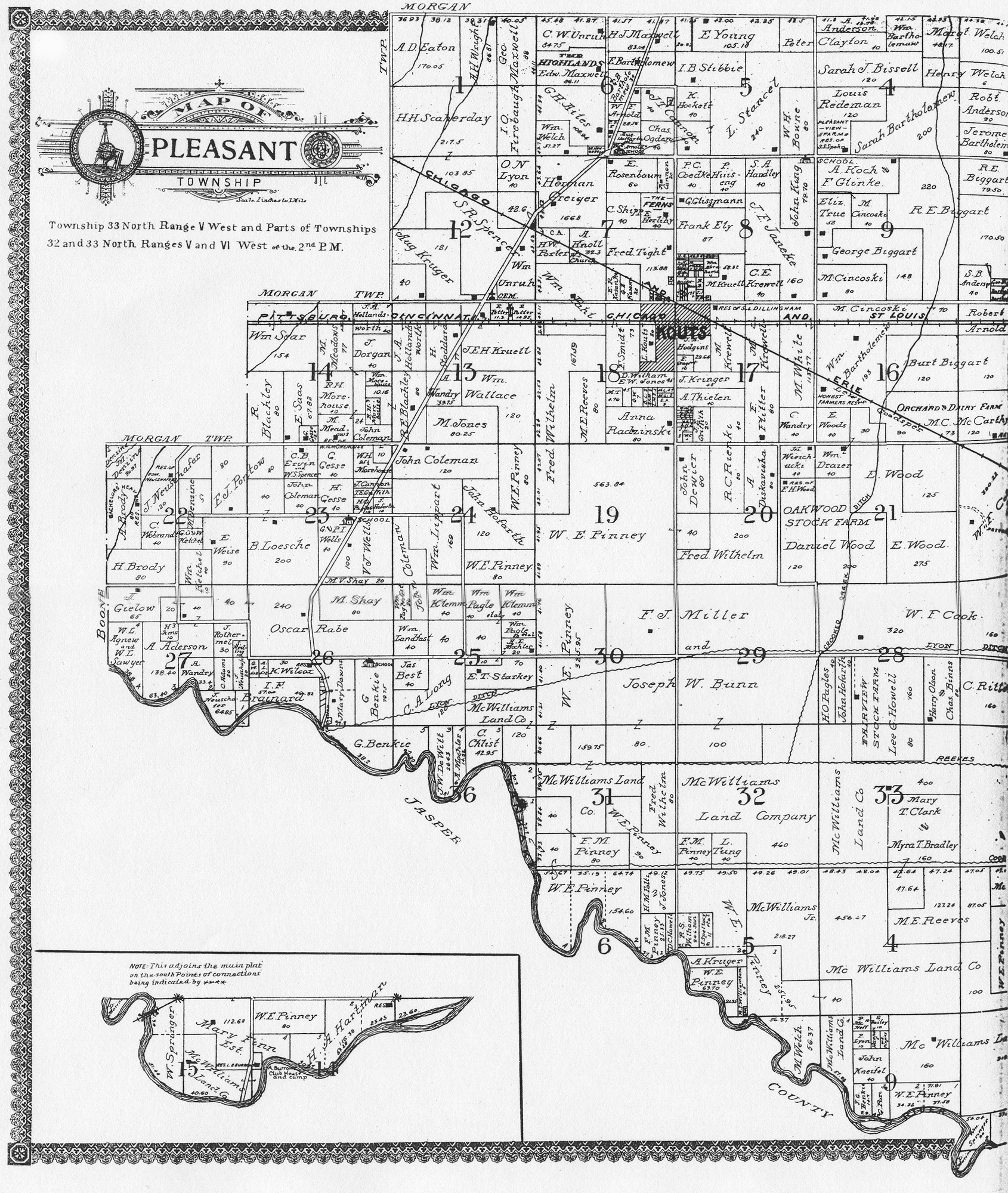
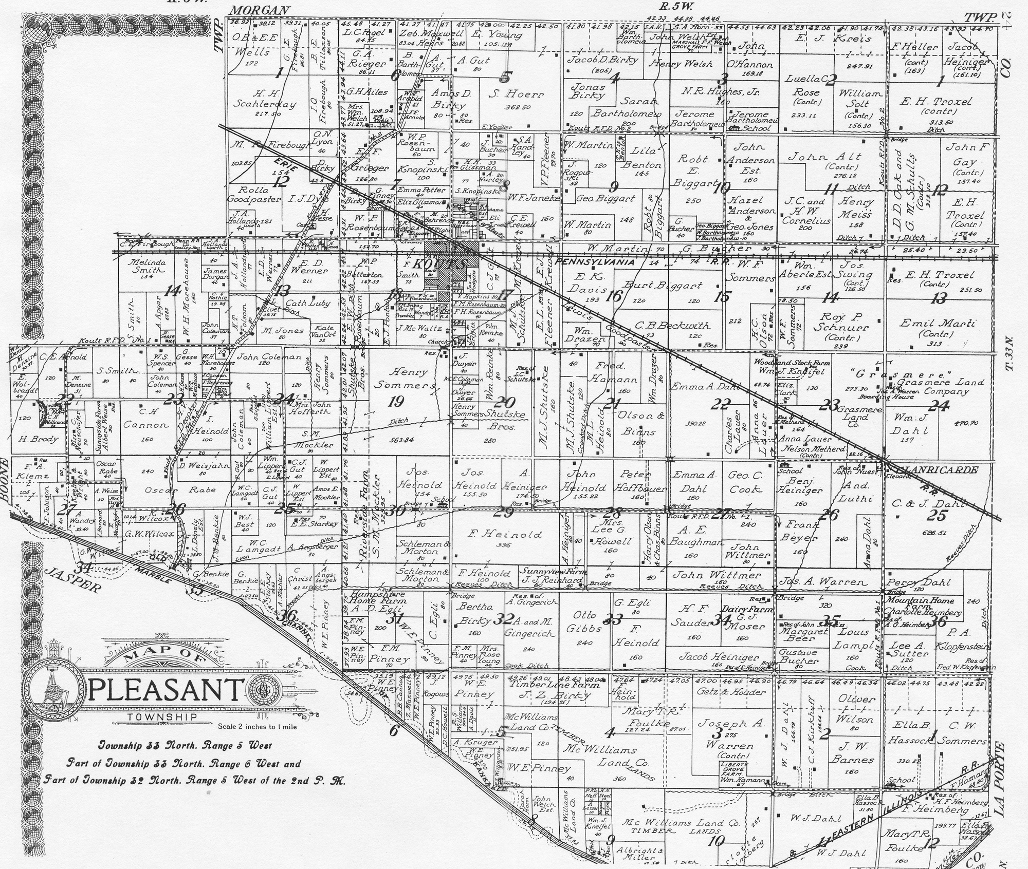
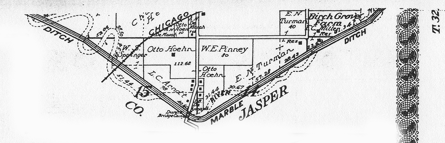
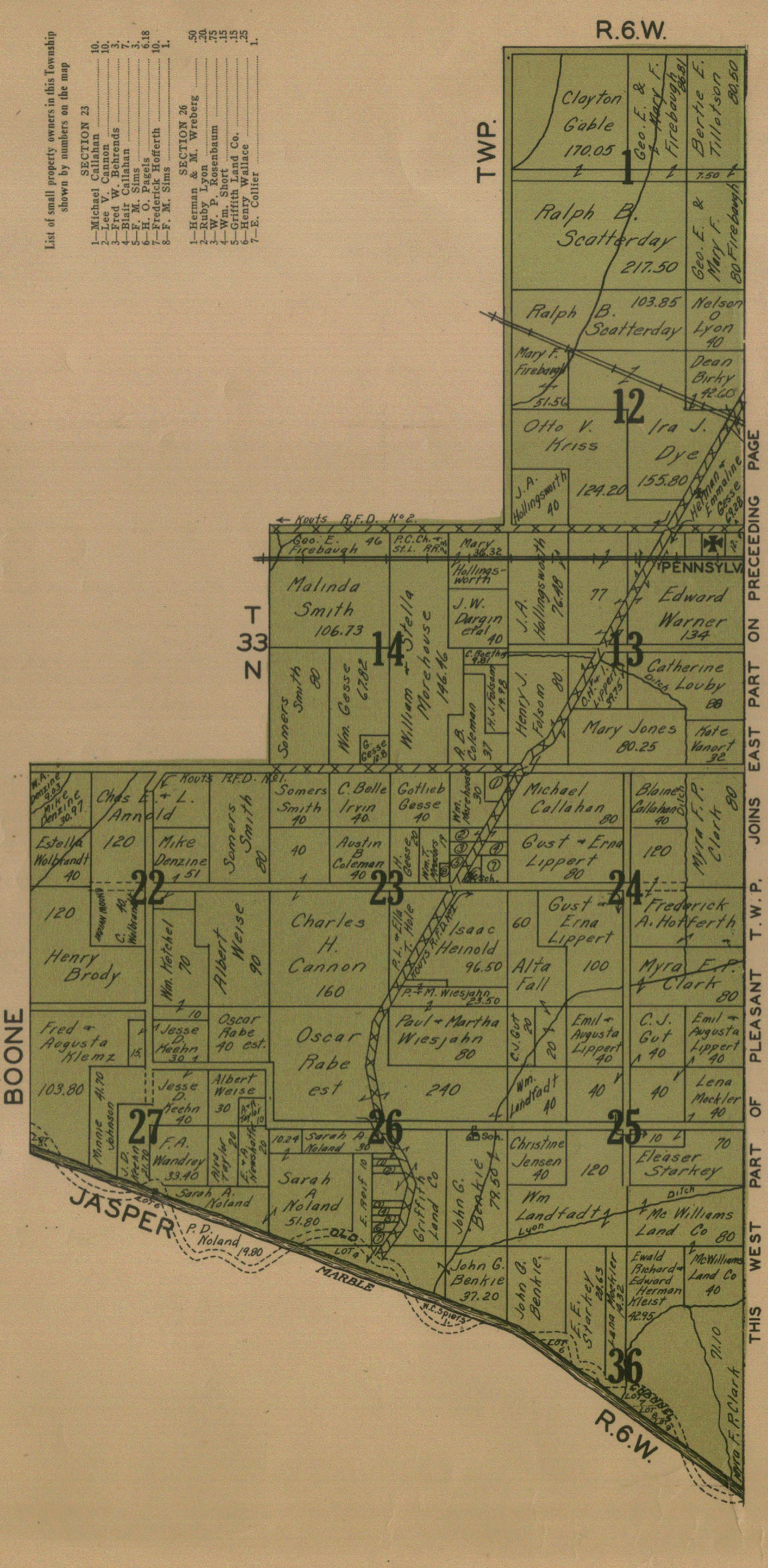
Map
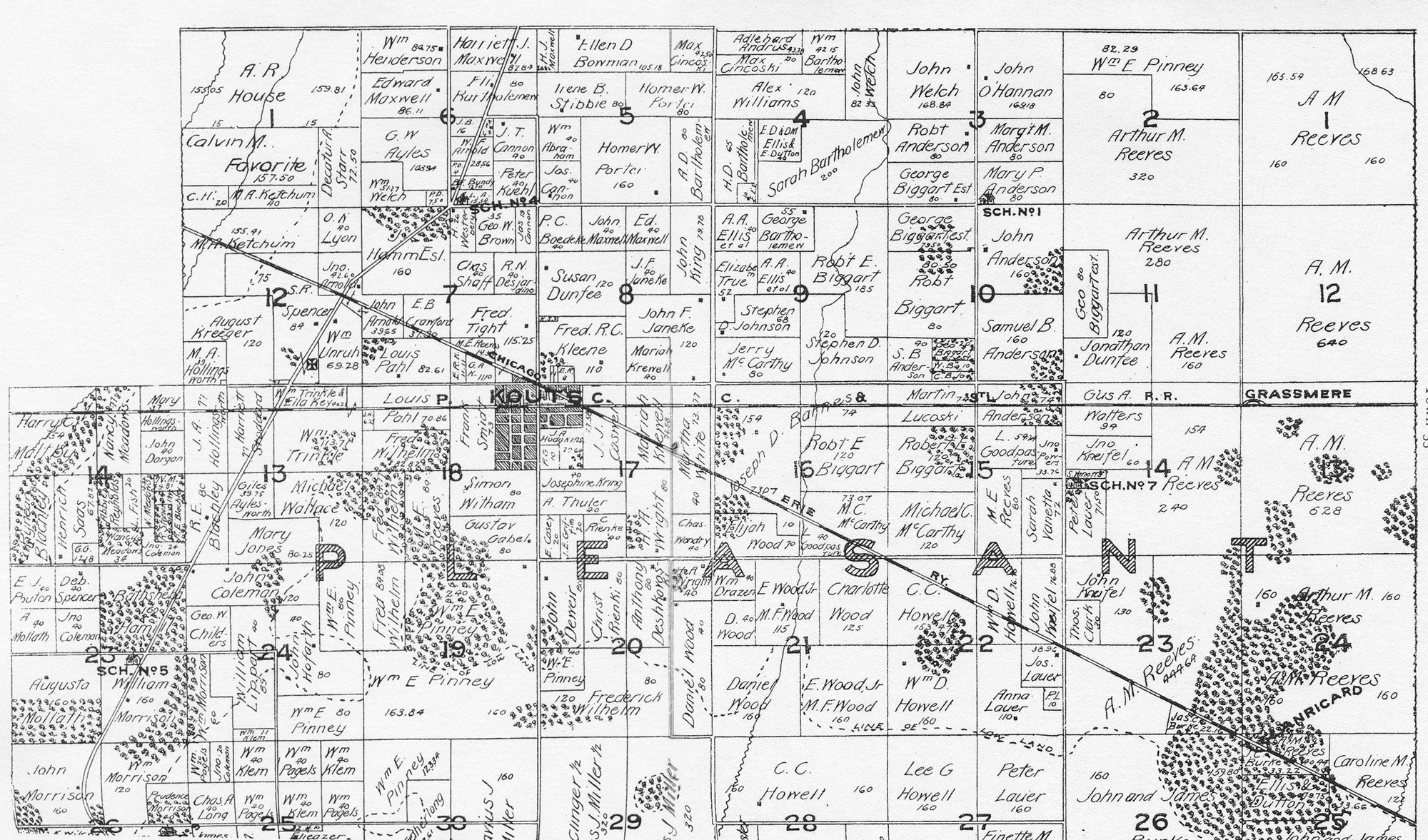
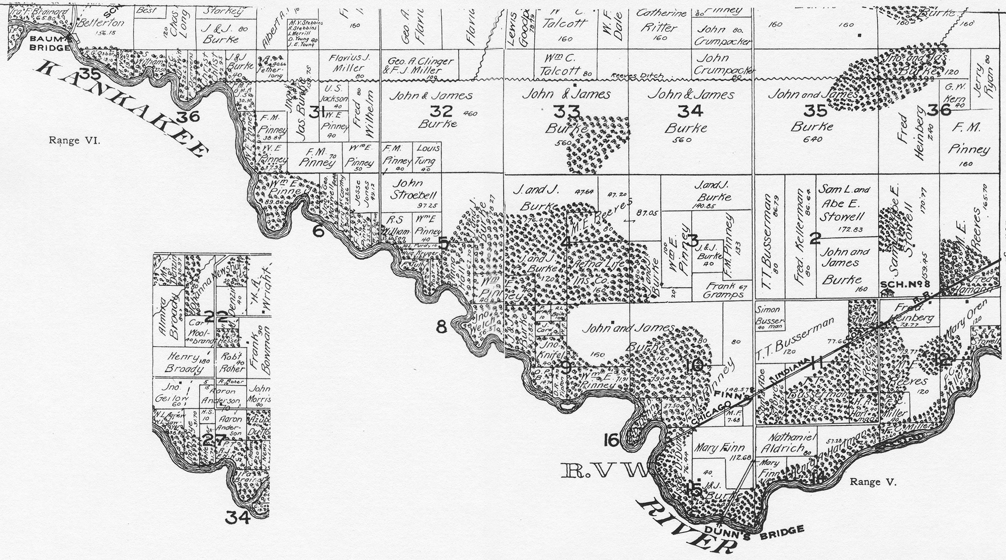
1895 Plat Map (North Half)
1895 Plat Map (South Half)
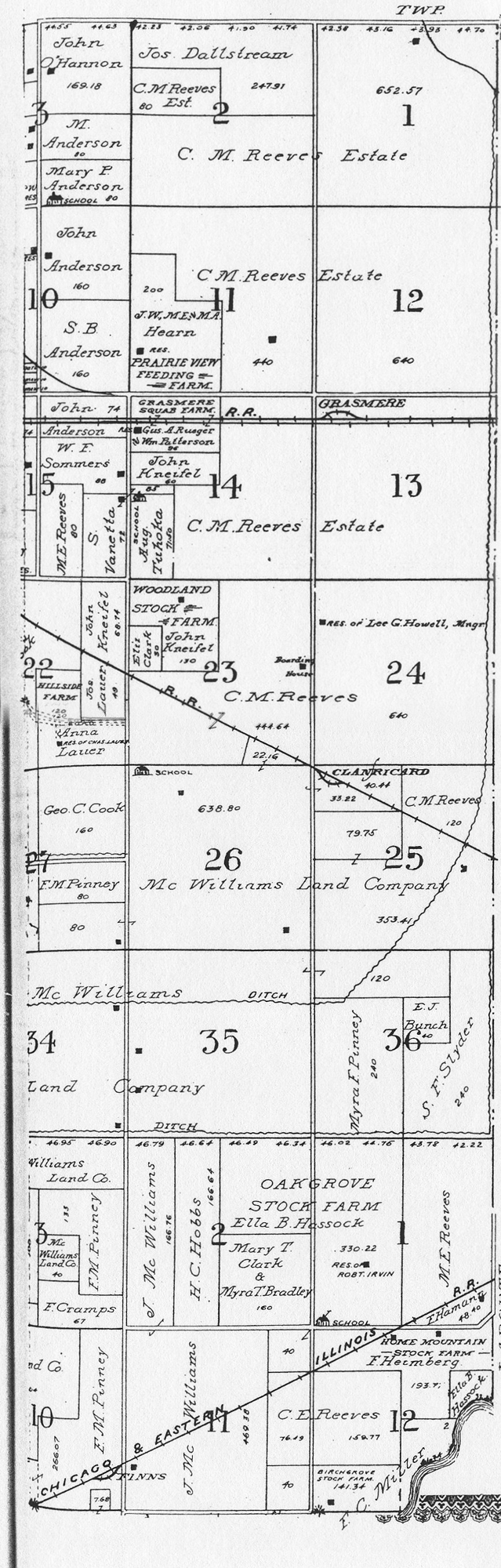
1906
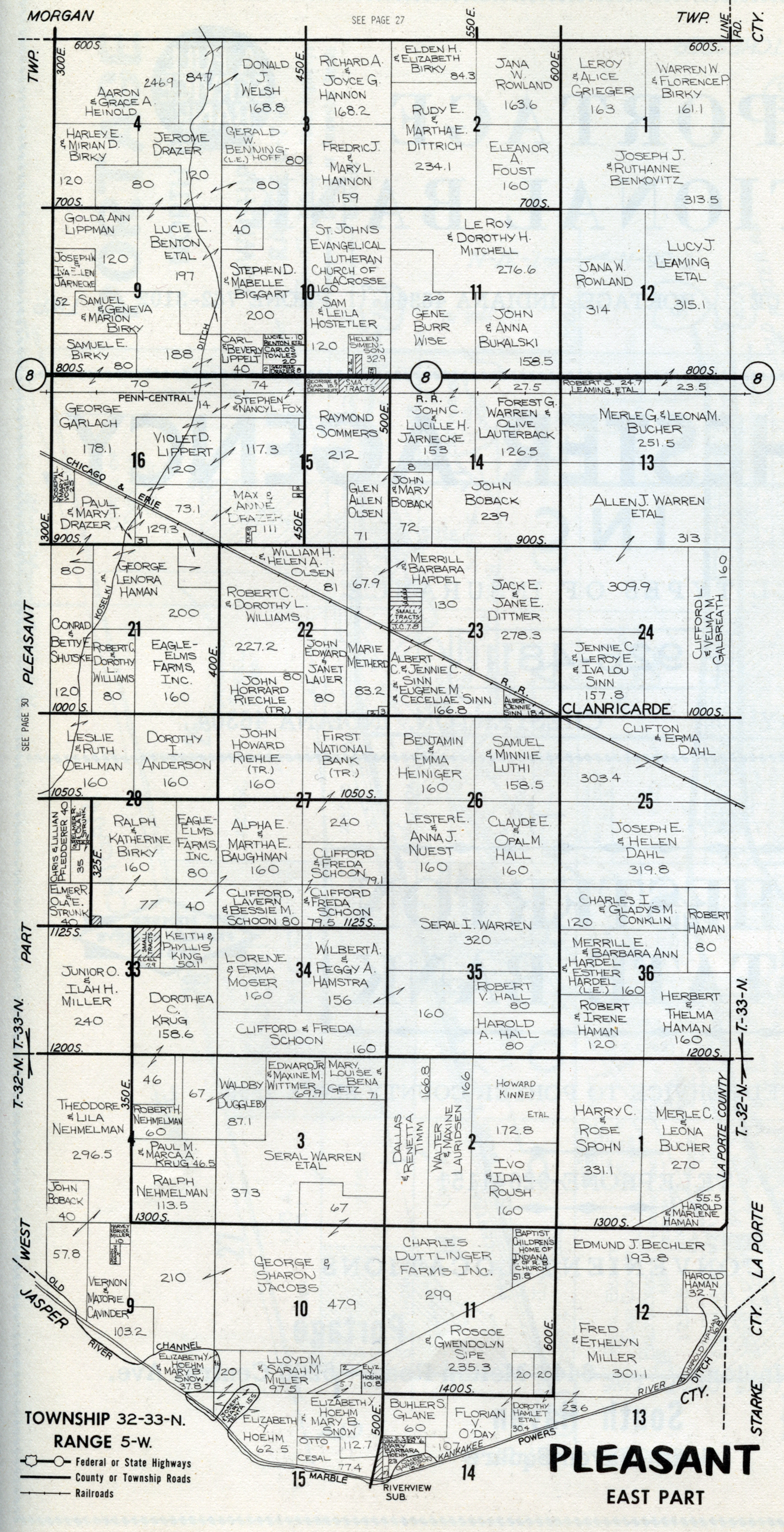
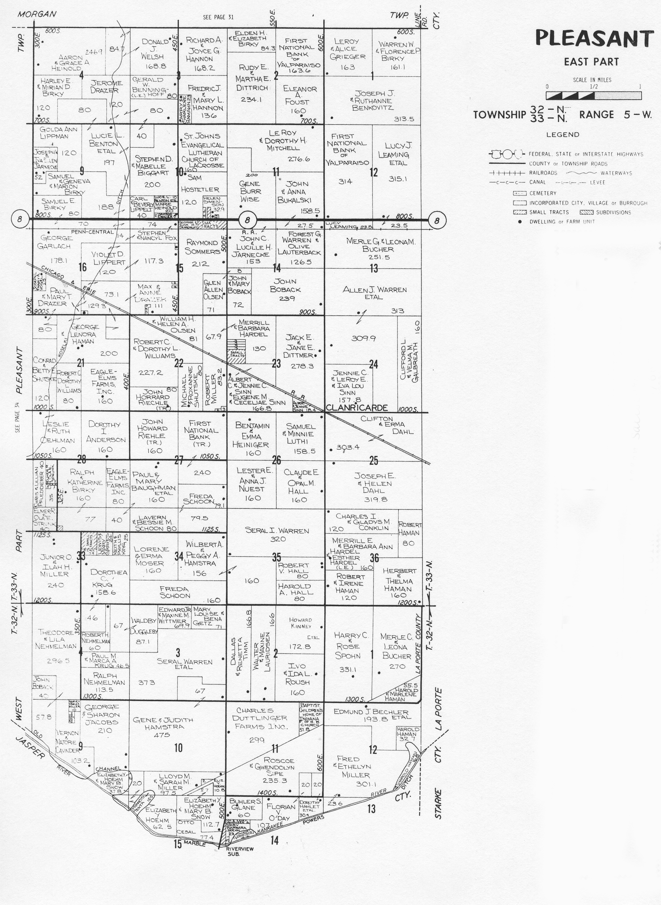
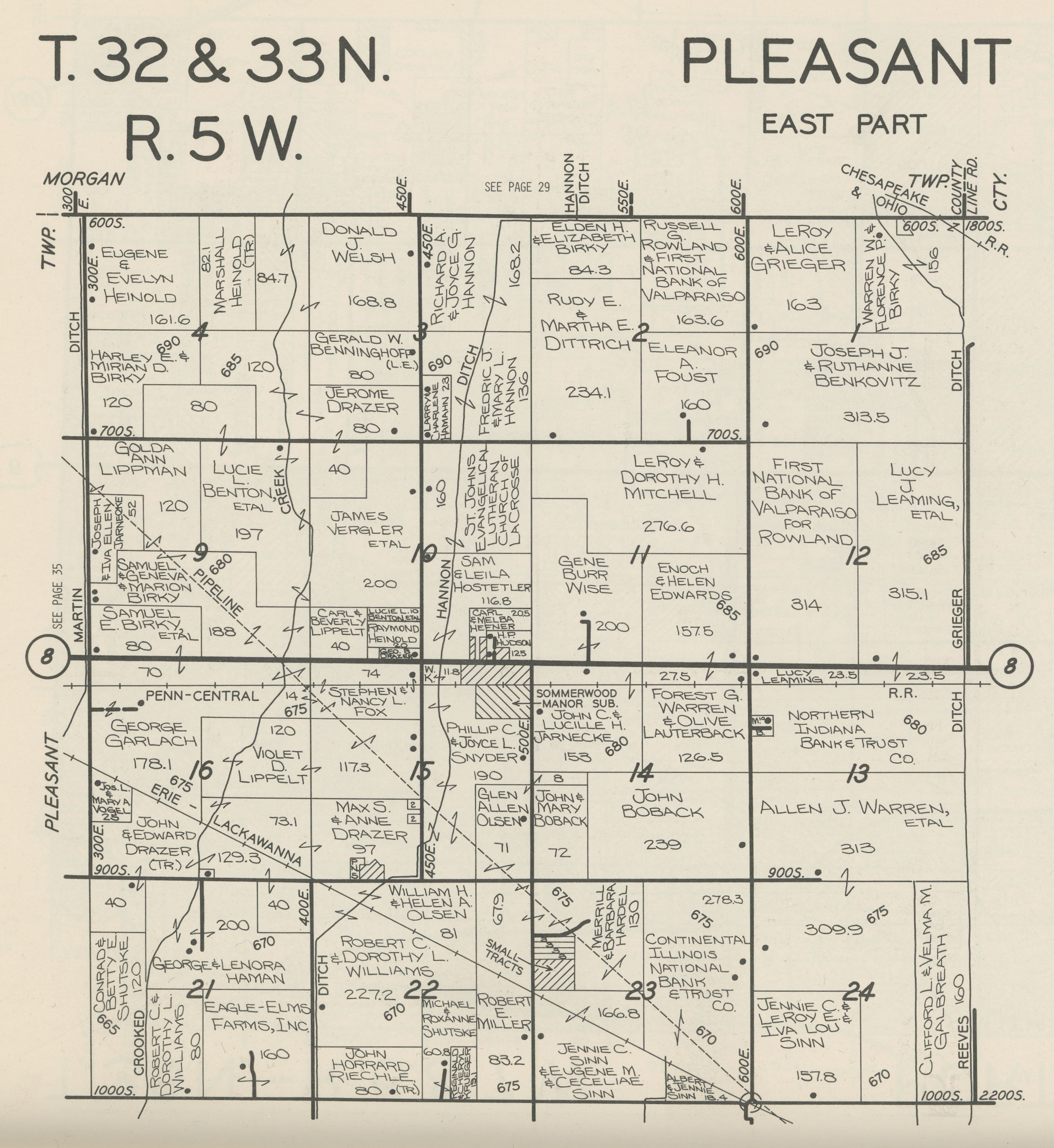
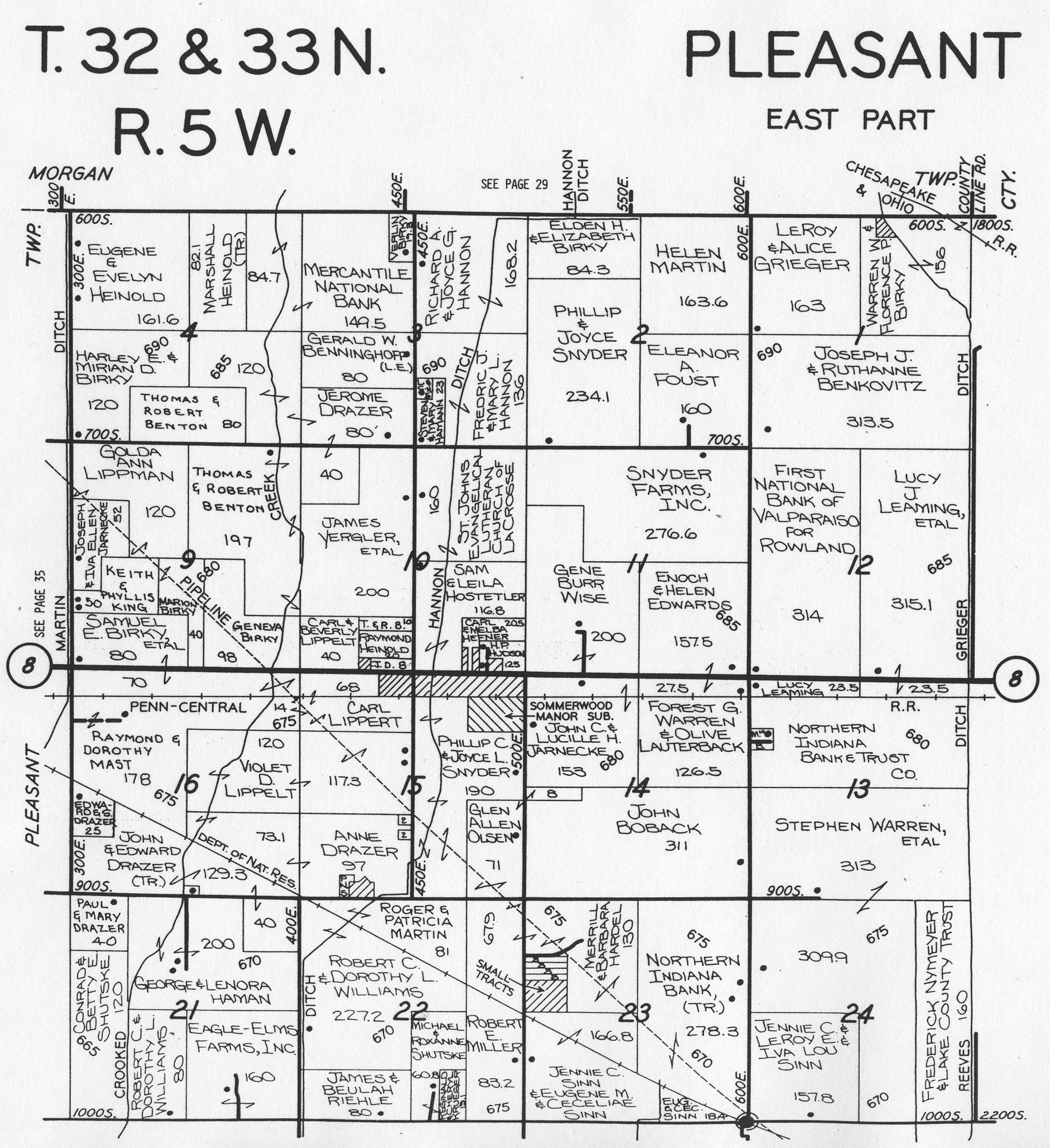
Plat Map (East Half)
1906
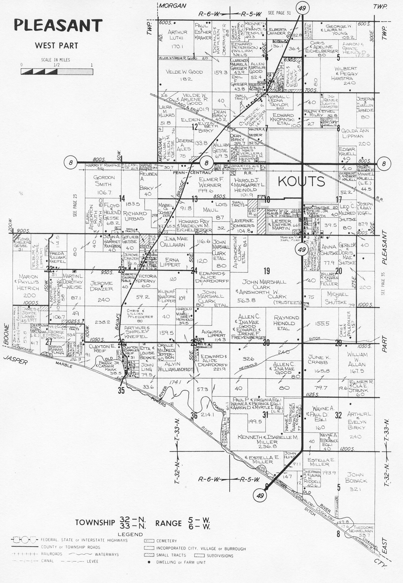
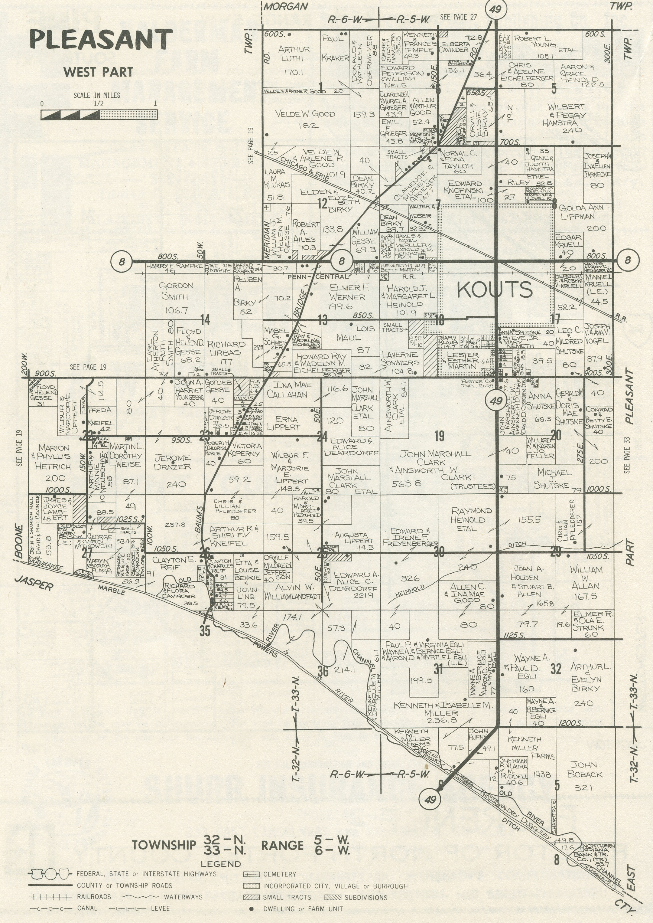
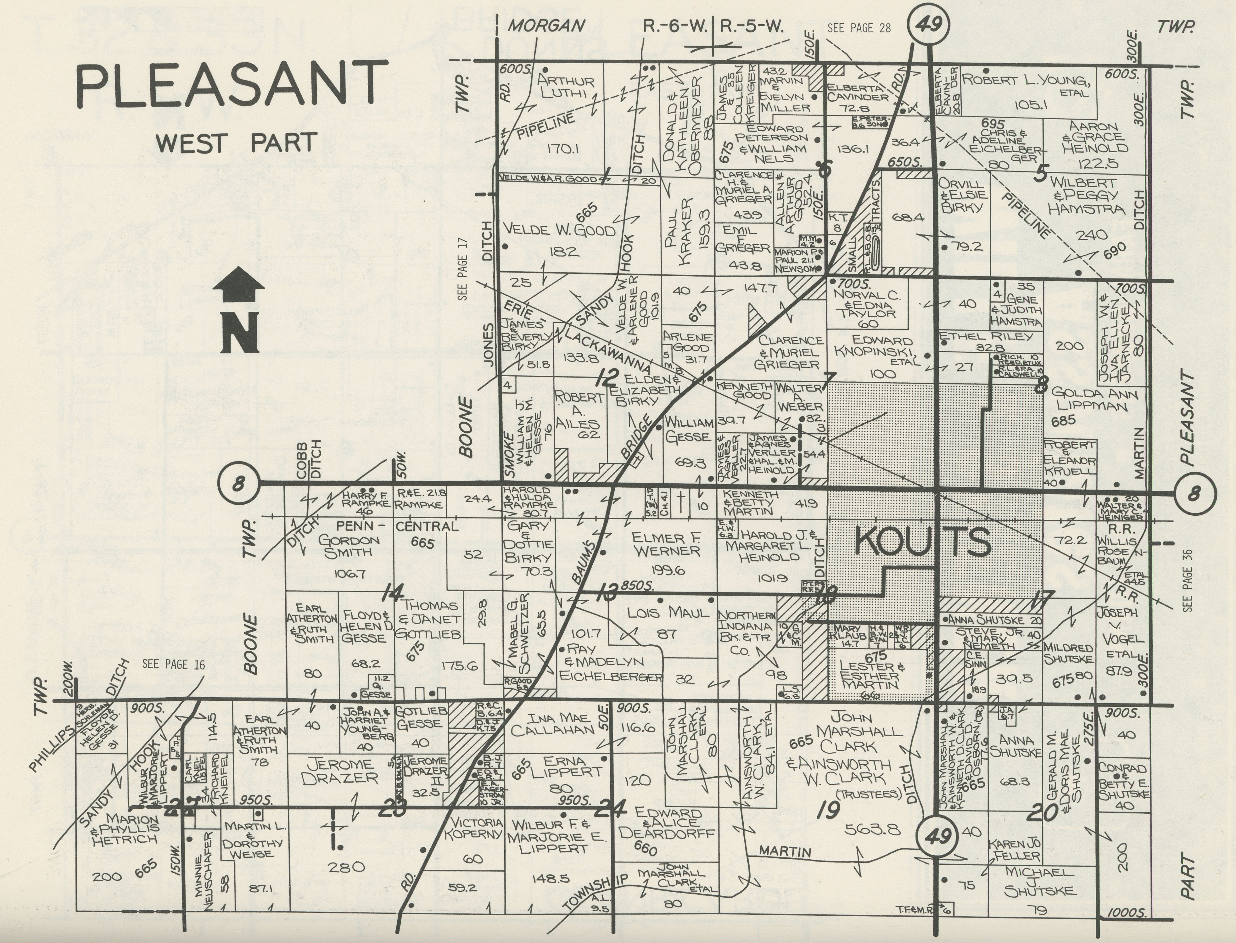
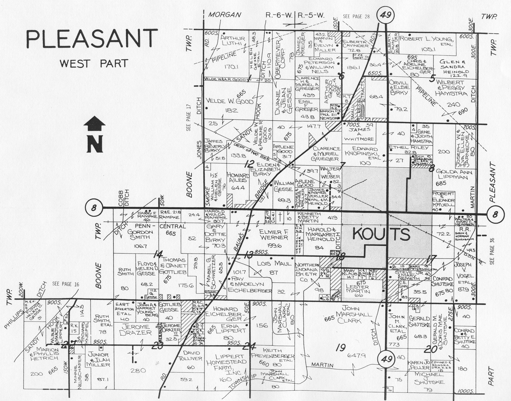
Plat Map (West Half)
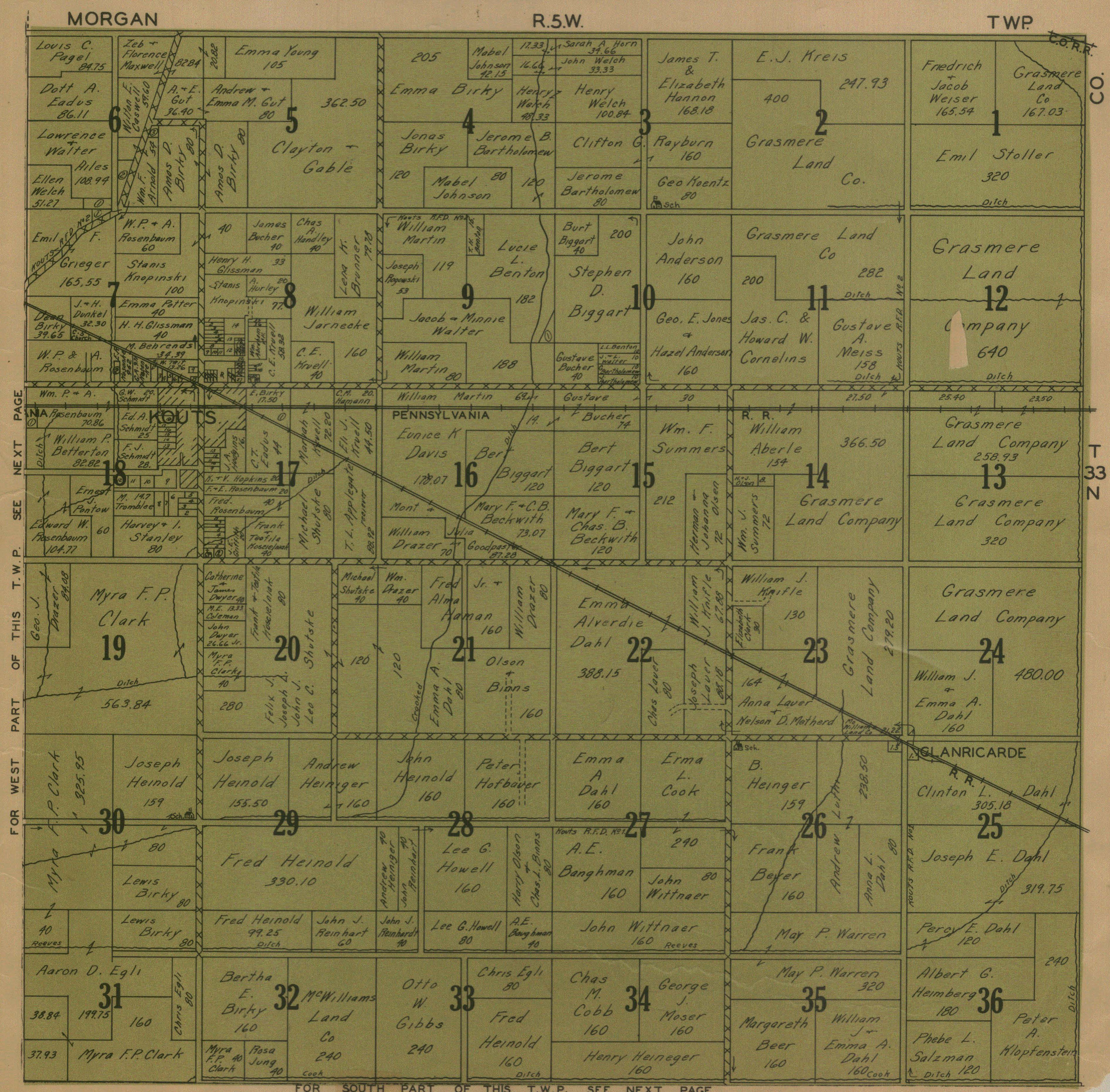
1921 Plat Map (North Half)
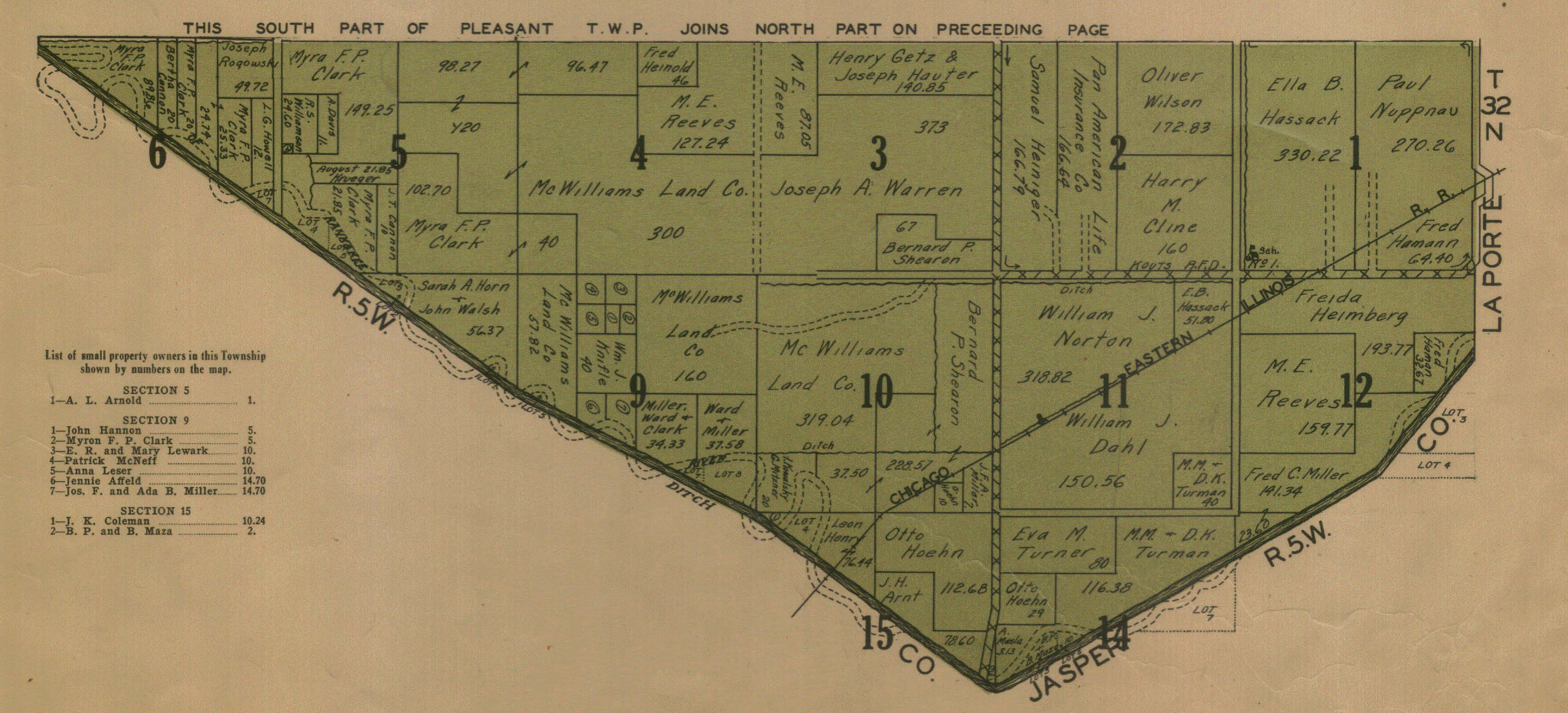
1921 Plat Map (South Half)
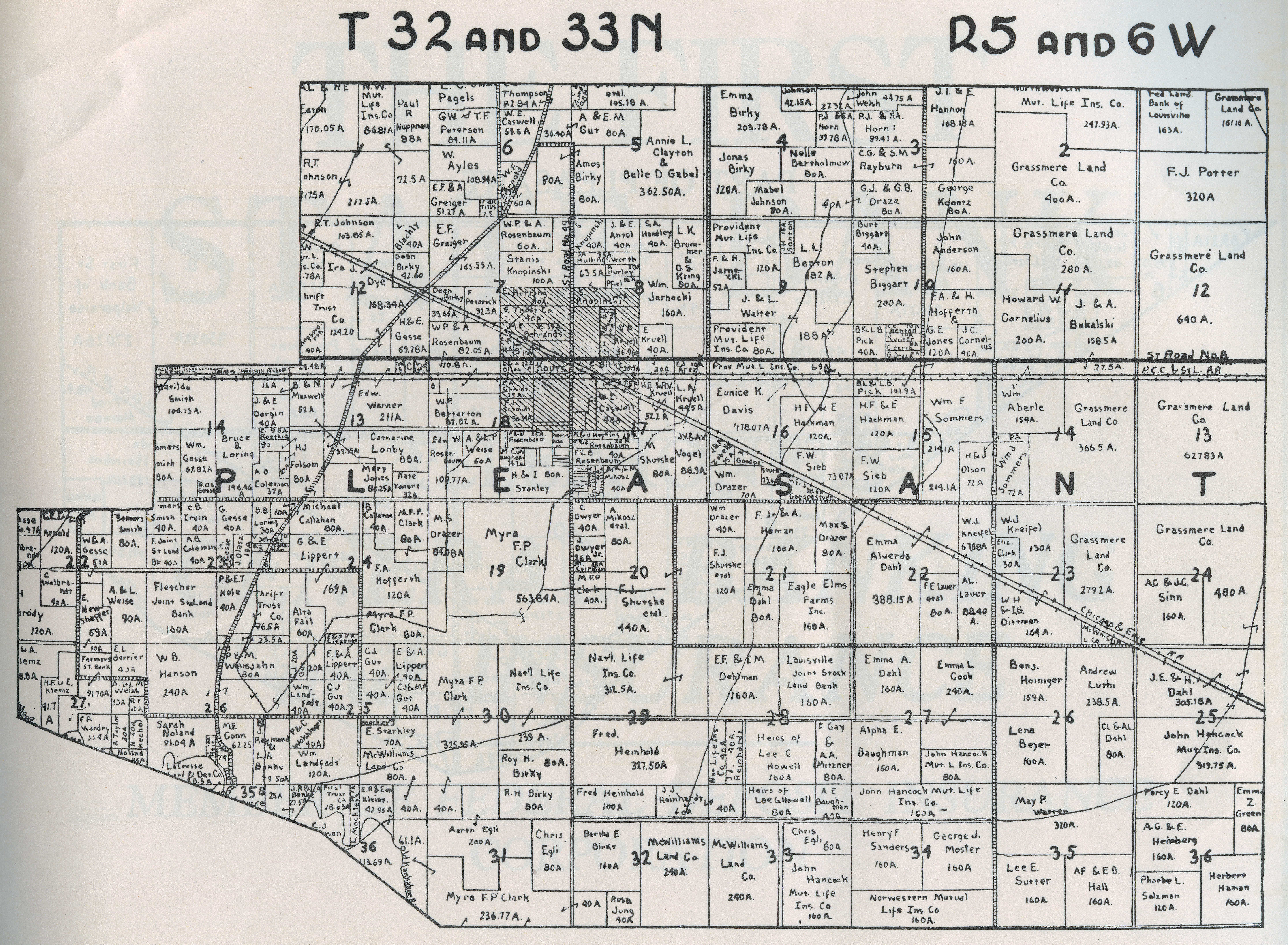
1928
Plat Map (West Portion)
1928 Plat
Map (East Portion)
1928 Plat
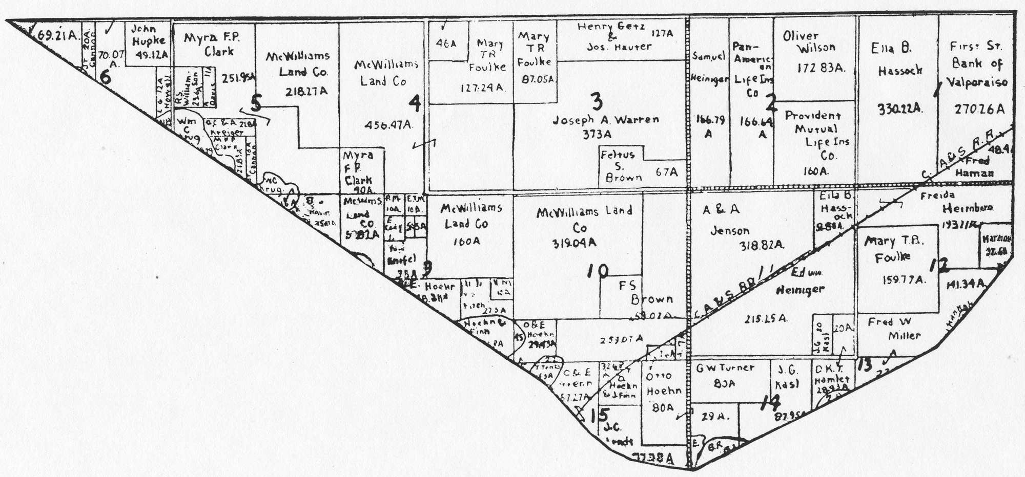
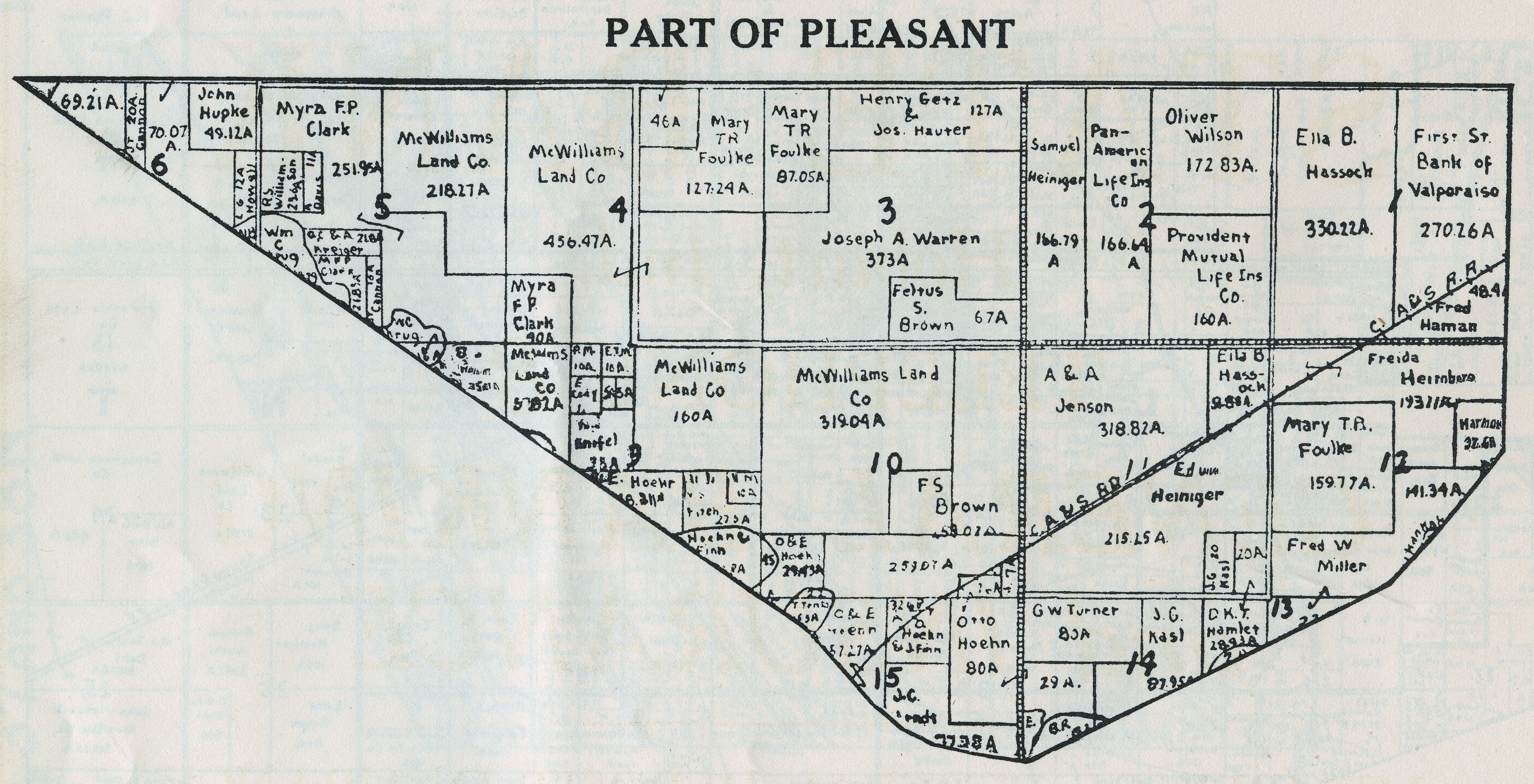
Map (South Portion)
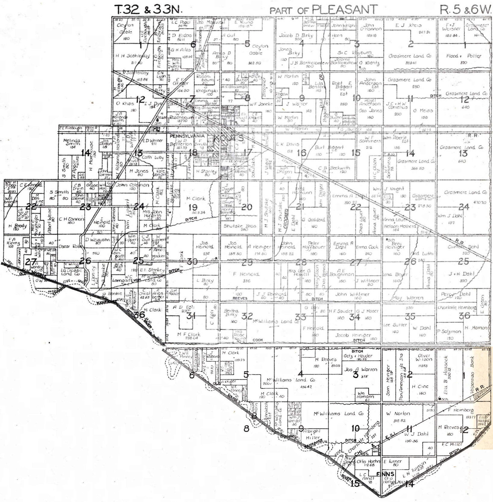
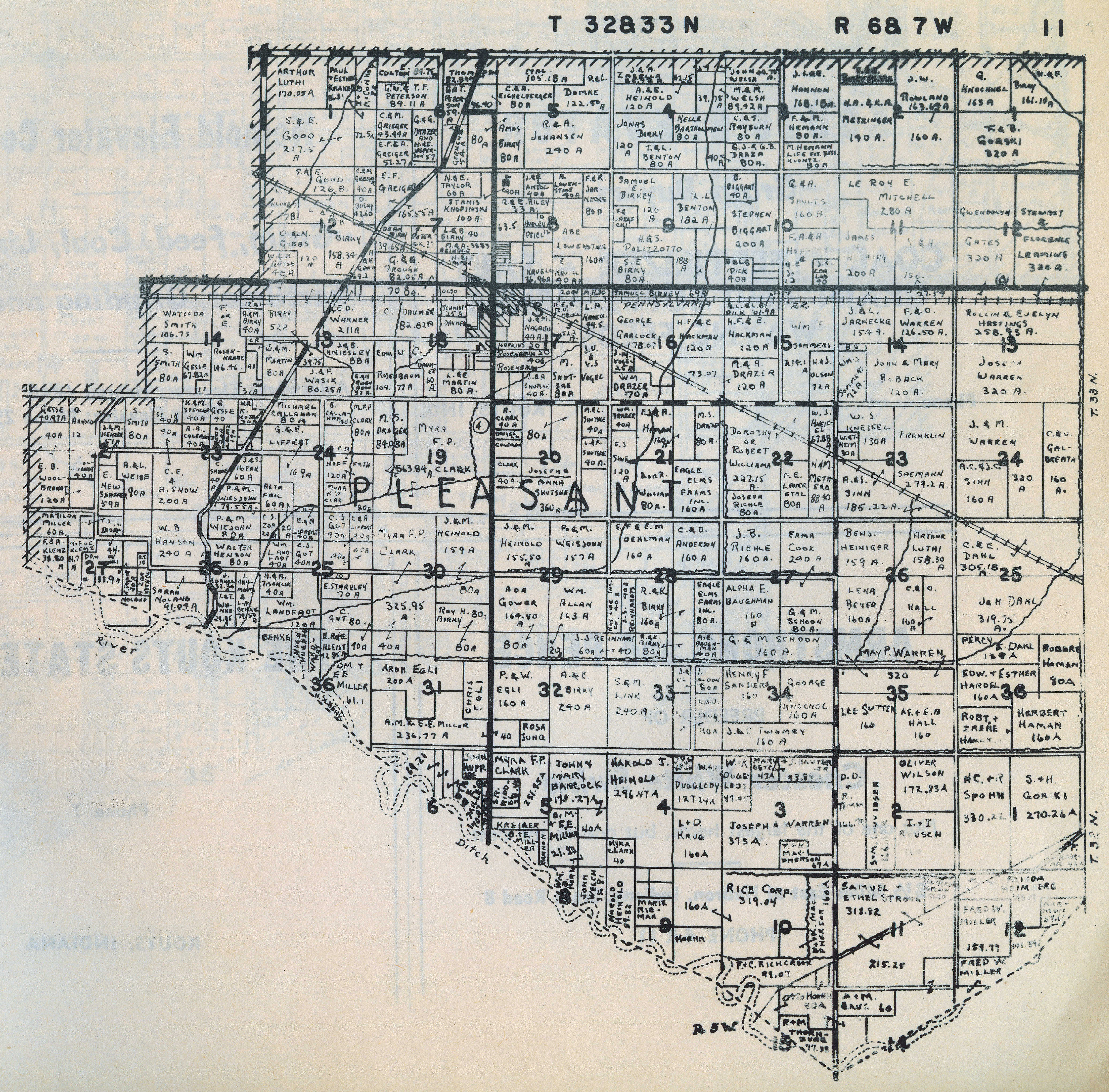
1929 Plat Map
1938 Plat Map (North Half)
1938 Plat Map (South Half)
1941
Plat Map (North Half)
1941
Plat Map (South Half)
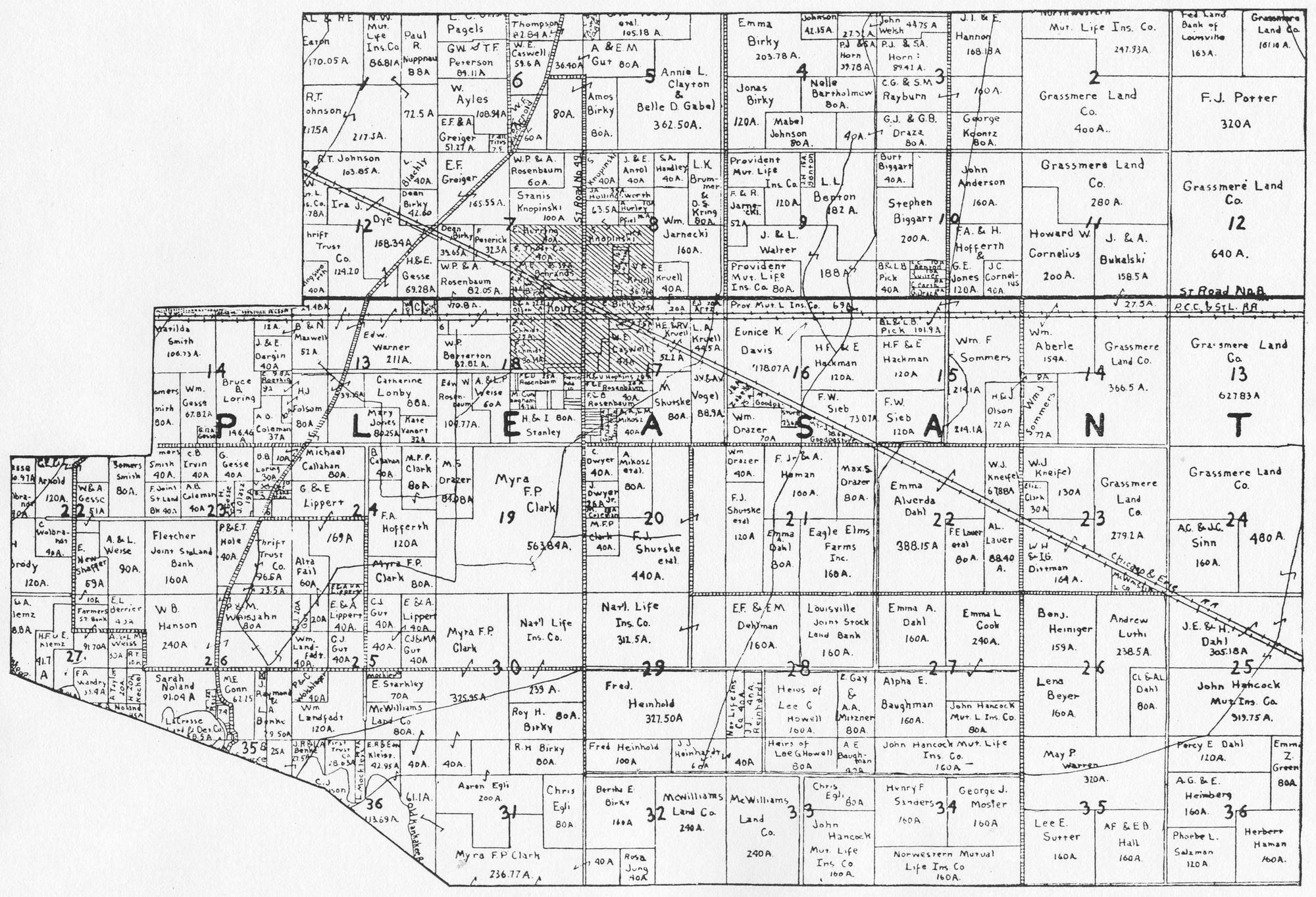
1948 Plat Map
1958 Plat Map
1969 Plat
Map
1973
Plat Map (East Half)
1973
Plat Map (West Half)
1974 Plat Map (East Half)
1974
Plat Map (West Half)
1976 Plat Map (East
Half)
1976 Plat Map (West
Half)
1979
Plat Map (East Half)
1979
Plat Map (West Half)
1982
Plat Map (Northeast Quadrant)
1982
Plat Map (Northwest Quadrant)
1982
Plat Map (Southeast Quadrant)
1982
Plat Map (Southwest Quadrant)
1984
Plat Map (Northeast Quadrant)
1984
Plat Map (Northwest Quadrant)
1984
Plat Map (Southeast Quadrant)
1984
Plat Map (Southwest Quadrant)
1988 Plat Map (Northeast Quadrant)
1988 Plat Map (Northwest Quadrant)
1988 Plat Map (Southeast Quadrant)
1988 Plat Map (Southwest Quadrant)
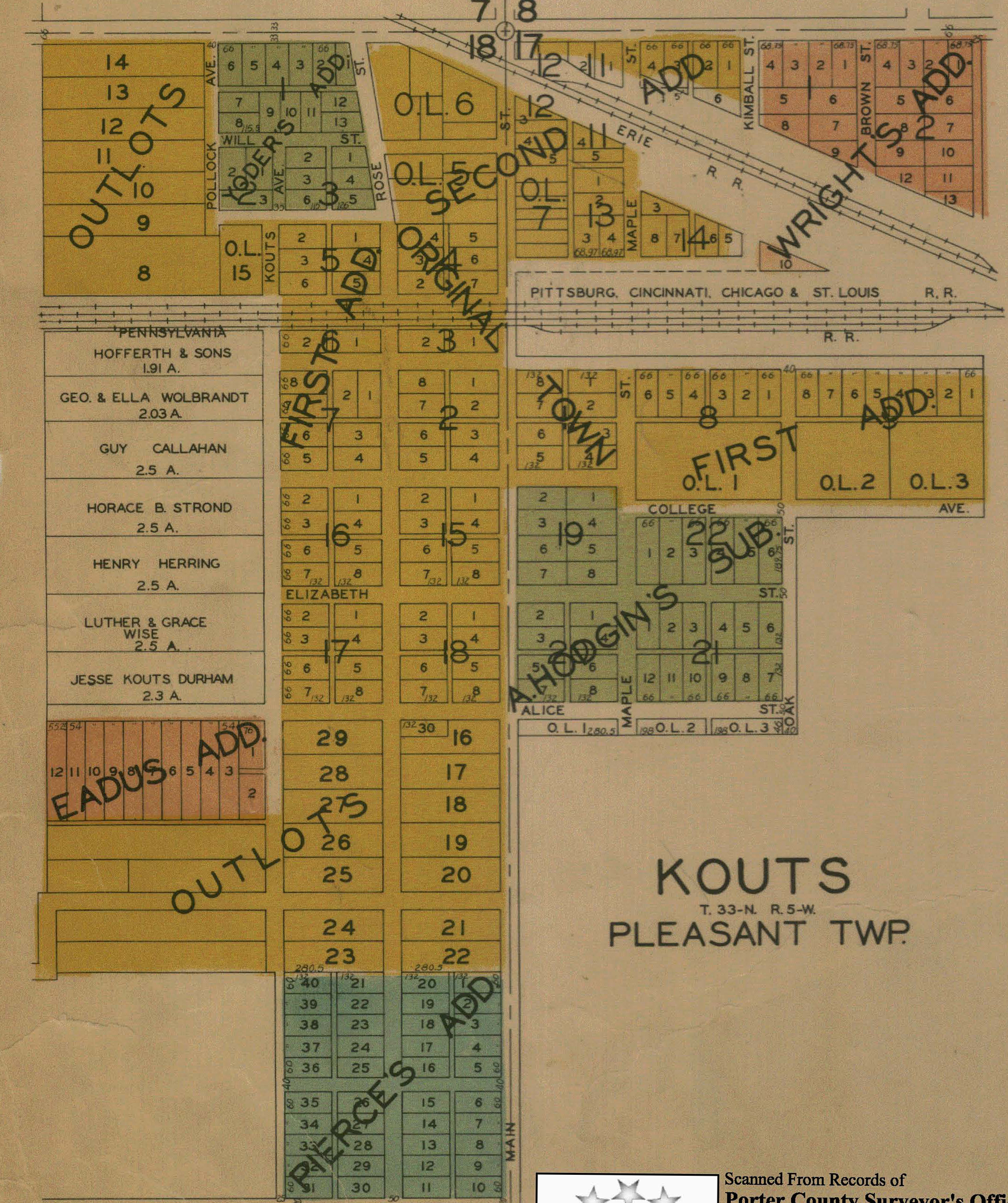
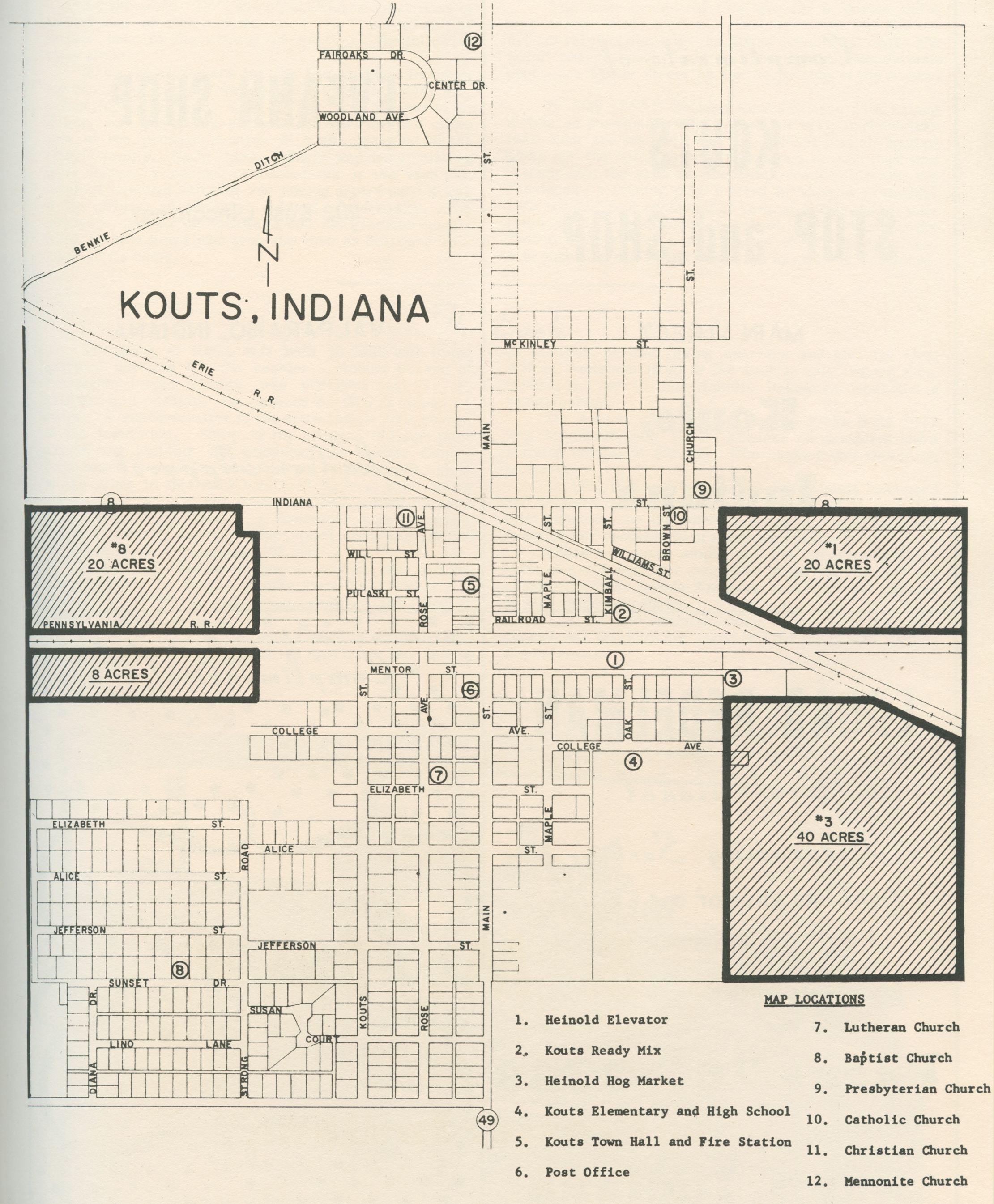
Pleasant Township Town and Village Plats
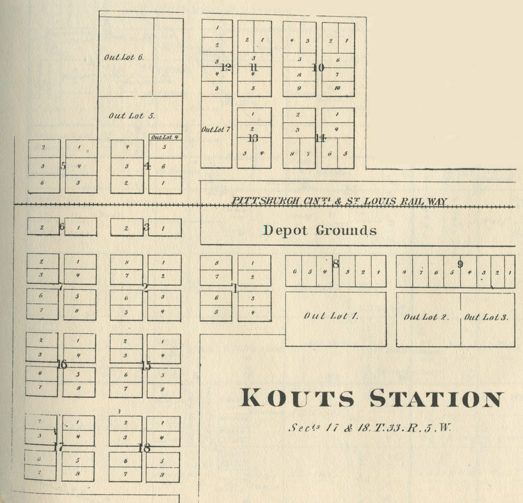
Kouts, 1876
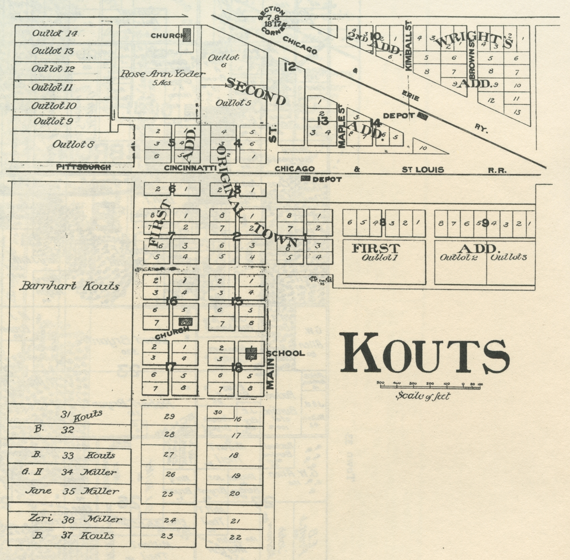
Kouts, 1895
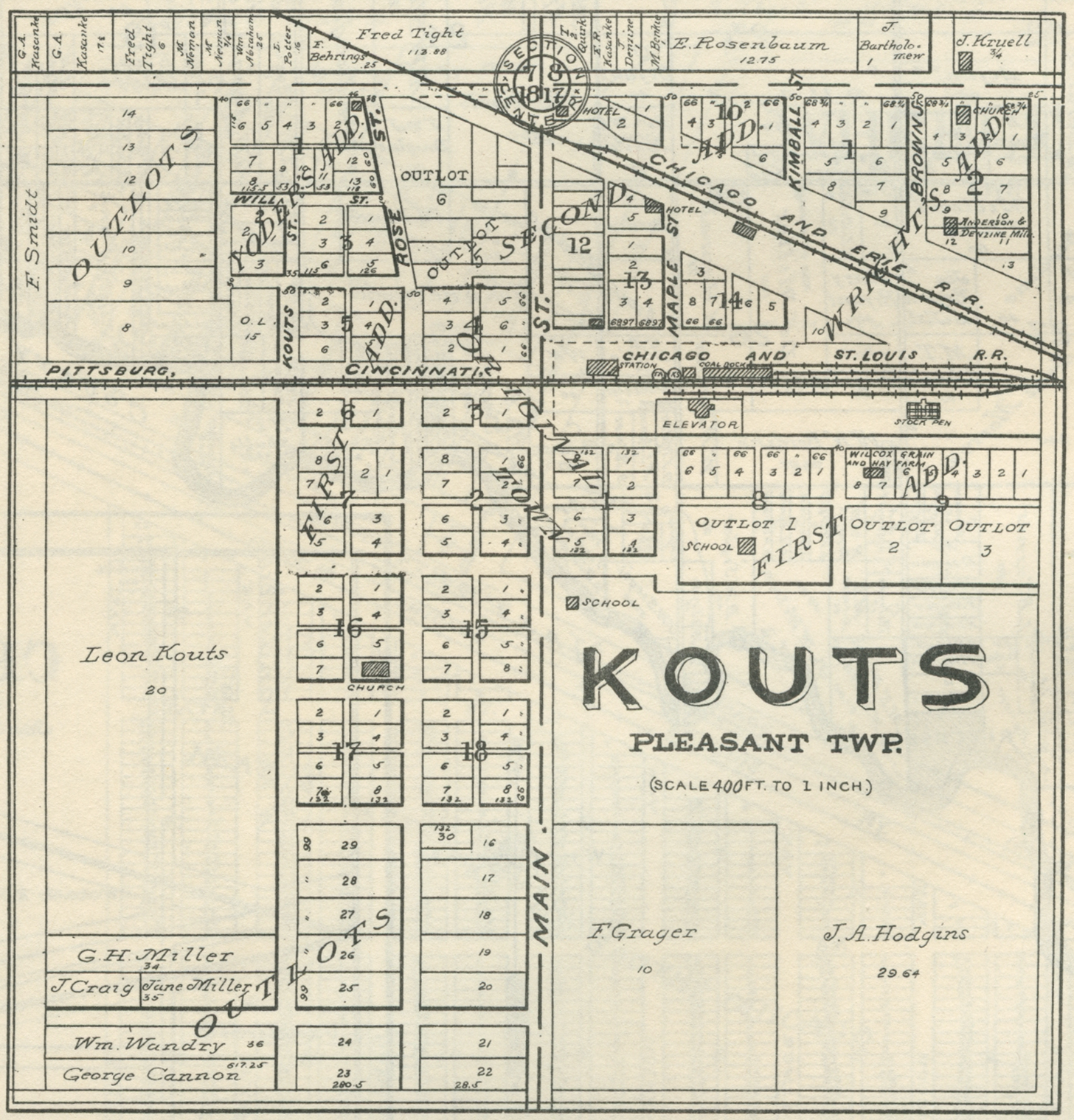
Kouts, 1906
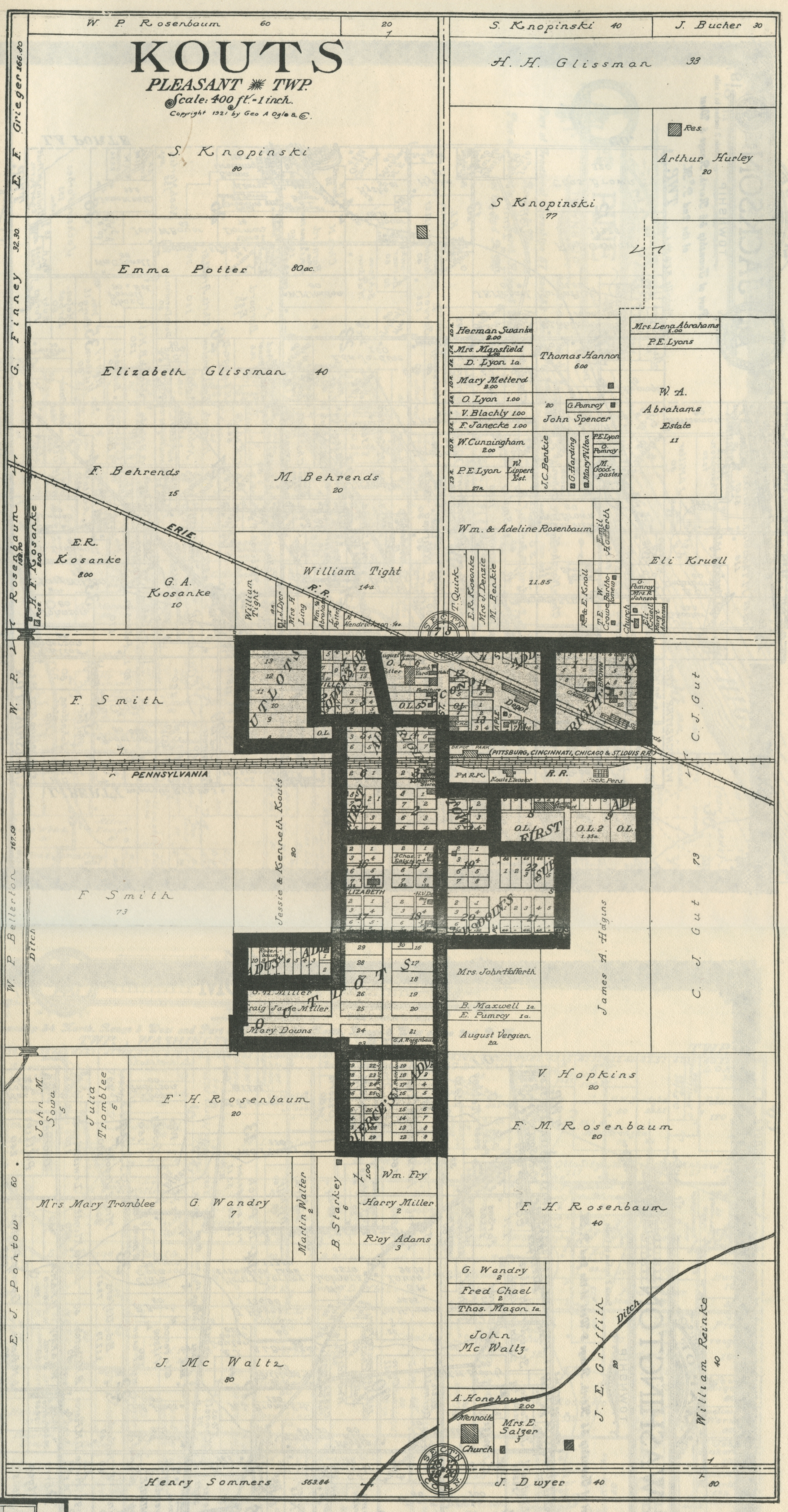
Kouts, 1921
Kouts, 1928
Kouts, 1965
Riverview, 1928
Roosevelt, no date
Also see:
1956 Drury's Porter County Aerial Images for Pleasant Township