Township Plat Maps, 19741974 Porter County township plat maps . . . .
The following township plat maps were obtained from
a plat book published in 1974 by the Town and Country Publishing Company, Inc.,
which was provided as a compliment to patrons of Harold L. Welkie Insurance
Agency in Wanatah.
This plat book contains a
landowner name index,
which assists in more easily locating a property by owner. Click the thumbnails below to access
full size images. Note that several of these images are large files and may take
considerable time to load on slower Internet connections, such as dialup.
Source Citation:
Town and Country Publishing Company, Inc. 1974. Porter County, Indiana:
Plat Book, Index of Owners, City Street Maps. LaPorte, Indiana: Town and Country Publishing
Company, Inc. 48 p.
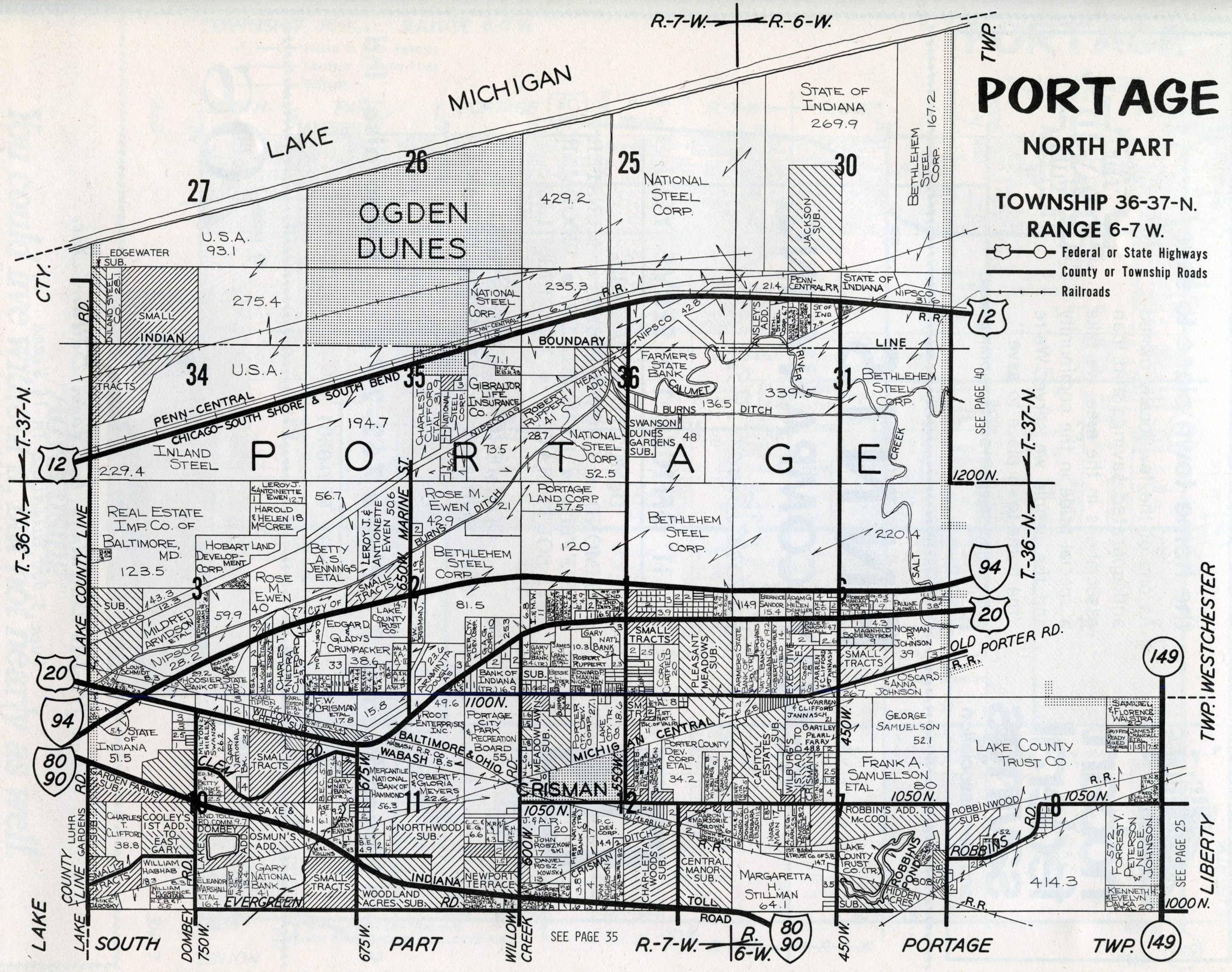 Portage (North) |
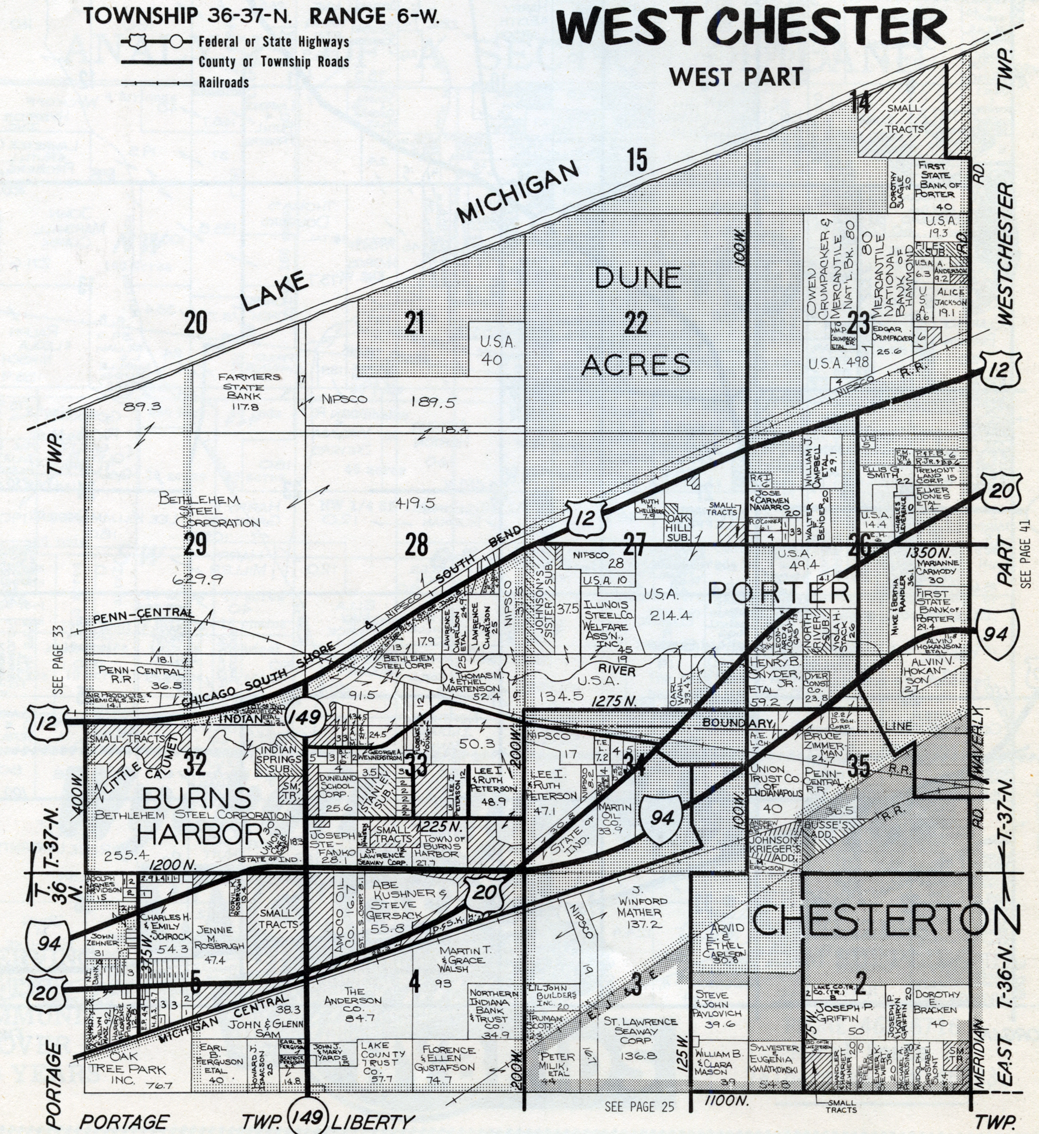 Westchester (West) |
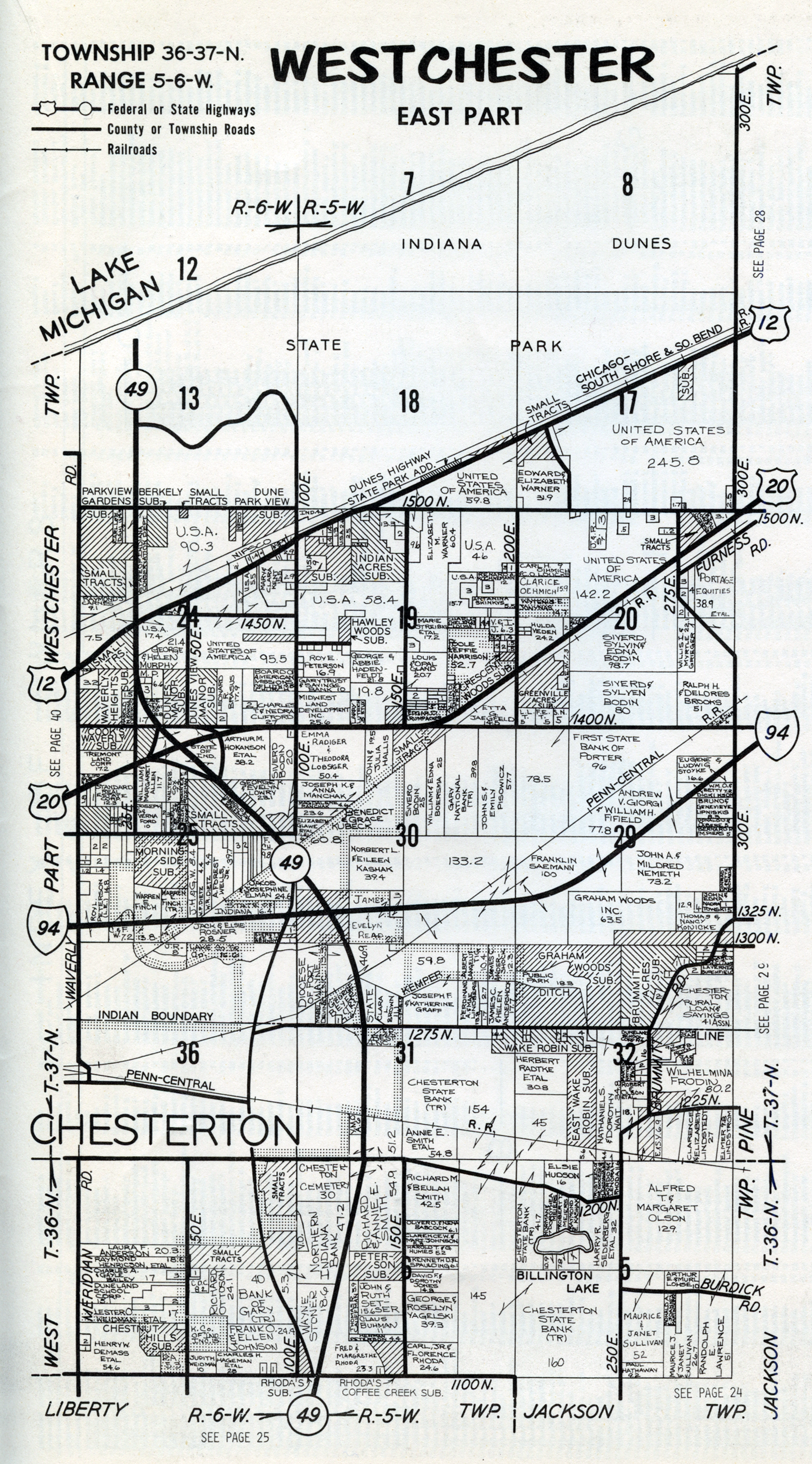 Westchester (East) |
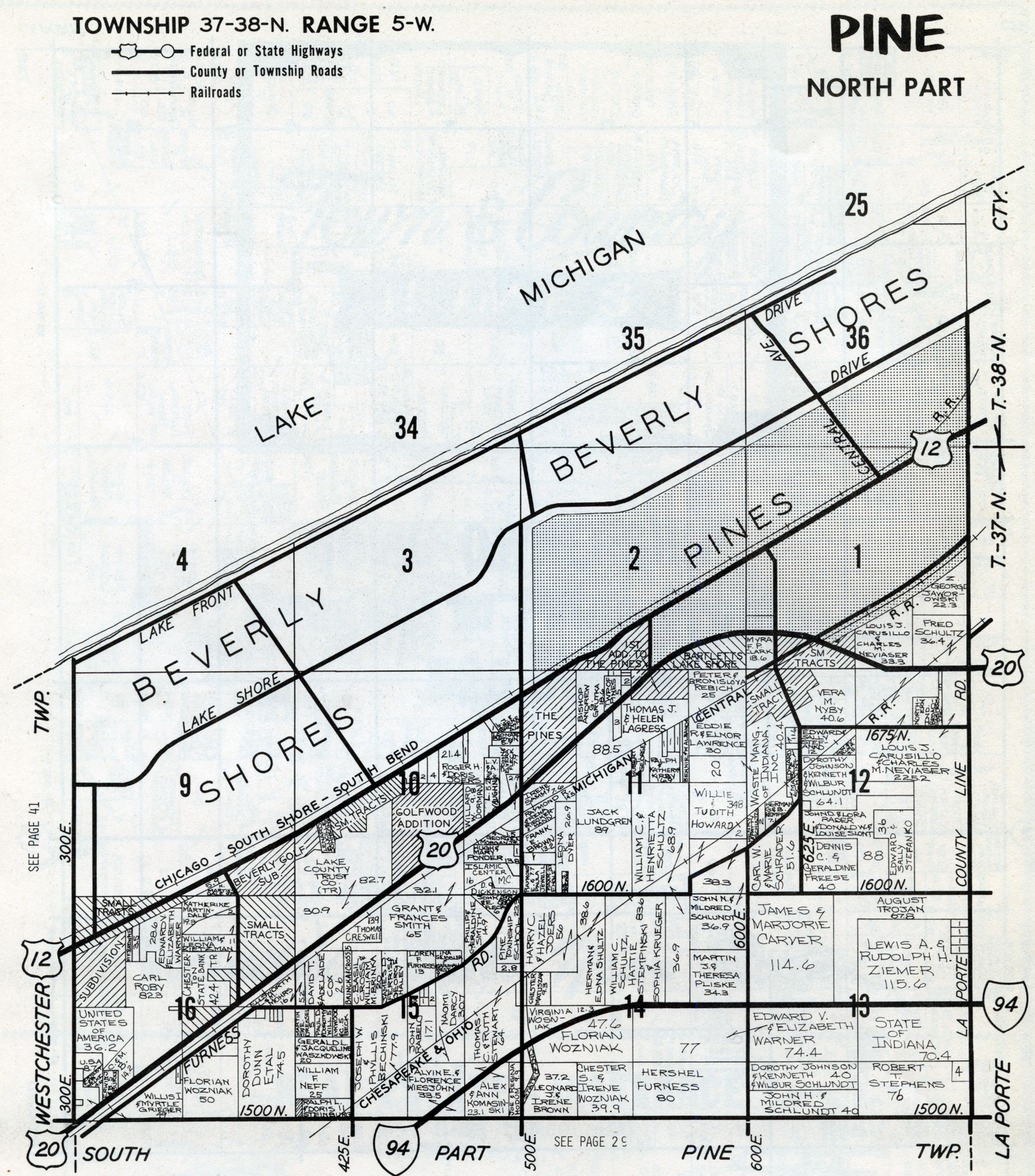 Pine (North) |
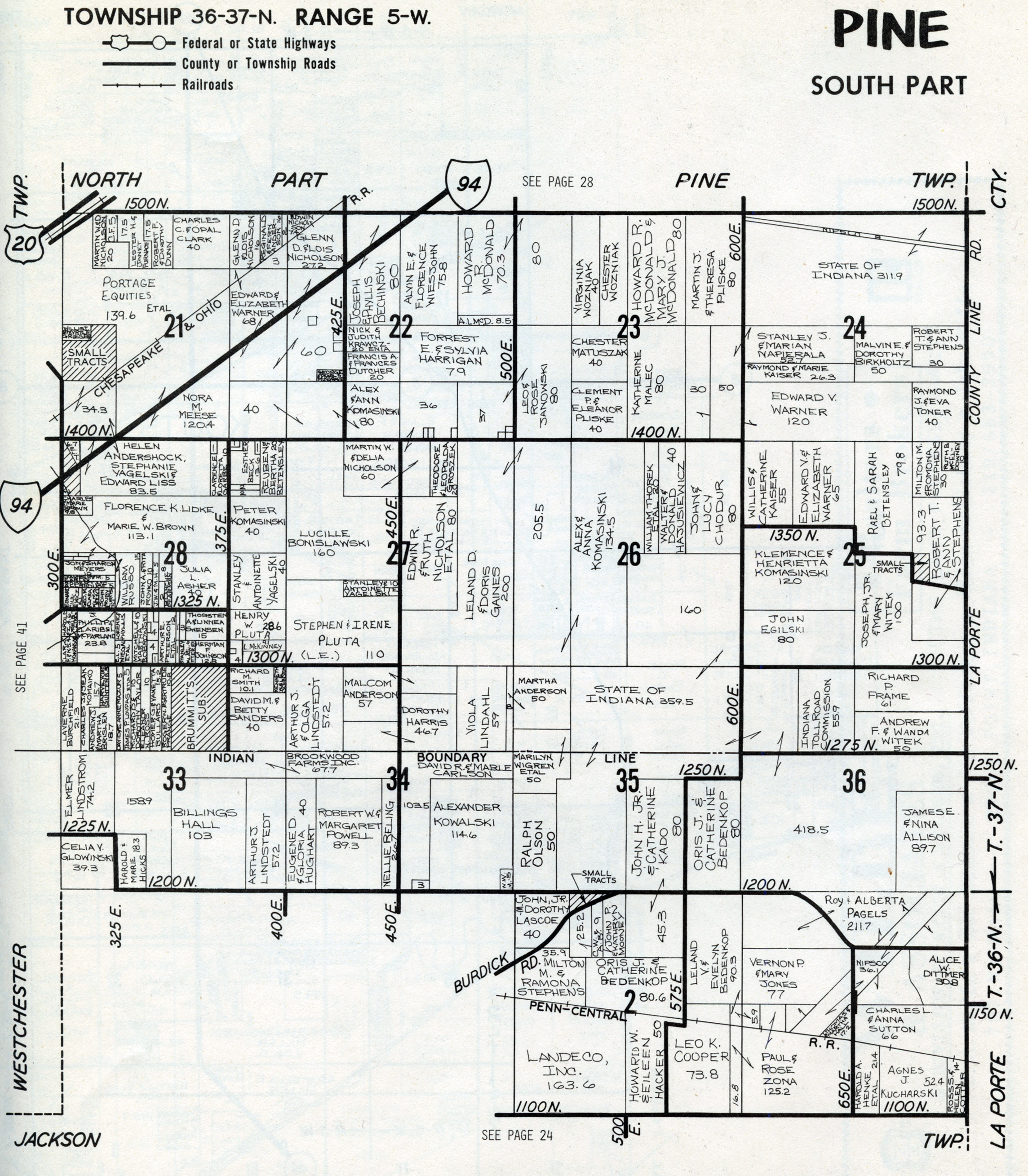 Pine (South) |
|||
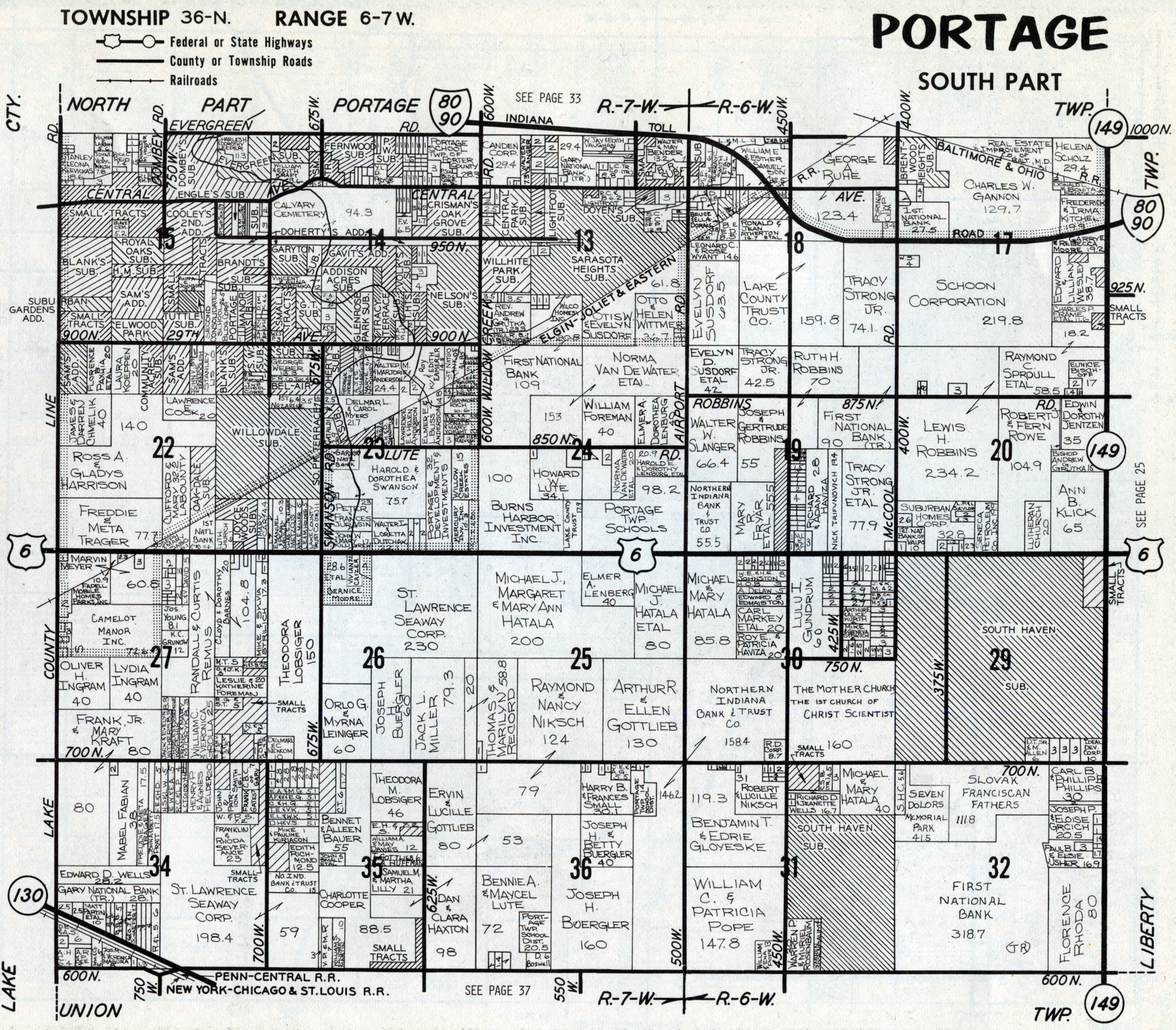 Portage (South) |
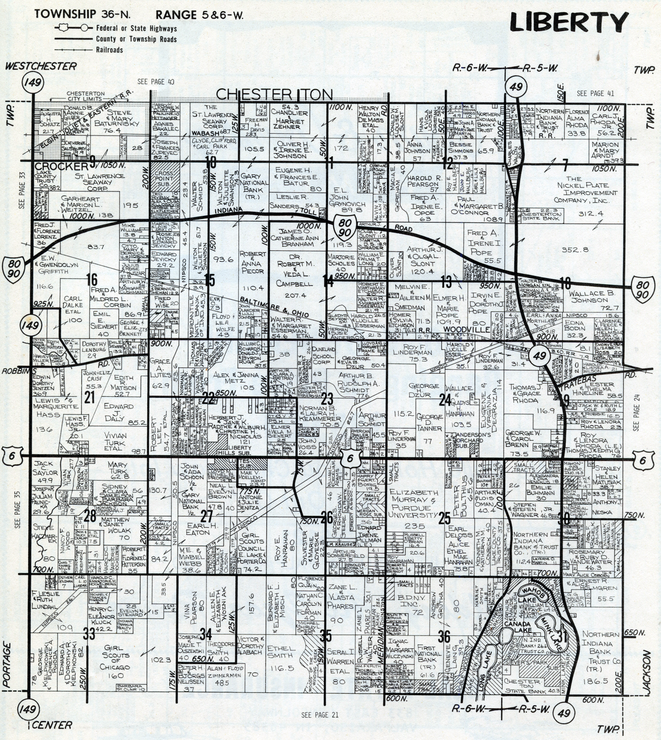 Liberty |
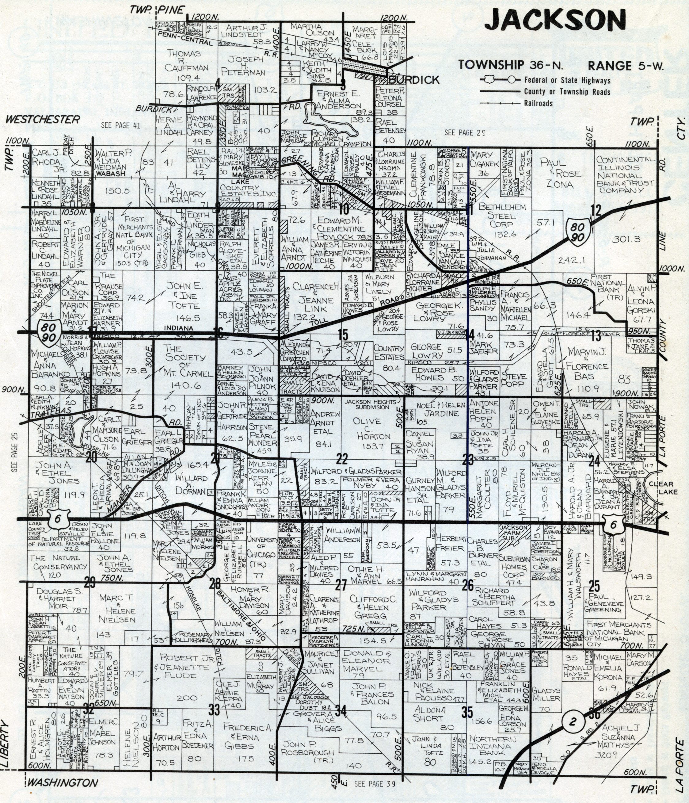 Jackson |
|
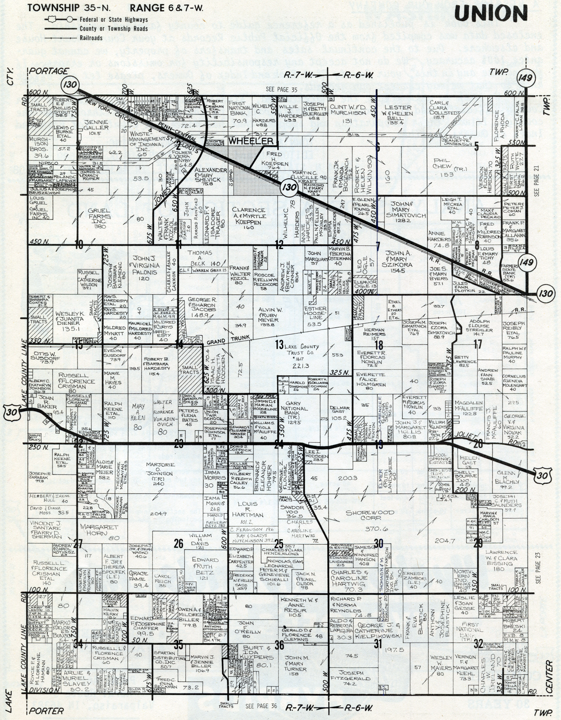 Union |
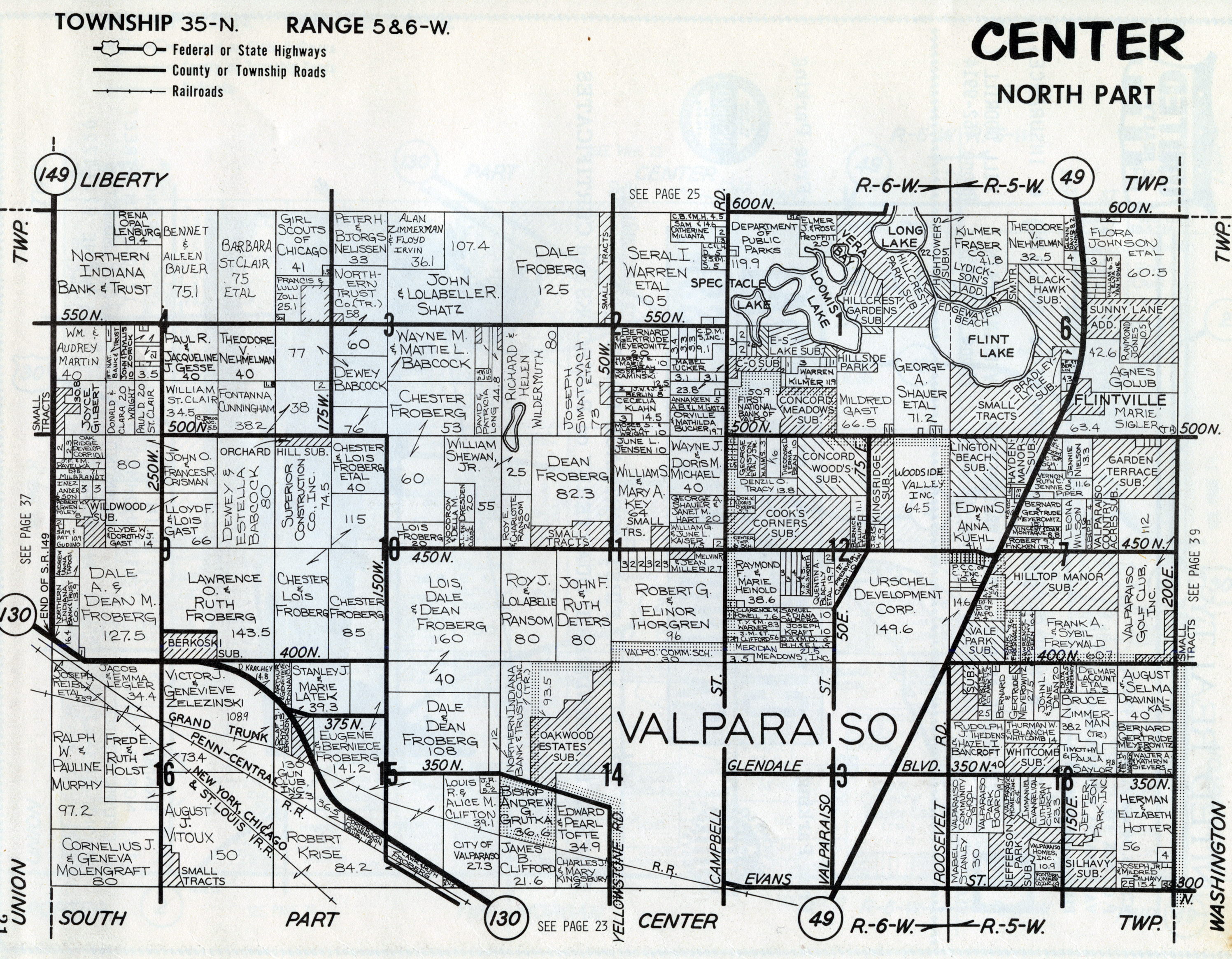 Center) (North) |
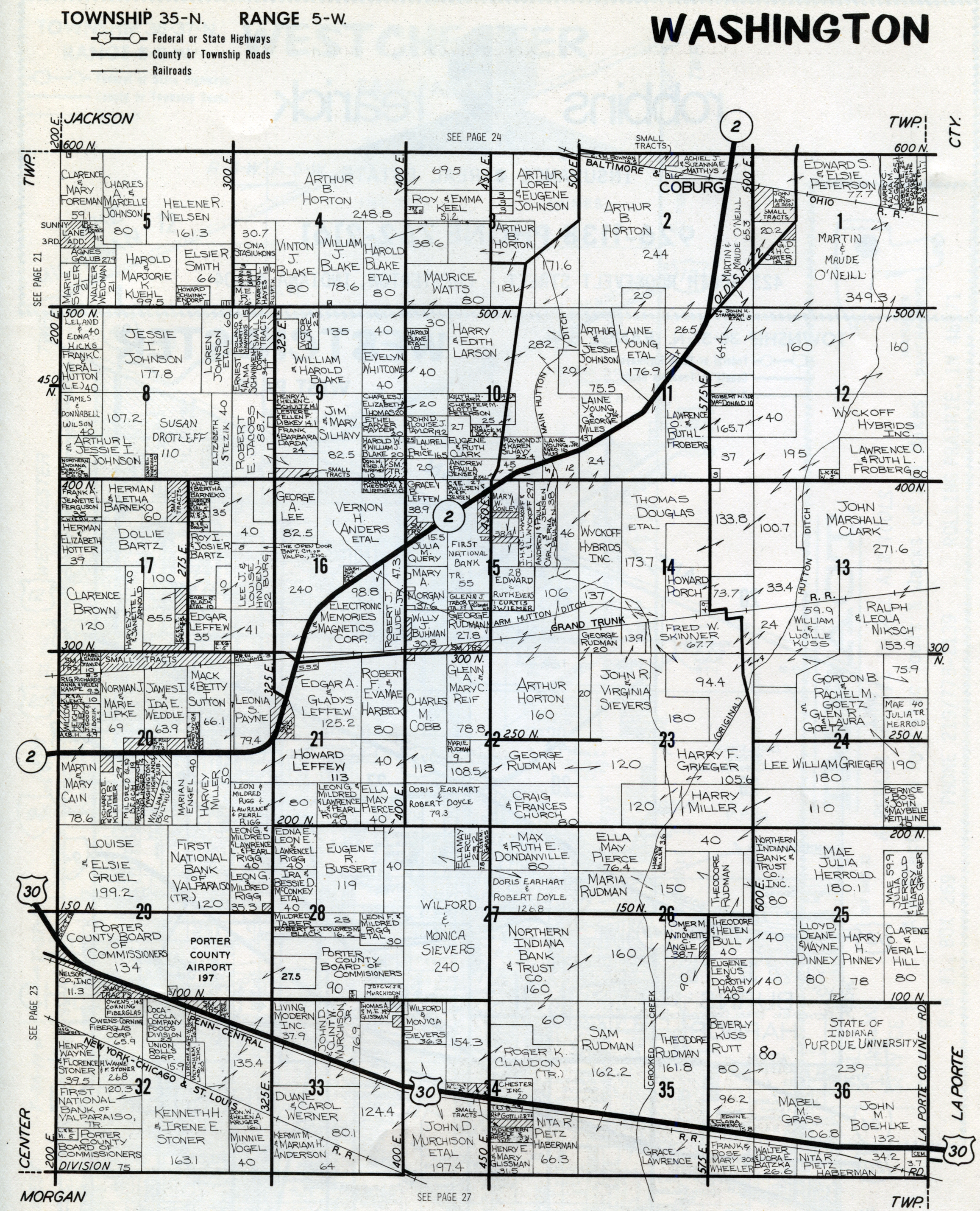 Washington |
|
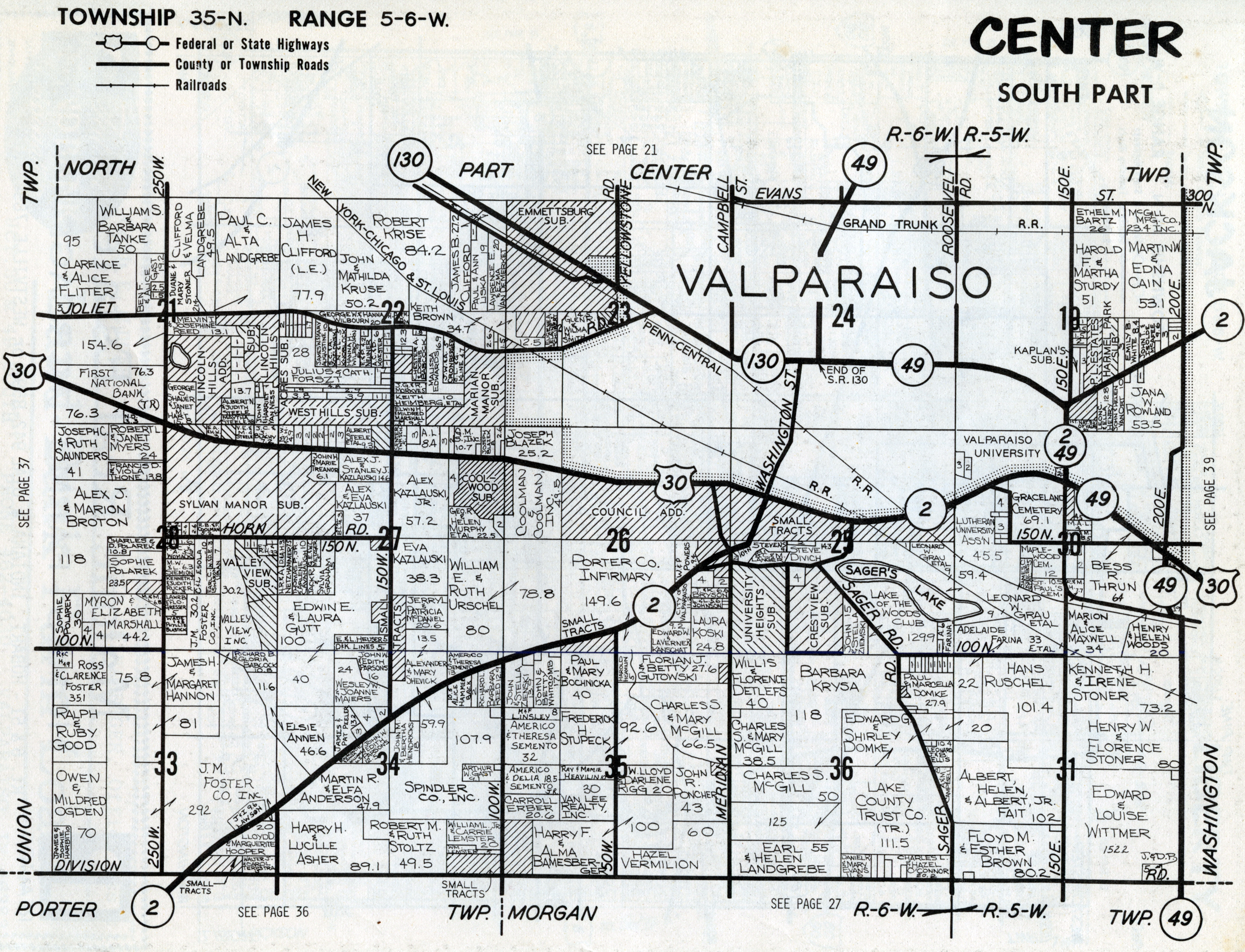 Center (South) |
|||
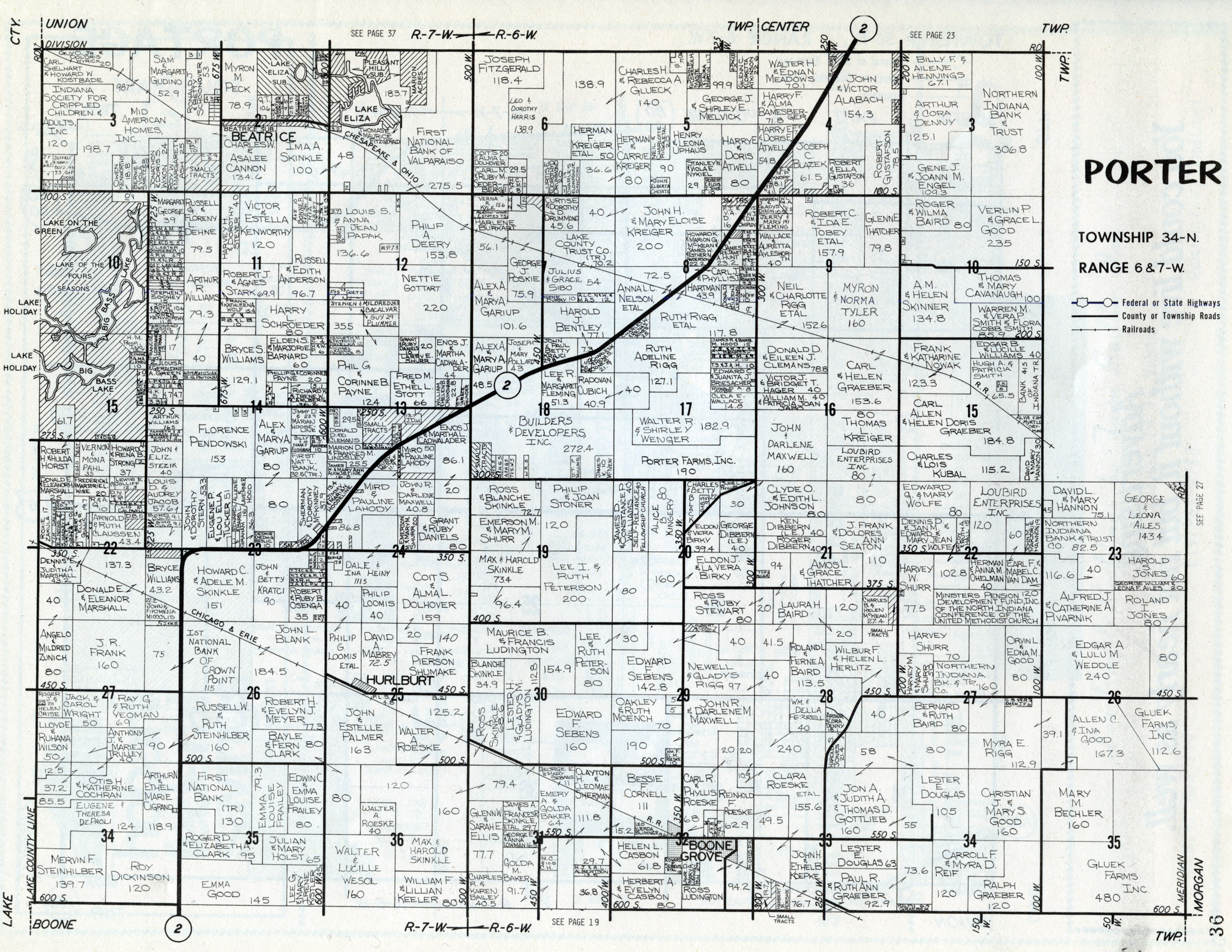 Porter |
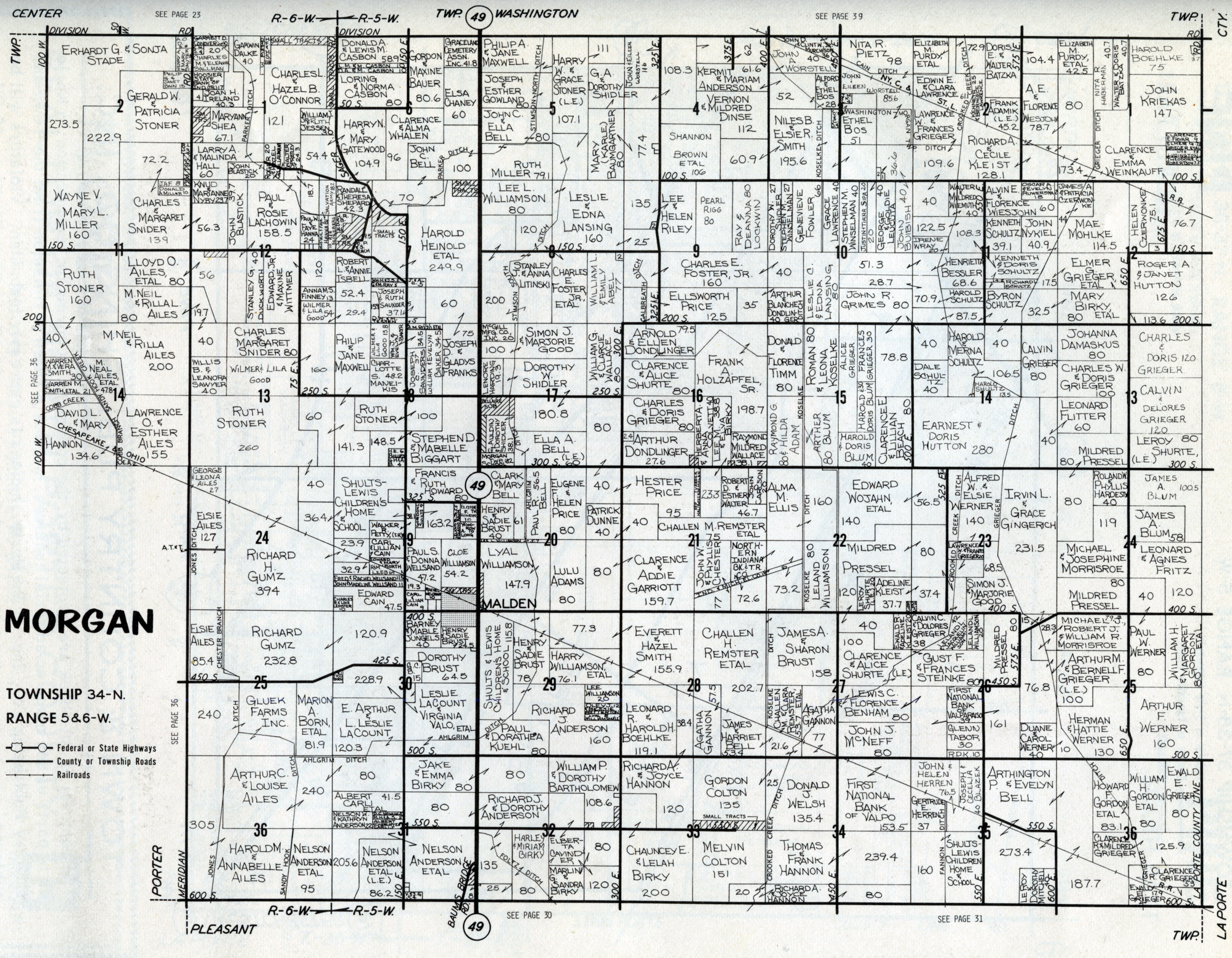 Morgan |
|
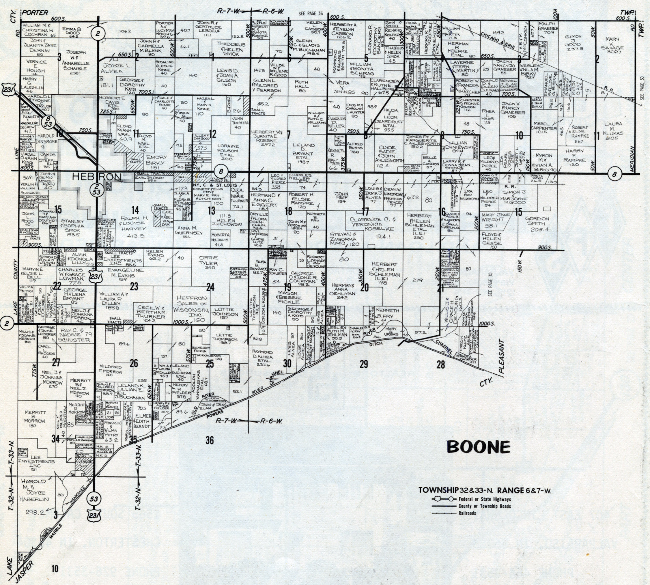 Boone |
 Pleasant (West) |
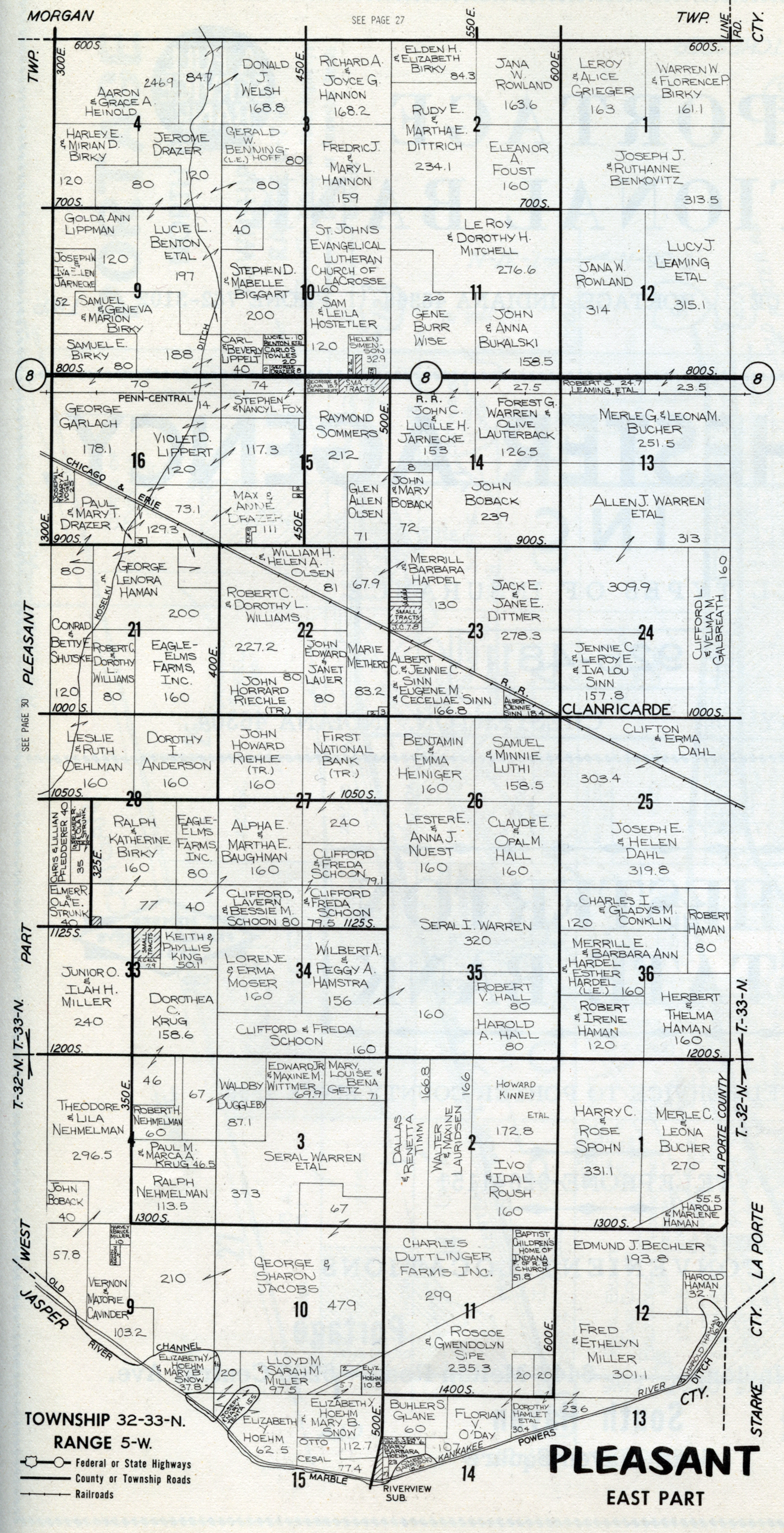 Pleasant (East) |
1974 plat maps prepared for web by Steven R. Shook, March 2013