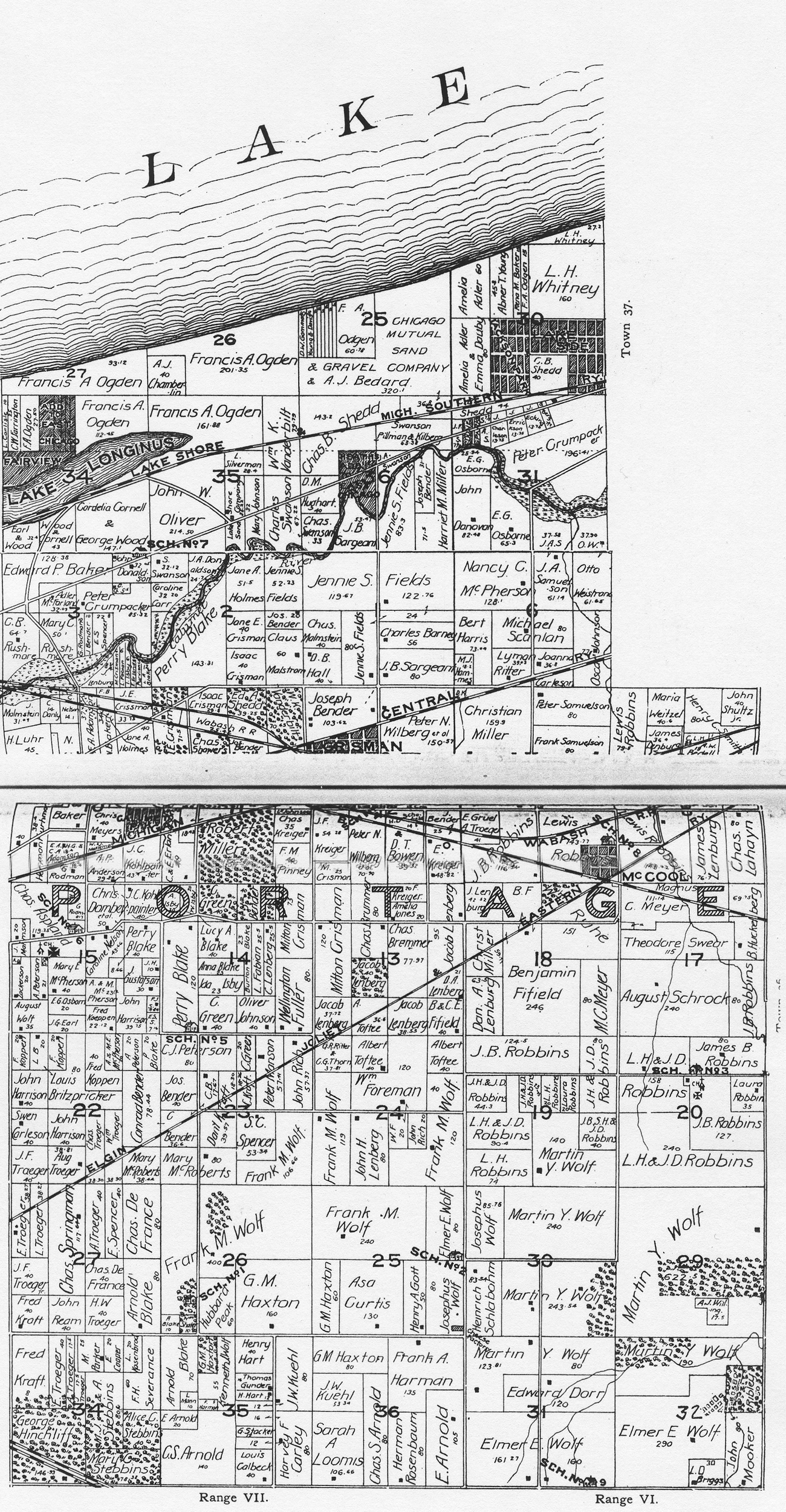
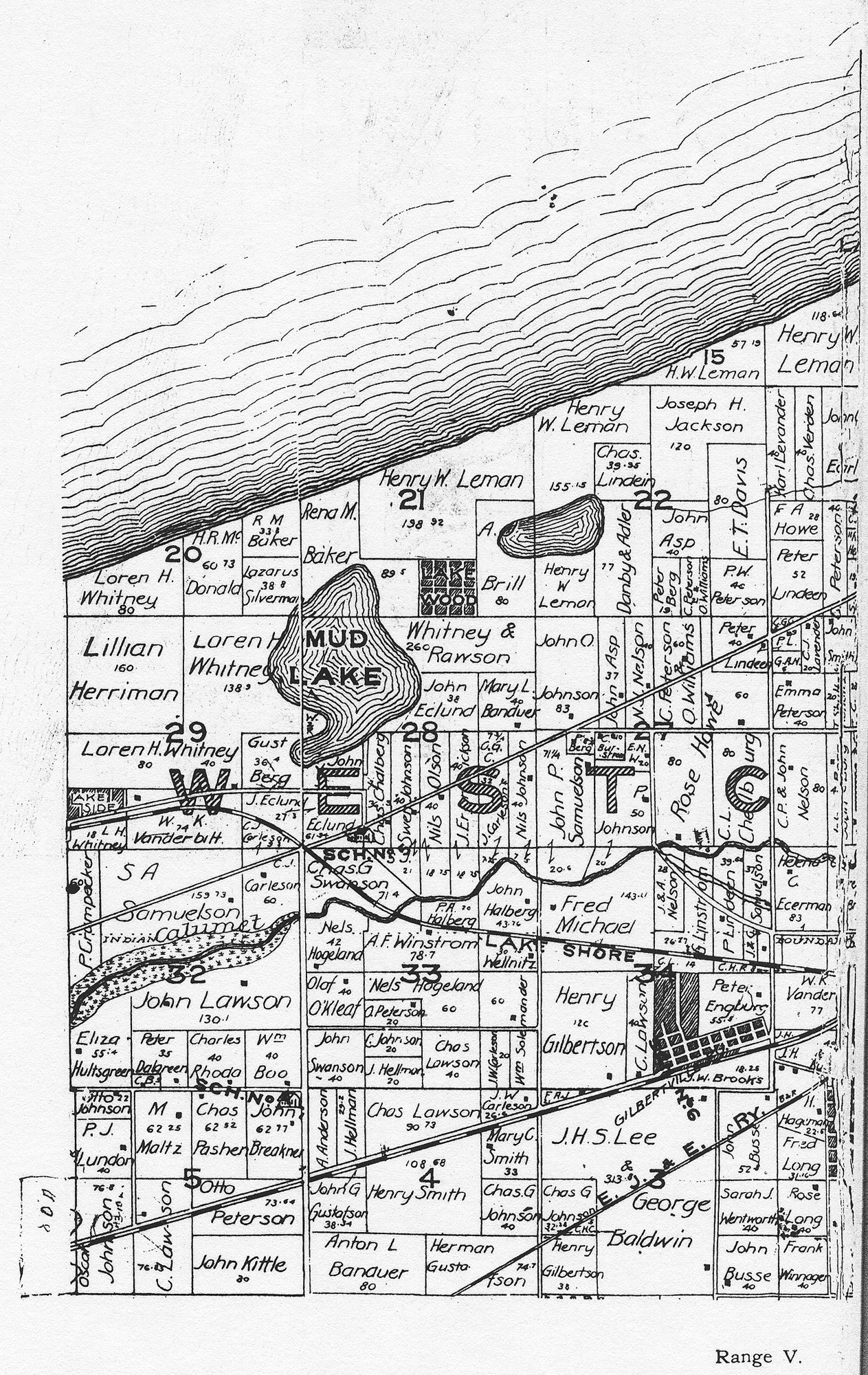
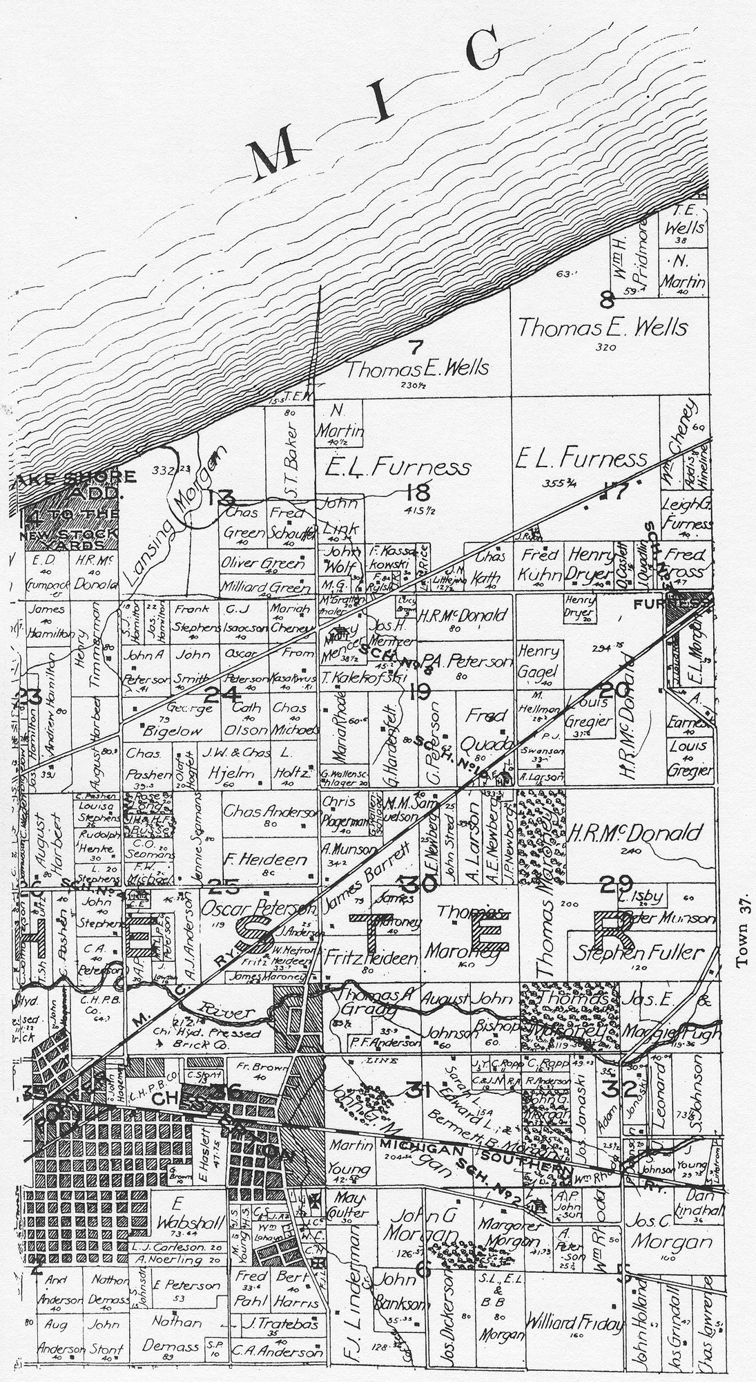
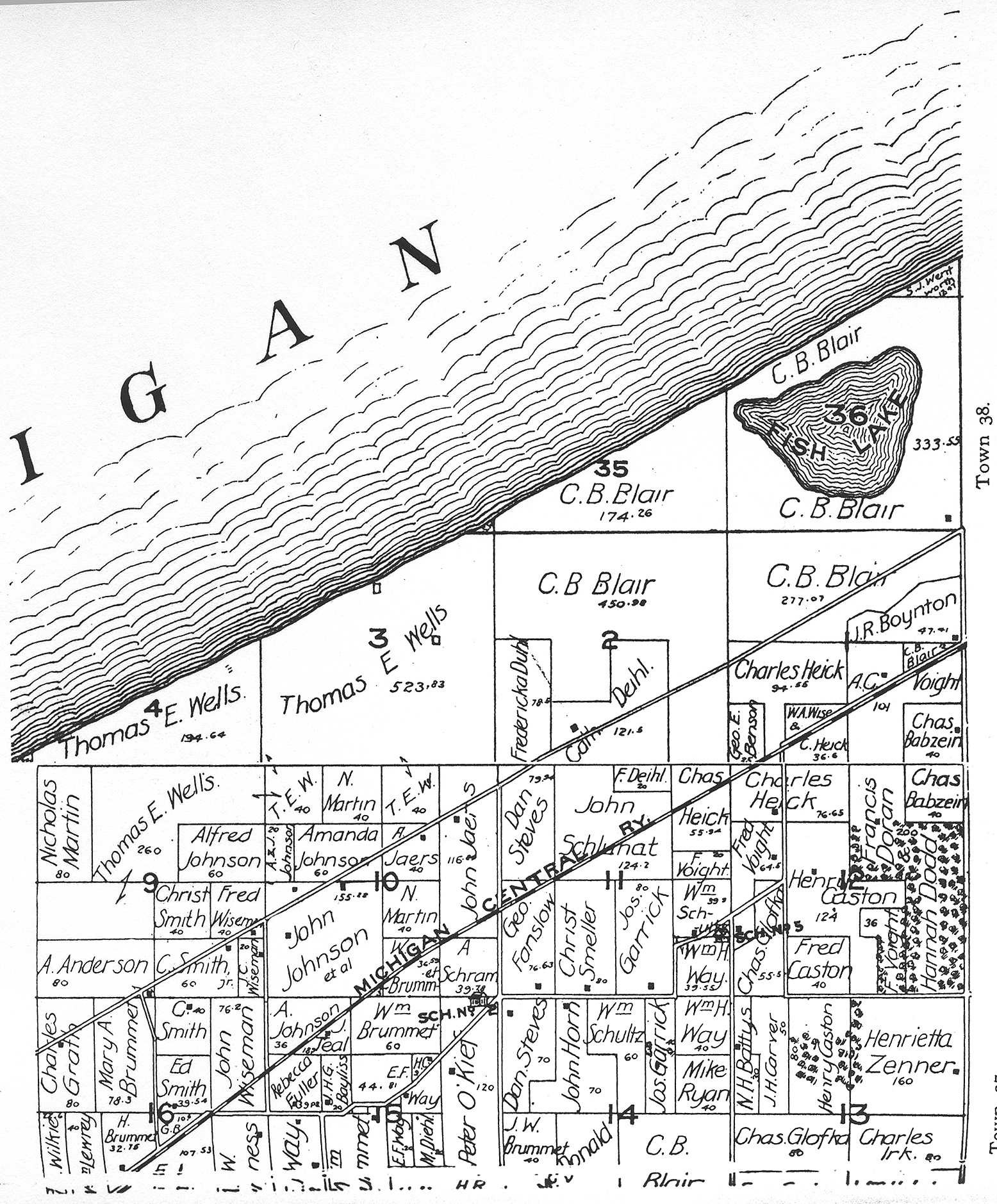
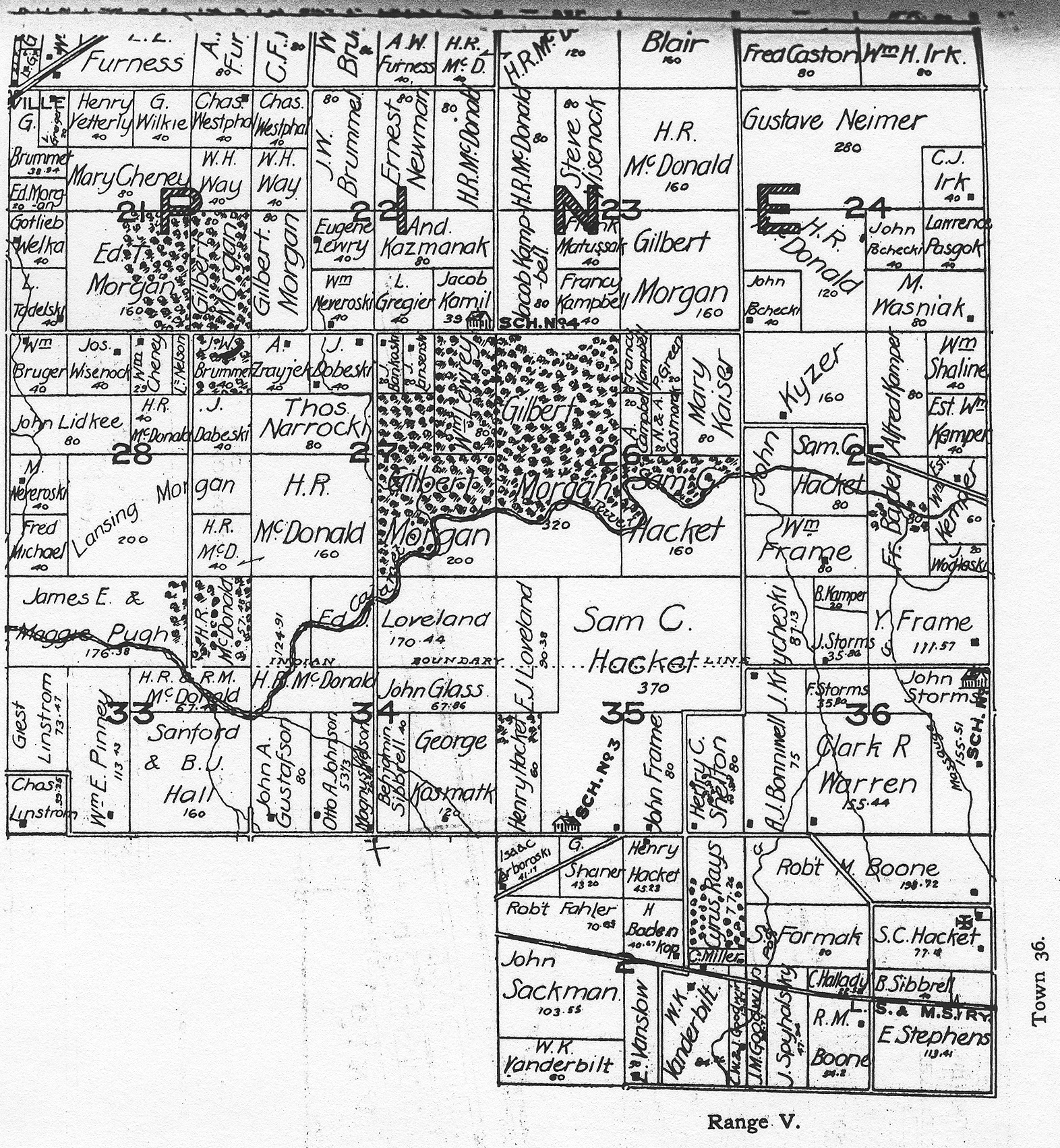
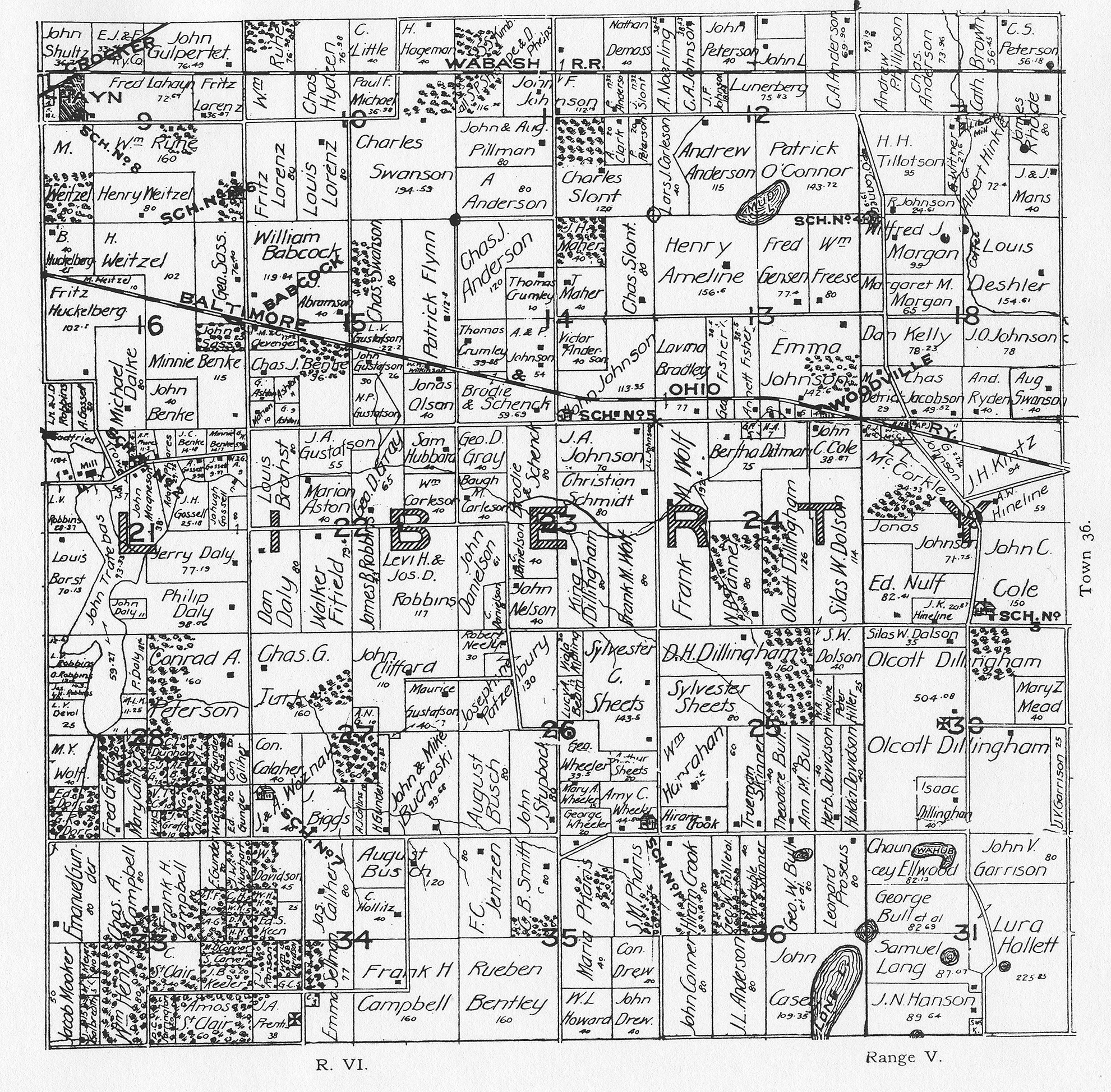
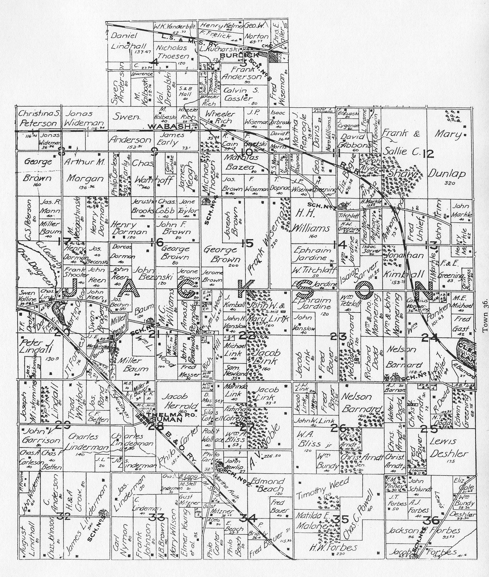
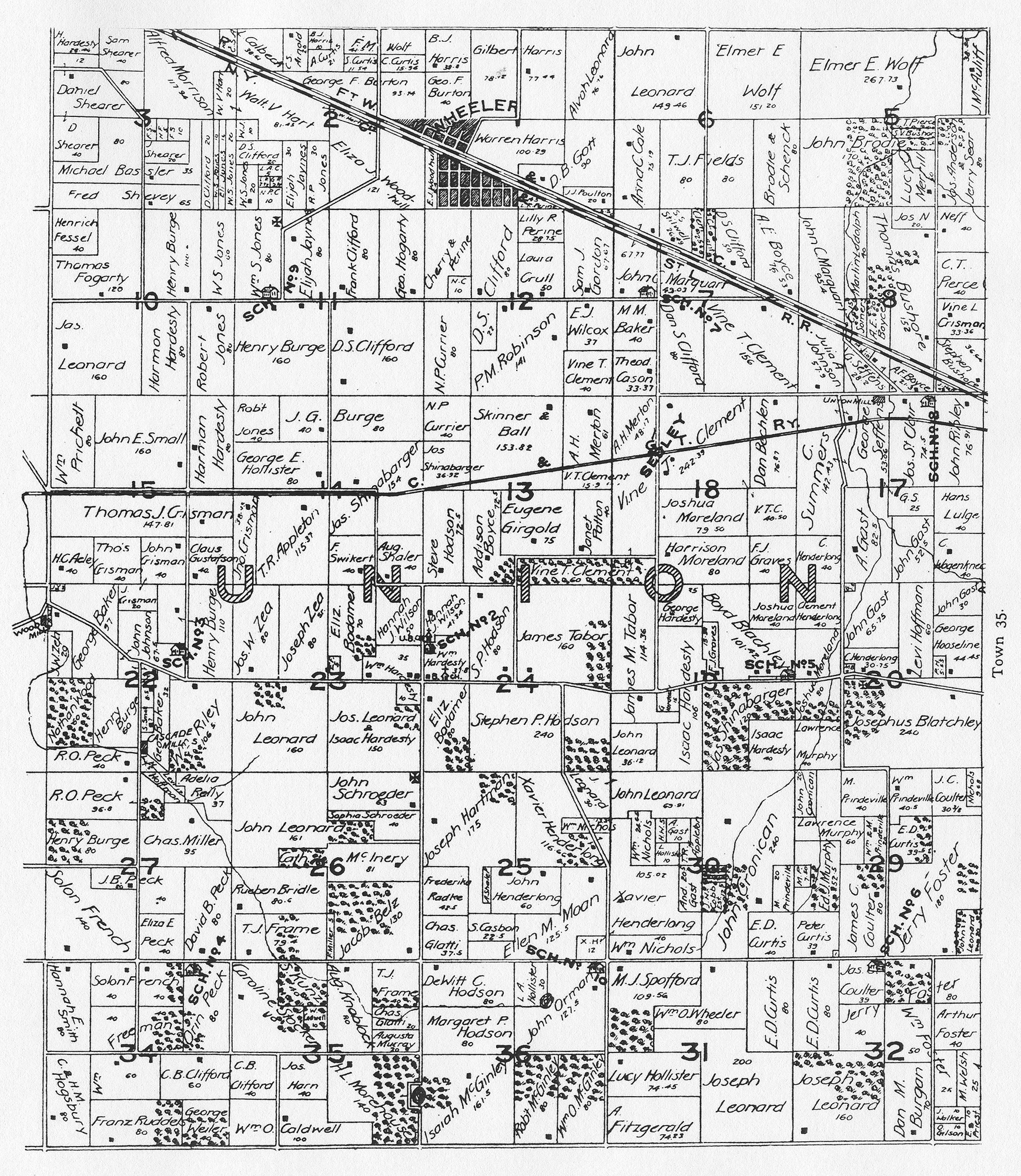
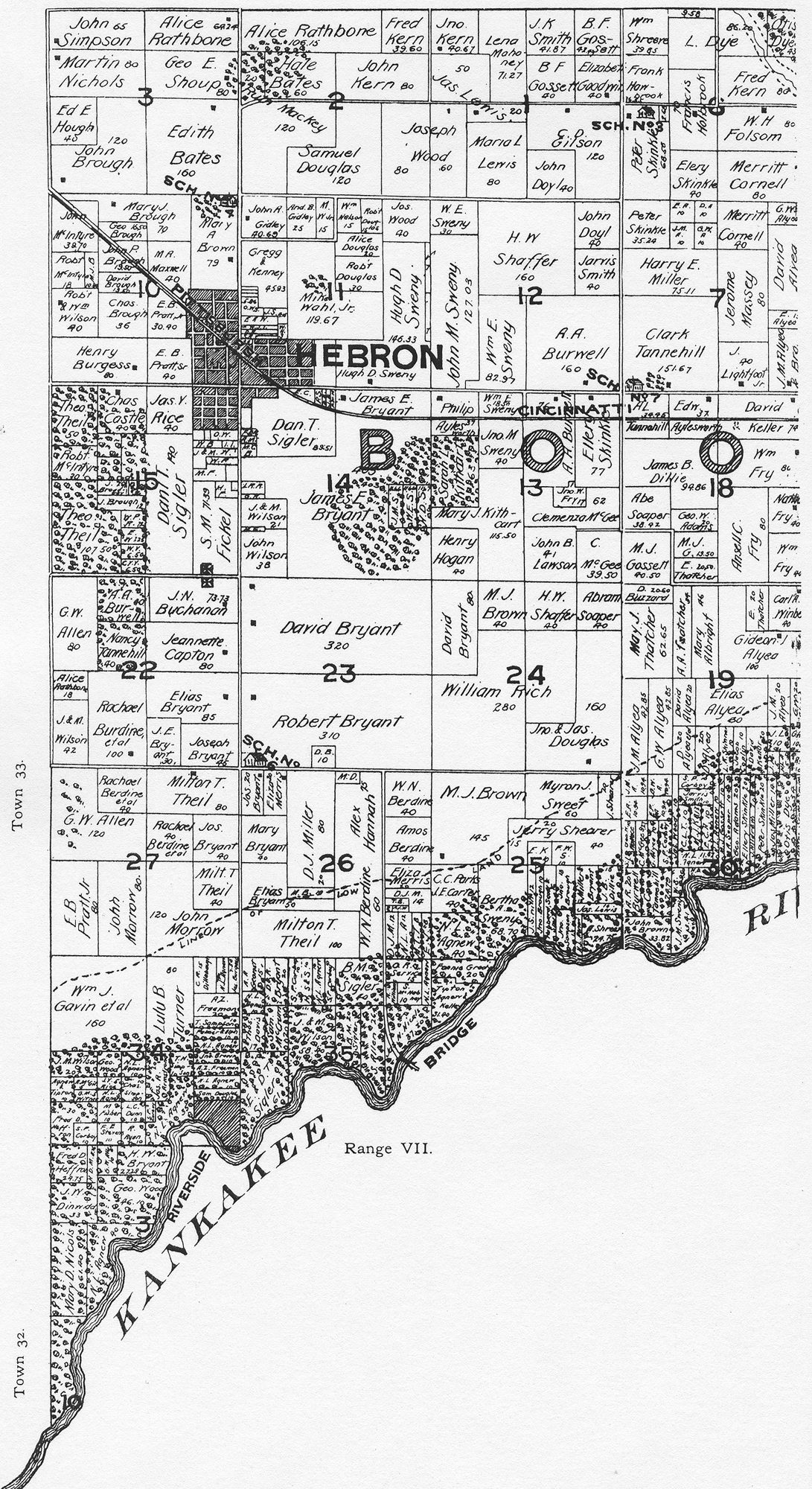
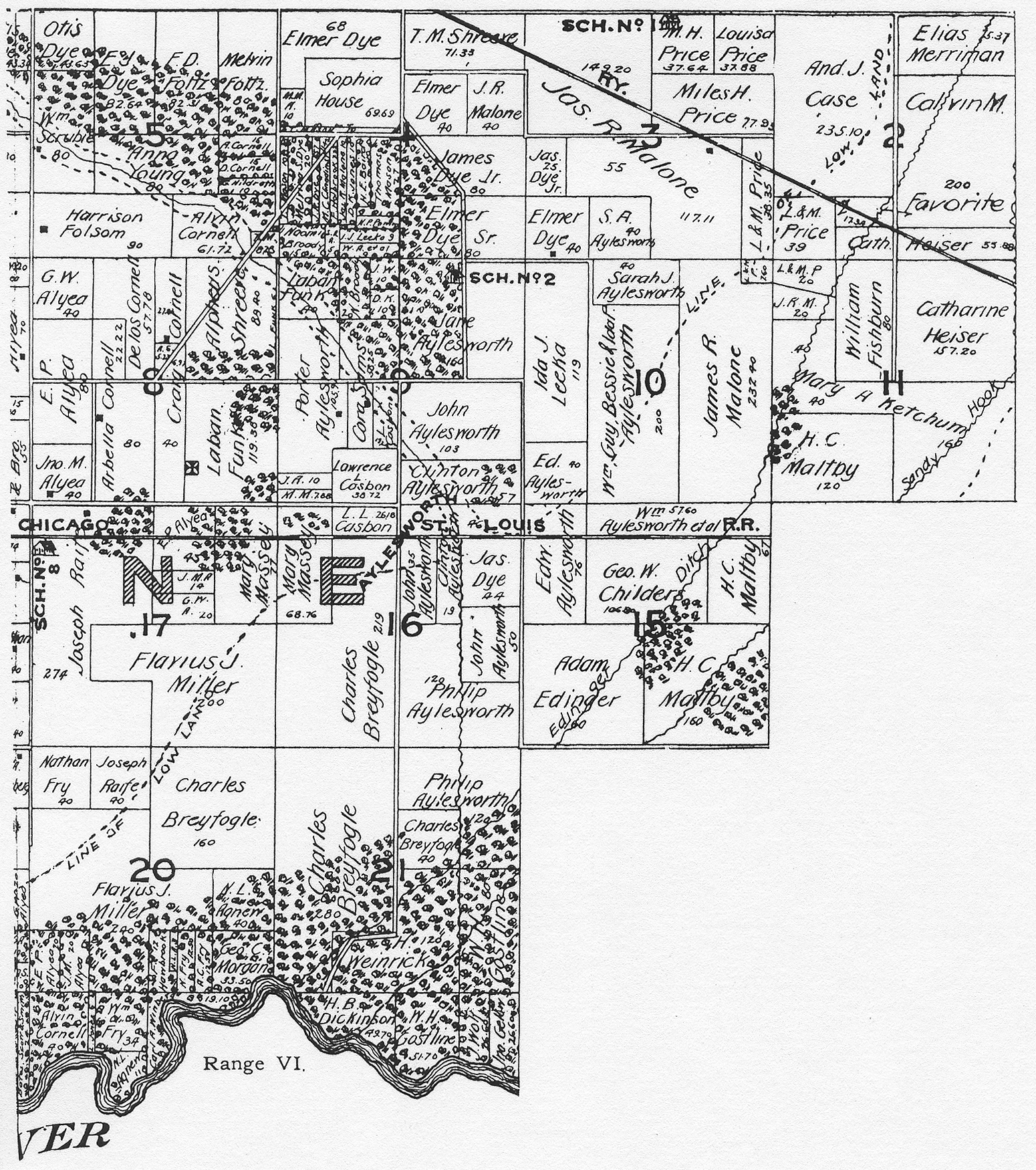
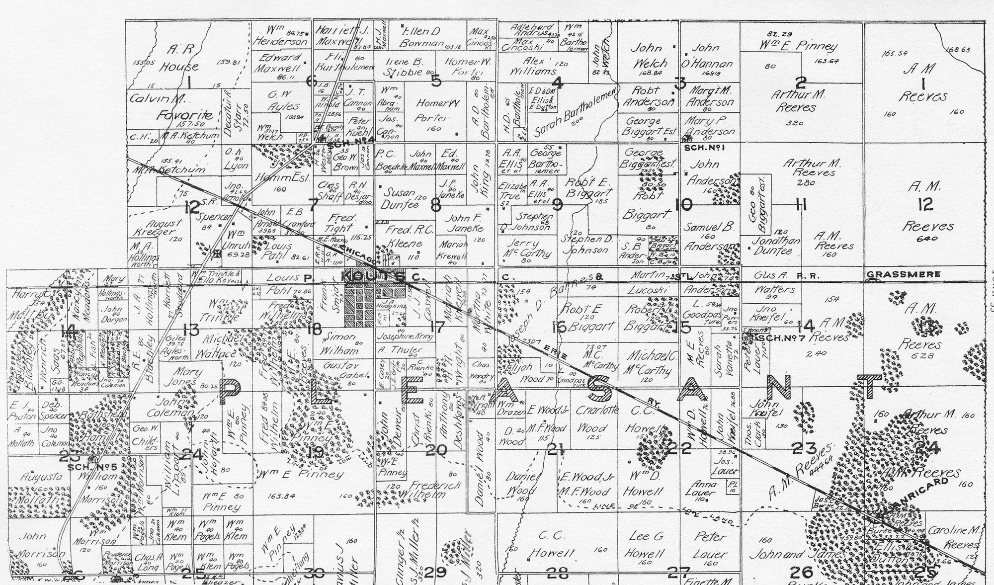
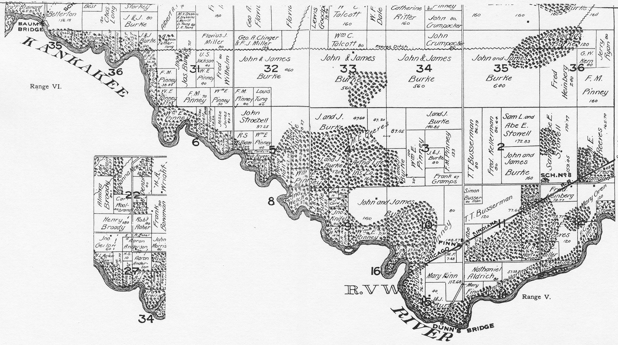
Township Plat Maps, 18951895 Porter County township plat maps . . . .
The following township plat maps were obtained from
the county atlas published in 1895 by Lee and Lee. Click the thumbnails below to access
full size images. Note that several of these images are large files and may take
considerable time to load on slower Internet connections, such as dialup.
Source Citation:
Lee and Lee. 1895.
Lee and Lee's Atlas of Porter County, Indiana.
Chicago, Illinois: Lee and Lee. 81 p.
 Portage |
 Westchester (West) |
 Westchester (East) |
 Pine (North) |
 Pine (South) |
|||
 Liberty |
 Jackson |
||
 Union |
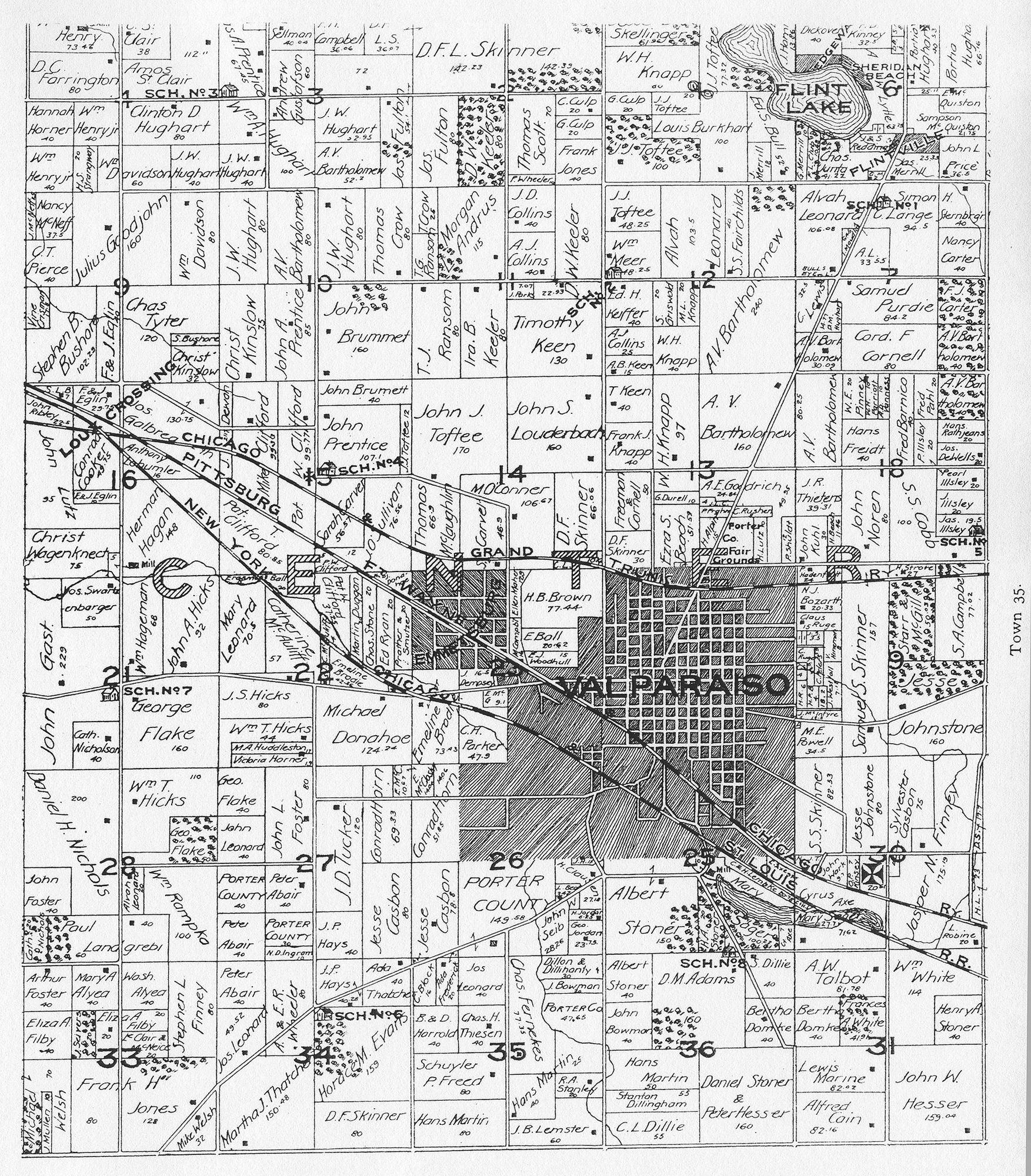 Center |
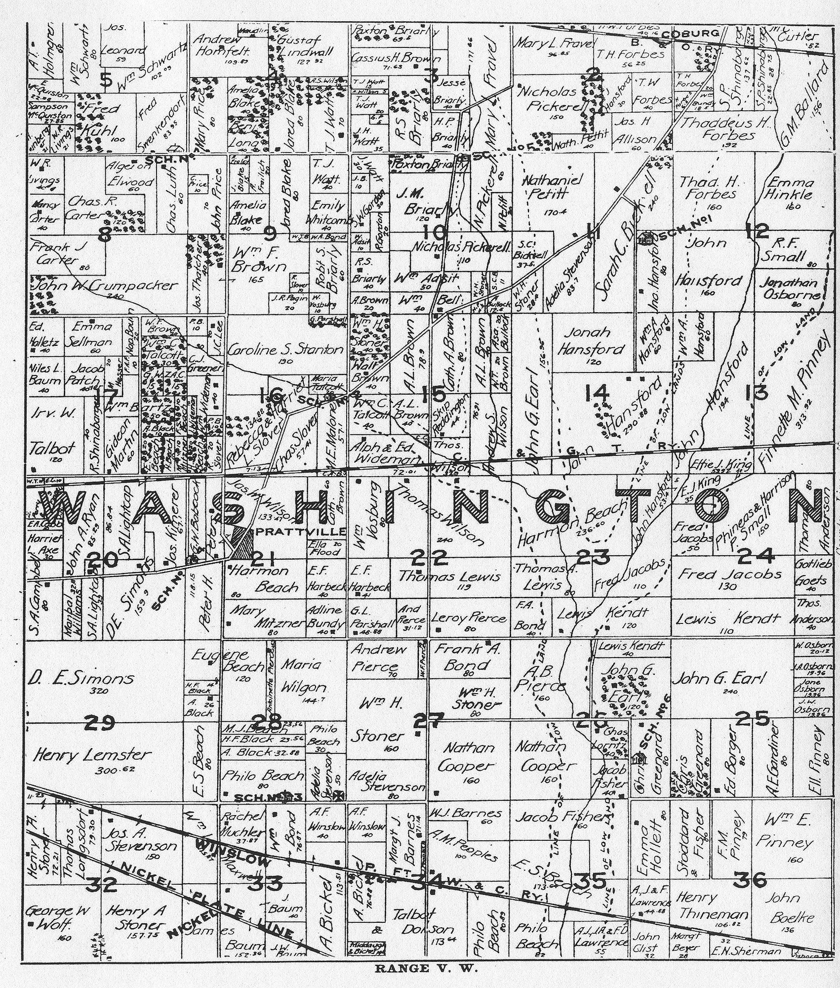 Washington |
|
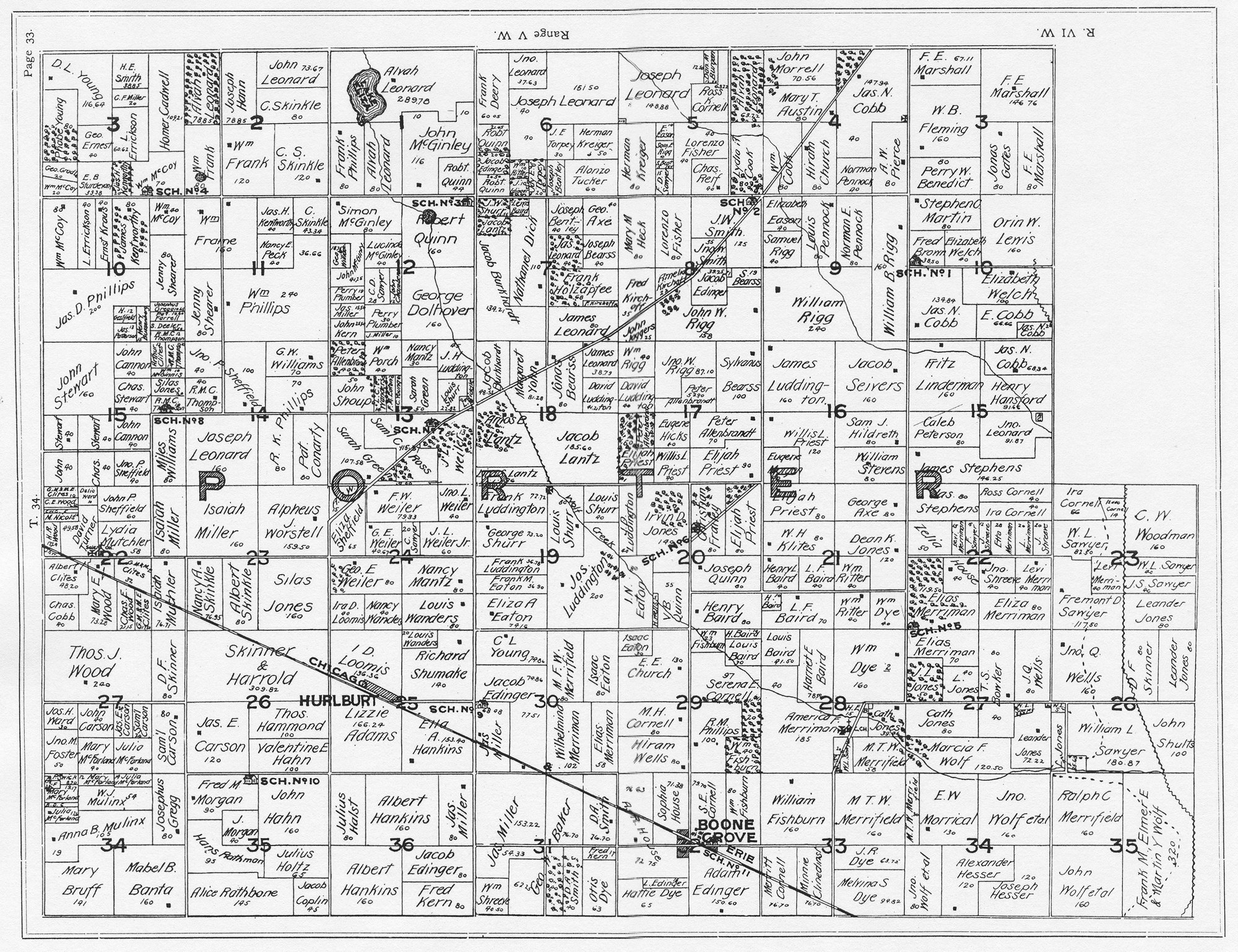 Porter |
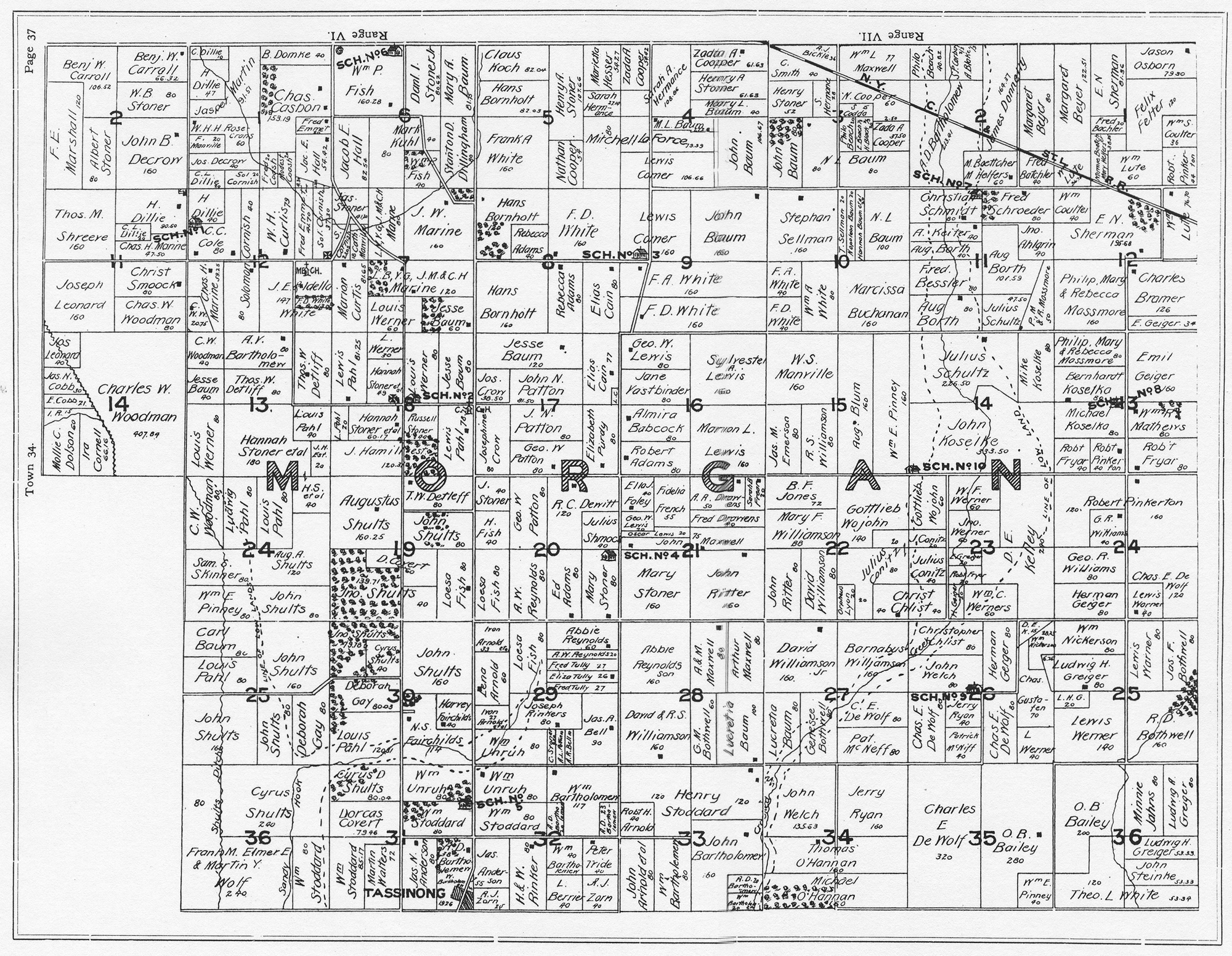 Morgan |
|
 Boone (West) |
 Boone (East) |
 Pleasant (North) |
 Pleasant (South) |
||
1895 plat maps prepared for web by Steven R. Shook, January 2009